


View forecast
Aoraki-Mt Cook at 3754 m altitude
Issued by Snow-Forecast.com at: 5 pm (local time) / 19 Apr 2024
Now
Fri 19 | Saturday 20 | Sunday 21 | Monday 22 | Tuesday 23 | Wednesday 24 | Thursday 25 | ||||||||||||||
PM | night | AM | PM | night | AM | PM | night | AM | PM | night | AM | PM | night | AM | PM | night | AM | PM | night | |
cloudy | clear | clear | clear | some clouds | clear | clear | some clouds | clear | clear | clear | clear | some clouds | snow shwrs | some clouds | some clouds | snow shwrs | clear | snow shwrs | heavy snow | |
km/h | ||||||||||||||||||||
Snow map |  |  |  | 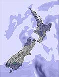 | 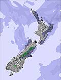 |  |  | |||||||||||||
— | — | — | — | — | — | — | — | — | — | — | — | — | — | — | — | — | — | 1.0 | 51 | |
— | — | — | — | — | — | — | — | — | — | — | — | — | — | — | — | — | — | — | — | |
max°C | -9 | -8 | -7 | -6 | -6 | -7 | -7 | -6 | -8 | -6 | -4 | -3 | -3 | -4 | -3 | -3 | -3 | -6 | -8 | -7 |
min°C | -10 | -9 | -8 | -6 | -6 | -7 | -7 | -8 | -8 | -7 | -6 | -3 | -4 | -7 | -3 | -3 | -7 | -8 | -9 | -8 |
-20 | -14 | -11 | -10 | -12 | -13 | -14 | -18 | -18 | -17 | -16 | -10 | -14 | -18 | -12 | -11 | -19 | -21 | -22 | -20 | |
82 | 58 | 34 | 9 | 40 | 44 | 53 | 63 | 11 | 9 | 12 | 12 | 17 | 69 | 13 | 7 | 30 | 46 | 68 | 98 | |
2100 | 2100 | 2350 | 2850 | 2600 | 2550 | 2500 | 2500 | 2500 | 2600 | 2600 | 3250 | 3150 | 2200 | 3250 | 3300 | 2750 | 2350 | 2150 | 2500 | |
— | — | 7:18 | — | — | 7:18 | — | — | 7:20 | — | — | 7:20 | — | — | 7:22 | — | — | 7:24 | — | — | |
5:59 | — | — | 5:57 | — | — | 5:55 | — | — | 5:53 | — | — | 5:52 | — | — | 5:51 | — | — | 5:49 | — | |
Next 0-3 days weather summary:
Mostly dry. Temperatures will be well below freezing (max -6°C on Sat afternoon, min -10°C on Fri afternoon). Winds increasing (light winds from the SW on Sat morning, strong winds from the SSW by Sun night).
Next 4-6 days weather summary:
Mostly dry. Temperatures will be below freezing (max -3°C on Tue morning, min -8°C on Thu morning). Winds increasing (fresh winds from the W on Tue morning, gales from the NW by Thu morning).
Popular Aoraki-Mt Cook Pages
Snow Radar
Latest snow reports near Aoraki-Mt Cook:
Aoraki-Mt Cook Snow Conditions
| Top snow depth: | — |
|---|---|
| Bottom snow depth: | — |
| Fresh snowfall depth: | — |
| Last snowfall: | 16 Apr 2024 |
| Snow Alerts | Create Alert |
Other resorts in New Zealand are reporting: powder (0) / good piste (0)
Snow-Forecast Partner Offers
Show your business here
Snow History
Week 3 of April has on average:
1.7 | Bluebird Powder days Fresh snow, mostly sunny, light wind. |
|---|---|
0.7 | Powder days Fresh snow, limited sun, any wind. |
3.6 | Bluebird days Average snow, mostly sunny, light wind. |

Aoraki-Mt Cook Forecast Snowfall


Photos of Aoraki-Mt Cook
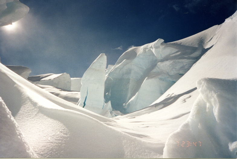
Serac on Tasman Glacier by Mike Statham
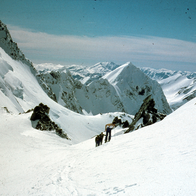
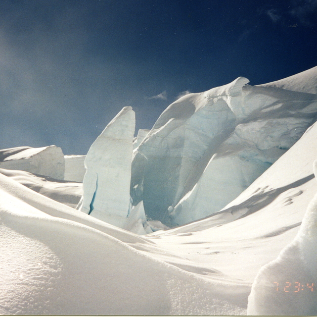
Tasman saddle 1980 by Guus van Rossum
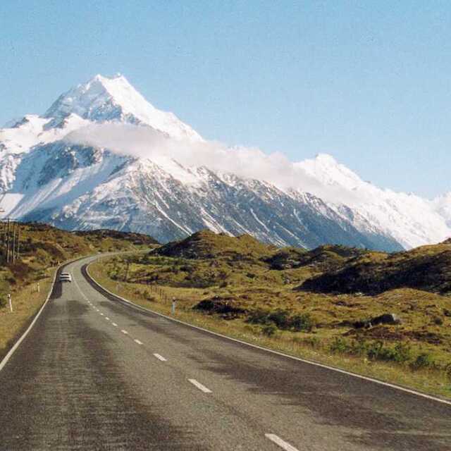
Mt Cook - New zealand by Kristien ROGISTER
Other resorts in New Zealand are reporting: powder (0) / good piste (0)
The above table gives the weather forecast for Aoraki-Mt Cook at the specific elevation of 3754 m. Our sophisticated weather models allow us to provide snow forecasts for the top, middle and bottom ski stations of Aoraki-Mt Cook. To access the weather forecasts for the other elevations, use the tab navigation above the table. For a wider view of the weather, check out the Weather Map of New Zealand.
Click here to read further information on freezing levels and how we forecast our temperatures.
Visitor Reviews of Aoraki-Mt Cook
- David Jones from New Zealand writes:
Fantastic review - I too have enjoyed the family friendly atmosphere that Mount Cook offers. There are a wealth of routes and entertainment for all. The grand traverse is a particular treat if you like to get off the beaten track but it is always good to get back to the warmth and hospitality of the Plateau Hut Resort. If you get board of the many routes on Mt Cook and need more challenge then Mount Tasman is just around the corner. Only disappointment was that the Plateau Resort gets very crowded and can be noisy at night, however, the view more than makes up for it. The mountain could also do with a few more lifts.
Visitor Reviews of Aoraki-Mt Cook
David Jones from New Zealand writes:
Fantastic review - I too have enjoyed the family friendly atmosphere that Mount Cook offers. There are a wealth of routes and entertainment for all. The grand traverse is a particular treat if you like to get off the beaten track but it is always good to get back to the warmth and hospitality of the Plateau Hut Resort. If you get board of the many routes on Mt Cook and need more challenge then Mount Tasman is just around the corner.
Only disappointment was that the Plateau Resort gets very crowded and can be noisy at night, however, the view more than makes up for it. The mountain could also do with a few more lifts.
Free Snow-Forecast.com weather widget for your website
The Aoraki-Mt Cook skiing weather widget is available to embed on external websites free of charge. It provides a daily summary of our Aoraki-Mt Cook snow forecast and current weather conditions. Simply go to the feed configuration page and follow the 3 simple steps to grab the custom html code snippet and paste it into your own site. You can choose the snow forecast elevation (summit, mid-mountain or bottom lift) and metric/imperial units for the snow forecast feed to suit your own website…. Click here to get the code.
View detailed snow forecast for Aoraki-Mt Cook at:
snow-forecast.com

 Nearest