

Global Weekly Snow Roundup #318
Weekly Snow News for the world, updated 11 June 2026: Australia's season begins, Val d’Isère reopens and major snowfall is forecast for the Andes.

Next 4 days weather summary:Mostly dry. Very mild (max 18°C on Sat afternoon, min 9°C on Fri night). Wind will be generally light. | Days 5-7 weather summary:Light rain (total 6.0mm), mostly falling on Thu afternoon. Very mild (max 18°C on Wed afternoon, min 9°C on Mon night). Wind will be generally light. | |||||||||||||||
Saturday 13 | Sunday 14 | Monday 15 | Tuesday 16 | Wednesday 17 | ||||||||||||
night | AM | PM | night | AM | PM | night | AM | PM | night | AM | PM | night | AM | PM | night | |
clear | clear | clear | clear | some clouds | some clouds | clear | clear | clear | clear | some clouds | clear | clear | clear | some clouds | rain shwrs | |
km/h | ||||||||||||||||
Snow map |  |  |  |  |  |  | ||||||||||
— | — | — | — | — | — | — | — | — | — | — | — | — | — | — | — | |
— | — | — | — | — | — | — | — | — | — | — | — | — | — | — | 2 | |
max °C | 14 | 16 | 18 | 16 | 15 | 17 | 14 | 14 | 16 | 14 | 14 | 17 | 15 | 16 | 18 | 15 |
min °C | 9 | 12 | 18 | 10 | 12 | 16 | 9 | 11 | 16 | 9 | 11 | 17 | 10 | 12 | 18 | 12 |
8 | 12 | 18 | 10 | 12 | 16 | 8 | 10 | 16 | 9 | 11 | 17 | 10 | 12 | 18 | 12 | |
72 | 23 | 31 | 65 | 24 | 34 | 56 | 30 | 34 | 63 | 31 | 39 | 67 | 41 | 52 | 82 | |
4200 | 4150 | 4300 | 4100 | 4000 | 4050 | 3950 | 3800 | 4000 | 3900 | 3750 | 4100 | 4050 | 4050 | 4400 | 4200 | |
— | 5:46 | — | — | 5:46 | — | — | 5:46 | — | — | 5:46 | — | — | 5:46 | — | — | |
— | — | — | 9:20 | — | — | 9:20 | — | — | 9:21 | — | — | 9:21 | — | — | 9:21 | |
Go pro and carve into:
Avalanche information: European Avalanche Warning Services (EAWS)
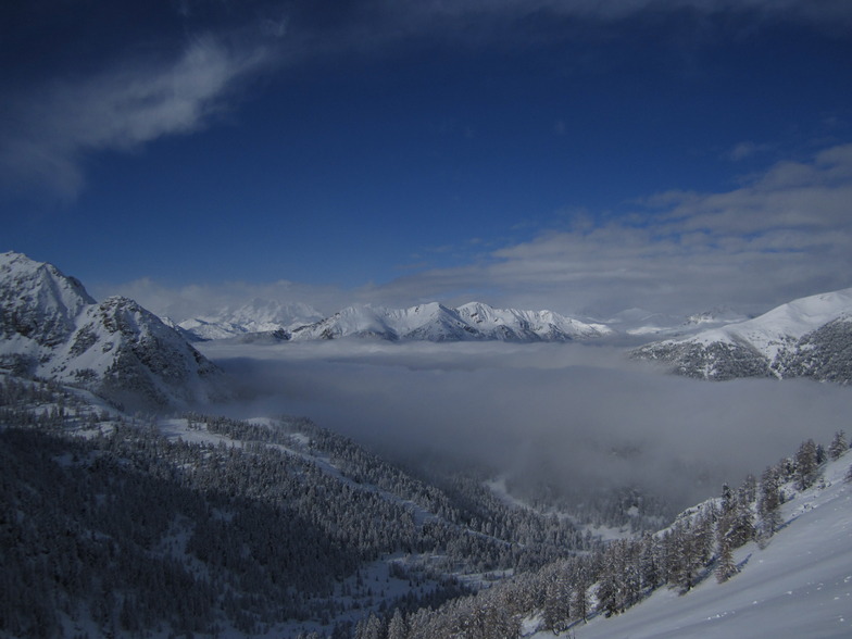
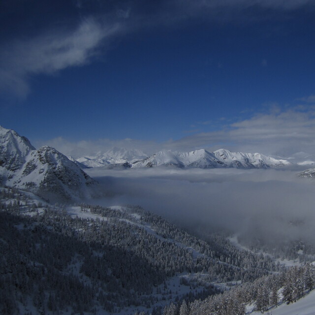
Latest snow reports near Montgenèvre (Vialattea):
| Top snow depth: | — |
|---|---|
| Bottom snow depth: | — |
| Fresh snowfall depth: | — |
| Last snowfall: | 15 May 2026 |
| Snow Alerts | Create Alert |
0.0 | Bluebird Powder days Fresh snow, mostly sunny, light wind. |
|---|---|
0.0 | Powder days Fresh snow, limited sun, any wind. |
0.0 | Bluebird days Average snow, mostly sunny, light wind. |
The above table gives the weather forecast for Montgenèvre (Vialattea) at the specific elevation of 2015 m. Our sophisticated weather models allow us to provide snow forecasts for the top, middle and bottom ski stations of Montgenèvre (Vialattea). To access the weather forecasts for the other elevations, use the tab navigation above the table. For a wider view of the weather, check out the Weather Map of France.
Click here to read further information on freezing levels and how we forecast our temperatures.
Resort name is also written as Montgenevre (Via Lattea).
Overall 4.1 Based on 18 votes and 34 reviews
Montgenevre is a little gem. Usually great snow, no crowds and plenty of variety We have skied every year and sometimes twice, since 2006. Linked access to the Via Latea is a bonus. Again, booked to go in January: all fingers crossed that France will let us in! We are fully jabbed and healthy!
deborah scollan from United Kingdom writes:
Montgenevre is a little gem. Usually great snow, no crowds and plenty of variety We have skied every year and sometimes twice, since 2006. Linked access to the Via Latea is a bonus. Again, booked to go in January: all fingers crossed that France will let us in! We are fully jabbed and healthy!
Read 33 more reviews of Montgenèvre (Vialattea) or submit your own


 Nearest