The snow forecast for La Bresse Hohneck is: Light rain (total 5.0mm), mostly falling on Sun morning. Very mild (max 14°C on Fri morning, min 5°C on Sun night). Wind will be generally light.
La Bresse Hohneck Weather (Next 3 days): The snow forecast for La Bresse Hohneck is: Light rain (total 5.0mm), mostly falling on Sun morning. Very mild (max 14°C on Fri morning, min 5°C on Sun night). Wind will be generally light.
La Bresse Hohneck Weather (Days 4-6): Moderate rain (total 14.0mm), heaviest on Mon afternoon. Very mild (max 11°C on Mon morning, min 5°C on Mon night). Winds increasing (calm on Mon afternoon, fresh winds from the SW by Tue night).
Issued by Snow-Forecast.com at:12 pm (local time) / 06 Mar 2026
La Bresse Hohneck Weather
(Next 3 days):
The snow forecast for La Bresse Hohneck is: Light rain (total 5.0mm), mostly falling on Sun morning. Very mild (max 14°C on Fri morning, min 5°C on Sun night). Wind will be generally light.
La Bresse Hohneck Weather (Days 4-6):
Moderate rain (total 14.0mm), heaviest on Mon afternoon. Very mild (max 11°C on Mon morning, min 5°C on Mon night). Winds increasing (calm on Mon afternoon, fresh winds from the SW by Tue night).
La Bresse Hohneck Weather (Days 7-16):
Interested in the 16-day Forecast? Unlock the full forecast and many more features by becoming a Pro member.
Light rain (total 5.0mm), mostly falling on Sun morning. Very mild (max 14°C on Fri morning, min 5°C on Sun night). Wind will be generally light.
Next 4-6 days weather summary:
Moderate rain (total 14.0mm), heaviest on Mon afternoon. Very mild (max 11°C on Mon morning, min 5°C on Mon night). Winds increasing (calm on Mon afternoon, fresh winds from the SW by Tue night).
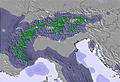
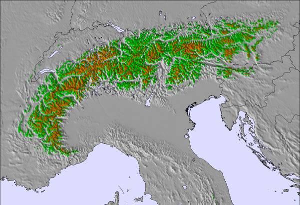
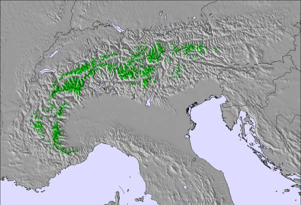
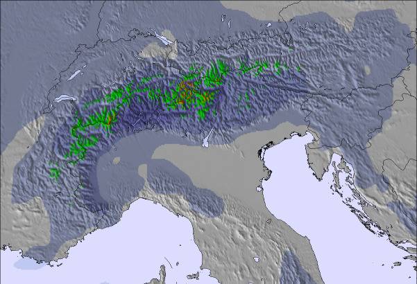
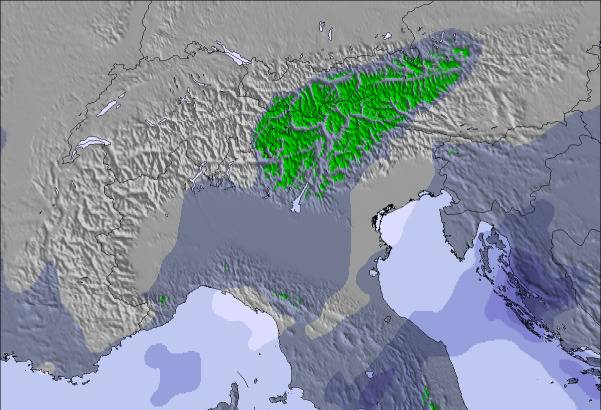
The above table gives the weather forecast for La Bresse Hohneck at the specific elevation of 900 m. Our sophisticated weather models allow us to provide snow forecasts for the top, middle and bottom ski stations of La Bresse Hohneck. To access the weather forecasts for the other elevations, use the tab navigation above the table. For a wider view of the weather, check out the Weather Map of France.
Click here to read further information on freezing levels and how we forecast our temperatures.
Après avoir acheté un forfait pour mes 3 enfants et moi même pour les aurores ce dimanche 15 janvier soit de 6 h 30 à 11 h, en ayant pris l'énorme file d'attente car il y avait seulement une caisse ouverte nous avons bien skié sur les pistes éclairées jusqu'à neuf heures.
Ensuite une vraie catastrophe, des remontées mécaniques en panne, le telesiège de belle hutte, était en panne, les teleskis sur Kastelberg idem, et qui plus est les perches étaient salles et pleine de graisse bien noire. De suoi bien marquer les fesses de nos vetements de skis.
Bref apres avoir attendu dans le telesiège et aussi dans les téléskis, que le personnel dépanne, je vais à la caisse pour faire une réclamation concernant mon pantalon de ski tout taché, la personne m'a donné une fiche de réclamation, et elle ne connaissait pas la procédure, il a encore fallu attendre que la personne m'explique en même temps qu'elle comprenne...Et quelle procédure...il fallait ensuite se rendre à la location pour faire prendre une cliché de mon pantalon, le laisser afin que la personne le porte au pressing...bref, au vu de la procédure quasiment irréalisable, et trois enfants qui m'attendaient dans la voiture, j'ai décidé de repartir et d'adresser un mail de reclamation à la station, nous sommes mardi et toujours aucun retour. Je suis toujours dans l'attente...et je saius que je n'aurais pas de réponse car il y a quelques années, idem, ma fille alors âgée de 6 ans, et moi même avons pris le télésiège de Belle Hutte, en partant, la barre de protection était gelée, on n'a pas pu la déscendre, j'ai crié au perchman, mais en vain, il ne nous a pas entendues. Nous avons fait toute la montée sans barre de protection, et ce jour il y avait bcp de vent, je tenais ma fille le plus fort possible pour que nous ne glissions pas. J'ai aussitot rentrée fait une réclamation, pourlaquelle nous n'avons eu aucun retour, j'ai envoyé un courrier en LRAR et un mail. Personne n'a pris contact avec nous,même pas pour s'excuser. Donc je reste dubitative quant à la considération que la station peut avoir envers ces clients...Juste prendre notre argent et après plus rien. Il en est de même quand la station est partiellement ouverte en raison du manque de neige, les forfaits n'en sont pas pour autant raccoucis.
Free Snow-Forecast.com weather widget for your website
Embed the La Bresse Hohneck weather widget on your site for free. It provides a weekly snapshot of snow and rain conditions across all elevations. Follow the two quick steps to grab your custom code and paste it into your site. Choose between metric or imperial units. Click here to get the code.


 Nearest