

Portillo Re-Opens To Guests Arriving By Helicopter
Chile’s famous Portillo ski resort is reported to have re-opened to guests arriving by helicopter after being cut off by road for more than two weeks by over 6m/20 feet of snowfall.

Next 3 days weather summary:Mostly dry. Very mild (max 17°C on Mon morning, min 4°C on Mon night). Wind will be generally light. | Days 4-6 weather summary:Mostly dry. Very mild (max 19°C on Fri afternoon, min 8°C on Sat night). Wind will be generally light. | |||||||||||||||||
Monday 3 | Tuesday 4 | Wednesday 5 | Thursday 6 | Friday 7 | Saturday 8 | |||||||||||||
AM | PM | night | AM | PM | night | AM | PM | night | AM | PM | night | AM | PM | night | AM | PM | night | |
some clouds | some clouds | clear | some clouds | cloudy | some clouds | clear | some clouds | clear | clear | some clouds | clear | clear | some clouds | some clouds | some clouds | cloudy | some clouds | |
km/h | ||||||||||||||||||
Snow map |  |  |  | 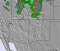 | 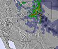 | 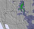 | ||||||||||||
— | — | — | — | — | — | — | — | — | — | — | — | — | — | — | — | — | — | |
mm | — | — | — | — | — | — | — | — | — | — | — | — | — | — | — | — | — | — |
max °C | 17 | 16 | 11 | 15 | 17 | 8 | 14 | 15 | 9 | 15 | 17 | 11 | 17 | 19 | 12 | 18 | 19 | 11 |
min °C | 15 | 16 | 4 | 11 | 16 | 5 | 11 | 15 | 6 | 13 | 17 | 9 | 15 | 19 | 9 | 16 | 16 | 8 |
chill °C | 14 | 15 | 4 | 10 | 15 | 2 | 9 | 14 | 5 | 12 | 16 | 9 | 15 | 19 | 9 | 16 | 16 | 8 |
Humid % | 26 | 33 | 55 | 35 | 26 | 71 | 18 | 13 | 21 | 16 | 18 | 19 | 14 | 19 | 30 | 21 | 21 | 41 |
Freeze m | 5550 | 5600 | 4800 | 5250 | 5500 | 4750 | 5200 | 5500 | 4900 | 5300 | 5500 | 5000 | 5450 | 5650 | 5100 | 5450 | 5700 | 5100 |
6:03 | — | — | 6:05 | — | — | 6:05 | — | — | 6:07 | — | — | 6:07 | — | — | 6:09 | — | — | |
— | 8:14 | — | — | 8:13 | — | — | 8:12 | — | — | 8:10 | — | — | 8:09 | — | — | 8:08 | — | |
Go pro and carve into:
Avalanche information: Colorado Avalanche Information Center
Latest snow reports near Keystone:
| Top snow depth: | 0 cm |
|---|---|
| Bottom snow depth: | 0 cm |
| Fresh snowfall depth: | — |
| Last snowfall: | 22 May 2026 |
| Snow Alerts | Create Alert |
0.0 | Bluebird Powder days Fresh snow, mostly sunny, light wind. |
|---|---|
0.0 | Powder days Fresh snow, limited sun, any wind. |
0.0 | Bluebird days Average snow, mostly sunny, light wind. |
The above table gives the weather forecast for Keystone at the specific elevation of 3717 m. Our sophisticated weather models allow us to provide snow forecasts for the top, middle and bottom ski stations of Keystone. To access the weather forecasts for the other elevations, use the tab navigation above the table. For a wider view of the weather, check out the Weather Map of United States.
Click here to read further information on freezing levels and how we forecast our temperatures.
Overall 4.0 Based on 16 votes and 5 reviews
Summary: Keystone is a very well run friendly ski area. I am a fairly advanced skier who wanted to get better at bumps (moguls). Also good for beginners and good night skiing and fun-park. Pluses at Keystone: Helpful, well organised (this is N America, not Italy after all). Because of the recession and the time of year I went (late March), it was fairly quiet and no/tiny lift queues. Enough skiing unless you are really hard core. You can always go the the nearby resorts of Vail, Beaver Creek, Breckenbridge if you want (same lift pass but need to take bus or go by car). Lots of accommodation nearby - little that is ski-in, ski-out, but little problem unless you are lazy or can't walk & hold skis at the same time. Superb free bus chuttles that take you all around Keystone. Well-organised night skiing. Fantastic ski school (I used Mountain Lodge and they were the best I have used - good for all levels) Minuses at Keystone: The elevation can take getting used to for some. The cost of the lift pass - ouch. Made worse for us Europeans by the terrible exchange rate. However, a season pass for all the local resorts costs roughly the same as a week pass so actually it is cheap if you go for a few weeks. Barry Peters
Barry Peters from United Kingdom writes:
Summary:
Keystone is a very well run friendly ski area.
I am a fairly advanced skier who wanted to get better at bumps (moguls). Also good for beginners and good night skiing and fun-park.
Pluses at Keystone:
Helpful, well organised (this is N America, not Italy after all).
Because of the recession and the time of year I went (late March), it was fairly quiet and no/tiny lift queues.
Enough skiing unless you are really hard core. You can always go the the nearby resorts of Vail, Beaver Creek, Breckenbridge if you want (same lift pass but need to take bus or go by car).
Lots of accommodation nearby - little that is ski-in, ski-out, but little problem unless you are lazy or can't walk & hold skis at the same time. Superb free bus chuttles that take you all around Keystone.
Well-organised night skiing.
Fantastic ski school (I used Mountain Lodge and they were the best I have used - good for all levels)
Minuses at Keystone:
The elevation can take getting used to for some.
The cost of the lift pass - ouch. Made worse for us Europeans by the terrible exchange rate. However, a season pass for all the local resorts costs roughly the same as a week pass so actually it is cheap if you go for a few weeks.
Barry Peters


 Nearest