The snow forecast for Karpacz - Kopa is: Mostly dry. Mild temperatures (max 6°C on Fri morning, min 2°C on Sun night). Winds increasing (light winds from the S on Fri night, fresh winds from the S by Sun night).
Karpacz - Kopa Weather (Next 3 days): The snow forecast for Karpacz - Kopa is: Mostly dry. Mild temperatures (max 6°C on Fri morning, min 2°C on Sun night). Winds increasing (light winds from the S on Fri night, fresh winds from the S by Sun night).
Karpacz - Kopa Weather (Days 4-6): Mostly dry. Mild temperatures (max 6°C on Wed morning, min 1°C on Mon afternoon). Winds decreasing (strong winds from the S on Mon morning, light winds from the SW by Wed morning).
Issued by Snow-Forecast.com at:12 pm (local time) / 06 Mar 2026
Karpacz - Kopa Weather
(Next 3 days):
The snow forecast for Karpacz - Kopa is: Mostly dry. Mild temperatures (max 6°C on Fri morning, min 2°C on Sun night). Winds increasing (light winds from the S on Fri night, fresh winds from the S by Sun night).
Karpacz - Kopa Weather (Days 4-6):
Mostly dry. Mild temperatures (max 6°C on Wed morning, min 1°C on Mon afternoon). Winds decreasing (strong winds from the S on Mon morning, light winds from the SW by Wed morning).
Karpacz - Kopa Weather (Days 7-16):
Interested in the 16-day Forecast? Unlock the full forecast and many more features by becoming a Pro member.
Mostly dry. Mild temperatures (max 6°C on Fri morning, min 2°C on Sun night). Winds increasing (light winds from the S on Fri night, fresh winds from the S by Sun night).
Next 4-6 days weather summary:
Mostly dry. Mild temperatures (max 6°C on Wed morning, min 1°C on Mon afternoon). Winds decreasing (strong winds from the S on Mon morning, light winds from the SW by Wed morning).
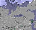
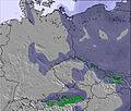
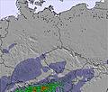
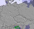
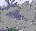
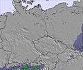
The above table gives the weather forecast for Karpacz - Kopa at the specific elevation of 1350 m. Our sophisticated weather models allow us to provide snow forecasts for the top, middle and bottom ski stations of Karpacz - Kopa. To access the weather forecasts for the other elevations, use the tab navigation above the table. For a wider view of the weather, check out the Weather Map of Poland.
Click here to read further information on freezing levels and how we forecast our temperatures.
Karpacz- Märchen ja, aber kein Wintermärchen! Stand 15.02.2011
Das Skigbiet liegt schön hoch, ist schön gelegen und über einen schönen langen und gefährlichen Aufstieg mit Skischuhen mühsam zu erreichen. Im Sommer bietet es den Zugang zu den Reizen des Riesengebirges. Im Winter bietet es all die Überraschungen, auf die jeder gerne im Urlaub verzichtet.
Die Betreiber des Gebietes haben zwei große Feinde. Das ist einerseits der Winter, der oft monatelang und dazu völlig unerwartet mit Schnee, Frost und Stürmen antritt. Dann schrumpfen regelmäßig 5km Piste auf 1,5km zusammen, obwohl nach Liftbetreiber 6km präpariert sind. Hierzu gehört neben Liczyrzepa auch Jan, Lifte, der seit Jahren nicht mehr laufen und zu den besten Abfahrten gehören. Auf den Pisten wachsen Sträucher und Gehölze, die wohl ersatzweise präpariert werden.
Der zweite Feind ist das bewegungslose Personal. Gemeinde und Liftbetreiber präsentieren eben nicht dass, was sie haben, sondern das, was sie gerne gewinnbringend hätten.
Trotzdem sollten Sie Karpacz im Winter nicht meiden, den „Berg Kopa“ aber schon. Denn Karpacz hat sehr viel zu bieten. Die Menschen sind freundlich, höflich, hilfsbereit und gute Gastgeber. Die Natur ist toll. Karpacz hat ein Problem mit dem Naturschutz. Skilaufen nein, auch keinen Langlauf, auch keine Rodelbahnen, außer auf dem Papier. Nein, nur Motorsport. Für einen Berliner kaum zu verstehen. Naturschutz kann aber nicht heißen, dass jeder Gast im Winter 24 Stunden im Hotel bleibt.
Der Skiläufer findet jedoch in Karpacz eine Straße, die über Kowary nach Mala Upa führt. Diese Straße sollte er nutzen, denn hier findet er all das zu angemessenen Preisen, was Karpacz nur verspricht.
Da gibt es sogar richtige Berghütten mit Toiletten. Hier beginnt ein Paradies für Wintersportler aller Art. Da gibt es sogar Sprungschanzen auf denen gesprungen wird und nicht nur ein verfallenes Denkmal aus dem Jahr 2004 mit Namen Olinek, welches schon am Tag der Einweihung lebendig begraben wurde.
Es gibt in Polen, nicht weit von Karpacz ein weiteres Skigebiet, welches vom ADAC getestet wurde. Das Ergebnis war nicht berauschend und lautete: sehr mangelhaft. Trotzdem wären nicht nur die Einheimischen froh, wenn „die Kopa“ die Qualität vom Skigebiet in Sklarska Poreba auch nur annähernd aufweisen könnte. Bei denen geht es sogar voran, stetig!
„Die Kopa“ wird wohl wie die Sprungschanze enden. Potemkinsche Dörfer werden nicht für die Zukunft gebaut. Zum 01.03.2011 werden die Eintrittskarten zum Skigebietsmärchen bis zu 50% gesenkt. Die Formulierung ist falsch. Eigentlich müsste es heißen: „Die Verluste beim Kauf einer Eintrittskarte werden drastisch gesenkt. Skipass möchte ich nicht sagen. Zum Skipass gehört ein Skigebiet. Finanziell kompensiert wird dieses Vorhaben durch die Erhöhung der Abgaben an die Gemeinde für Pensionen und Hotels, die im Winter weitgehend leer stehen und die trotzdem, gleich einem Wunder, wie Pilze aus der Erde schießen. Denn die Abgabe an die Gemeinde wird nach Quadratmetern berechnet. Rechte Tasche, linke Tasche. Investitionsruine Karpacz. Ein falsches Märchen, kein Wintertraum, eher ein Alptraum und sicheres, gewinnträchtiges Zlotygrab.
Peter Rutke am 15.02.2011
Karpacz- Märchen ja, aber kein Wintermärchen! Stand 15.02.2011
Das Skigbiet liegt schön hoch, ist schön gelegen und über einen schönen langen und gefährlichen Aufstieg mit Skischuhen mühsam zu erreichen. Im Sommer bietet es den Zugang zu den Reizen des Riesengebirges. Im Winter bietet es all die Überraschungen, auf die jeder gerne im Urlaub verzichtet.
Die Betreiber des Gebietes haben zwei große Feinde. Das ist einerseits der Winter, der oft monatelang und dazu völlig unerwartet mit Schnee, Frost und Stürmen antritt. Dann schrumpfen regelmäßig 5km Piste auf 1,5km zusammen, obwohl nach Liftbetreiber 6km präpariert sind. Hierzu gehört neben Liczyrzepa auch Jan, Lifte, der seit Jahren nicht mehr laufen und zu den besten Abfahrten gehören. Auf den Pisten wachsen Sträucher und Gehölze, die wohl ersatzweise präpariert werden.
Der zweite Feind ist das bewegungslose Personal. Gemeinde und Liftbetreiber präsentieren eben nicht dass, was sie haben, sondern das, was sie gerne gewinnbringend hätten.
Trotzdem sollten Sie Karpacz im Winter nicht meiden, den „Berg Kopa“ aber schon. Denn Karpacz hat sehr viel zu bieten. Die Menschen sind freundlich, höflich, hilfsbereit und gute Gastgeber. Die Natur ist toll. Karpacz hat ein Problem mit dem Naturschutz. Skilaufen nein, auch keinen Langlauf, auch keine Rodelbahnen, außer auf dem Papier. Nein, nur Motorsport. Für einen Berliner kaum zu verstehen. Naturschutz kann aber nicht heißen, dass jeder Gast im Winter 24 Stunden im Hotel bleibt.
Der Skiläufer findet jedoch in Karpacz eine Straße, die über Kowary nach Mala Upa führt. Diese Straße sollte er nutzen, denn hier findet er all das zu angemessenen Preisen, was Karpacz nur verspricht.
Da gibt es sogar richtige Berghütten mit Toiletten. Hier beginnt ein Paradies für Wintersportler aller Art. Da gibt es sogar Sprungschanzen auf denen gesprungen wird und nicht nur ein verfallenes Denkmal aus dem Jahr 2004 mit Namen Olinek, welches schon am Tag der Einweihung lebendig begraben wurde.
Es gibt in Polen, nicht weit von Karpacz ein weiteres Skigebiet, welches vom ADAC getestet wurde. Das Ergebnis war nicht berauschend und lautete: sehr mangelhaft. Trotzdem wären nicht nur die Einheimischen froh, wenn „die Kopa“ die Qualität vom Skigebiet in Sklarska Poreba auch nur annähernd aufweisen könnte. Bei denen geht es sogar voran, stetig!
„Die Kopa“ wird wohl wie die Sprungschanze enden. Potemkinsche Dörfer werden nicht für die Zukunft gebaut. Zum 01.03.2011 werden die Eintrittskarten zum Skigebietsmärchen bis zu 50% gesenkt. Die Formulierung ist falsch. Eigentlich müsste es heißen: „Die Verluste beim Kauf einer Eintrittskarte werden drastisch gesenkt. Skipass möchte ich nicht sagen. Zum Skipass gehört ein Skigebiet. Finanziell kompensiert wird dieses Vorhaben durch die Erhöhung der Abgaben an die Gemeinde für Pensionen und Hotels, die im Winter weitgehend leer stehen und die trotzdem, gleich einem Wunder, wie Pilze aus der Erde schießen. Denn die Abgabe an die Gemeinde wird nach Quadratmetern berechnet. Rechte Tasche, linke Tasche. Investitionsruine Karpacz. Ein falsches Märchen, kein Wintertraum, eher ein Alptraum und sicheres, gewinnträchtiges Zlotygrab.
Free Snow-Forecast.com weather widget for your website
Embed the Karpacz - Kopa weather widget on your site for free. It provides a weekly snapshot of snow and rain conditions across all elevations. Follow the two quick steps to grab your custom code and paste it into your site. Choose between metric or imperial units. Click here to get the code.


 Nearest