

Global Weekly Snow Roundup #318
Weekly Snow News for the world, updated 11 June 2026: Australia's season begins, Val d’Isère reopens and major snowfall is forecast for the Andes.

Next 3 days weather summary:Heavy rain (total 39.0mm), heaviest during Sun afternoon. Very mild (max 11°C on Fri afternoon, min 7°C on Sun afternoon). Wind will be generally light. | Days 4-6 weather summary:Heavy rain (total 49.0mm), heaviest during Tue afternoon. Very mild (max 13°C on Wed afternoon, min 10°C on Tue afternoon). Wind will be generally light. | ||||||||||||||||
Fri 12 | Saturday 13 | Sunday 14 | Monday 15 | Tuesday 16 | Wednesday 17 | ||||||||||||
PM | night | AM | PM | night | AM | PM | night | AM | PM | night | AM | PM | night | AM | PM | night | |
t-storm risk | rain shwrs | t-storm risk | t-storm risk | rain shwrs | t-storm risk | heavy rain | rain shwrs | t-storm risk | t-storm risk | rain shwrs | t-storm risk | heavy rain | rain shwrs | t-storm risk | t-storm risk | rain shwrs | |
km/h | |||||||||||||||||
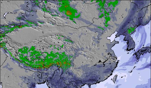
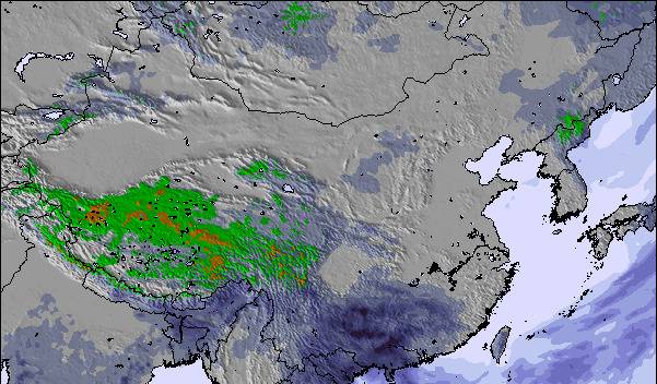
Snow map |  |  |  | 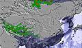 | 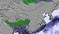 | 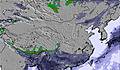 | |||||||||||
— | — | — | — | — | — | — | — | — | — | — | — | — | — | — | — | — | |
3 | 6 | 2 | 6 | 2 | 3 | 14 | 2 | 1 | 3 | 7 | 3 | 17 | 1 | 1 | 7 | 7 | |
max °C | 11 | 10 | 10 | 10 | 10 | 10 | 10 | 9 | 11 | 12 | 12 | 12 | 11 | 10 | 12 | 13 | 11 |
min °C | 11 | 9 | 8 | 10 | 9 | 9 | 7 | 8 | 9 | 11 | 11 | 11 | 10 | 10 | 11 | 10 | 11 |
10 | 9 | 8 | 9 | 9 | 9 | 6 | 6 | 9 | 11 | 11 | 11 | 9 | 10 | 11 | 10 | 11 | |
57 | 61 | 67 | 63 | 61 | 64 | 73 | 58 | 63 | 62 | 63 | 66 | 65 | 61 | 62 | 77 | 58 | |
4800 | 4600 | 4650 | 4750 | 4650 | 4750 | 4500 | 4650 | 4800 | 5000 | 4850 | 4950 | 4900 | 4950 | 5050 | 5050 | 5000 | |
— | — | 5:20 | — | — | 5:20 | — | — | 5:20 | — | — | 5:20 | — | — | 5:20 | — | — | |
7:44 | — | — | 7:44 | — | — | 7:44 | — | — | 7:45 | — | — | 7:45 | — | — | 7:45 | — | |
Go pro and carve into:
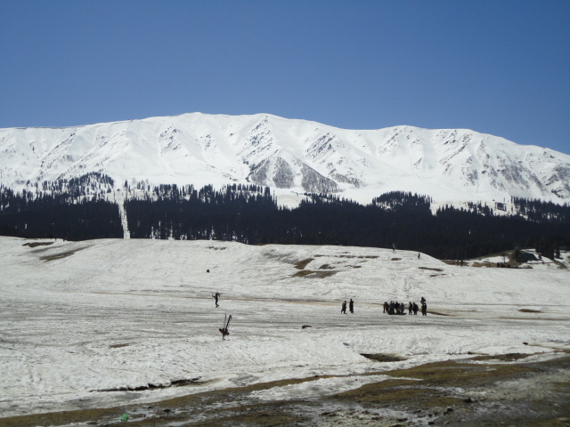
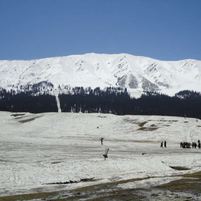
Latest snow reports near Gulmarg:
| Top snow depth: | — |
|---|---|
| Bottom snow depth: | — |
| Fresh snowfall depth: | — |
| Last snowfall: | 4 May 2026 |
| Snow Alerts | Create Alert |
0.0 | Bluebird Powder days Fresh snow, mostly sunny, light wind. |
|---|---|
0.0 | Powder days Fresh snow, limited sun, any wind. |
0.0 | Bluebird days Average snow, mostly sunny, light wind. |
The above table gives the weather forecast for Gulmarg at the specific elevation of 3275 m. Our sophisticated weather models allow us to provide snow forecasts for the top, middle and bottom ski stations of Gulmarg. To access the weather forecasts for the other elevations, use the tab navigation above the table. For a wider view of the weather, check out the Weather Map of India.
Click here to read further information on freezing levels and how we forecast our temperatures.
Overall 3.6 Based on 29 votes and 63 reviews
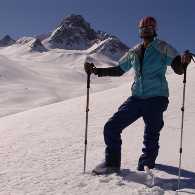
Nestled against the magnificent Himalayas, Gulmarg ski resort is a haven for winter sports enthusiasts. The pristine alpine landscape and abundant powdery snow create an unparalleled ski terrain. The Himalayan backdrop adds a touch of awe-inspiring beauty to every run, making it a unique and unforgettable experience for skiers. The well-maintained slopes cater to various skill levels, offering both thrills for seasoned skiers and a welcoming environment for beginners. Despite occasional weather challenges, the overall combination of Himalayan grandeur and exceptional skiing opportunities makes Gulmarg a standout destination for those seeking an adventure in the heart of the world's highest mountain range.
Himalayan Ski Guides from India writes:
Nestled against the magnificent Himalayas, Gulmarg ski resort is a haven for winter sports enthusiasts. The pristine alpine landscape and abundant powdery snow create an unparalleled ski terrain. The Himalayan backdrop adds a touch of awe-inspiring beauty to every run, making it a unique and unforgettable experience for skiers. The well-maintained slopes cater to various skill levels, offering both thrills for seasoned skiers and a welcoming environment for beginners. Despite occasional weather challenges, the overall combination of Himalayan grandeur and exceptional skiing opportunities makes Gulmarg a standout destination for those seeking an adventure in the heart of the world's highest mountain range.

 Nearest