


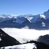
Portillo Re-Opens To Guests Arriving By Helicopter
Chile’s famous Portillo ski resort is reported to have re-opened to guests arriving by helicopter after being cut off by road for more than two weeks by over 6m/20 feet of snowfall.

Next 3 days weather summary:Heavy rain (total 45.0mm), heaviest during Mon night. Warm (max 24°C on Mon afternoon, min 15°C on Tue afternoon). Wind will be generally light. | Days 4-6 weather summary:Moderate rain (total 11.0mm), heaviest on Thu afternoon. Very mild (max 19°C on Sat afternoon, min 12°C on Thu night). Wind will be generally light. | |||||||||||||||||
Monday 3 | Tuesday 4 | Wednesday 5 | Thursday 6 | Friday 7 | Saturday 8 | |||||||||||||
AM | PM | night | AM | PM | night | AM | PM | night | AM | PM | night | AM | PM | night | AM | PM | night | |
clear | t-storm risk | rain shwrs | clear | t-storm risk | rain shwrs | clear | rain shwrs | rain shwrs | clear | mod. rain | rain shwrs | some clouds | some clouds | clear | clear | clear | clear | |
km/h | ||||||||||||||||||
Snow map |  |  |  |  |  |  | ||||||||||||
— | — | — | — | — | — | — | — | — | — | — | — | — | — | — | — | — | — | |
mm | — | 3 | 17 | — | 13 | 10 | — | 1 | 1 | — | 9 | 2 | — | — | — | — | — | — |
max °C | 22 | 24 | 17 | 19 | 21 | 16 | 18 | 20 | 20 | 18 | 16 | 13 | 13 | 16 | 16 | 16 | 19 | 18 |
min °C | 19 | 19 | 16 | 16 | 15 | 16 | 16 | 20 | 17 | 16 | 14 | 12 | 12 | 14 | 14 | 13 | 18 | 16 |
chill °C | 19 | 19 | 16 | 16 | 15 | 16 | 16 | 20 | 17 | 16 | 14 | 12 | 12 | 14 | 14 | 13 | 18 | 16 |
Humid % | 40 | 63 | 64 | 57 | 82 | 65 | 57 | 51 | 59 | 59 | 94 | 89 | 82 | 67 | 66 | 56 | 42 | 47 |
Freeze m | 4550 | 4400 | 4500 | 4500 | 4350 | 4400 | 4300 | 4350 | 4400 | 4300 | 4300 | 4150 | 4150 | 4250 | 4300 | 4300 | 4200 | 4250 |
6:15 | — | — | 6:16 | — | — | 6:18 | — | — | 6:18 | — | — | 6:20 | — | — | 6:20 | — | — | |
— | — | 9:00 | — | — | 8:59 | — | — | 8:58 | — | — | 8:55 | — | — | 8:54 | — | — | 8:52 | |
Go pro and carve into:
Avalanche information: European Avalanche Warning Services (EAWS)
Latest snow reports near Chatel:
| Top snow depth: | — |
|---|---|
| Bottom snow depth: | — |
| Fresh snowfall depth: | — |
| Last snowfall: | 16 May 2026 |
| Snow Alerts | Create Alert |
0.0 | Bluebird Powder days Fresh snow, mostly sunny, light wind. |
|---|---|
0.0 | Powder days Fresh snow, limited sun, any wind. |
0.0 | Bluebird days Average snow, mostly sunny, light wind. |

The above table gives the weather forecast for Chatel at the specific elevation of 1701 m. Our sophisticated weather models allow us to provide snow forecasts for the top, middle and bottom ski stations of Chatel. To access the weather forecasts for the other elevations, use the tab navigation above the table. For a wider view of the weather, check out the Weather Map of France.
Click here to read further information on freezing levels and how we forecast our temperatures.
Overall 4.4 Based on 59 votes and 66 reviews
Bij uitstek het skigebied voor lange tochten en veel afwisseling. Chatel ligt in het hart van het gebied, waardoor je makkelijk in Zwitserland en Avoriaz komt. De Apres ski is gemoedelijk en gezellig, niet uitbundig met hollandse hits, maar dat is wat mij betreft een pluspunt. De barretjes, winkels en zeker ook de restaurants zijn van goed niveau. Mooi prijsniveau en van lokaal tot Italiaans etc. Zowel op de pistes (wel reserveren), als in het dorp (ook daar beter reserveren. Wij komen er zeker terug!
B from The Netherlands writes:
Bij uitstek het skigebied voor lange tochten en veel afwisseling. Chatel ligt in het hart van het gebied, waardoor je makkelijk in Zwitserland en Avoriaz komt. De Apres ski is gemoedelijk en gezellig, niet uitbundig met hollandse hits, maar dat is wat mij betreft een pluspunt. De barretjes, winkels en zeker ook de restaurants zijn van goed niveau. Mooi prijsniveau en van lokaal tot Italiaans etc. Zowel op de pistes (wel reserveren), als in het dorp (ook daar beter reserveren. Wij komen er zeker terug!


 Nearest