


Global Weekly Snow Roundup #318
Weekly Snow News for the world, updated 11 June 2026: Australia's season begins, Val d’Isère reopens and major snowfall is forecast for the Andes.

Next 3 days weather summary:Mostly dry. Warm (max 21°C on Sat afternoon, min 9°C on Fri morning). Mainly fresh winds. | Days 4-6 weather summary:Mostly dry. Warm (max 22°C on Wed afternoon, min 10°C on Mon night). Wind will be generally light. | |||||||||||||||||
Friday 12 | Saturday 13 | Sunday 14 | Monday 15 | Tuesday 16 | Wednesday 17 | |||||||||||||
AM | PM | night | AM | PM | night | AM | PM | night | AM | PM | night | AM | PM | night | AM | PM | night | |
clear | clear | clear | clear | clear | some clouds | some clouds | some clouds | clear | clear | clear | some clouds | cloudy | some clouds | some clouds | clear | clear | clear | |
km/h | ||||||||||||||||||
Snow map | 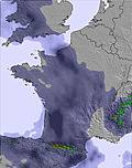 | 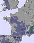 | 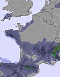 | 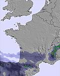 |  |  | ||||||||||||
— | — | — | — | — | — | — | — | — | — | — | — | — | — | — | — | — | — | |
— | — | — | — | — | — | — | — | — | — | — | — | — | — | — | — | — | — | |
max °C | 13 | 18 | 16 | 16 | 21 | 18 | 18 | 20 | 18 | 16 | 20 | 17 | 15 | 20 | 17 | 18 | 22 | 20 |
min °C | 9 | 17 | 11 | 13 | 19 | 13 | 15 | 20 | 11 | 13 | 19 | 10 | 12 | 19 | 11 | 14 | 20 | 15 |
7 | 17 | 8 | 11 | 19 | 13 | 15 | 20 | 10 | 12 | 19 | 9 | 12 | 19 | 10 | 14 | 20 | 15 | |
70 | 47 | 67 | 51 | 33 | 38 | 43 | 30 | 47 | 48 | 31 | 40 | 46 | 32 | 38 | 41 | 33 | 35 | |
3950 | 3900 | 4100 | 4050 | 3950 | 3950 | 3850 | 3650 | 3800 | 3650 | 3500 | 3800 | 3800 | 3550 | 3850 | 3900 | 3850 | 4300 | |
5:58 | — | — | 5:58 | — | — | 5:58 | — | — | 5:58 | — | — | 5:58 | — | — | 5:58 | — | — | |
— | — | 9:37 | — | — | 9:37 | — | — | 9:37 | — | — | 9:38 | — | — | 9:38 | — | — | 9:39 | |
Go pro and carve into:
Avalanche information: European Avalanche Warning Services (EAWS)
Latest snow reports near Chastreix-Sancy:
| Top snow depth: | 0 cm |
|---|---|
| Bottom snow depth: | 0 cm |
| Fresh snowfall depth: | — |
| Last snowfall: | 16 May 2026 |
| Snow Alerts | Create Alert |
0.0 | Bluebird Powder days Fresh snow, mostly sunny, light wind. |
|---|---|
0.0 | Powder days Fresh snow, limited sun, any wind. |
0.0 | Bluebird days Average snow, mostly sunny, light wind. |
The above table gives the weather forecast for Chastreix-Sancy at the specific elevation of 1350 m. Our sophisticated weather models allow us to provide snow forecasts for the top, middle and bottom ski stations of Chastreix-Sancy. To access the weather forecasts for the other elevations, use the tab navigation above the table. For a wider view of the weather, check out the Weather Map of France.
Click here to read further information on freezing levels and how we forecast our temperatures.


 Nearest