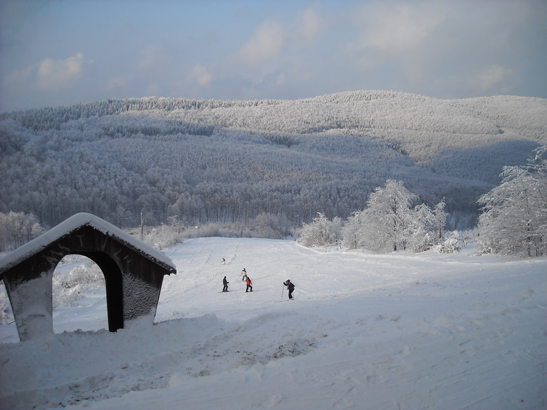


America’s Next Indoor Snow Centre Takes Shape
Construction of a new indoor snow centre for skiers, boarders and tubers appears to be making good progress at Heritage Farm in Wayne County, West Virginia.

Next 4 days weather summary:Light rain (total 4.0mm), mostly falling on Thu morning. Very mild (max 19°C on Thu afternoon, min 8°C on Thu night). Winds increasing (calm on Wed morning, fresh winds from the WNW by Thu afternoon). | Days 5-7 weather summary:Moderate rain (total 10.0mm), heaviest on Sun night. Warm (max 27°C on Sun afternoon, min 9°C on Fri night). Wind will be generally light. | |||||||||||||||
Wednesday 22 | Thursday 23 | Friday 24 | Saturday 25 | Sunday 26 | ||||||||||||
night | AM | PM | night | AM | PM | night | AM | PM | night | AM | PM | night | AM | PM | night | |
some clouds | cloudy | cloudy | some clouds | light rain | some clouds | rain shwrs | some clouds | light rain | clear | some clouds | clear | clear | clear | some clouds | light rain | |
km/h | ||||||||||||||||
Snow map |  |  |  | 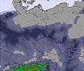 | 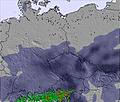 | 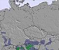 | ||||||||||
— | — | — | — | — | — | — | — | — | — | — | — | — | — | — | — | |
mm | — | — | — | — | 1 | — | 2 | — | 1 | — | — | — | — | — | — | 5 |
max °C | 16 | 14 | 17 | 14 | 15 | 19 | 14 | 15 | 15 | 13 | 18 | 21 | 17 | 22 | 27 | 22 |
min °C | 10 | 13 | 15 | 12 | 13 | 18 | 8 | 11 | 15 | 9 | 14 | 20 | 14 | 18 | 26 | 16 |
chill °C | 10 | 13 | 15 | 12 | 11 | 17 | 7 | 10 | 15 | 8 | 14 | 20 | 13 | 18 | 26 | 16 |
Humid % | 73 | 66 | 54 | 55 | 65 | 44 | 82 | 64 | 62 | 73 | 52 | 31 | 35 | 28 | 28 | 66 |
Freeze m | 3000 | 2600 | 2800 | 2750 | 2750 | 2850 | 2600 | 2550 | 2650 | 2850 | 3200 | 3250 | 3400 | 3800 | 3700 | 3800 |
— | 5:00 | — | — | 5:01 | — | — | 5:03 | — | — | 5:03 | — | — | 5:05 | — | — | |
— | — | — | 8:27 | — | — | 8:25 | — | — | 8:24 | — | — | 8:23 | — | — | 8:22 | |
Go pro and carve into:
Latest snow reports near Bánkút:
| Top snow depth: | — |
|---|---|
| Bottom snow depth: | — |
| Fresh snowfall depth: | — |
| Last snowfall: | 9 Apr 2026 |
| Snow Alerts | Create Alert |
0.0 | Bluebird Powder days Fresh snow, mostly sunny, light wind. |
|---|---|
0.0 | Powder days Fresh snow, limited sun, any wind. |
0.0 | Bluebird days Average snow, mostly sunny, light wind. |
The above table gives the weather forecast for Bánkút at the specific elevation of 800 m. Our sophisticated weather models allow us to provide snow forecasts for the top, middle and bottom ski stations of Bánkút. To access the weather forecasts for the other elevations, use the tab navigation above the table. For a wider view of the weather, check out the Weather Map of Hungary.
Click here to read further information on freezing levels and how we forecast our temperatures.
Resort name is also written as Bankut.
Overall 3.0 Based on 4 votes and 2 reviews
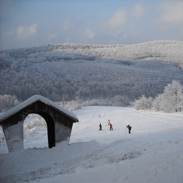
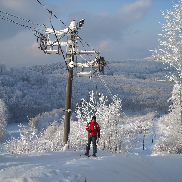
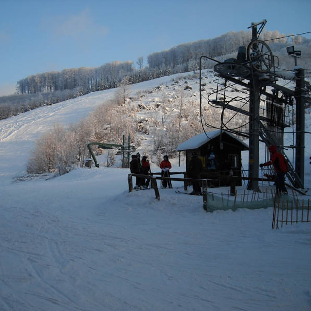
Mt. Bukk, or its top resort Bankut has been afflicted with some unfairly dry weather since the beginning of this ski season. The available snow making capacity is insufficient to make up for the almost complete lack of natural snow. Bankut could be otherwise great with its unique atmosphere of decent slopes arranged side by side in an increasing order of vertical drop and excitement/ challenge, and the club and lodging house right in the middle of the 'ski circus'. There is even a brand new and high capacity ski lift installed beside the good old J-bar lifts. Local authorities (including the strictly restrictive Bukk National Park) should join the enthusiastic local people in their effort to find more water and step up snow making facilities. Bankut, at the top of Mt. Bukk and just beside Miskolc city is an ideally laid out resort with a homely feel, run by a passionate personnel but not often blessed with substantial snowfalls.
Thomas Kekesi from Hungary writes:
Mt. Bukk, or its top resort Bankut has been afflicted with some unfairly dry weather since the beginning of this ski season. The available snow making capacity is insufficient to make up for the almost complete lack of natural snow. Bankut could be otherwise great with its unique atmosphere of decent slopes arranged side by side in an increasing order of vertical drop and excitement/ challenge, and the club and lodging house right in the middle of the 'ski circus'. There is even a brand new and high capacity ski lift installed beside the good old J-bar lifts. Local authorities (including the strictly restrictive Bukk National Park) should join the enthusiastic local people in their effort to find more water and step up snow making facilities. Bankut, at the top of Mt. Bukk and just beside Miskolc city is an ideally laid out resort with a homely feel, run by a passionate personnel but not often blessed with substantial snowfalls.


 Nearest