

Portillo Storm Snowfall Total Passes 5m / 17 Feet
A snow storm that has now continued for nine days has taken Chilean ski resort Portillo to a snowfall total of 5.2 metres (17 feet) so far, with more snow forecast.

Next 4 days weather summary:Moderate rain (total 11.0mm), heaviest on Mon morning. Very mild (max 11°C on Mon afternoon, min 6°C on Mon night). Winds increasing (light winds from the NW on Mon morning, strong winds from the WNW by Tue afternoon). | Days 5-7 weather summary:Moderate rain (total 15.0mm), heaviest on Thu night. Very mild (max 19°C on Thu afternoon, min 6°C on Fri night). Mainly fresh winds. | |||||||||||||||
Monday 27 | Tuesday 28 | Wednesday 29 | Thursday 30 | Friday 31 | ||||||||||||
night | AM | PM | night | AM | PM | night | AM | PM | night | AM | PM | night | AM | PM | night | |
rain shwrs | rain shwrs | rain shwrs | some clouds | cloudy | light rain | rain shwrs | some clouds | some clouds | some clouds | some clouds | t-storm risk | rain shwrs | rain shwrs | light rain | light rain | |
km/h | ||||||||||||||||
Snow map | 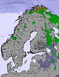 | 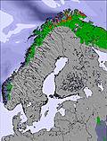 | 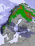 | 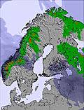 | 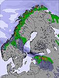 | 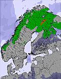 | ||||||||||
— | — | — | — | — | — | — | — | — | — | — | — | — | — | — | — | |
mm | 4 | 2 | 2 | — | — | 2 | 1 | — | — | — | — | 1 | 4 | 2 | 3 | 2 |
max °C | 9 | 9 | 11 | 8 | 7 | 7 | 7 | 9 | 11 | 11 | 15 | 19 | 16 | 13 | 8 | 8 |
min °C | 8 | 8 | 10 | 6 | 7 | 6 | 6 | 8 | 10 | 10 | 13 | 17 | 14 | 8 | 8 | 6 |
chill °C | 6 | 7 | 7 | 3 | 3 | 0 | 1 | 5 | 7 | 8 | 12 | 17 | 12 | 4 | 4 | 2 |
Humid % | 86 | 72 | 70 | 91 | 93 | 97 | 90 | 81 | 74 | 77 | 69 | 61 | 87 | 90 | 85 | 90 |
Freeze m | 2150 | 2100 | 2150 | 2000 | 2050 | 2000 | 2300 | 2400 | 2450 | 2900 | 3250 | 3200 | 3550 | 2650 | 2200 | 1900 |
— | 4:01 | — | — | 4:03 | — | — | 4:07 | — | — | 4:09 | — | — | 4:13 | — | — | |
— | — | — | 10:23 | — | — | 10:21 | — | — | 10:17 | — | — | 10:15 | — | — | 10:12 | |
Go pro and carve into:
Avalanche information: European Avalanche Warning Services (EAWS)
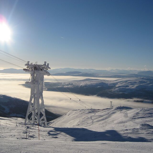
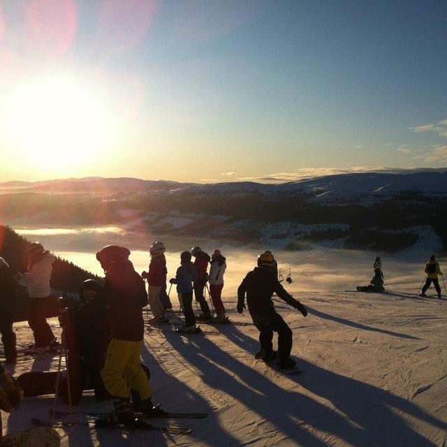
Latest snow reports near Åre:
| Top snow depth: | 0 cm |
|---|---|
| Bottom snow depth: | 0 cm |
| Fresh snowfall depth: | — |
| Last snowfall: | 27 May 2026 |
| Snow Alerts | Create Alert |
0.0 | Bluebird Powder days Fresh snow, mostly sunny, light wind. |
|---|---|
0.0 | Powder days Fresh snow, limited sun, any wind. |
0.0 | Bluebird days Average snow, mostly sunny, light wind. |
The above table gives the weather forecast for Åre at the specific elevation of 829 m. Our sophisticated weather models allow us to provide snow forecasts for the top, middle and bottom ski stations of Åre. To access the weather forecasts for the other elevations, use the tab navigation above the table. For a wider view of the weather, check out the Weather Map of Sweden.
Click here to read further information on freezing levels and how we forecast our temperatures.
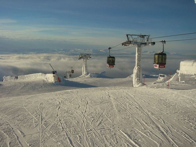
Resort name is also written as Are.
Overall 4.2 Based on 3 votes and 14 reviews
Have had a great ski holiday in Are. I think we were lucky with the weather: blue skies and no wind all week. Went last week of March with perfect snow all over the mountain and no slush even at the end of the day! Probably best later in the season; cold and dark in January I guess. Easy to get to from Ostersund airport and only about a 75 minute drive. Very little traffic. No more expensive than France, with higher standards. Skistar run the resort and in my opinion do an excellent job. If you hire equipment and buy lift passes in advance they give a good price reduction. Also, as the resort is not high, you're not likely to suffer from any altitude sickness. Quite a lot of T bars, however. I think these are there because of the wind that other people have reported on. Plenty of easy off-piste through the trees that my children love. Went over Easter and it was quite busy with some long queues especially in the morning, all quite orderly though. Despite being busy the runs were not at all crowded. All in all, had a great family holiday. Makes a pleasant change from the Alps. If you go, be sure to have a ride on the old funicular. Over one hundred years old and absolutely beautiful!
Michael from United Kingdom writes:
Have had a great ski holiday in Are. I think we were lucky with the weather: blue skies and no wind all week. Went last week of March with perfect snow all over the mountain and no slush even at the end of the day! Probably best later in the season; cold and dark in January I guess. Easy to get to from Ostersund airport and only about a 75 minute drive. Very little traffic. No more expensive than France, with higher standards. Skistar run the resort and in my opinion do an excellent job. If you hire equipment and buy lift passes in advance they give a good price reduction. Also, as the resort is not high, you're not likely to suffer from any altitude sickness. Quite a lot of T bars, however. I think these are there because of the wind that other people have reported on. Plenty of easy off-piste through the trees that my children love. Went over Easter and it was quite busy with some long queues especially in the morning, all quite orderly though. Despite being busy the runs were not at all crowded. All in all, had a great family holiday. Makes a pleasant change from the Alps. If you go, be sure to have a ride on the old funicular. Over one hundred years old and absolutely beautiful!


 Nearest