 Ski Austria
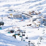
Welcome to the Ski Austria page, providing a regular round-up of the skiing conditions and current snow reports for the main ski resorts in the Austrian Alps. Over recent years some of the most consistent good piste conditions have been reported at Kaprun, Zurs, Obergurgl, St Anton, Hintertux, Neustift, Lech and Pitztal showing a mix of glacial resorts and those most exposed to prevailing storm tracks.
However, in any given week or season the best slope conditions may be found at any of the other high Austrian resorts or at lower elevation ski stations in poor weather.
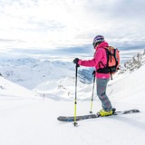
Austrians have a very relaxed policy when it comes to skiing or boarding off-piste, however it is important to observe the warnings because Austria has its fair share of avalanche fatalities. Check out the snow reports below for the latest news as conditions change quickly in the Alps. Generally the best snow conditions arrive in Austria with weather systems tracking in from the north and northwest but you can expect snow from any direction producing reliable snow cover at most of the higher altitude resorts.
Austria is one of the world’s six leading ski nations and has played a crucial role in the development of downhill skiing over the past century.
There are more than 600 Austrian ski resorts of all sizes that fill every corner of the country, from the famous mountainous regions of Tirol and Stiermark in the West to the rolling hills of Eastern Austria.
Unlike in its Alpine neighbours, purpose build ski resorts are a real rarity in Austria. Although many of the country’s most famous resorts have been 95% built from scratch due to their success and expansion over the past 60 years, almost all new building is to strict planning regulations in the classic chalet style so villages always look attractive and it’s hard to know what is 2 years old and what 200.
Critics of Austrian skiing say that as a result of not building ski resorts on mountain tops most Austrian resorts are low – ranging from perhaps 600 to 1000m above sea level, and often their top lifts are below 2000m – which, the argument goes, can be bad news for snow cover.
In fact one of the most famous resorts criticised for that, Kitzbühel, published stats showing that their snow cover is little changed in the past 50 years. Perhaps, on average, arriving a day sooner and ending a day later than in the 1960s, but otherwise fairly constant.
Austria also beats its neighbours, and indeed any other country in the world, for glacier skiing. For much of those seven months of the year from May to November when few ski areas are open, up to eight glacier ski areas are open to ski Austria when no more than three are open in any other country north of the equator. These include the country’s highest ski lift at Pitztal Glacier 3440m.
Skiing in Austria was the most popular destination choice for British skiers in the 1970s and 1980s and remains second most popular after France. It lacks the vast ski areas of the French Alps – the largest region the slightly tenuous connection between the 280km of the Skiwelt and 160km or so around Kitzbühel, but Austria’s fans point out the terrain is more varied with runs down through the forest; friendly wooden mountain restaurants to stop off at, rather than vast motorway-services style concrete-cafeterias, and prices are generally 10 or 20% less for a lift ticket too.
The fore-runner of the style of downhill skiing we all enjoy today actually began in those smaller hills near Vienna. Pioneer Mathias Zdarsky developed it from the Norwegian Telemark technique invented 40 years earlier in to the first ‘Alpine’ style in 1905 and taught thousands of people the basics, many in huge 100+ people classes. Within a few years the Arlberg technique had appeared in St Anton, pioneered this time by one Johann ‘Hannes’ Schneider, which further developed downhill and popularised skiing worldwide as Schneider appeared in films and took the invention to Japan before going to the US when asked to support the Nazis. Instead he helped train the US Army mountain division, veterans from which were in turn behind the post-war development of ski areas in the Western US states like Colorado.
Austria: latest snow conditions round-up
Summary of forecast snowfall and ski conditions for resorts in Austria. Fresh snow is forecast at 31 resorts. Powder is reported at 0 resorts and 0 are reporting good piste conditions.

Ski resorts in Austria from A to D


|
|||||||||||||||||||||||||||||||||||||
|---|---|---|---|---|---|---|---|---|---|---|---|---|---|---|---|---|---|---|---|---|---|---|---|---|---|---|---|---|---|---|---|---|---|---|---|---|---|
| Resort |

|
snow depth top and bottom |
 on-piste |
 off-piste |
 Last Snow |
Next 9 Days 0–3 | 3–6 | 6–9 snow (cm) |
 Next 7 days weather forecast.
Freezing level (m) |
||||||||||||||||||||||||||||||
| Sun | Mon | Tue | Wed | Thu | Fri | Sat | |||||||||||||||||||||||||||||||
|
(712 m — 1200 m) snow report 4 days ago |
|
|
|
||||||||||||||||||||||||||||||||||
|
(950 m — 1780 m) snow report 4 days ago |
|
|
|
||||||||||||||||||||||||||||||||||
|
(1107 m — 1480 m) snow report 4 days ago |
|
|
|||||||||||||||||||||||||||||||||||
|
(810 m — 1810 m) snow report yesterday |
|
|
|
||||||||||||||||||||||||||||||||||
|
(721 m — 1201 m) |
|
|
|||||||||||||||||||||||||||||||||||
|
(813 m — 2025 m) snow report today |

|
|
|
||||||||||||||||||||||||||||||||||
|
(1000 m — 1280 m) |
|
|
|||||||||||||||||||||||||||||||||||
|
(750 m — 1750 m) snow report 4 days ago |
|
|
|
||||||||||||||||||||||||||||||||||
|
(655 m — 1700 m) snow report 4 days ago |
|
|
|
||||||||||||||||||||||||||||||||||
|
(896 m — 1300 m) snow report 4 days ago |
|
|
|
||||||||||||||||||||||||||||||||||
|
(1349 m — 1593 m) |
|
|
|||||||||||||||||||||||||||||||||||
|
(699 m — 1551 m) snow report 4 days ago |
|
|
|||||||||||||||||||||||||||||||||||
|
(1310 m — 1900 m) |
|
|
|||||||||||||||||||||||||||||||||||
|
(1560 m — 2340 m) snow report today |
|
|
|
||||||||||||||||||||||||||||||||||
|
(1079 m — 2007 m) snow report 4 days ago |
|
|
|
||||||||||||||||||||||||||||||||||
|
(840 m — 2300 m) snow report 4 days ago |
|
|
|
||||||||||||||||||||||||||||||||||
|
(470 m — 1415 m) |
|
|
|
||||||||||||||||||||||||||||||||||
|
(1100 m — 2055 m) snow report 4 days ago |
|
|
|
||||||||||||||||||||||||||||||||||
|
(1670 m — 2120 m) snow report 4 days ago |
|
|
|
||||||||||||||||||||||||||||||||||
|
(1098 m — 2231 m) snow report today |

|
|
|
||||||||||||||||||||||||||||||||||
|
(1075 m — 1740 m) snow report today |

|
|
|
||||||||||||||||||||||||||||||||||
|
(1000 m — 1800 m) snow report 4 days ago |

|
|
|
||||||||||||||||||||||||||||||||||
|
(1167 m — 1214 m) snow report 4 days ago |
|
|
|||||||||||||||||||||||||||||||||||
|
(681 m — 1700 m) |
|
|
|||||||||||||||||||||||||||||||||||
|
(1030 m — 1201 m) snow report 4 days ago |
|
|
|||||||||||||||||||||||||||||||||||
|
(964 m — 1050 m) |
|
|
|||||||||||||||||||||||||||||||||||
|
(891 m — 2000 m) snow report 4 days ago |
|
|
|
||||||||||||||||||||||||||||||||||
|
(421 m — 1064 m) |

|
|
|
||||||||||||||||||||||||||||||||||
|
(620 m — 1957 m) |

|
|
|
||||||||||||||||||||||||||||||||||
|
(560 m — 690 m) snow report 4 days ago |

|
|
|
||||||||||||||||||||||||||||||||||
|
(1200 m — 2701 m) |

|
|
|
||||||||||||||||||||||||||||||||||
|
(1000 m — 2301 m) |
|
|
|||||||||||||||||||||||||||||||||||
|
(669 m — 2009 m) snow report today |
|
|
|
||||||||||||||||||||||||||||||||||
|
(1410 m — 2525 m) snow report 4 days ago |

|
|
|
||||||||||||||||||||||||||||||||||
|
(850 m — 2060 m) snow report today |
|
|
|
||||||||||||||||||||||||||||||||||
|
(800 m — 2000 m) snow report 4 days ago |
|
|
|
||||||||||||||||||||||||||||||||||
|
(1367 m — 2168 m) |
|
|
|||||||||||||||||||||||||||||||||||
|
(990 m — 2100 m) snow report today |
|
|
|||||||||||||||||||||||||||||||||||
|
(681 m — 1551 m) |

|
|
|
||||||||||||||||||||||||||||||||||
|
(800 m — 1600 m) snow report 4 days ago |
|
|
|||||||||||||||||||||||||||||||||||

 Nearest