NORTH AMERICA WEEKLY ROUNDUP #228
NORTH AMERICA INTRO
It’s been a big weekend across North America with some good snowfalls in the Rockies and the moist snow so far this season on the West Coast as a week-long series of storms moved into California to start February. It’s a nuanced picture though because, ironically, further north, ski areas in Western Canada have had to close terrain and in one case close completely due to spells of warm weather and rain danaging the snowpack. But across most of the continent, the picture is, nonetheless, the most positive it’s been all season, with particularly good conditions in the Colorado and Utah Rockies while Californians are celebrating their first deep powder days of the winter.
ROCKIES REPORT
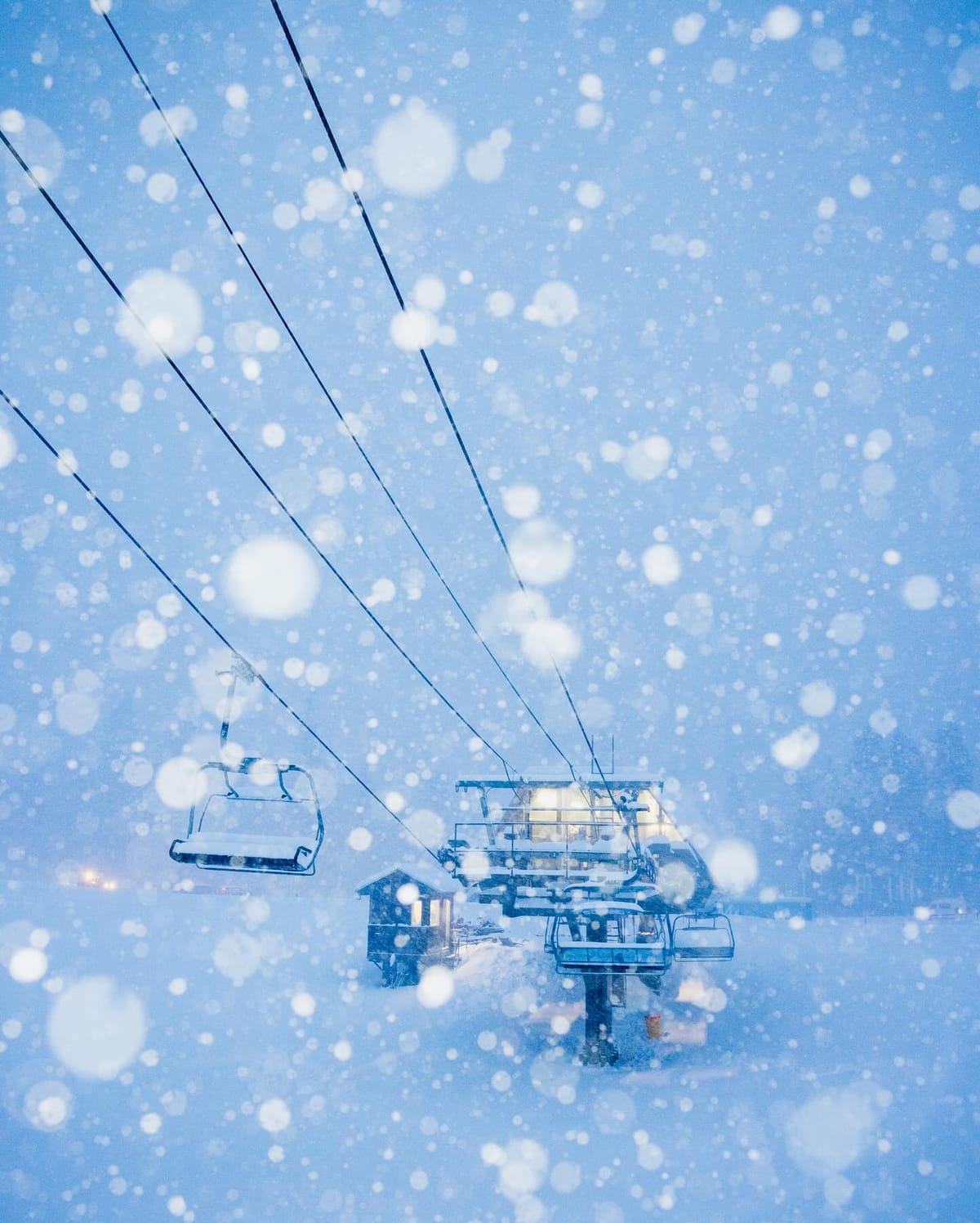
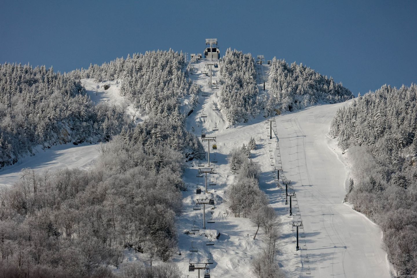
Significant snowfall returned to the Rockies at the weekend with a 48-hour snowstorm blowing in and bringing fresh powder across the region. For many, this was the biggest snowstorm of the season so far with many ski areas in Colorado and Utah posting at least a foot (30cm) of fresh cover and great powder conditions at present. Taos in New Mexico posted that it received 30” (75cm) in 48 hours at the weekend. It comes as more ski areas in the region report January was one of the best for snowfall of the past decade, Steamboat (20/48” / 50/120cm) saying it was its third snowiest of the last 12 years.
ROCKIES FORECAST
Sunshine with mostly light snowfall forecast through the coming week with snowfall totals of around 1-3″ (2-10cm) most days and temperatures between 20-40F through the 24-hour cycle, mostly below freezing.
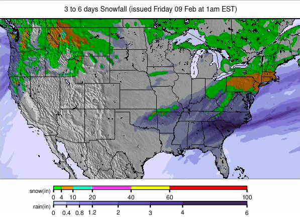
Image: USA summary overview snowfall forecast for the next 3-6 days.
USA WEST REPORT
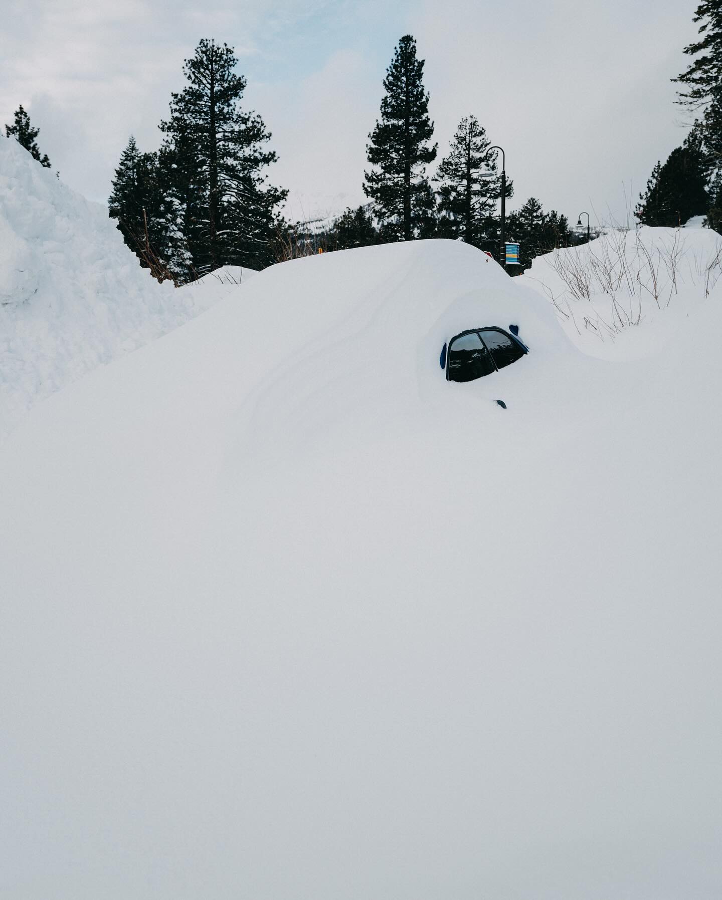
A stream of snowstorms has been hitting America’s Pacific Coast since Mammoth Mountain (57/57” / 142/142cm) reported 12-14″ (30-40cm) at its base for February 1st and unofficially 18-24 (45-60 cm) higher up for the start of February. After a calm few days, a second wave hit on Sunday and by Tuesday morning it had reached over 44″ (110cm) in total. Other ski areas in California have been dumped on too, just not quite as much. Although Alaska has been overtaken by ski areas in Oregon and Utah in terms of the deepest published snow depths in North America, Anchorage has posted its earliest-ever winter to date for reaching the 100″ (2.5m) season snowfall, although the snow is unusually heavy due to a higher than normal water content.
USA WEST FORECAST
The snowfall is expected to continue for a few more days before sunshine returns from Thursday/Friday and this is set to continue through the weekend.
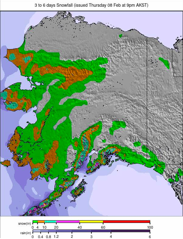
Image: Alaska snowfall report for the next 3-6 days.
MIDWEST REPORT
It has been another mixed week in the Midwest, with some cold weather and even fresh snowfall, but the week has also seen spells of mild weather bringing rainfall to some centres. Snow coverage and open terrain also vary a good deal across the region as it has all season to date. Ski areas in Michigan continue to post the deepest snow led by Ski Brule (48/56″ / 120/140cm) which is fully open. At the other extreme, Roundtop (12/12” / 30cm/30cm) in Pennsylvania reports its base just a foot deep, although it still has 95% of its terrain open.
MIDWEST FORECAST
Unfortunately, it’s not looking a lot better for the coming week with rain forecast and temperatures climbing up to the mid 40’s Fahrenheit. Overnight lows should drop below freezing at times and snowfall is possible, but more consistent cold is needed.
USA EAST REPORT
January was quite a transformative month in the eastern US with Vermont’s Sugarbush (24/40” / 60/100cm) reporting it was the snowiest it has been in more than a decade – great timing after one of the warmest and driest/wettest Novembers and Decembers in decades that came before it. Fortunately most ski areas in the region now have at least two-thirds of their terrain open, many 80-95%, and some even more.
USA EAST FORECAST
It’s looking sunny for the week ahead with temperatures up to the high 30s and low 40s Fahrenheit in the afternoons, but dropping back below freezing overnight. Temperatures are dropping and snowfall is expected at the weekend.
CANADA
CANADA WEST REPORT
Warm temperatures have, unfortunately, been impacting Western Canadian ski areas. Not that warm compared to other parts of the world, but getting up to +5C here is not good for the famous powder. Kicking Horse closed much of its steeper terrain due to what it says was an unstable snowpack caused by the warm temperatures, and Mount Washington closed completely at the end of last week due to rain damage to its snow. Even Whistler Blackcomb was forced to concede “rain damage” and a “decreased footprint” due to warm weather at the end of last week, though things have cooled a little since.
CANADA WEST FORECAST
Light to moderate snowfall over the next few days, then a dry end to the week before more weekend snowfall. Temperatures should stay below freezing, with highs up at about zero, and lows of -15C.
CANADA EAST REPORT
A predominantly cold, dry, and frequently sunny week is predicted for Eastern Canada, with temperatures generally in the -5 to -20C range, so closer to the seasonal average and no danger of freeze-thaw here. Mont Tremblant (5/130 cm / 2/52″) continues to post both the deepest snow and the most terrain (over 90% of its full area) open. However, most of the areas in Ontario and Quebec are now almost fully open as well, and Mont-Sainte-Anne (50/70 cm / 20/28”) are not far behind Tremblant with 80% of their slopes open.
CANADA EAST FORECAST
Mainly dry but overcast skies predicted for the coming week. Temperatures are set to warm rapidly and unfortunately there’s concerns of rain again at the weekend, however this could still fall as snow with forecasting marginal at this point.


