


View forecast
Ifen (Kleinwalsertal) at 1655 m altitude
Issued by Snow-Forecast.com at: 1 am (local time) / 02 May 2024
Now
Thursday 2 | Friday 3 | Saturday 4 | Sunday 5 | Monday 6 | Tuesday 7 | Wednesday 8 | |||||||||||||||
AM | PM | night | AM | PM | night | AM | PM | night | AM | PM | night | AM | PM | night | AM | PM | night | AM | PM | night | |
cloudy | heavy rain | light snow | light snow | light rain | light snow | cloudy | light rain | light rain | light rain | light rain | light rain | light rain | light rain | heavy rain | mod. rain | mod. rain | mod. rain | light rain | light rain | light rain | |
km/h | |||||||||||||||||||||
Snow map |  |  |  |  |  |  |  | ||||||||||||||
— | — | 2.0 | — | — | — | — | — | — | — | — | — | — | — | — | — | — | — | — | — | — | |
— | 11 | 2.0 | — | 2.0 | 2.0 | — | 1.0 | 3 | 3 | 2.0 | 3 | 5 | 1.0 | 12 | 8 | 8 | 7 | 1.0 | 2.0 | 2.0 | |
max°C | 9 | 8 | 3 | 1 | 3 | 3 | 4 | 6 | 5 | 3 | 7 | 7 | 7 | 10 | 9 | 6 | 5 | 5 | 5 | 5 | 5 |
min°C | 7 | 6 | 0 | 0 | 3 | 2 | 2 | 6 | 3 | 3 | 5 | 5 | 5 | 10 | 6 | 5 | 5 | 4 | 5 | 5 | 4 |
6 | 4 | -4 | -3 | 3 | 2 | 2 | 6 | 3 | 1 | 3 | 4 | 5 | 10 | 5 | 5 | 5 | 4 | 5 | 3 | 2 | |
65 | 91 | 99 | 96 | 86 | 93 | 75 | 78 | 99 | 94 | 78 | 88 | 79 | 67 | 98 | 98 | 97 | 97 | 96 | 93 | 87 | |
2750 | 2600 | 1750 | 1800 | 2150 | 1950 | 2400 | 2600 | 2200 | 2250 | 2600 | 2550 | 2700 | 2950 | 2800 | 2600 | 2550 | 2500 | 2500 | 2600 | 2450 | |
6:01 | — | — | 5:58 | — | — | 5:56 | — | — | 5:56 | — | — | 5:54 | — | — | 5:52 | — | — | 5:52 | — | — | |
— | — | 8:31 | — | — | 8:34 | — | — | 8:35 | — | — | 8:36 | — | — | 8:37 | — | — | 8:38 | — | — | 8:39 | |
Next 0-3 days weather summary:
Heavy rain (total 21.0mm), heaviest during Thu afternoon. Later becoming colder with a dusting of snow on Thu night. Freeze-thaw conditions (max 9°C on Thu morning, min 0°C on Thu night). Wind will be generally light.
Next 4-6 days weather summary:
Heavy rain (total 49.0mm), heaviest during Mon night. Very mild (max 10°C on Mon afternoon, min 3°C on Sun morning). Wind will be generally light.
Popular Ifen (Kleinwalsertal) Pages
Snow Radar
Latest snow reports near Ifen (Kleinwalsertal):
Ifen (Kleinwalsertal) Snow Conditions
| Top snow depth: | 0 cm |
|---|---|
| Bottom snow depth: | 0 cm |
| Fresh snowfall depth: | — |
| Last snowfall: | 25 Apr 2024 |
| Snow Alerts | Create Alert |
Other resorts in Austria are reporting: powder (0) / good piste (3)
Snow-Forecast Partner Offers
Show your business here
Snow History
Week 1 of May has on average:
0.0 | Bluebird Powder days Fresh snow, mostly sunny, light wind. |
|---|---|
0.5 | Powder days Fresh snow, limited sun, any wind. |
0.0 | Bluebird days Average snow, mostly sunny, light wind. |
Ifen (Kleinwalsertal) Forecast Snowfall
Photos of Ifen (Kleinwalsertal)
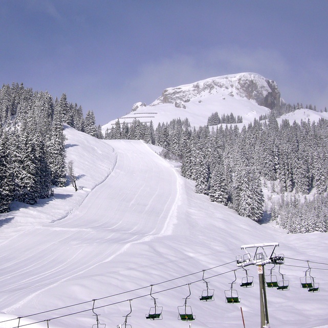
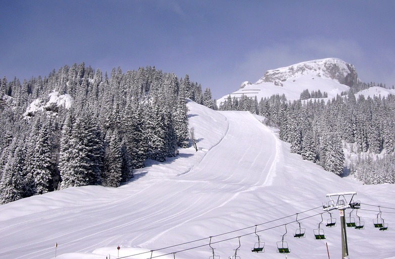
Ifen from the bottom station by Alessandro De Maria
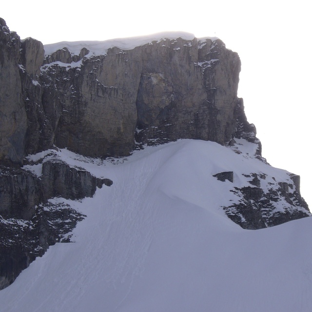
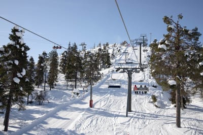
Fen from the top station by Alessandro De Maria
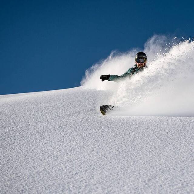
Fresh pow ... pic by Yorck Dertinger by Reinhold Uhrner
Other resorts in Austria are reporting: powder (0) / good piste (3)
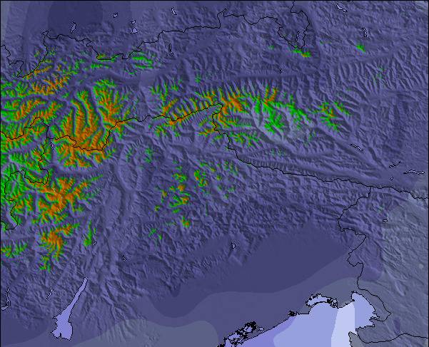
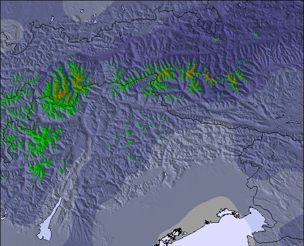
The above table gives the weather forecast for Ifen (Kleinwalsertal) at the specific elevation of 1655 m. Our sophisticated weather models allow us to provide snow forecasts for the top, middle and bottom ski stations of Ifen (Kleinwalsertal). To access the weather forecasts for the other elevations, use the tab navigation above the table. For a wider view of the weather, check out the Weather Map of Austria.
Click here to read further information on freezing levels and how we forecast our temperatures.
Resort name is also written as Ifen/Kleinwalsertal.
Visitor Reviews of Ifen (Kleinwalsertal)
Free Snow-Forecast.com weather widget for your website
The Ifen (Kleinwalsertal) skiing weather widget is available to embed on external websites free of charge. It provides a daily summary of our Ifen (Kleinwalsertal) snow forecast and current weather conditions. Simply go to the feed configuration page and follow the 3 simple steps to grab the custom html code snippet and paste it into your own site. You can choose the snow forecast elevation (summit, mid-mountain or bottom lift) and metric/imperial units for the snow forecast feed to suit your own website…. Click here to get the code.
View detailed snow forecast for Ifen (Kleinwalsertal) at:
snow-forecast.com

 Nearest