WORLD SNOW ROUNDUP #228
Issued: 7th February 2024
By Patrick “Snowhunter” Thorne
World Overview
There have been stark differences in snow and ski conditions in the world’s major ski regions over the past week. We have seen big snowfalls in the southwestern US, but more warm weather last weekend in the northwest, although things have now cooled a little. In Europe, the place to be for fresh snow, has been Scandinavia, where Norway got lots as a major storm blew through. While it has been ridiculously warm for another week in the Alps and Pyrenees, although hopefully, change is now imminent there too.
Overall, the most snowfall reported for one place this past week and, in fact, for the past fortnight or so, has been at the southern end of America’s Pacific Coast (and it’s the first time we’ve been able to publish a statement like that all season). Several feet (60cm) of snowfall was reported on high slopes in the Sierra Nevada, with powder conditions to start February, and the snowfalls have continued.
Thus, we finally have the complete reverse of the scenario in November and December, at the start of the season, when it was dry and sunny in the US but dumping in Europe.
Europe
EUROPE INTRO
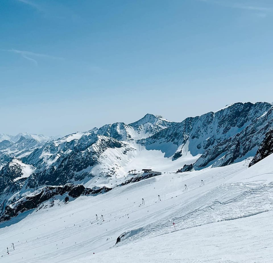
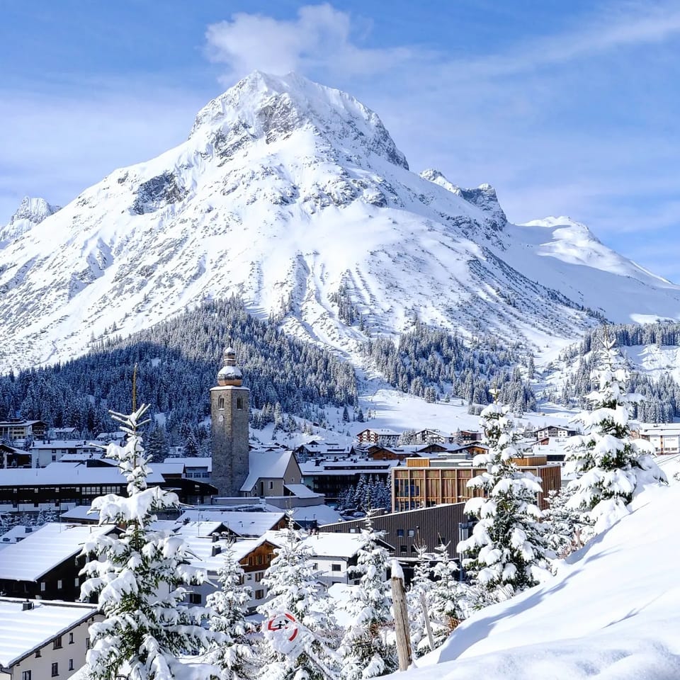
It’s been another mostly dry, mostly sunny, and very warm week across much of Europe, with the western Alps and southwestern areas, including the Pyrenees, seeing the most extreme warmth. The freezing point has again been up above 3,500m in the afternoon, higher than most top lifts, and temperatures as high as +15C have been reported in low valleys. This is clearly not good news for snow in late January/early February. The only positive is that we did see good snowfalls earlier in the season, So above 2000m cover remains good and as most big-name ski areas have much of their terrain above that height, most still have all their runs open. But it is generally old, hard-packed snow conditions with a freeze-thaw cycle, you’d normally expect in spring, already well underway. The avalanche danger has dropped, for those times when you can still find snow worth skiing off-piste that is. Gale force winds have also been thrown into the mix, particularly in the north of the continent. Many ski areas across Scandinavia were closed going into the weekend by the most violent gales since the early 1990s and Scottish centres continue to be impacted by strong winds there. However, on the Scandinavian side at least, the storms brought a lot of fresh snowfall, as well as heightened avalanche risk. The good news for the Alps is that the weather is finally changing, with colder, snowier conditions now forecast.
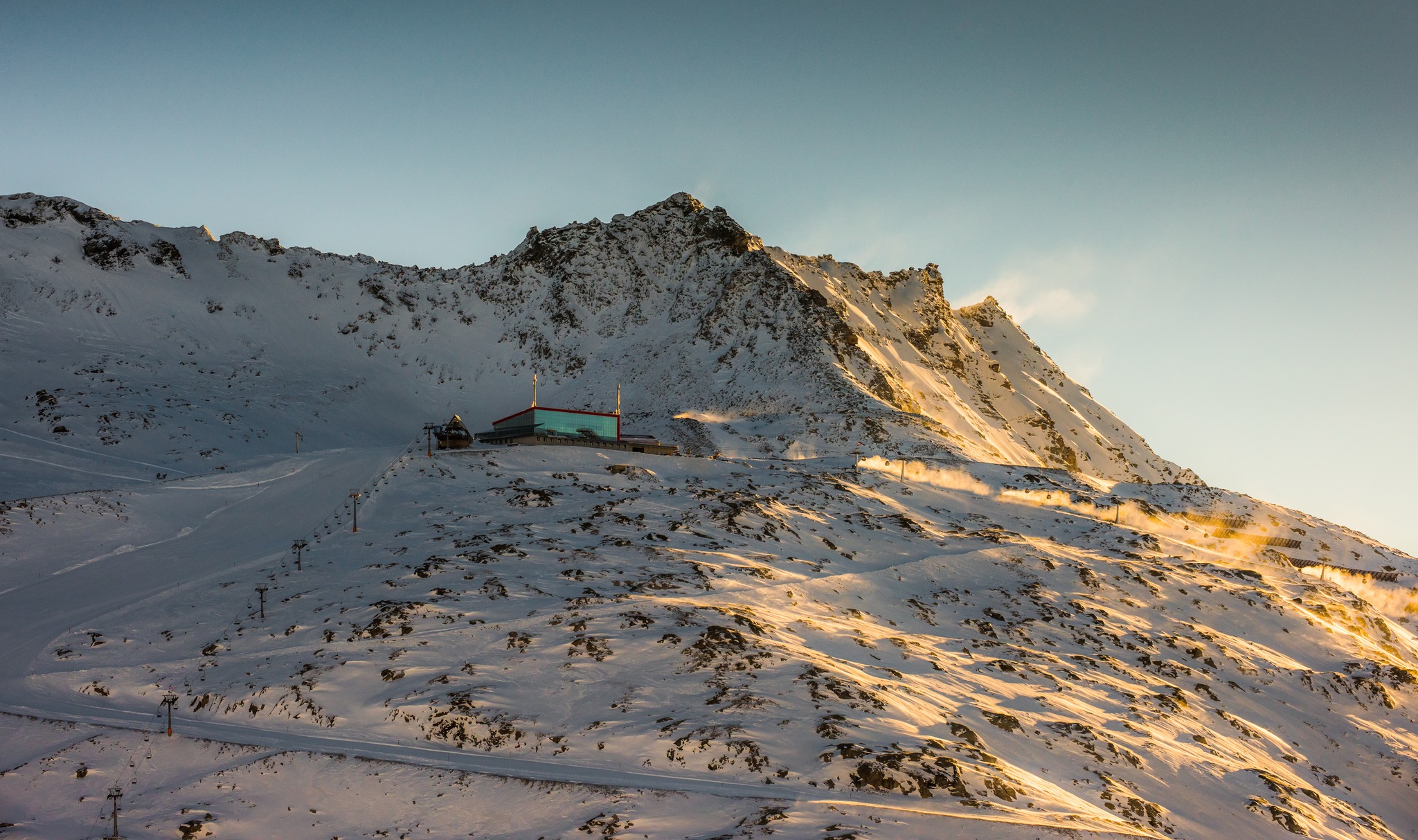
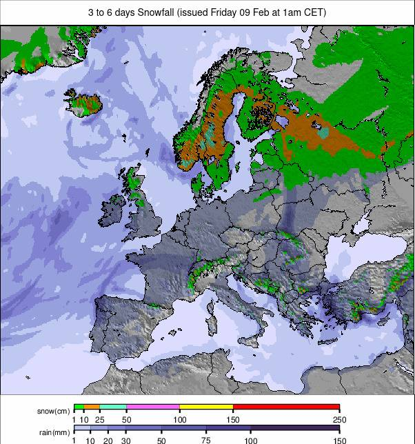
Image: European snowfall summary overview for the next 3-6 days.
AUSTRIA REPORT
As forecast, the past week has remained predominantly warm, dry and sunny across Austria. That being said, there have been some snow showers for some higher slopes, with the warm temperatures occasionally drawing in cooler air from the north. The main thing, however, has been valley highs hitting double figures above zero again in the afternoon and the freezing point reaching as high as 3,500m, higher than the top Austrian lift. The warmth is taking its toll on low slopes but most Austrian areas, at least the big-name resorts, are prepared and have enough snow piled on low runs to withstand the thaw, it’s just not very fresh. Kitzbuhel (70/101cm / 28/40″), for example, remains 100% open and most other Austrian regions have 90% or more of their slopes available.
AUSTRIA FORECAST
A day or two more of very warm temperatures should finally give way to a change from Thursday onward with colder temperatures and fresh snow forecast. The only issue may initially be that as precipitation meets cooling air some lower slopes may initially see rainfall rather than snowfall.
SWITZERLAND REPORT
Swiss ski areas have had the same sunny, warm week with temperatures into double figures in valleys and the freezing point up above 3,500m in the afternoons there too. The country’s snow depths were relatively good before the warm spell began a fortnight ago, in most places at least. So, while freeze-thaw isn’t welcome to high elevations this early in the season, at least most slopes remain open. Higher resorts like Saas Fee (63/310 cm / 25/124”) have begun pointing out on social media that their glacier-crowned runs, which are among Europe’s highest, are particularly well placed in the current conditions. The 4 Valleys (40/270 cm / 16/108”) around Verbier continue to post the most open terrain entirely in Switzerland with 390 km of slopes (over 95% of the maximum possible area) available.
SWITZERLAND FORECAST
The protracted period of warm weather is thankfully expected to end in the latter half of this week with temperatures dropping back down towards seasonal averages and moderate snowfall forecast across the country’s ski slopes from Thursday onward.
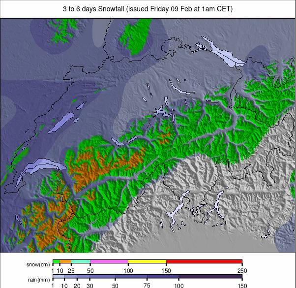
Image: Switzerland snowfall forecast for the next 3-6 days.
FRANCE REPORT
The state of French ski slopes became apparent last weekend when downhill races planned for Les Houches, in the Chamonix Valley (celebrating the centenary since the FIS was established in the famous ski town), had to be abandoned due to the warm temperatures. As with the rest of the Alps, valley highs have been up at +8 to +12C at and below 1,000m altitude. The freezing point is up as high as 3,500m so base depths are dropping, particularly on lower slopes and the snow quality is also not great below 2,000m or off-piste either. However, French ski areas are still posting the world’s deepest bases on higher runs and most centres remain almost fully open. The 3 Valleys, for example, still have the most terrain in the world open, around 560km (350 miles) of runs and the other big French areas also have 90% or more of their terrain open. In other good news, the avalanche danger has dropped from 3 to 2 on the scale (that goes up to 5) in most areas.
FRANCE FORECAST
The weather should finally begin to change from Thursday onward, with clouds and light snowfall moving in as temperatures fall. We may again see rain initially in valleys, but it will be getting colder and the snowfall heavier as the weekend approaches.
Image: European Alps snowfall forecast for the next 3-6 days.
ITALY REPORT
Italy has also enjoyed a week of predominantly dry and sunny weather, with the warmest temperatures in the south and west of the country, where valley temperatures have reached +15C at the height of the afternoon at the lowest altitudes. Despite this, most of the big Italian areas are still 80-95% open, as a result of preparing for this scenario by piling snow on low pistes. The cross-border Via Lattea (Milky Way), including the slopes of Sestriere, Sauze d’Oulx, Claviere and Montgenèvre, over in France (165/215cm / 56/86”), is posting the most terrain open in Italy, up to about 70% of its terrain and 275km.
ITALY FORECAST
Much colder temperatures at altitude to end this week, with some significant snowfall likely from Friday (though that’s still a little too far off for certainty on just how much). Valley temperatures are not dropping hugely so the danger of rain, particularly initially, is low as the weather changes.
GERMANY REPORT
German ski areas continue to battle mild temperatures, which have wiped out snow cover on lower slopes. Garmisch Partenkirchen (45/125cm / 18/50”) has managed to keep theirs open but with wet snow at the base, which led to the Women’s World Cup races (due to be staged there last weekend) being cancelled. It has been a few degrees cooler here than further south and west, however, and there have even been some light snow showers reported on high slopes. So it’s really all about altitude. Garmisch reports that its slopes are 95% open despite the snow quality issue. Balderschwang (40/60cm / 16/24”) has the most terrain open though at 41 km (26 miles) and 100% of its slopes.
GERMANY FORECAST
Colder weather at altitude from Thursday as precipitation moves in, so fresh snow falls on higher slopes. Unfortunately, it is not getting so cold at lower elevations according to the current forecast predictions. So unless things change they will see rain rather than snowfall.
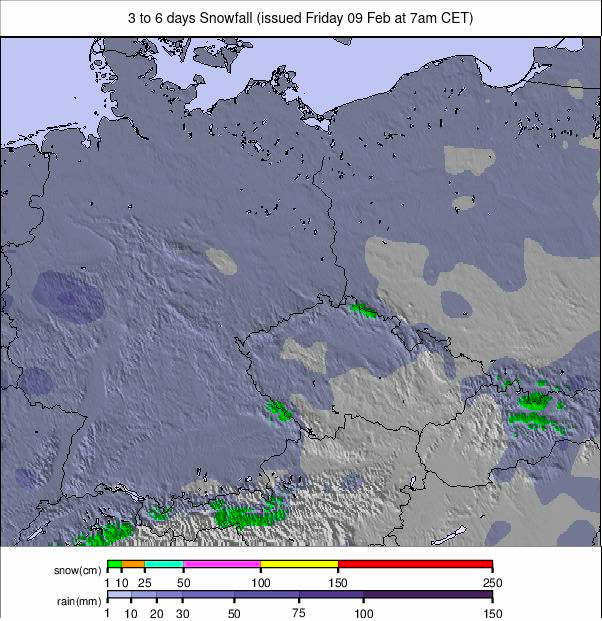
Image: Germany snowfall forecast for the next 3-6 days.
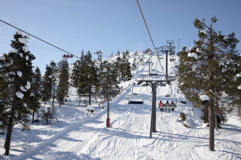
SCANDINAVIA REPORT
Scandinavian ski areas are in very good shape overall, but they were hit by severe storm force wins of up to 180 kilometres per hour (113 mph) at the end of last week, closing many centres in Norway and Sweden for several days as it blew through, and there have been more gusty, windy days since. Other than that though, conditions are pretty positive with most of the region’s slopes open and snow depths growing. Several resorts reported the storm had left over 30cm (a foot) of fresh snow, but also warned of snowpack instability. Myrkdalen (130/200cm / 52/80”), near Voss in Norway, is posting the region’s deepest snow, with Voss itself (125/150cm / 50/60”) in second place. Sweden’s Are (50/95cm / 20/38”) has the most terrain open, more than 80km (50 miles) of runs.
SCANDINAVIA FORECAST
A largely snowy forecast for Scandinavia still, although with a few sunny days in the mix. Temperatures typically between -2 and -20C with regular snow showers bringing 5-10 cm (2-4″) most days to most centres.
SCOTLAND REPORT
The forecast has been hard to pin down for Scotland over the past week, with warm southerly airflow hitting colder air from the north. The former has brought a lot of precipitation. So, the result has been down to how cold the air might get due to the latter. Unfortunately, so far the answer has been, mostly, not cold enough. There has been more snow on mountain tops but the country’s ski centres have faced snow loss due to rain and mild air with gale force winds continuing to make their presence felt as well. Therefore, most have been closed yet again for much of the past week, and when open it’s mostly been back to the all-weather-snowmaking maintained nursery slopes at the base of the hills.
SCOTLAND FORECAST
There’s some hope of improving conditions. Less precipitation is forecast but we should be getting back below freezing more consistently. So there will at least be something to build on and any surviving snow can potentially be knocked back into shape.
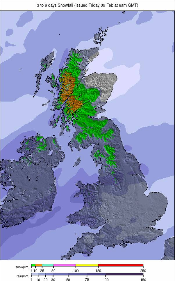
Image: UK and Northern Ireland snowfall forecast for the next 3 days.
SPAIN / ANDORRA REPORT
It’s been a month now of almost non-stop sunny days with the freezing point all too often high above the highest peaks in the Pyrenees, at over 3,000m. So the battle to keep slopes open continues and the reality is that the existing snowpack is mostly very hard packed snow. The region’s largest area, Andorra’s Grandvalira (25/70cm / 10/28”), continues to post about half its terrain open. Although, in truth, higher areas like Pas de la Casa have more open and lower areas have less. It’s a bigger struggle for some centres like Spain’s Formigal (15/45cm / 6/18”), which has only a quarter of its 143 km (90 miles) of slopes open.
SPAIN / ANDORRA FORECAST
Temperatures are expected to finally start falling below freezing from Thursday, with some snowfall to come from Friday through the weekend. Potentially as much as 30 cm (12”) by Monday down to low elevations.
BULGARIA / ROMANIA REPORT
A mostly sunny week in Bulgaria and Romania although the occasional light snow shower up high has bubbled up. We’ve seen colder temperatures down here than in the Alps for the second week, although not by much. Valley highs have remained in single figures above freezing in the afternoons though and overnight lows up high have become well below freezing. This would be keeping the snow fresher if it was not mostly old/machine-made. Bansko (15/90 cm / 6/36”) has jumped to almost 100% open ahead of hosting World Cup races, Borovets (125/135 cm / 50/54”) continues to post Bulgaria’s deepest snow and remains over 90% open.
BULGARIA / ROMANIA FORECAST
Staying mostly sunny through the coming week. Overnight lows up high -5C, daytime highs down low up to +10C.
CZECH REPUBLIC / SLOVAKIA REPORT
It’s been a little cooler in the Czech and Slovak Republics than further south and less sunshine too. Unfortunately, this has meant rain on many slopes towards the end of last week, but then it did turn to snow overnight, then to sunshine to start this week. Higher altitude centres in the region have most of their runs open, lower centres half, on average. In the Czech Republic Špindlerův Mlýn (70/125 / 28/50”) is almost fully open. In the Slovak Republic it’s Jasna (40/100cm / 16/40”) with the most terrain open and in the wider region more than 90% of its 50km (31 miles) plus of slopes are open.
CZECH REPUBLIC / SLOVAKIA FORECAST
Cold and cloudy with more snowfall up high and rain at lower elevations through the remainder of this week.
NORTH AMERICA
NORTH AMERICA INTRO
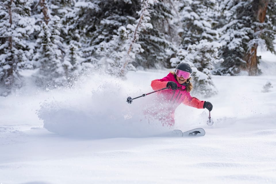
It’s been a big weekend across North America with some good snowfalls in the Rockies and the moist snow so far this season on the West Coast as a week-long series of storms moved into California to start February. It’s a nuanced picture though because, ironically, further north, ski areas in western Canada have had to close terrain and in one case close completely due to spells of warm weather and rain damaging the snowpack. But across most of the continent, the picture is, nonetheless, the most positive it’s been all season, with particularly good conditions in the Colorado and Utah Rockies while Californians are celebrating their first deep powder days of the winter.
ROCKIES REPORT
Significant snowfall returned to the Rockies at the weekend with a 48-hour snowstorm blowing in and bringing fresh powder across the region. For many, this was the biggest snowstorm of the season so far with many ski areas in Colorado and Utah posting at least a foot (30cm) of fresh cover and great powder conditions at present. Taos, in New Mexico, posted that it received 30” (75cm) in 48 hours at the weekend. It comes as more ski areas in the region report January was one of the best for snowfall of the past decade, Steamboat (20/48” / 50/120cm) saying it was its third snowiest of the last 12 years.
ROCKIES FORECAST
Sunshine with mostly light snowfall forecast through the coming week with snowfall totals of around 1-3″ (2-10cm) most days and temperatures between 20-40F through the 24-hour cycle, mostly below freezing.
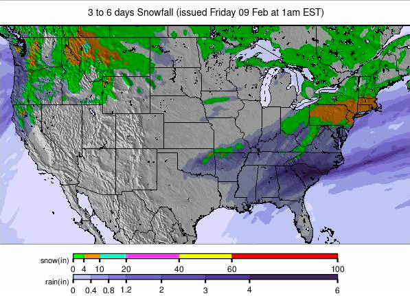
Image: USA summary overview snowfall forecast for the next 3-6 days.
USA WEST REPORT
A stream of snowstorms has been hitting America’s Pacific coast since Mammoth Mountain (57/57” / 142/142cm) reported 12-14″ (30-40cm) at its base for February 1st and unofficially 18-24 (45-60 cm) higher up for the start of February. After a calm few days, a second wave hit on Sunday and by Tuesday morning it had reached over 44″ (110cm) in total. Other ski areas in California have been dumped on too, just not quite as much. Although Alaska has been overtaken by ski areas in Oregon and Utah in terms of the deepest published snow depths in North America, Anchorage has posted its earliest-ever winter to date for reaching the 100″ (2.5m) season snowfall, although the snow is unusually heavy due to a higher than normal water content.
USA WEST FORECAST
The snowfall is expected to continue for a few more days before sunshine returns from Thursday/Friday and this is set to continue through the weekend.
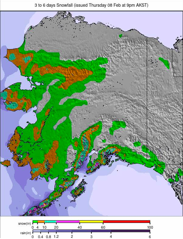
Image: Alaska snowfall report for the next 3-6 days.
MIDWEST REPORT
It has been another mixed week in the Midwest, with some cold weather and even fresh snowfall, but the week has also seen spells of mild weather bringing rainfall to some centres. Snow coverage and open terrain also vary a good deal across the region as it has all season to date. Ski areas in Michigan continue to post the deepest snow led by Ski Brule (48/56″ / 120/140cm), which is fully open. At the other extreme, Roundtop (12/12” / 30cm/30cm), in Pennsylvania, reports its base just a foot deep, although it still has 95% of its terrain open.
MIDWEST FORECAST
Unfortunately, it’s not looking a lot better for the coming week with rain forecast and temperatures climbing up to the mid 40’s Fahrenheit. Overnight lows should drop below freezing at times and snowfall is possible, but more consistent cold is needed.
USA EAST REPORT
January was quite a transformative month in the eastern US with Vermont’s Sugarbush (24/40” / 60/100cm) reporting it was the snowiest it has been in more than a decade; great timing after one of the warmest and driest/wettest Novembers and Decembers in decades that came before it. Fortunately, most ski areas in the region now have at least two-thirds of their terrain open, many 80-95%, and some even more.
USA EAST FORECAST
It’s looking sunny for the week ahead with temperatures up to the high 30s and low 40s Fahrenheit in the afternoons, but dropping back below freezing overnight. Temperatures are dropping and snowfall is expected at the weekend.
CANADA
CANADA WEST REPORT
Warm temperatures have, unfortunately, been impacting western Canadian ski areas. Not that warm compared to other parts of the world, but getting up to +5C here is not good for the famous powder. Kicking Horse closed much of its steeper terrain due to what it says was an unstable snowpack caused by the warm temperatures, and Mount Washington closed completely at the end of last week due to rain damage to its snow. Even Whistler Blackcomb was forced to concede “rain damage” and a “decreased footprint” due to warm weather at the end of last week, though things have cooled a little since.
CANADA WEST FORECAST
Light to moderate snowfall over the next few days, then a dry end to the week before more weekend snowfall. Temperatures should stay below freezing, with highs up at about zero, and lows of -15C.
CANADA EAST REPORT
A predominantly cold, dry, and frequently sunny week is predicted for eastern Canada, with temperatures generally in the -5 to -20C range, so closer to the seasonal average and no danger of freeze-thaw here. Mont Tremblant (5/130 cm / 2/52″) continues to post both the deepest snow and the most terrain (over 90% of its full area) open. However, most of the areas in Ontario and Quebec are now almost fully open as well, and Mont-Sainte-Anne (50/70 cm / 20/28”) is not far behind Tremblant with 80% of its slopes open.
Image: West Canada snowfall forecast for the next 3-6 days.
CANADA EAST FORECAST
Mainly dry but overcast skies predicted for the coming week. Temperatures are set to warm rapidly and, unfortunately, there’s concerns of rain again at the weekend; however, this could still fall as snow with forecasting marginal at this point.
ASIA
JAPAN REPORT
Regular daily snowfalls are quickly pushing Japanese ski areas towards the top of the world snow depths table as the numbers in Europe, which have led all winter, stalled and even fell in recent weeks. Niseko (115/330 cm / 46/ 132”) and other Hokkaido ski areas are posting the biggest numbers for upper slope base depth. Although welcomed, this snowfall has been accompanied by strong winds, which has resulted in upper mountain closures at times. Shigakogen Mountain Resort (100/270 cm / 40/108”) is posting the most terrain open in the country, 98% of its 83 km (52 miles) of slopes.
JAPAN FORECAST
Continuing cold temperatures (-3 to -15C typically), overcast and frequently snowy weather will reign across Japan’s main ski regions for the rest of the week and over the weekend, with 5-15 cm (2-6 inch) average snow accumulations expected most days.
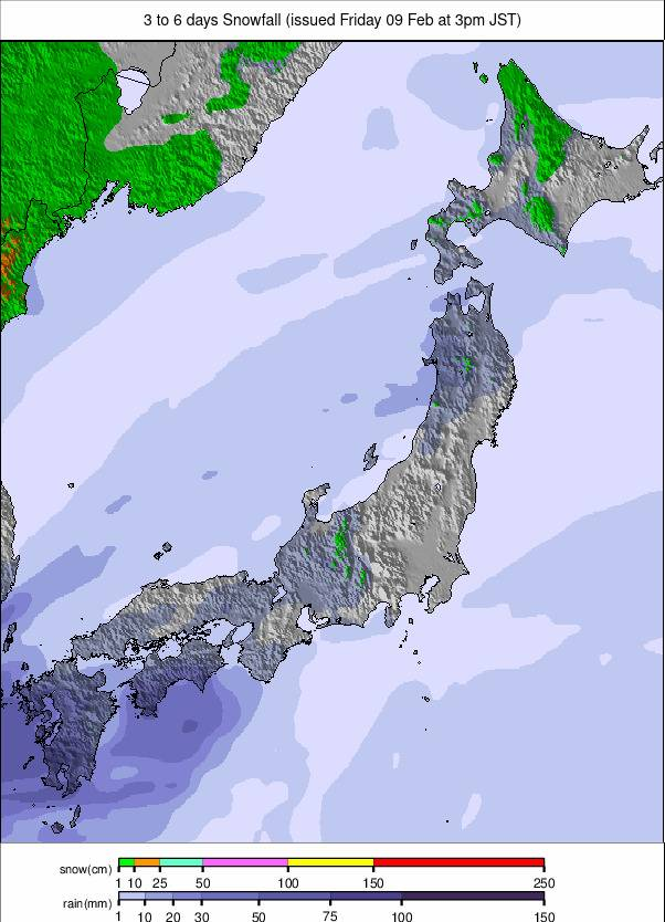
Image: Japan snowfall forecast for the next 3-6 days.