WORLD SNOW ROUNDUP #226
(Updated 24 January 2024) A comprehensive review of snow conditions, weather, and updates for Europe, North America and Asia's winter sports destinations.
Issued: 24th January 2024
By Patrick “Snowhunter” Thorne
World Overview
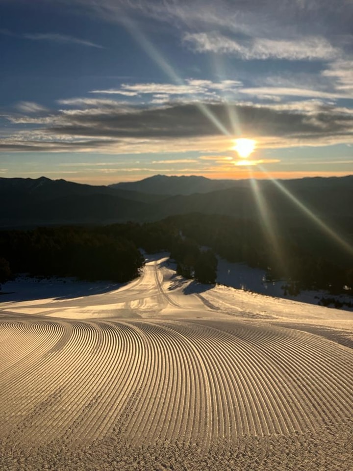
The world’s deepest snow depth reached 5 metres (nearly 17 feet) in the French Alps at the end of last week, quite unusual for Europe to be leading the way when usually it’s a ski centre in Japan or the western US topping the tables. However, it reflects the fact that in a week of weather extremes, which included torrential rain at some low lying resorts in the western Alps for nearly 48 hours at the end of last week, higher slopes only a short distance away were getting abundant snowfall instead.
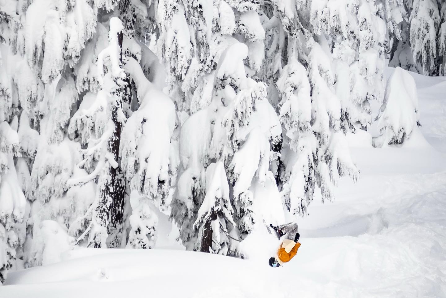
Although North America and indeed Japan are playing catch up after the poor start to the season around the Pacific, the transformation since the start of 2024 has continued with snowfall, mostly moderate to heavy continuing and in some cases intensifying across the region. Ski areas in the Pacific Northwest reported up to 100” (2.5m) of snowfall in 7 days.
Europe
A rather up and down week in the Alps with heavy snowfall for some bringing up to a metre of snowfall to higher slopes in the latter half of last week before a cold, clear and sunny weekend in many areas gave way to more unsettled conditions again and rising temperatures to start this week. Yoyoing temperatures though meant that when all that snow was falling up high, some low-lying slopes were unfortunately seeing torrential rain. There’s bad news for the Pyrenees too with ever warmer, sunny weather rather than the snowfall needed and its not a whole lot better in Bulgaria. But in the north, Scotland’s five centres all managed to open together for the first time this season last week and conditions continues to be largely very good across Scandinavia.
AUSTRIA REPORT
Austria has had an up-and-down weather week with a murky end to last week with low cloud, sleet and gusty winds in the latter days turning to a perfect weekend of cold, crisp temperatures and sunshine. This week has seen mostly dry weather so far although the occasional snow showers and temperatures and thus the snowline unfortunately rising. Accumulated snow depths though mean that for now this shouldn’t be an issue at most major areas. More Austrian areas have passed the 3m (10 feet) upper slope base depth mark with St Anton (70/340cm / 28/136”) still topping the table for the country’s snow depth and most terrain open at over 280km (175 miles), more than 90% of its maximum area,
AUSTRIA FORECAST
More unsettled conditions are forecast in the latter half of this week with snowfall returning down to low elevations, although with temperatures still set to reach +3 to +6C in valleys, some could see rain down low.
SWITZERLAND REPORT
Swiss ski areas report good conditions and many got a decent dump of snowfall in the latter half of last week (although, in France as seen below, low-lying slopes in the west of the country saw rain or sleet at the same time). Glacier 3000, high up near Gstaad, posted a 1 metre accumulation. Temperatures dipped and the skies cleared at the weekend for crisp, sunny weather, but it’s since got unsettled again and temperatures have warmed. Switzerland continues to have more terrain open than most other countries and Verbier and the 4 Valleys continue to top the table for most open with 95% of its 400km (250 miles +) of runs open. Laax (37/345cm / 15/138”) now tops the Swiss table for deepest snow, closely followed by Saas-Fee (76/320cm / 30/128”) and Engelberg (35/294cm / 14/117”), the latter announcing more of its freeride terrain has opened thanks to the better snow depths.
SWITZERLAND FORECAST
Some midweek snowfall on high slopes, but temperatures will creep up to high single figures in the valleys, which may damage lower slope cover a little. Sunnier to end the week and current models suggest its likely to stay dry through the weekend.
FRANCE REPORT
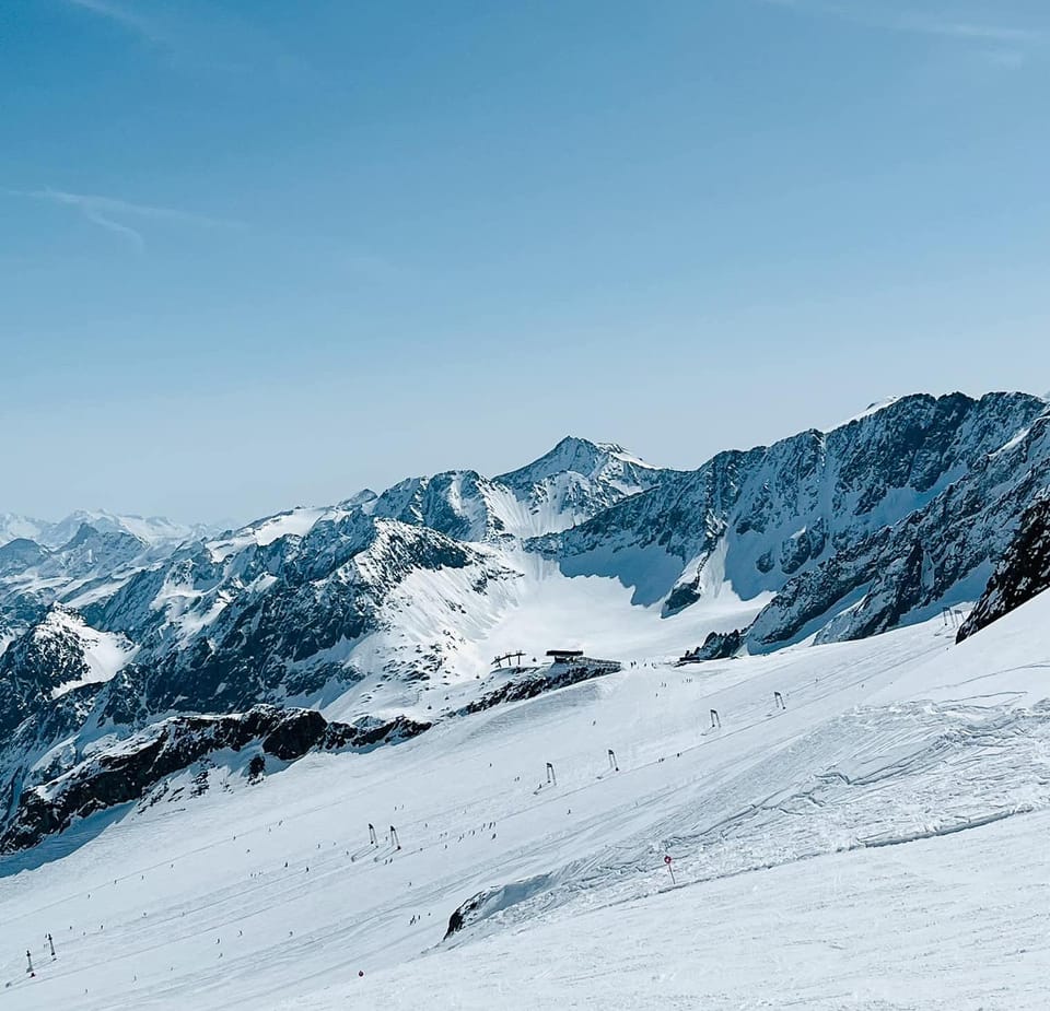
We’ve seen weather extremes in the French Alps with torrential rain below 1800m during a warm spell at the end of last week. But that rain falling as very heavy snow at higher elevations. As a result four French areas are now posting 4m (13.3 feet) plus bases and one, Alpe d’Huez (103/500cm / 41/200”) has become the first in the world to post a 5 metre (200”) base this winter on its highest slopes. So great conditions up high, although with avalanche danger widely at level 3 (“considerable”) on the danger scale. Not so good down low though, the Portes du Soleil (20/145cm / 8/58”) has lost cover and open terrain on its lower runs at resorts like Les Gets and Morzine.
FRANCE FORECAST
Mostly dry, mostly sunny weather forecast with warm valley temperatures getting as high as +9C down at 1,000m in the afternoons. The freezing point will move up as high as 3,000m altitude later in the week, very high for January.
ITALY REPORT
There’s been plenty of sunshine in Italy since the end of last week, with cold temperatures at the weekend but warming now. There’s not much fresh snow to report except in the latter days of last week at the big resorts in the northwest of the country, which saw a decent dump on Wednesday/Thursday as forecast. The country’s deepest snow is, unsurprisingly, lying up in that northwest corner with La Thuile (180/390cm / 72/156”) topping the table. Most of the country’s ski slopes are open with Val Gardena (60/70cm / 24/28”) posting the largest area wholly in Italy, 180km (114 miles), which is 98% of its runs. The Milky Way / Via Lattea (140/190cm / 56/76”) continues to struggle a bit it seems with only 60% of its runs reported open despite posting decent snow depths.
ITALY FORECAST
Some very warm temperatures and a rising freezing point in western Italy, valley highs of +12C will challenge resort teams maintaining snow cover. However, the Dolomites should remain colder under the influence of a separate weather system. So there’ll be a clear dividing line. Most areas though dry and sunny.
GERMANY REPORT
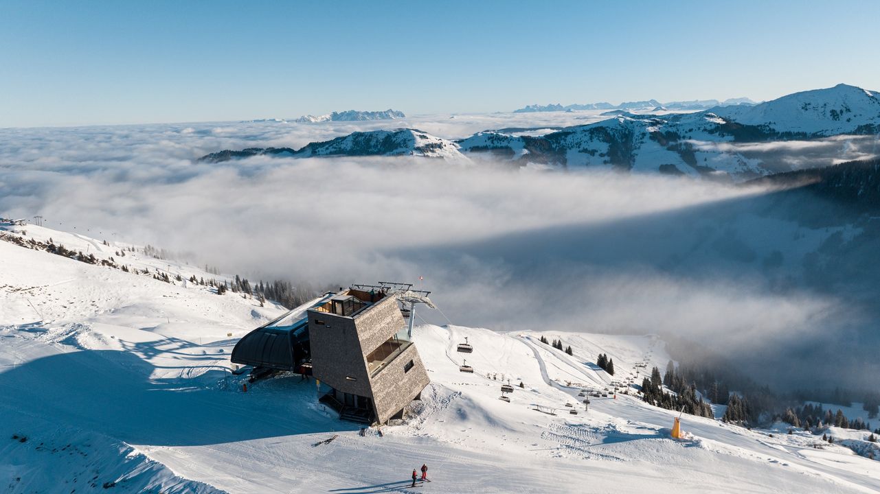
It has been a largely dry week on German ski slopes, where the ski racing world’s attention is about to be focused as the World Cup tour prepares to make its annual stop here at Garmisch Partenkirchen (50/130cm / 20/52”). Things are looking good there with everything open and decent snow depths. The only fly in the ointment is rather warm temperatures expected before the race. The nearby Zugspitze Glacier (120/230cm / 48/92”) has, as usual, the country’s deepest snow on its highest slopes.
GERMANY FORECAST
Unfortunately, warmer weather over the next few days (+4 to +8C forecast) could bring rain to lower slopes. More snowfall up high though and skies clearing and temperatures should drop later in the week.
SCANDINAVIA REPORT
We’ve had everything this week in Scandinavia with snowfall, cloud, gales and dry spells hitting different regions at different times. The big picture remains positive though with temperatures generally in the freezing down to -15C range, and most centres fully open. Temperatures have been creeping above freezing at lower, coastal resorts but Norway’s Voss (125/1509cm / 50/60”) reports a healthy snow depth. Sweden’s Are (50/86cm / 20/34”) has the most terrain open in the region with 90% of its slopes available.
SCANDINAVIA FORECAST
More mixed weather is ahead with some strong winds, sunny spells and also snow showers. Temperatures as low as -20C are forecast.
SCOTLAND REPORT
Getting tantalisingly close to the ‘proper’ opening of Scottish ski slopes as cold weather continues with light snowfalls. Four of the five Highland centres (all but Nevis Range) have at least beginner slopes open and Glenshee (0/15cm / 0/6”) and Cairngorm (10/20cm / 4/8”) have both gone a little further opening a few more runs. Cairngorm is frustrated by the fact that its funicular is out of action once again, so it’s an uphill hike to access the M1 Poma serving the White Lady and M1 runs, other slopes have opened there too. Glencoe (0/20cm / 0/8”) hasn’t opened any inbounds terrain yet except its nursery slope, but continues to operate its access chair for tourers happy to hike to the snowclad summit above. As we complete this week’s report Nevis Range has just announced plans to open from Thursday, but has not said what will be open.
SCOTLAND FORECAST
It’s a fine line, as is often the case, for Scottish ski areas with gales and lots of precipitation forecast over the next few days. The question is whether the snowline is, as rising temperatures could mean the precipitation is rain and washes away the thin cover, or in the best case scenario, they get dumped on.
SPAIN / ANDORRA REPORT
Sadly, no improvement to report in the Pyrenees where The Freeride World Tour announced on Saturday they were cancelling the planned first event of the 2024 season in Spain’s Baqueira Beret due to inadequate snow for off-piste descent at a competitive level, and warm weather forecast. Baqueira Beret (120/150cm / 48/60”) actually has had the most pisted terrain open in the region for much of this winter to date, although it has just been overtaken by a kilometre by the bigger Grandvalira (30/70cm / 12/28”) in Andorra, both on around 120km (75 miles) of slopes, 65% of Baqueira’s maximum area, 50% of Grandvalira’s.
SPAIN / ANDORRA FORECAST
Non-stop sunshine and some very warm temperatures are forecast, getting up to +10C on higher slopes, +15C in resort, which looks to be very bad news.
BULGARIA / ROMANIA REPORT
Some snowfall in Bulgaria and Romania this week, but nothing really transformative and the issue of not much fresh and warm weather continues with ski centres operating on a mix of older natural and machine-made snow on the whole, the upper mountains in the best shape. Snow depth stats are down a little with Borovets (80/105cm / 32/42”) still posting the healthiest numbers. Bansko (5/80cm / 2/32”) still struggling with only about half of its terrain open. It’s a similar scenario for other centres in the region with Vitosha (30/50cm / 12/20”) only reporting a third of its runs open.
BULGARIA / ROMANIA FORECAST
Not much improvement likely with a week of sunshine forecast. The only positive is that it should actually stay close to freezing down to low levels. So, hopefully, not too much more of a thaw.
CZECH REPUBLIC / SLOVAKIA REPORT
It has been a fairly dry few days, with lots of sunshine at the weekend in northeastern European mountains, but things have just turned a little more unsettled with the first snow showers moving in. The good news is it has been cold, with highs around freezing in valleys in the afternoons, lows down at -10C or a degree or two lower. Most larger, higher resorts are 90% open or more, including the biggest in the region, Slovakia’s Jasná (40/100cm / 16/40”), however low-lying centres are struggling due to warmer temperatures and rain lower down. Veľká Rača (10/15cm / 4/6”), with lifts between 600 and 1500m for example, has limited snow and only about 10% of its runs open still.
CZECH REPUBLIC / SLOVAKIA FORECAST
A new front is bringing fresh snowfall to Czech and Slovakian slopes as we publish this week’s report. Initially, light snowfall is expected through the next few days, temperatures remaining below freezing.
NORTH AMERICA INTRO
The season continues its rapid turnaround that seems to have begun with the change of the year. More consistently cold temperatures and frequent snow showers right across the continent but heaviest in the Pacific Northwest, where one ski area claimed to have received 100 inches (2.5 metres) of snowfall in a week, as much as it had had in the previous first two months of the season. All the snow translates into ever more open terrain and we’ve gone from only about 50% of North American ski slopes open between Christmas and New Year to more than 80% now and much closer to the seasonal norm for skiable terrain and snow depths in most areas.
ROCKIES REPORT
It’s looking better and better in the Rockies after the snowfall and cold temperatures that marked the first half of January. Utah’s Park City Mountain Resort (54/73” / 135/183cm) is up to 100% open for the first time this year, the largest ski area in the US. The past week has seen more snowfall, but also some dry days enabling centres to take stock and open more terrain, with more steep and deep runs now opening alongside the groomers at resorts like Crested Butte as the snow depths allow it. Most other ski areas in the region are now 80-100% open, with another Utah area, Alta (60/111” / 150/277cm) posting the deepest snow again.
ROCKIES FORECAST
Mostly dry weather is forecast for the coming week, although overcast with occasional light snow showers. Highs around freezing point, lows in the teens Fahrenheit.
USA WEST REPORT
The transformation of the 23-24 season from zero to hero continues with Timberline (78/116” / 195/289cm) ski area in Oregon reporting it has had 100 inches (2.5 metres) of snowfall in 7 days, up to the weekend. The fear now is of avalanches and tree well traps so skiers are advised to always ski with a buddy and of course keep aware of current conditions. It’s now reporting the deepest snow in North America. But it’s a fast-improving picture right along the US West. Other resorts are looking much better with the snow now six feet deep up top at Mammoth Mountain (46/75” / 114/187cm), which is also up top 85% open now.
USA WEST FORECAST
Continuing heavy snowfall in the Pacific Northwest with several feet (60cm+) more snowfall likely by the end of the weekend. Lighter snowfall interspersed with sunny spells further south. Temperatures are at a high of around freezing, with lows in the 20s Fahrenheit.
MIDWEST REPORT
Conditions in the Midwest have continued to improve over the past week, thanks in part to another storm system. Winter storm Indigo was a big help into the weekend, bringing plenty more snow and helping with the ongoing transformation to a snowy wonderland after the warm and dry start to the season. There’s still a lot of variety in terms of open terrain, but Michigan’s Ski Brule (48/56″ / 120/140cm) is posting the region’s deepest snow and is around 90% open. Many have hit 100% now though including Wisconsin’s Tyrol Basin (25/40” / 62/100cm) with all runs open, while Boyne Mountain (30/30” / 75/75cm) has hit 50 runs open.
MIDWEST FORECAST
Temperatures hovering around freezing in the Midwest over the next few days. Not much snowfall in the forecast although showers in the north on slopes in states like Michigan and Minnesota are on the cards, but there’ll also be sunny spells and some dry but overcast weather.
USA EAST REPORT
It’s been a good start to 2024 in the eastern US following the bad end of the year and the start of the season in November and December. The snow has kept falling allowing centres that were hardly open to open ever more terrain. It has stayed snowy too, not turned to rain as had been the reposted problem. So resorts in the region have been posting some of the best snowfall numbers in the world. For example, four feet (1/2m) in seven days at Vermont’s Sugarbush (37/37” / 93/93cm). The East’s largest resort, Killington (16/16” / 40/40cm), still isn’t publishing much snow depth but says it had three feet (90cm) of snowfall in the same period and has also gone from being virtually closed for the first month or so of the season in terms of very limited terrain to now being around 96% open.
USA EAST FORECAST
Mostly dry weather is expected for the coming week. Temperatures down towards single figures Fahrenheit overnight, highs at freezing point, and a mixture of sunny and overcast days with flat light.
CANADA
CANADA WEST REPORT
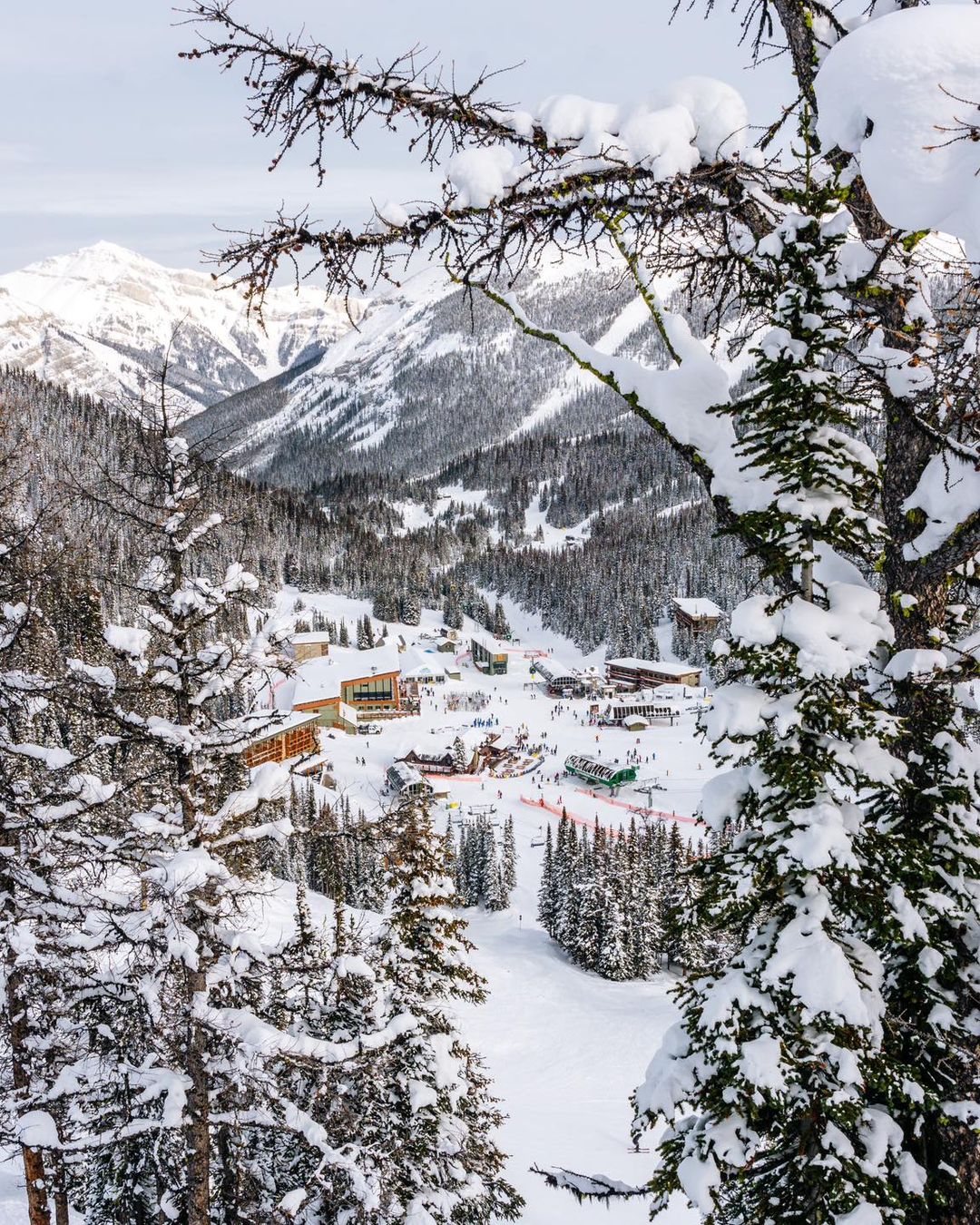
Conditions in western Canada are the best they’ve been all season. Nowhere is the transformation more marked than at Red Mountain resort (110/110cm / 44/44”) in BC, which couldn’t open at all until about four weeks ago and then only had 10% of its slopes open. Now, thanks to cold weather and some good snowfalls, its almost 100% open. That’s also the case for Whistler Blackcomb (11/156cm / 4/62”) which has snow down to resort level and also almost all of its terrain open. The past week has seen temperatures rise from the extreme cold earlier this month but remains below freezing with regular snow showers interspersed by sunny spells.
CANADA WEST FORECAST
Staying fairly cold, if not really cold, mostly in the -10 to -1C range. More light to moderate snowfalls are expected but with prolonged dry and frequently sunny periods in between.
CANADA EAST REPORT
Ski areas in Quebec and Ontario as well as the wider eastern Canadian region are definitely posting the best conditions of the season so far, going up from many only able to open less than 50% of their terrain to all having 70-90% of runs open now. This follows 2024 starting with consistently low temperatures for snowmaking and some good snowfalls too. The largest, Tremblant (0/128cm / 0/51”) continues to post the deepest snow and most runs open, 90% of its area. Mont-Sainte-Anne (50/70cm / 20/28″), the region’s second-largest resort to the east, is in much better shape now though with 75% of its runs open.
CANADA EAST FORECAST
Mostly overcast skies for the remainder of the week with frequent snow showers, temperatures in the freezing down to -15C range.
ASIA
JAPAN REPORT
It’s full winter in Japan now with temperatures generally in the -5 to -15C range and most ski areas seeing snow falling daily. There’s some catching up to be done but bases are building and most of the country’s centres are now 80 to 100% open. As you’d expect the deepest snow is on northerly Hokkaido with Niseko (130/310cm / 52/124”) reporting the most snow up top and now nearly 90% of its runs open.
JAPAN FORECAST
There’s snow, snow and more snow in the forecast for Japan with most areas set to see 10-20cm (4-8”) daily every day and temperatures in the -15C up to freezing range.