WORLD SNOW ROUNDUP #225
(Updated 17 January 2024) A comprehensive review of snow conditions, weather, and updates for Europe, North America and Asia's winter sports destinations.
Issued: 17th January 2024
By Patrick “Snowhunter” Thorne
World Overview
A mixed week for snowfall around the world with things getting a little quieter after the big snowfalls a week ago in Europe, but intensifying further in North America and Japan.
Ski areas in the Rockies and Pacific Northwest have reported particularly exceptional accumulations of up to five feet (1.5 m) of snowfall over the past seven days. The snow has brought these regions, which had been suffering from too little snow up to now, back on track. Once lifts and access roads have been dug out, winds eased and areas made avalanche-safe, resorts have finally been able to open much more terrain. And although the snowfall has been most intense in the west, it’s also widespread across the continent.
Although there has been more snowfall across European slopes, the most obvious weather factor has been cold, with over 90% of the continent’s slopes open and a growing number of ski areas reporting bases of more than 4 metres.
Elsewhere in the ski world, there have been good snowfalls for Japan, with bases growing by up to a metre at some resorts, whereas the Himalayas are reporting well below average snowfall, leading India’s Gulmarg ski area to report most of its slopes remain closed unfortunately.
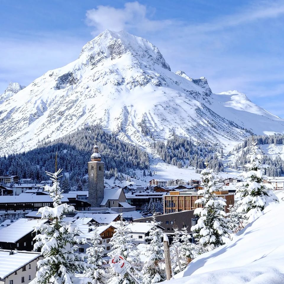
Europe
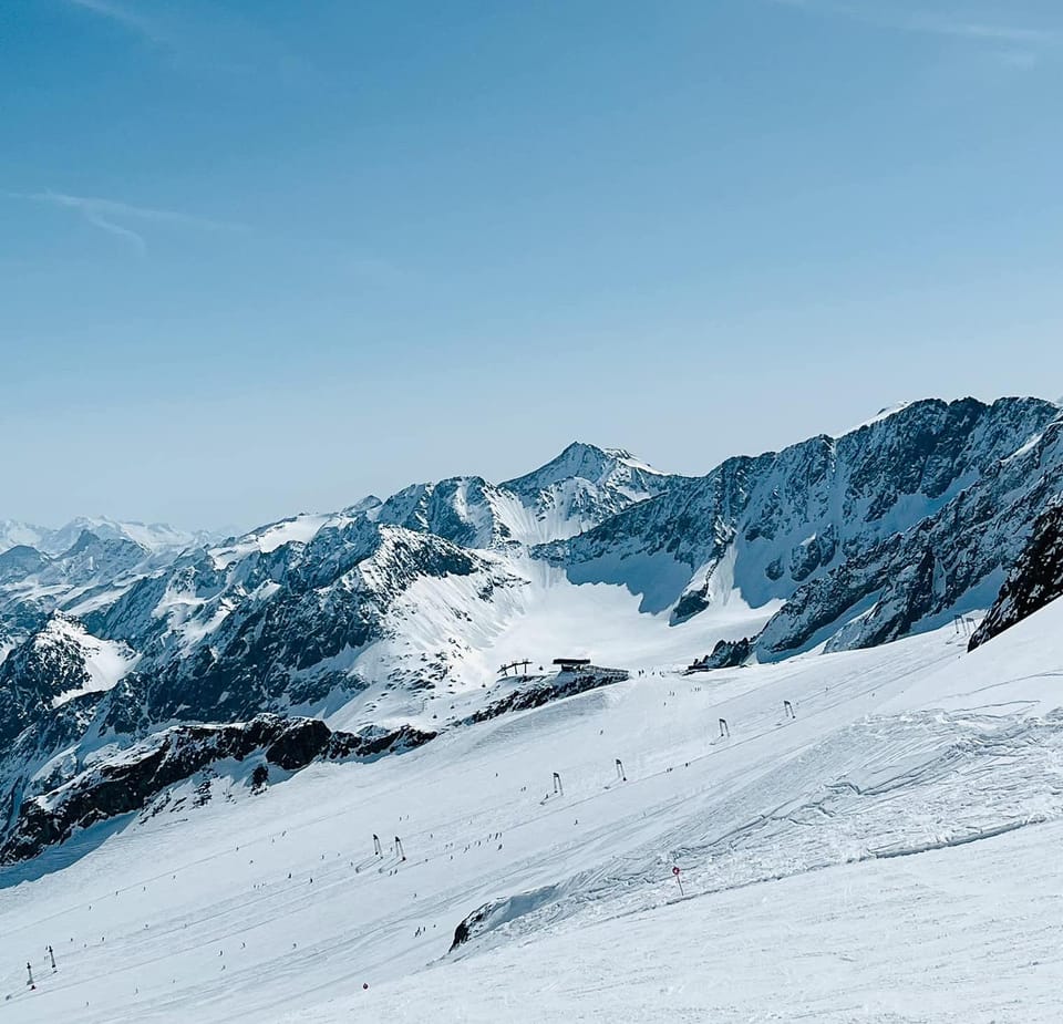
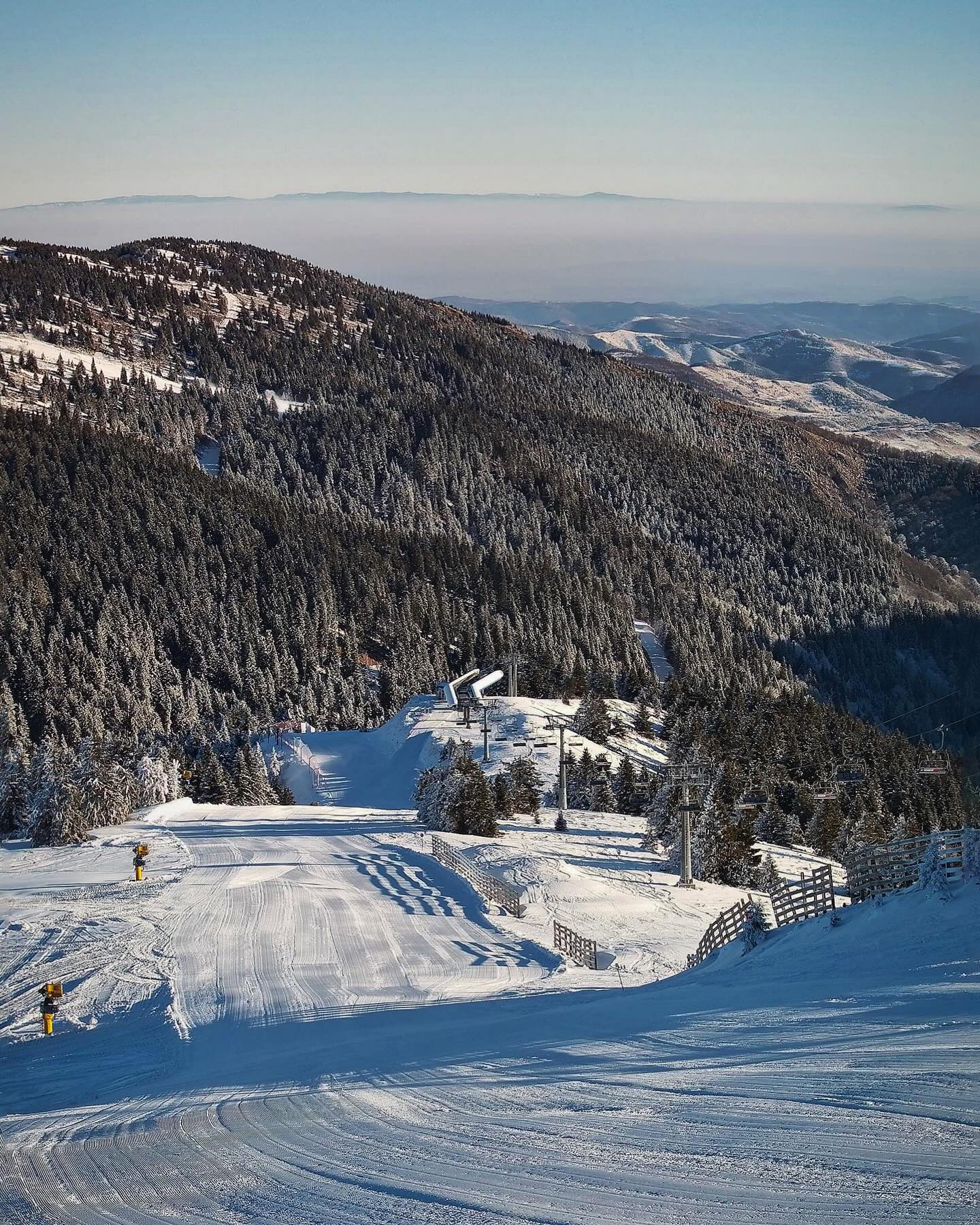
After all the snowfall in the Alps a week ago, which eventually saw some areas see their bases grow by over a metre on high slopes by the middle of last week, it was cold and sunny over much of the west of the continent through the latter half of last week and into the weekend. The last few days though have seen more changeable conditions with daytime valley temperatures creeping back above freezing and a return of snow showers. The big picture though remains of some of the best January conditions this century in the northern and western Alps, with snow depths above average and almost everything open. There’s an improvement further south in the Dolomites and Pyrenees too where it has not been such a bumper season start, but there has been some fresh snow. It’s still looking good in Scandinavia and a gradually improving picture in Scotland as well.
AUSTRIA REPORT
It has been mostly wall-to-wall sunshine across Austria for much of the past week, following the heavy snowfall over the weekend before last. Most have 85-95% of their slopes open. There have been some light snow showers in the last 48 hours across Tyrol, but the bigger picture is mostly dry. Gusty winds have been an issue at times. Most of the country’s major ski areas are in the best shape they’ve been in years with a combination of machine-made bases and abundant natural snowfall. The Arlberg region around Lech and St Anton (70/325cm / 28/130”) continues to post the most open terrain (270km/168 miles of slopes), but the Kauntertal Glacier (210/340cm / 84/136”) has overtaken it to post the greatest depth.
AUSTRIA FORECAST
There is some snowfall in the forecast for the next few days, but just light, interspersed with sunny spells for most.
SWITZERLAND REPORT
Swiss ski areas saw a cold and sunny end to last week and weekend after plenty of snowfall in the first half of last week then temperatures down as low as -15C giving glorious conditions. It’s looking snowy again now with more unsettled weather and warmer temperatures. Almost 90% of Swiss slopes are open meaning the big areas have pretty much everything on offer available. That means over 500km (315 miles) of slopes available at the Portes du Soleil around Champéry (110/165cm / 44/66”) for the first time this winter, with Verbier (40/250cm / 16/100”) and the 4 Valleys 95% open with 390km (243 miles) of runs available.
SWITZERLAND FORECAST
It looks like more snowfall for the next few days, with further 15-30cm (6-12″) accumulations expected but then a sunny end to the week and weekend. Temperatures are slightly warmer in the -5 to +5 range.
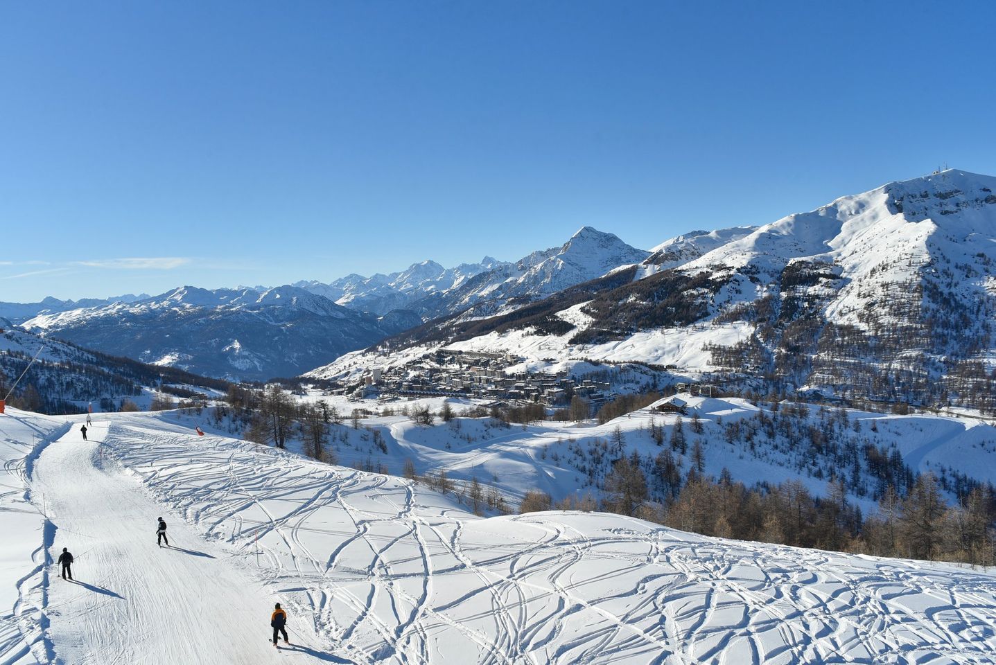
FRANCE REPORT
It’s been a mostly clear, largely dry but still cold week across the French Alps, with temperatures widely in the freezing down to -10C range. There have been light snowfalls and issues with flat light between the sunny spells, the avalanche danger is also widely at level 3 of 5, considerable, but conditions remain excellent overall. Most of the country’s slopes are open with the Portes du Soleil (110/165cm / 44/66”) including Morzine and Les Gets, joining the 3 Valleys in being alone in the world in having over 5000km (313 miles) of runs open and also being home to the only two resorts in the world posting 4m (13/3 feet) plus snow depth on higher runs. The Chamonix Valley’s Grands Montets area above Argentière (15/410cm / 6/154”) and Flaine in the Grand Massif (20/405 cm / 8/162”) topping global snow depth league tables right now.
FRANCE FORECAST
Another band of heavy snowfall is forecast over the next few days bringing 30-60cm (12-24”) of fresh cover by the end of the week. More sunshine is expected into the weekend before snowfall again to start next week. Temperatures in the -15 to +5C range.
ITALY REPORT
There’s been snowfall in the Dolomites this week, deepening the thin cover a little, but as most slopes were open anyway despite not a lot of snow reported lying, there’s no huge change in the numbers. But snow depths have been rising faster in the Italian Alps to the west with La Thuile (120/320cm / 48/128”) the first centre in the country to pass the 3m/10 feet base mark this season. Cervinia’s (25/225cm / 10/90”) ski area linked to Zermatt is currently posting the most terrain open in the country at just under 300km (187 miles) of runs – nearly 90% of the full area.
ITALY FORECAST
Some cloud and some light snow showers over the next few days but staying cold with temperatures down as low as -10C, and highs around freezing. Skies are expected to clear with sunny weather, but staying cold, for most of the country at the weekend.
GERMANY REPORT
It was a cold and sunny weekend for most German ski areas after some good snowfalls last week. Temperatures have been as low as -12C even in mountain valleys but it is warming up again now and becoming more unsettled with temperatures getting back around freezing and light snowfall reported. The country’s deepest snowpack on the Zugspitze Glacier (120/252 cm / 48/101″) has passed the 2.5-metre mark. Balderschwang (50/60cm / 20/24”) has overtaken Reit im Winkl (20/100cm / 8/40”) to post the most terrain open – all 41km (26 miles) of its slopes.
GERMANY FORECAST
Remaining overcast for the rest of this week. Snow showers for most areas with temperatures in the -10 to +2C range, but lower resorts could unfortunately see some rain. A sunny weekend before more unsettled weather next week.
SCANDINAVIA REPORT
Scandinavian ski areas have seen low temperatures and some decent snowfalls this week. Accumulations of up to 25cm (10”) in 24 hours have been reported by some areas in western Norway over the past few days. Sweden’s Åre (45/75cm / 18/30”) continues to have the most terrain open with more than 80km (50 miles) of runs representing 90% of its slopes.
SCANDINAVIA FORECAST
Some more snowy days and temperatures down as low as -30C over the next few days, before a sunny end to the week for most Scandi destinations.
SCOTLAND REPORT
Getting tantalisingly close to the ‘proper’ opening of Scottish ski slopes as cold weather continues with light snowfalls. Four of the five Highland centres (all but Nevis Range) have at least beginner slopes open, and Glenshee (0/15cm / 0/6”) and Cairngorm (10/20cm / 4/8”) have both gone a little further opening a few more runs. Cairngorm is frustrated by the fact that its funicular is out of action once again, so it’s an uphill hike to access the M1 Poma serving the White Lady and M1 runs, other slopes have opened there too. Glencoe (0/20cm / 0/8”) hasn’t opened any inbounds terrain yet except its nursery slope but continues to operate its access chair for tourers happy to hike to the snowclad summit above. As we complete this week’s report Nevis Range has just announced plans to open from Thursday, but has not said what will be open.
SCOTLAND FORECAST
Staying down around freezing to -10C over the coming week. Some snow showers are forecast but a lot of sunshine too, unfortunately. However, what snowmaking systems there are will be able to operate.
SPAIN / ANDORRA REPORT
The Pyrenees are ski areas in Spain and Portugal are in the best shape of the season so far following significant snowfall and temperatures down to -15C and rarely getting above freezing. Baqueira Beret (120/150cm / 48/60”) has led the way in terms of terrain open all winter and now jumped to have nearly 150km of slopes open, nearly 90% of its terrain and still the largest area open in the region with the deepest snow too. The region’s largest area, Andorra’s Grandvalira (40/70cm / 16/28”) still has some way to go to be able to open all its runs but its snow depth has doubled at least and it has more than half its terrain open, about 55% in fact. Temperatures have warmed a little since the snowfalls and have gotten back above freezing in the daytime, with drier weather too.
SPAIN / ANDORRA FORECAST
There’s unsettled weather this week with temperatures in the -8 to +2C range and light to moderate snow showers forecast. Overnight lows are cold enough for snowmaking. Skies clearing and sunshine are expected through the weekend.
BULGARIA / ROMANIA REPORT
Some mostly light snow showers in Southeastern Europe this week between predominantly sunny periods, but with the snowline getting up to around 2,000m and valley temperatures hitting +10C in the afternoons, it remains a less-than-ideal winter for many areas. Bansko (5/80cm / 2/32”) remains one of the hardest hit with just under half its slopes open. Borovets (100/105cm / 40/42”) is looking better with most of its slopes still open.
BULGARIA / ROMANIA FORECAST
Sunny over the next few days but temperatures should fall away towards the weekend when 10-20cm (4-8”) falls are forecast, potentially improving matters.
CZECH REPUBLIC / SLOVAKIA REPORT
While the Alps saw mostly clear skies after last week’s snowfall, it stayed overcast with snow showers in many parts of Northeastern Europe, temperatures remaining in the freezing down to minus 10C range too. Most of the region’s ski areas are in good shape with 60-90% of slopes open. Klínovec (90/110cm / 36/44”) is posting the deepest base in the Czech Republic. Slovakia’s Jasna (40/100cm / 16/40”) has the most terrain open in the wider region though – 48km/30 miles of runs.
CZECH REPUBLIC / SLOVAKIA FORECAST
Staying cold with light to moderate snowfalls (109-20cm, / 4-8” accumulations) over the next few days and temperatures remaining in the -10 to 0C range. Clearing skies and sunshine to end the week and through the weekend before another snow-loaded front moves in early next week.
NORTH AMERICA INTRO
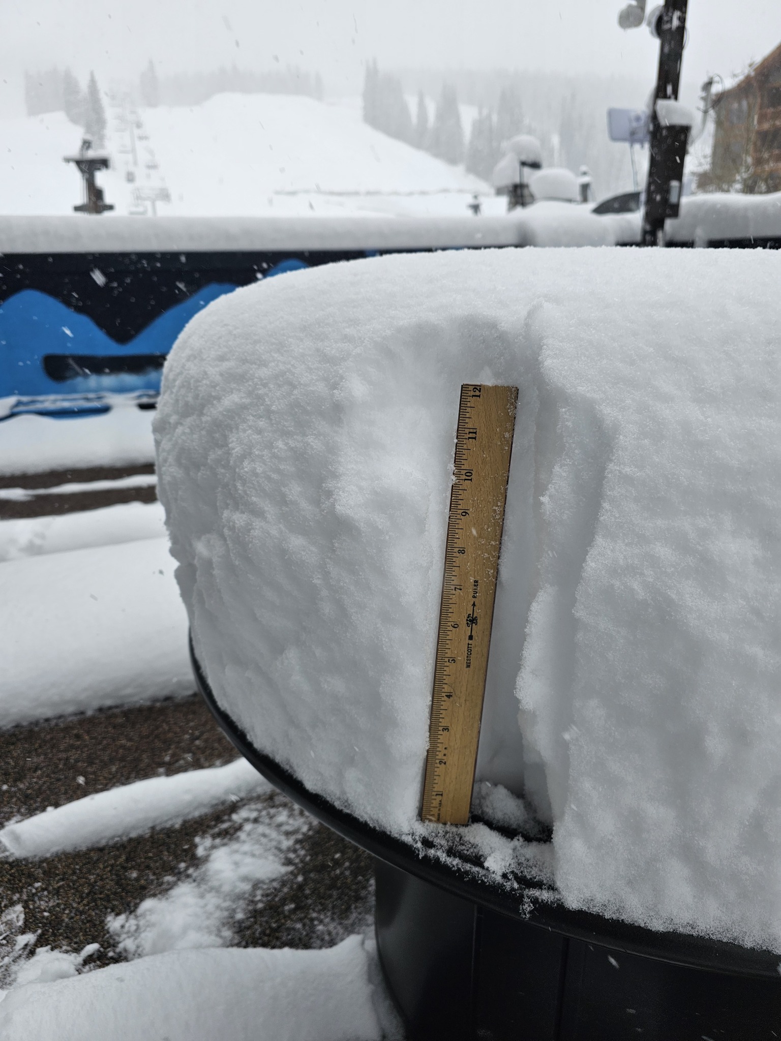
It has been quite a week across North America with heavy snowfall, gale-force winds, blizzard conditions and related events including buried roads and lifts and, unfortunately, but inevitably, some avalanches. Extreme cold also closed ski areas in the north and west in the latter half of last week, just to add another bit of weather excitement into the mix. It’s all a huge change from, the dry final few months of 2023 and although it’s a battle for many areas to dig out and open terrain, average snow depths are now finally getting up towards the average for mid-January and much more terrain can open. Many of Canada and America’s biggest resorts are finally fully open, or almost so. It’s the Rockies and the Pacific Northwest that have done particularly well, but there’s been more snowfall to further south in the west for states like California and there’s been some good snowfall too in the Northeast and blizzards for the Midwest.
ROCKIES REPORT
It’s been quite a week in the Rockies with some areas reporting as much as six feet (1.8m) of snowfall in the last seven days and up to 24” (60cm) in 24 hours. So we are definitely getting back close to normal in the region at last. The snowfall has caused some issues. Access into Little Cottonwood Canyon in Utah to access Alta (46/79” / 115/198cm) and Snowbird (36/57” / 90/142cm) ski resorts were closed at times to allow avalanche mitigation work on roads, although ski slopes remained open. Alta also celebrated passing 200” (5m) of snowfall so far this season, although still way off last winter’s 900”+ total! The opposite was the case at Powder Mountain (28/46” / 70/115cm) which was closed while lifts were dog out. Park City Mountain (46/73” / 116/183cm)resort has at last taken its place as having the most terrain open in the country – over 7,000 acres.
ROCKIES FORECAST
It seems things are calming down a little with some light midweek snowfall the mostly sunny skies. A little warmer too although overnight lows are still in the teens, but getting up to the 40s at lower elevations by the afternoons.
USA WEST REPORT
After two months wait, the kind of full-blown winter you’d expect in the Pacific Northwest has been hitting with full force, with ski areas like Mt Bachelor (36/70” / 90/175cm) in Oregon reporting 5 feet (1.5 metres) of snowfall in five days through last week. The snow hasn’t just floated down though, gale force winds caused blizzard conditions which closed access roads and indeed ski areas as teams that had been battling to move snow around to open slopes over the last few months faced a big digging-out job to open slopes this time. Besides the snow, there’s also been cold weather with temperatures low enough to completely close ski areas like Mt Baker in Washington state at the weekend.
USA WEST FORECAST
Drier and warmer over the next week, with more sunny days in the south, and cloud and light snowfall (an inch or two a day) further north. Temperatures still cold but in the teens and twenties Fahrenheit rather than below zero.
MIDWEST REPORT
After the dry, sunny months, some normal winter weather has finally hit the Midwest. Somewhat turbocharged in fact with low temperatures, gales and snowfall bringing blizzard conditions this week. Ski areas in Michigan, Minnesota and other regions reported particularly significant snowfall accumulations of 12-24” (30-60cm) through the weekend. As a result, resorts have been opening much more terrain and are reporting powder conditions having previously battled to open much terrain at all. Michigan’s Ski Brule (48/56″ / 120/140 cm) is publishing some of the best stats in the region with 90% of its slopes open.
MIDWEST FORECAST
Very cold weather continuing through the coming week, with lows down to -10F and highs well below freezing. Not much more snow forecast though, but obviously great temperatures for snowmaking.
USA EAST REPORT
It has been one of the best weeks of a very bad season in the Eastern US with many areas receiving over a foot of fresh snowfall at the weekend. Unfortunately, before the snowfall conditions were so bad, we are still a long way from normal in terms of snow depths or terrain open. But the region’s largest resort, Killington (6/12” / 15/30cm), although still publishing a very thin base, reports that its open terrain has jumped from just a quarter of its runs to nearer 75% thanks to over a foot (30cm) of fresh snowfall. Other resorts in the region have been publishing improved numbers too, with more open terrain and powder conditions.
USA EAST FORECAST
A mixed bag of weather for the week ahead but predominantly cloudy or overcast, generally below freezing, in the 20s Fahrenheit, with occasional sunny spells and snow showers too, although these are expected to be light.
CANADA
CANADA WEST REPORT
Very cold temperatures were a big factor in the past week in Western Canada, particularly on Thursday-Friday and the weekend. Many resorts in the region were closed because of temperatures as low as -41C overnight and daytime highs still in the -30s, with Friday the coldest day that saw the most areas completely closed, largely to avoid frostbite danger to skiers and boarders. Whistler Blackcomb (5/166cm / 2/66”) has at last got the most terrain open in North America, now up to 90% of its slopes open.
CANADA WEST FORECAST
Continuing to be cold, but not half as cold as last weekend, instead ‘up to’ -20 to -5C. Staying overcast with frequent snow showers, although likely to total only 5cm (2″) or so per 24 hours, nothing huge is expected and sunshine will return at the weekend.
CANADA EAST REPORT
There are some of the best conditions of the (admittedly, so far fairly lacklustre) season in Eastern Canada right now after many areas posted 20-40cm (8-16”) accumulations of fresh snowfall and low temperatures for snowmaking, while also avoiding the recurrent problem of rain. The region’s largest centre, Tremblant (0/108cm / 0/43”) has reset its reported snow depth to a more realistic looking metre mark compared to other centres in the region. It reports about 70% of its slopes open, the best of this season so far. The second biggest area Mont-Sainte-Anne (45/60 cm / 18/24”) continues to suffer though with only about a third of its runs open.
CANADA EAST FORECAST
Continuing cold and overcast skies with frequent snow showers, temperatures in the freezing to -20C range.
ASIA
JAPAN REPORT
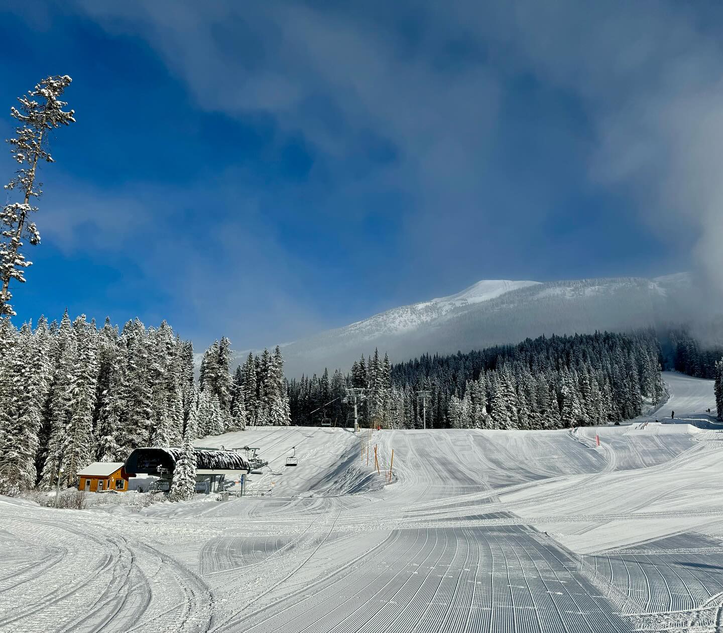
Ever improving conditions in Japan where there was some excitement that Tokyo saw snowfall this week. Niseko (145/315cm / 58/126”) is posting the deepest base of the big resorts and is now more than 80% open. Most other Hokkaido resorts have a little less snow but 90-98% of their terrain open. On Honshu ski areas around Hakuba are back on track after their low-snowfall delayed start to the 23-24 season, Happo One (75/240cm / 30/96”) has the deepest snow and 90% of its slopes open.
JAPAN FORECAST
A bit more of an unsettled picture than in recent weeks with breaks for sunny spells between the snowfalls. But fear not they are set to continue with 10-30cm (4-012″) daily accumulations likely on the snowy days, temperatures between -10C and freezing.