WORLD SNOW ROUNDUP #224
(Updated 10 January 2024) A comprehensive review of snow conditions, weather, and updates for Europe, North America and Asia's winter sports destinations.
Issued: 10th January 2024
By Patrick “Snowhunter” Thorne
World Overview
It’s been a good week for snowfall in many of the world’s ski regions. Perhaps the best news has been for North America where ski areas on the western and eastern sides of the continent have in many cases seen their first decent dump and powder days of the season. In the Alps, meanwhile, up to a metre more snow has taken base depths further above the long-term average and given great conditions for those lucky enough to be there now. Although, with more areas posting 3m (10 feet) plus bases, its looking good for the rest of the season even if it stops snowing now.
Elsewhere, conditions continue to be good in Scandinavia and it has warmed up a little from the extreme cold in the latter half of last week. The Pyrenees have finally had some snowfall, but unfortunately not so much as forecast. Things are slowly improving in Scotland with the first terrain outside of nursery slopes opening and it remains good for most eastern European centres. Japan also has the best conditions of the season so far after some good snowfalls there.
Europe
There’s been a temperature drop and plenty of snowfall across western Europe, bringing better and better conditions to the Alps and some improvement to the poor cover on more southerly mountains across the continent.
The Iberian peninsula saw some snowfall, heaviest on the French side, allowing areas to open more terrain. Up in the western Alps up to 1m accumulations have been reported over the last 7 days and more resorts have passed the 3m/10 feet mark for their upper slope snow depths, plus more and more areas are now 90-100% open.
The latest snowfall in the Alps arrived as temperatures dipped below freezing to low levels, leading to snowfalls down to valley floors. Good news for lower, traditional ski resorts, that had not seen much snow below about 1500m, leaving home runs ribbons of white on green hillsides. Now valleys are white too.
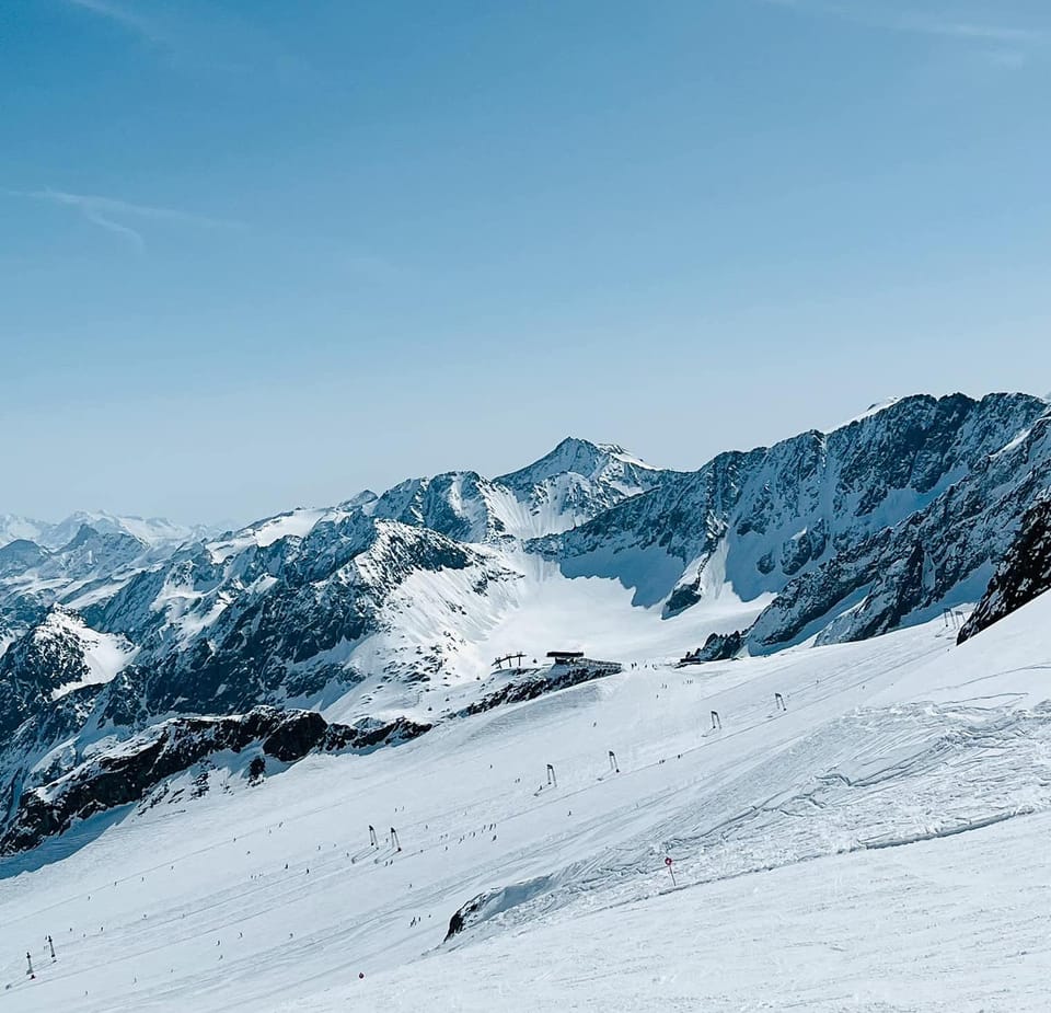
AUSTRIA REPORT
Great conditions in Austria with ski areas reporting up to 50cm (20”) of snowfall in 24 hours at the weekend. With snow conditions already good, this extra powder boost has further improved matters. Saalbach (40/110cm / 16/44”) and the Stubai Glacier (70/305cm / 28/122”) were among the ski areas posting 30cm (a foot) of fresh snowfall on Sunday morning and have had more snowfall since. It means that Stubai joins Kaunertal (240/340cm / 96/136”) and St Anton (65/340cm / 26/136”) as being one of three Austrian areas now posting 3m (10 feet) plus base depths. St Anton and the wider Arlberg area also continues to post the most terrain open in the country at over 270km (169 miles) of runs, more than 90% of the full area.
AUSTRIA FORECAST
Skies have now cleared and its sunny weather forecast for the week ahead. Colder than it has been though with temperatures staying below freezing and getting to double digits below overnight.
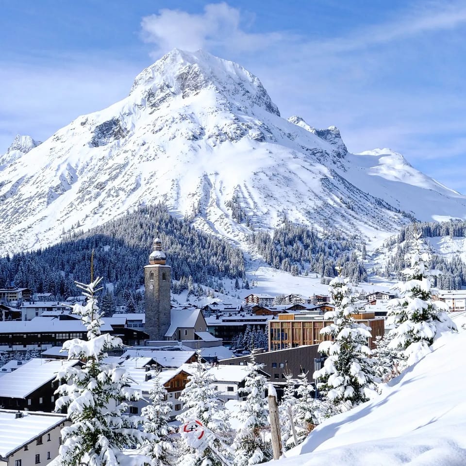
SWITZERLAND REPORT
Swiss centres have had a good week with fresh snowfall to low levels at the weekend, followed by lighter snowfalls and some clear skies and lower temperatures. Overall, 80% of Swiss slopes are open, one of the highest percentages in the world. The 4 Vallées (30/180cm / 12/72”) around Verbier, La Tzoumaz, Nendaz and other resorts still have 95% of slopes open, the most entirely in Switzerland, but the new snow to lower levels has allowed the cross-border Portes du Soleil (10/146cm / 4/58”) region to France, with ski villages including Morgins and Champéry, to open more runs and overtake it, just, with 400km (250 miles) of slopes, 10km (6 miles) more than the 4 Valleys has.
SWITZERLAND FORECAST
Mostly sunny skies are expected for the rest of the week, but with temperatures staying cold, around +2 down to -15C.
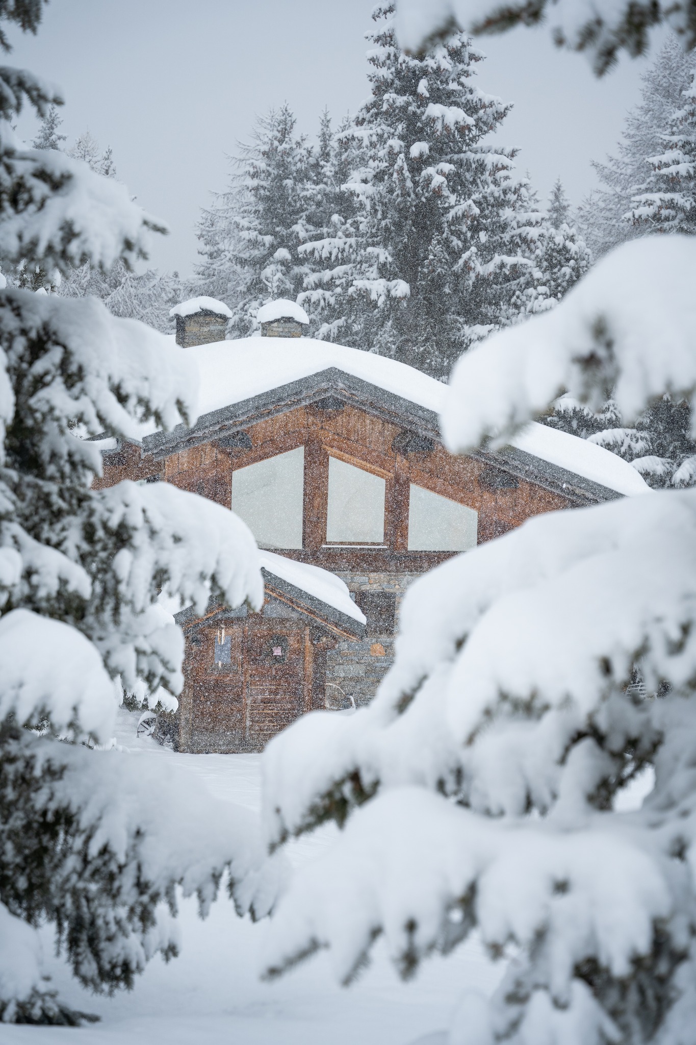
FRANCE REPORT
It has been a great week on French ski slopes with plenty of snowfall and lower temperatures. The main downside has been creased avalanche danger and some sleet and rain at times at the lowest resorts. Chamonix (5/400cm / 2/160”) became the first resort in the world to reach the 4m (160”) based mark up at Grands Montets above Argentiere late last week after reporting more than a metre (40”) of snowfall over five days. The 3 Valleys (120/180cm / 48/72”) continues to post the most open terrain in the world. Of the big areas though, Tignes/Val d’Isere (94/315cm / 38/126”) has the most terrain open, about 90%.
FRANCE FORECAST
Staying cold in the French Alps for the next few days, with temperatures down to freezing in the afternoons even in valleys, getting to -10 to -15C at altitude. Clearing skies but some light snow showers.
ITALY REPORT
Parts of southern Italy and the Dolomites that have not had a lot of snowfall this season got a healthy dose with 20-40cm (8-16”) accumulations reported at the weekend with the snowfall continuing at the start of this week. The lack of snowfall hasn’t really been a problem at areas liker Dolomiti Superski that are so adept at making and maintaining slopes with snowmaking almost regardless of mother nature’s efforts (or the lack of sometimes), but it was still good to see valleys turning white around the ski slopes. The Via Lattea (Milky Way) (110/160cm / 44/64”), which had been suffering with only about 40% of its slopes open up to New Year, has seen a big improvement with its reported snow depth trebling after heavy snowfall and now 70% of its slopes around Sauze d’Oulx and Sestriere open, the most in the country.
ITALY FORECAST
The sunny weather that returned at the start of this week is expected to continue through to the weekend at least, but it is much colder with highs only a degree or two above freezing, lows down to -10C.
GERMANY REPORT
Unfortunately, Germany’s lower lying ski areas have seen rain on their slopes over the past week with the freezing point lying a little too high to deliver snow. As a result, the majority of the country’s smaller, lower ski areas are currently temporarily closed it being too warm and wet for consistent snow cover, as is ever more often the case. But the bigger, higher destination resorts by contrast are looking pretty good. They’ve had more snowfall rather than snow. Reit im Winkl (1/90cm / 0/36”) continues to post 90% of its slope open and the most terrain in the country, 38km (24 miles) of runs. The Zugspitze Glacier (100/240cm / 40/96”) has the deepest snow in Germany.
GERMANY FORECAST
Sunny weather is expected in Germany as well for the rest of this week, cooler too with highs around +3C, lows at -10C.
SCANDINAVIA REPORT
Scandinavian centres have been continuing to warn of very low temperatures, in the -25 to -35C range, over the last week. It has led many to close some lifts and runs, with chairlifts the most likely to be shut down for fear a mechanical failure could leave skiers stuck in the air in these kind of fast-frostbite temperatures. When not closed by the cold though conditions remain good across the region with most areas fully open or nearly so. Western Norway’s Myrkdalen (90/140cm / 36/56”), near Voss, is starting to live up to its snowy reputation with the deepest snowpack in the region. The biggest centre, Sweden’s Are (45/73cm / 18/29”), unsurprisingly has the most terrain open, around 80km (50 miles) of runs.
SCANDINAVIA FORECAST
Mostly dry and sunny weather (in the brief daylight hours) forecast for much of Norway and Sweden, temperatures in the range of +2C down to -20C. Much more cloud and some light snowfall further north up in Lapland across Finland and northern Sweden.
SCOTLAND REPORT
There’s a slowly improving picture in Scotland as more terrain beyond the nursery slopes created with all-weather snowmaking opened up as well as high altitude ski touring terrain. There has still not yet been a lot of natural snowfall, and wind and rain has damaged what snowpack there is, but ski centres have decided it’s enough to open more, including at Glenshee (0/15cm / 0/6”) and Cairngorm )0/10cm / 0/4”), the latter opening its iconic White lady and M1 pistes at the weekend. The only hitch is that the funicular up to access them remains out of action so a hike up to the drag lift as required, the experience designated “only.”
SCOTLAND FORECAST
There is little or no precipitation forecast this week but it should stay cold, down around -3 to +3C in valleys, colder in the hills. So there should not be much snow loss and in Scotland there’s always the chance of unexpected snow showers.
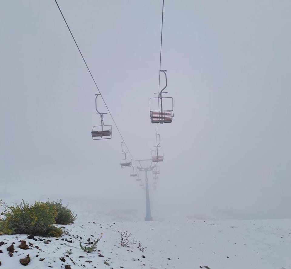
SPAIN / ANDORRA REPORT
It has been about the best week of the season to date in the Pyrenees, coming from a very low bar. Up to 50cm (20”) of snowfall has been recorded on the Andorran/Spanish side and still more on the French side and temperatures down as low as -15C allowing snowmaking systems to fire up and aim to catch up on lost ground, bases currently being around a third of where there should be and more than half of lower slopes and smaller centres closed because of it. France’s Grand Tourmalet region (50/60cm / 20/24”) comprising the slopes of La Mongie and Barèges is the only area in the region reporting its slopes 100% open. There are 100km (63 miles) of slopes, but it has finally been overtaken by the huge Andorran Grandvalira region (20/40cm / 8/16”), which finally has more than half of its 210km of slopes open. Baquyeira Beret (50/60cm / 20/24”) now has the second most with 105km (66 miles) of runs. Portugal’s ski season has also begun at the country’s lone resort Serra de Estrella, thanks to cold temperatures for snowmaking at last and some natural snowfall.
SPAIN / ANDORRA FORECAST
Colder temperatures forecast than we’ve seen, lows around -7C, highs only at +2C, but there’s not much snowfall in the forecast unfortunately.
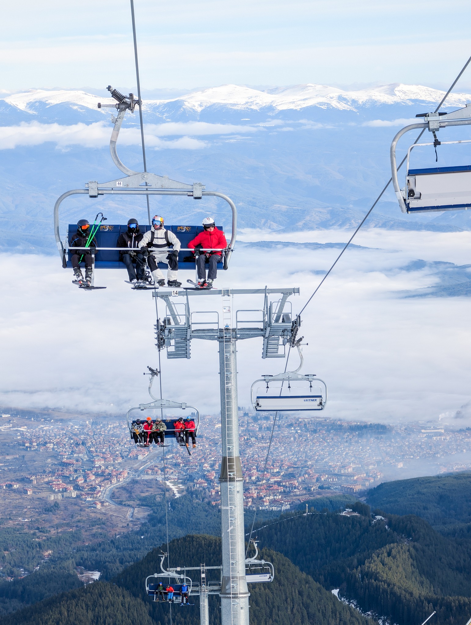
BULGARIA / ROMANIA REPORT
There have been colder temperatures and some fresh snowfall for Bulgarian and Romanian ski areas over the past week. Borovets (85/95cm / 34/38”) continues to post the most terrain open, more than 85% of its runs. Bansko (0/105cm / 0/42”) has a slightly better snow depth up high, but nothing on its lower slopes, hence only a little over 50% of its terrain reported open.
BULGARIA / ROMANIA FORECAST
Colder and sunnier over the next few days with temperatures down to -10C, which will allow for snowmaking in the absence of the natural stuff.
CZECH REPUBLIC / SLOVAKIA REPORT
A mixed picture from northeastern Europe with some fresh snowfall for higher slopes and rain for the lowest at the end of last week, although it has turned increasingly to snowfall even to low levels through the start of this week. Slovakia’s Jasna (409/100cm / 16/40”) continues to post the most impressive starts in the region, both for snow depths and for having its slopes more than 98% open.
CZECH REPUBLIC / SLOVAKIA FORECAST
Largely cold and sunny conditions forecast with light winds. Temperatures in the -5 to -15C range with a chance of some fresh snowfall towards the weekend.
NORTH AMERICA INTRO
A much more promising week across North America than we have seen all season to date. West Coast ski areas initially saw at least a foot (30cm) of fresh snowfall last week and some western Canadian areas had over 20 inches (50cm), by far the most of the season so far. However, it has just kept snowing since and the falls have intensified. Similar accumulations reported in the Rockies with Colorado doing especially well, and there’s also been colder weather and up to as foot (30cm) of fresh snowfall in the east too. On top of this good news the forecast is for more snowfall and, crucially, temperatures staying well below freezing, for the week ahead. So things are looking the most positive they have all season. That’s against the background of a very poor season start with only about half of the continent’s terrain able to open so far, so some catching up is required.
ROCKIES REPORT
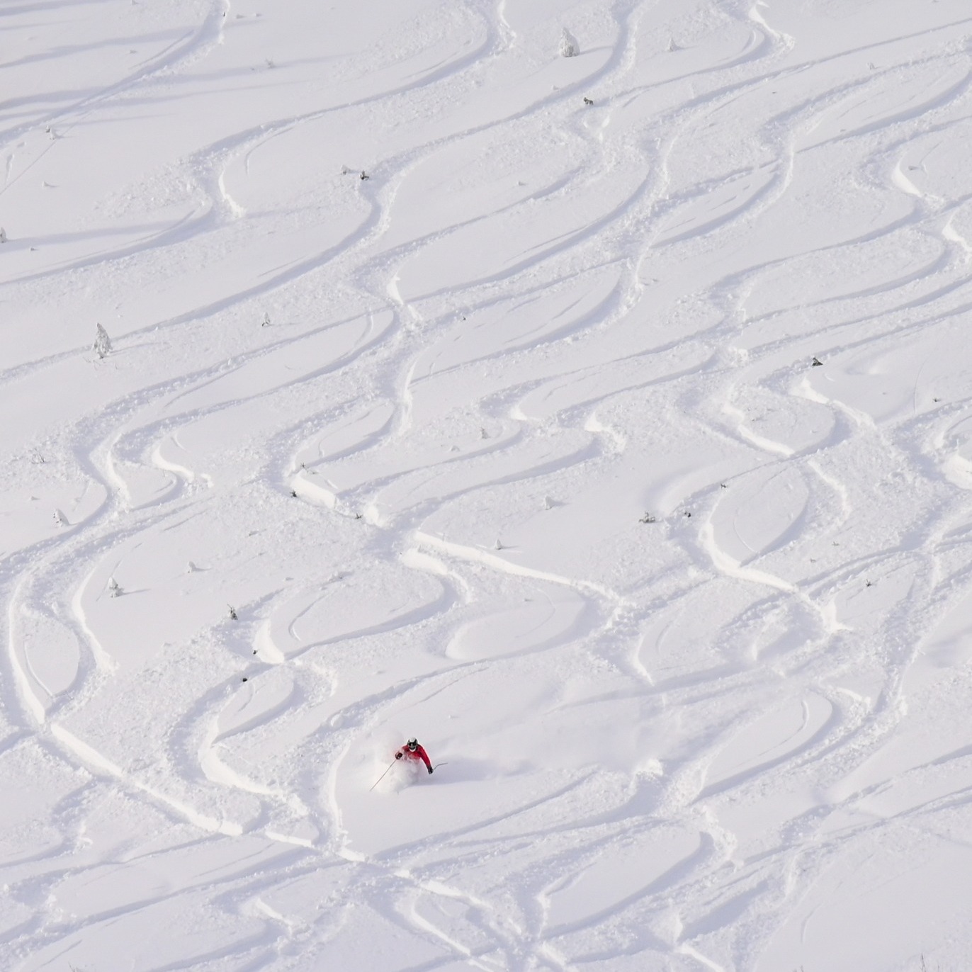
A good week for most parts of the Rockies with some of the biggest snowfalls of the season so far reported in Colorado and Utah. Steamboat (16/35” / 40/84cm) was one of the big winners reporting nearly 20” (50cm) of fresh snowfall at the weekend. It now has nearly 90% of its slopes open, one of the highest percentages in the US this season and all lifts running. The deepest snow in the region continues to be in Utah though with Alta (36/58” / 90/145cm) reporting the deepest, although that is down from the peak a few weeks ago. Vail (26/36” / 60/90cm) posts the most terrain open in the region, 80% of its area. Snowbird is pictured top on Tuesday this week.
ROCKIES FORECAST
It is looking good for the week ahead, at last, with temperatures remaining well below freezing and plenty more snow forecast. Hopefully, this is the turning point for the season.
USA WEST REPORT
There was great excitement at Mammoth Mountain (30/41” / 76/104cm) shortly after we published last week’s report as snowfall turned out heavier than expected and 15” (37cm) was reported, the biggest fall of winter so far. It’s now up to two-thirds of its terrain open, the most in California by some distance, with most resorts around Tahoe still posting 20-40% open area totals following the dismal first few months of the 23-24 season in the western US for snowfall. There are a few exceptions though, with Mt Rose (24/48″ / 60/120cm) saying 80% of its slopes are skiable. North America’s deepest snow is up in Alaska where Alyeska (43/96″ / 107/241cm) is the first and only ski area in the continent to post 300 inches (7.5 metres) of snowfall already this season.
USA WEST FORECAST
A promising forecast of continuing cold temperatures and daily snowfalls through the remainder of this week. Temperatures stay well below freezing in ski areas.
MIDWEST REPORT
Conditions in the Midwest continue to be challenging with the snowpack currently about a third of its normal level at this point in the season after weeks of mostly dry and wet, warm weather. But there have been some improvements this week with some light snowfalls and cold enough temperatures for snowmaking. While some areas are still closed or just have one or two runs open, some, like Alpine Valley (7/12” / 18/30cm) in Wisconsin, are reporting all 21 trails open but conditions “variable”. So it’s a very mixed picture as to how areas are coping.
MIDWEST FORECAST
Temperatures are expected to stay closer to what they should be, but haven’t up to now, with lows in the 20s, and highs a degree or two above freezing. So overnight snowmaking should be possible in most areas most days. Overcast skies with the odd light snowfall forecast.
USA EAST REPORT
Conditions have continued to improve across the eastern US after heavy rain closed many centres temporarily three weeks ago. After colder weather and fresh snowfall returned, there’s been more cold weather and the biggest snowfalls so far in the past week, bringing up to 18” (45cm) of fresh snow to the slopes. Things are far from perfect though, most areas still have only 20-40% of their slopes open, including big players like Killington (2/12” / 5/30cm) and Sunday River (60/70cm / 24/28”).
USA EAST FORECAST
Mostly cold with some snow showers forecast. Lows in the 20s Fahrenheit. Unfortunately, some daytime highs could reach the low 40s at bases, bringing a danger of more rain, but sleet and snowfall are more likely.
CANADA
CANADA WEST REPORT
There have been some much-needed good numbers for Canada’s West coast this week, most notably a 42cm (17″) snowfall for North America’s largest ski area. Whistler Blackcomb (17/150cm / 6/60″) reported a 42cm (17″) accumulation at the weekend and now has 75% of its terrain open, the most terrain open in North America, as well as powder conditions up in the alpine. There was up from 40% over Christmas. The snowfall also brought improvements for Red Mountain (77/77cm / 33/33″), which only managed to open about 5% of its terrain a fortnight ago after a terrible start to the season. It’s still not great but it’s up to 25% and reports powder conditions on the runs that are open.
CANADA WEST FORECAST
Cold temperatures will continue through the coming week, staying below freezing and getting as low as -15C. Light to moderate snowfall is forecast which should continue to improve matters.
CANADA EAST REPORT
It has been a better week in eastern Canada with some decent natural snowfalls and cold temperatures allowing snowmaking systems to fire up. Of course, we are starting from a place where warm and wet weather has left the eastern Canadian snowpack at about a third of what it should be, but what bases there are have kept growing and a little more terrain is now open. Tremblant (0/200cm / 0/80″) continues to post by far the deepest snow and has about 60% of its slopes open now. Other areas are typically at 10-40% of their slopes open with maximum snow depths of 50cm (20″).
CANADA EAST FORECAST
Cloudy with temperatures close to freezing for the remainder of this week. Some precipitation, which will hopefully be sleet or snowfall, although with a small danger of more rain later this week.
ASIA
JAPAN REPORT
We’re seeing much more consistent cold weather and constant snowfall across Japan now, including down on Honshu. So much more terrain has opened at most resorts. Up on Hokkaido, the reliable conditions have been with us longer and Niseko (85/200cm / 34/80”) now has 80% of its slopes open. It reported a 65cm (26″) 24 hour accumulation on Wednesday, one of the biggest of the past decade. Kamui ski Link (100/160cm / 40/64”) doesn’t have as much terrain or quite as deep snow but it is 90% open. There’s some catching up to be done on Honshu with Nozawa Onsen (30/90cm / 12/36”) still reporting only 20% of its slopes open, although most other big-name resorts are up to 75-85% open now, including Hakuba’s famous Happo One (35/140cm / 14/56”) also at 80%.
JAPAN FORECAST
Snowfall continuing, normally daily, with 10-30cm (4-12”) accumulations expected and temperatures in the freezing to -15C range. So normal service has well and truly resumed, it seems.