WORLD SNOW ROUNDUP #219
(Updated 8th December 2023) A comprehensive review of snow conditions, weather, and updates for Europe, North America and Asia's winter sports destinations.
Issued: 8th December 2023
By Patrick “Snowhunter” Thorne
World Overview
Storms have been a big factor of the past week on both sides of the Atlantic. In North America they were mostly welcome, bringing much-needed snowfall. Although, on the down side, they lead to resort closures at the weekend due to heightened avalanche danger and the cancellation of all three planned World Cup races at Beaver Creek over successive days. In the Alps (in Europe), there were again resort closures due to the combination of strong winds and high avalanche danger. Unfortunately, along with still more heavy snowfall, a short temperature spike brought rain to high elevations, causing a dramatic and severely damaging ‘torrent’ down the mountainside in French resort Risoul.
Taking a step back from all this atmospheric drama, the big picture is of improving base depths, more terrain opening and more and more ski areas opening. We’re now past the 500 mark, about 10% of the northern hemisphere total, open for the 23-24 season already.
Europe
EUROPE INTRO
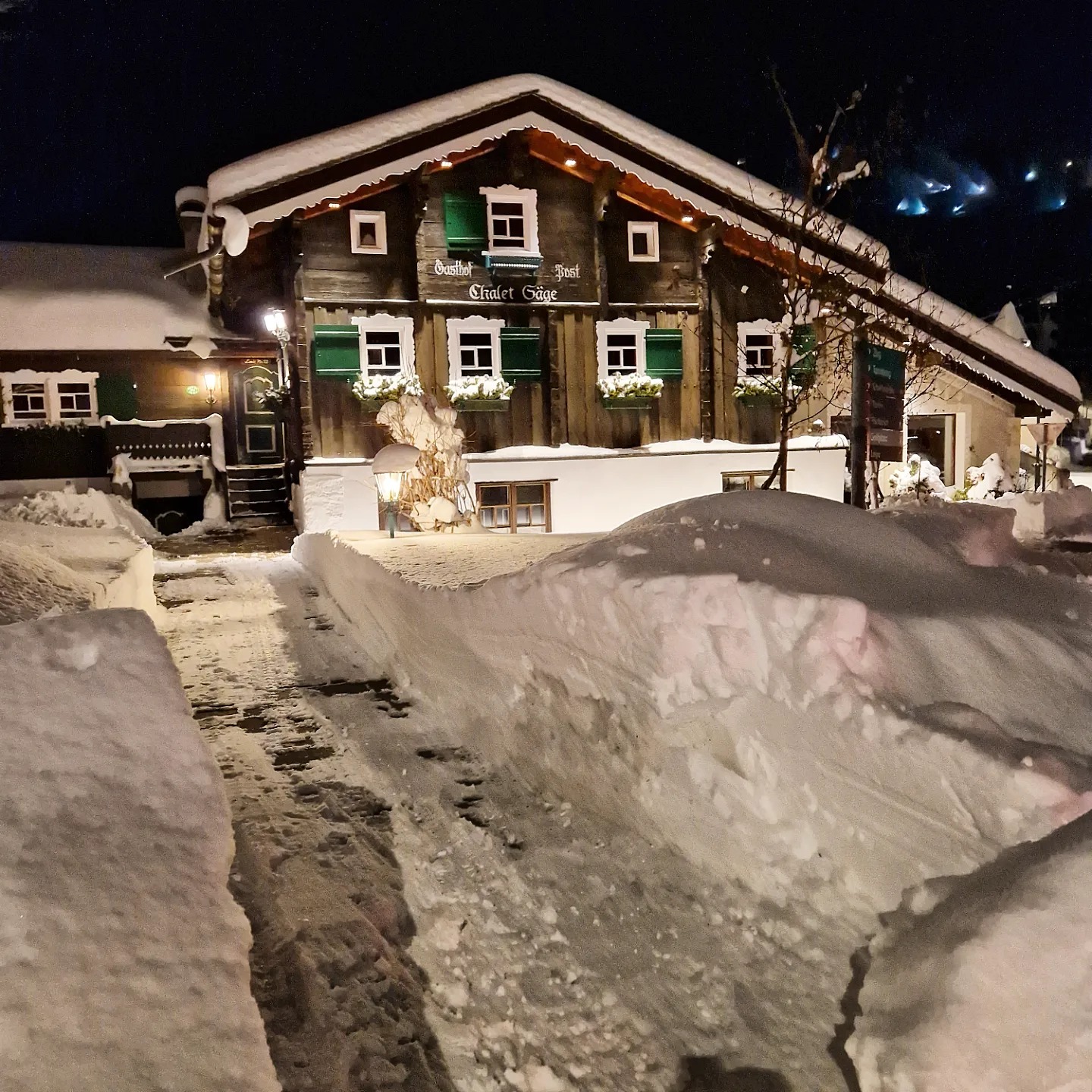
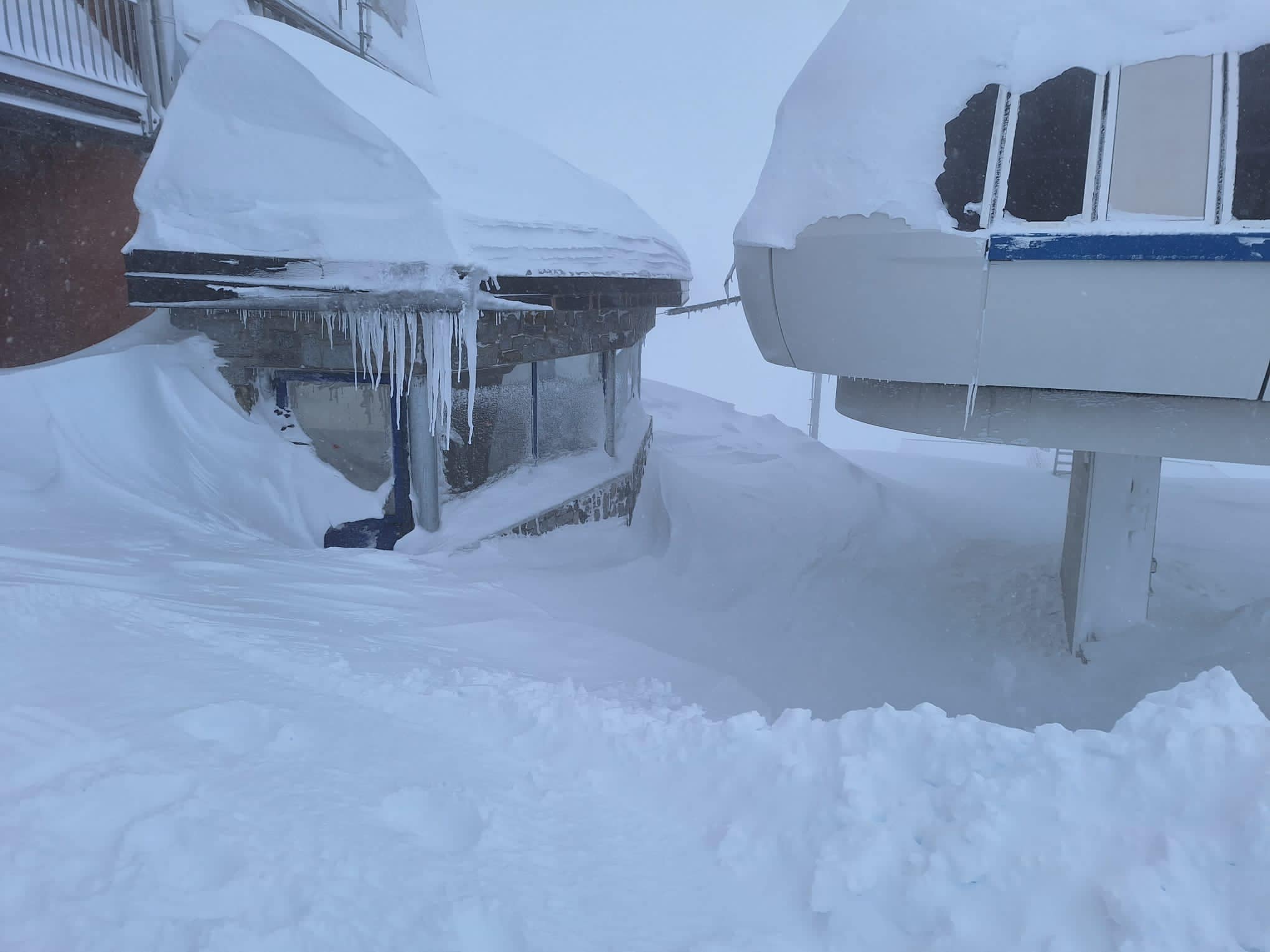
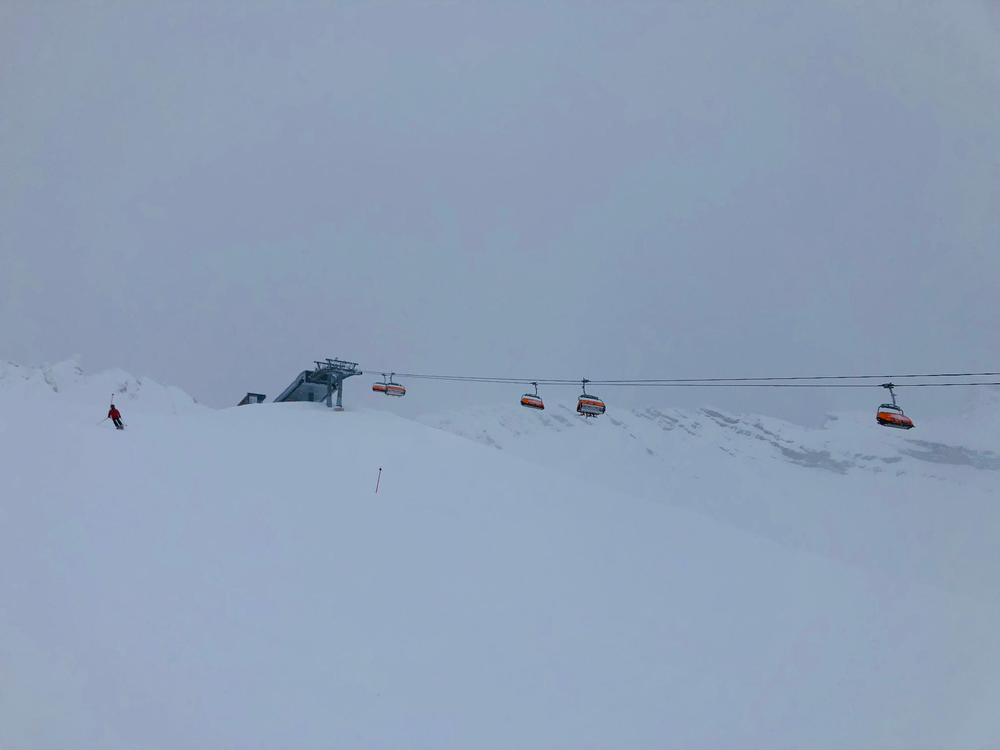
There’s been still more pre-season heavy snowfall in the Alps but this past week there’s been other weather factors at play including strong winds and an unfortunate brief period of heavy rain as temperatures spiked at the start of the weekend. This led to a number of the 200 or so ski areas, now open for the 23-24 season in Europe, closing some or all of their slopes as the worst of it blew through at the weekend; the most severe weather was on Saturday for most. The weather mix also led to high avalanche danger for many areas, but by Sunday conditions looked beautiful again with fresh snow and blue skies. Outside the Alps, more and more ski areas have been opening in Scandinavia, where conditions remain more stable and generally very cold. The first areas have also begun opening in Eastern Europe and after a brief delay, more resorts are open now in the Pyrenees too.
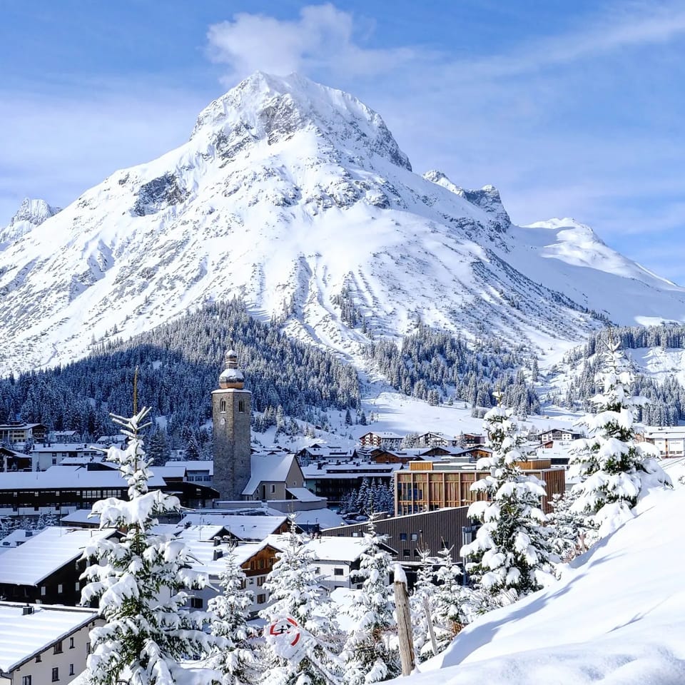
AUSTRIA REPORT
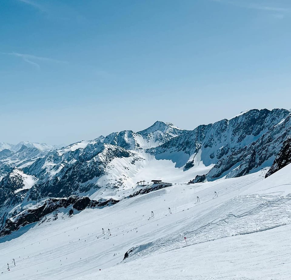
Austria continues to lead Europe when it comes to open terrain at its centres and indeed in the number of open resorts. About a third of the country’s ski areas have now opened with the Arlberg region around Lech-Zurs (100/210cm / 40/84”) and St Anton (100/210cm / 40/84”), as well as the 2024 World Cup finals and alpine world championships hosts Saalbach (70/10cm / 28/44”). Ischgl (40/226cm / 16/90”), with its Silvretta ski region shared with Samnaun, tops the European open-terrain tables with 200km (125 miles) of slopes open already. Bases are also building with plenty more snowfall down to low levels over the last week. The Kaunertal Glacier (135/290cm / 44/116”) has the country’s deepest snow.
AUSTRIA FORECAST
Not as snowy and not as cold for the week ahead but still cold enough to stop a big thaw in most areas. Staying below freezing above about 2,000m and only getting to 3-5 degrees above freezing in valleys. A mixture of sunny and cloudy days with some seeing fresh snowfall at the weekend.
SWITZERLAND REPORT
Swiss resorts have seen some more big snowfalls over the last week with Verbier (45/105cm / 18/42”) posting the best part of a metre (40”) of new snow. The only issues have been a period of warmer, wetter weather in the west to high elevations at the end of last week, and resulting snowpack instability bringing high off-piste avalanche danger. But for those on the groomed runs, after stormy weather closed some centres on Saturday, the sunshine returned with glorious weather and fresh snow to round out the weekend and start this week. The 4 Valleys have the most terrain open so far within the country, about a fifth of their area (80km/50 miles), but the cross-border Samnaun-Ischgl (50/100cm / 20/40″) areas top Switzerland, Europe and the world with 200km (125 miles) of runs open already. The deepest snowpack is at Glacier 3000 (65/225cm / 26/90″) near Gstaad.
SWITZERLAND FORECAST
A fairly good forecast with, on the whole, low temperatures and some snow forecast, if not so heavy or frequent as in recent weeks. The only possible blip is the chance of a weekend temperature spike towards +10C in valleys, but that’s way off yet and it may end up cooler, hopefully.
FRANCE REPORT
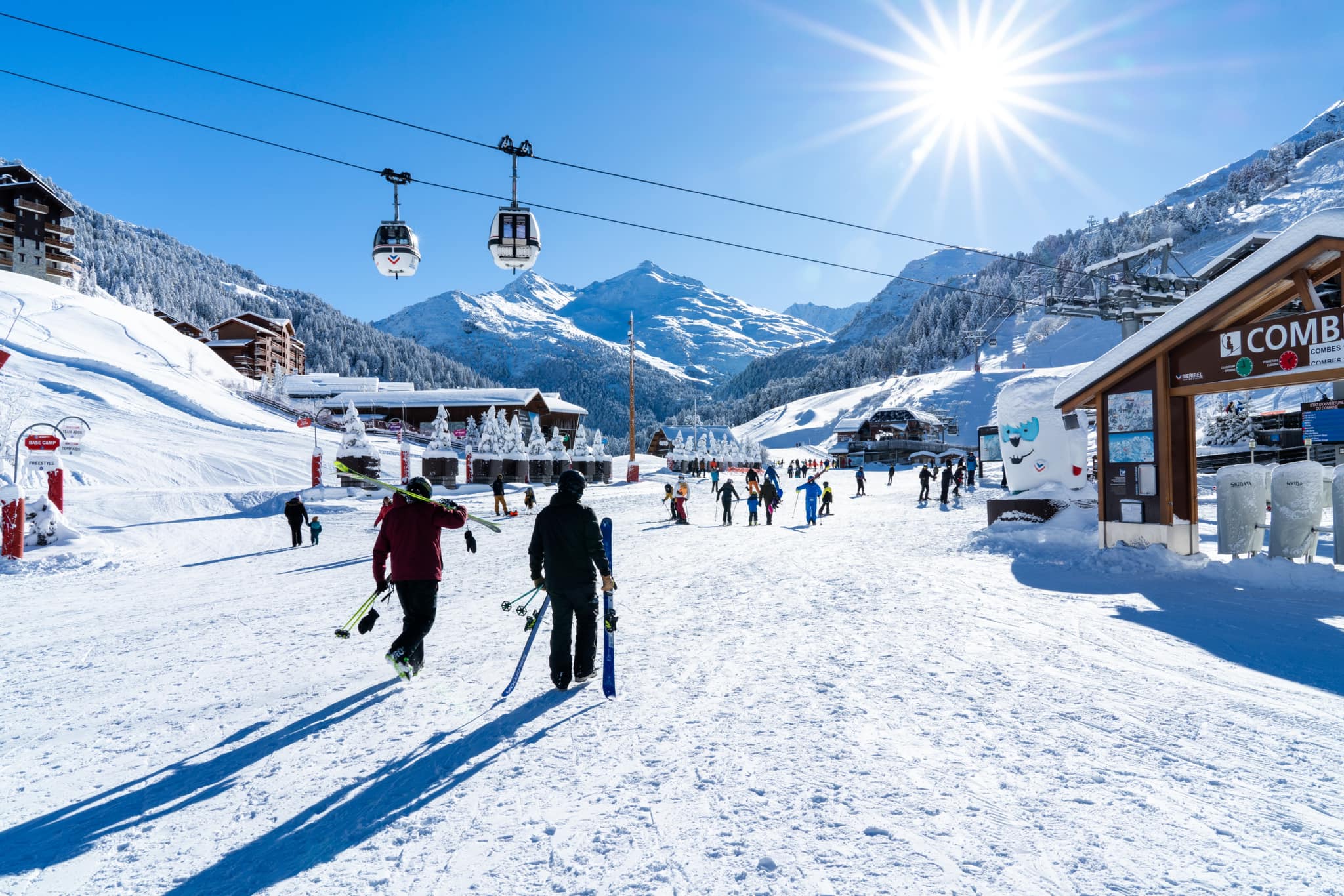
It has been a predominantly good week in the French Alps with lots more snowfall, but there has been a blip with rain as high as 2,800m altitude at the end of last week before temperatures dipped again and snow returned to low levels. Unfortunately, that brief rain event caused significant damage to the Risoul ski area in the southern Alps when a torrent of water, snow, mud and rocks crashed down on the base. It’s unclear whether this will delay its planned season opening this coming weekend. Otherwise, mountain safety experts Henry’s Avalanche Talks (HAT) say the rain is actually helping bring the avalanche danger down from its previous considerable-high (levels 3-4 on the scale to 5), down to 2-3, due to the stability it brings to the snowpack. We had a jump in the number of French areas open at the weekend from just Tignes (30/200cm / 12/80″) and Val Thorens (90/190cm / 36/76”) in the Alps to a dozen areas with Avoriaz (10/60cm / 4/24”) opening early for a preview weekend while larger resorts Chamonix (Argentiere/Les Grands Montets)(70/320cm / 28/128”), Alpe d’Huez (55/180cm / 22/72”) and Les 2 Alpes (30/40cm / 12/16”) opening as planned. Val Thorens still has the most terrain open in the country at 110km (69 miles), although Alpe d’Huez opened with 80km (50 miles) of runs available from day one. Other parts of the 3 Valleys have also opened some terrain. Chamonix has opened with the deepest base in the world.
FRANCE FORECAST
It’s continuing to look promising with more snow forecast for the week ahead after a calmer few days. Temperatures should stay cold with highs a few degrees above freezing, lows down to the minus 10s.
ITALY REPORT
There’s been a big jump in the number of open Italian ski areas, about half of the country’s centres now have their lifts running. The weather for most has been a little more stable than further north and west. But, still, there have been some big snowfalls with Bormio posting images of snow lying metres (6 feet plus) deep at the top of its highest lifts at 3000m. Similarly, nearby Livigno posted a 40cm (16″) powder alarm to start this week. The country’s deepest base has jumped to 2.5 metres (over 8 feet) on the Presena Glacier (40/250cmm / 16/100”) above Passo Tonale with Kronplatz (20/60cm / 8/24”) reporting the most terrain open, 100km (63 miles) of slopes already, part of the greater Dolomiti Superski region.
ITALY FORECAST
Looking promising with a mixture of sunshine and snow showers over the coming week. Temperatures should only climb a degree or two above freezing in valleys but be down at -10C overnight on ski slopes, so the mighty Italian snow-making arsenal can run to the max.
GERMANY REPORT
Germany’s season is getting properly underway now with some promising snowfalls down to low elevations creating the best start to December for some years. There was 10cm (4”) of snow down to valley floors, well below 1,000m altitude in the last few days. Up high, the Zugspitze Glacier (40/240cm / 16/96”) is among the first to open, immediately posting one of the world’s deepest snow depths to date, but dozens more German centres started running their lifts at the weekend. However, the Feldberg area has the most terrain open with 13km (8 miles) of runs so far.
GERMANY FORECAST
It’s a promising forecast of temperatures generally in the freezing to -10C range with frequent showers, mostly snow, expected to continue. The worst case is some of that snow is rain.
SCANDINAVIA REPORT
About 80% of Scandinavian ski areas have now opened, perhaps the highest percentage of resorts opening for any area in this early part of December. It has been predominantly cold with light snow showers this last week, although there have been reports of brief periods of rain at more southerly locations. Nowhere has a great deal of terrain open yet with Norway’s Hafjell (50/60cm / 20/24”) posting the most with about 16km (10 miles) of slopes skiable so far, around a third of its full area. Klövsjö/ (70/90cm / 28/36”), in Northern Sweden, which was one of the first in the region to open a month ago, is reporting the most snow lying.
SCANDINAVIA FORECAST
Very cold and snowy weather is forecast for the rest of this week with temperatures staying well below freezing, in the -5 to -25C range, with frequent snow showers.
SCOTLAND REPORT
There was some excitement in the Highlands when the local Press & Journal newspaper reported that the “ski season was starting early” and noted snowfall at The Lecht and Cairngorm. In reality though, this was just a fairly light pre-season covering and both reported no plans to open until there was more. It has been exceptionally cold in the region with temperatures getting below -10C overnight and not getting much above freezing during the day. Snowfall has been light. Glenshee is the latest to announce their target season start day, Wednesday 20th December. Glencoe has turned on their access chairlift for tourers and has made snow for snow play (sledging not skiing).
SCOTLAND FORECAST
Temperatures are expected to creep up a few degrees but otherwise stay very cold with the likelihood of heavier snow showers.
SPAIN / ANDORRA REPORT
It has been a rather frustrating week in the Pyrenees with temperatures rising and some rain as well as snowfall following more promising winter weather in late November. As a result, the Andorran ski areas and many others that had planned to open at the weekend were mostly forced to delay at the start of what is one of the most important early-season weeks of the winter with a series of public holidays on the Spanish side of the mountains that resorts hope to get as many skiers and riders to book in for as possible. Baqueira Beret (10/30cm / 4/12″) remains open but with terrain available down to around 20km (13 miles) and on the French side Font Romeu (10/20cm / 4/8”) managed to open at the weekend too, despite very thin cover so far.
SPAIN / ANDORRA FORECAST
Alas, still not a super exciting forecast with overnight lows well below freezing and snowfalls expected, but daytime highs in the resort are still rather warm and there’s the chance of more rain at lower levels.
BULGARIA / ROMANIA REPORT
It’s continuing to look promising for the upcoming start of the 23-24 season in southeastern Europe’s mountains, but that’s not got underway in Bulgaria yet with Bansko, Borovets and others targeting the weekend after next for the season start date. A little further north several Romanian resorts are open, however, including the biggest Poiana Brașov (20/50cm / 8/20”), which has about half of its runs open already.
BULGARIA / ROMANIA FORECAST
Cold and cloudy for the next few days, mostly below freezing at all levels, but getting two or three degrees into positive numbers in valleys in the daytime. Snowfall to end the week then a sunny weekend in store.
CZECH REPUBLIC / SLOVAKIA REPORT
About a dozen ski areas opened at the weekend including many of the region’s big players. The largest, Jasna, reported more than half of its 45km (28 miles) or so of runs open from day one after a great few weeks of low temperatures and frequent snow showers, which continued through last week.
CZECH REPUBLIC / SLOVAKIA FORECAST
A little drier for the week ahead with more days of sunshine and light cloud forecast and fewer snowy ones, although at least a day of snowfall is expected before the weekend. Staying cold though, so snowmaking systems will be able to operate to the max.
NORTH AMERICA INTRO
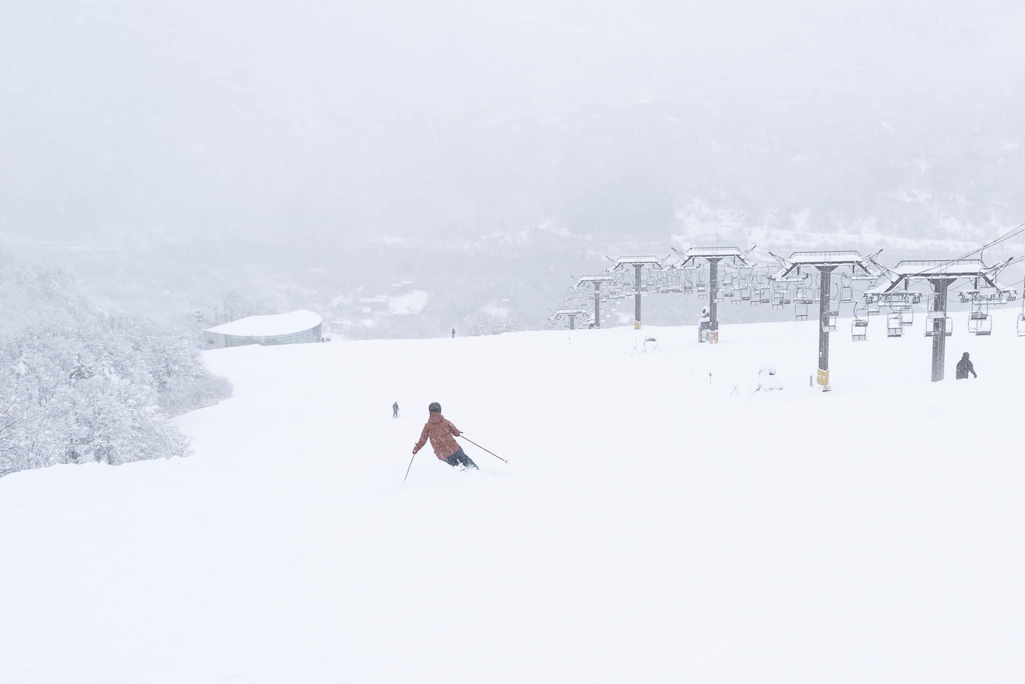
We’re into meteorological winter time in North America and the rest of the northern hemisphere and it seems that Mother Nature is finally starting to get the memo with more wintery weather at last in the Rockies and on the East Coast, as well as low temperatures in the Midwest and enough cold and snow in the Pacific Northwest for resorts in Oregon and Washington state that had delayed opening to now do so. We’re still in a situation of thin bases and limited terrain open but then it is only early December. All the fresh snowfall in Colorado and Utah at the weekend led to travel issues and some avalanche slope closures for the first time this season, but overall it’s obviously good news that it’s been cold and snowing.
ROCKIES REPORT
Ironically, after the fairly dry start to the 23-24 season, the three Men’s World Cup Downhill and Super G Races on the infamous Birds of Prey course at Beaver Creek had to be cancelled on successive days last Friday-Sunday due to too much snow freshly fallen on the course, as well as low visibility and high winds. That’s been the picture of the start of this week in the Rockies with the long-awaited first serious storm of winter hitting, bringing two-foot (24”) accumulations for some, along with travel disruption and heightened avalanche danger. Snow depths and open terrain (once it could re-open) improved as a result, with last season’s 900”+ area Alta (120/160”) again topping the snow depth chart.
ROCKIES FORECAST
Back to mostly sunny weather with a front moving through to end the week bringing snowfall. Temperatures look good though, remaining a degree or two below freezing at the resort base level, with lows more like the teens to high 20s on upper slopes.
USA WEST REPORT
The western weather continues to challenge ski areas in the region but despite not a lot of natural snowfall south of the Canadian border, it has been colder allowing snowmaking systems to fire up and ski areas like Mt Bachelor (18/28” / 46/71cm) in Oregon, which had delayed opening due to the conditions have now managed to open. It’s a different story in the far northwest with Alaska posting a very snowy November and Alyeska (15/54” / 38/135cm) opening there at the weekend with one of North America’s deepest for snow from day one.
USA WEST FORECAST
It’s back to a dry weather forecast with plenty of sunshine; however, temperatures should stay low, typically in the 20s or teens Fahrenheit, despite there being plenty of sunshine forecast, especially in southern states. The further north you go the more snowfall is likely with Alyeska likely to see fresh snow daily totalling several feet by this time next week.
MIDWEST REPORT
Colder weather and some natural snowfall have allowed a boom in the number of mid-western ski areas open with several (including Michigan’s Granite Peak, Nub’s Nob and Ski Brule) reporting three feet (90cm) of snow lying already on their higher slopes, much of it thanks to snowmaking efforts. It has been mostly sub-zero and mostly dry but with some snow showers. Most only have 10-20% of their slopes open but Wisconsin’s Alpine Valley Resort (12/15″ / 30/37”) says it has 100% of its runs skiable already.
MIDWEST FORECAST
Conditions will remain predominantly dry, with daytime highs just a few degrees above freezing, and lows well down into the teens Fahrenheit over the coming week.
USA EAST REPORT
Conditions are looking a whole lot whiter on eastern US slopes after snow showers over the past week culminated with a major storm to start the week. Temperatures remain a little marginal with some areas seeing rain on lower slopes, although it was predominantly snow with some resorts having had more than a foot (30cm) now in the last week, most of it in the past 48 hours. The snowfall arrived mixed in with strong winds too which brought power outages in the region. More or less all resorts in the region are now open and are opening more terrain as conditions allow. The largest, Killington (2/12” / 5/30cm), has the most, about a quarter of its terrain open. Sunday Rover (24/28” / 60/70cm), in Maine, is just a little way behind. Snowshoe (16/41” / 40/102cm), down in West Virginia, has the deepest snow.
USA EAST FORECAST
Not much snow in the forecast now until early next week and a worrying warming into the 50s at bases is expected by the weekend. Otherwise, it will remain below freezing on high slopes, creeping above in valleys.
CANADA
CANADA WEST REPORT
It’s been a slow start to the 23-24 season in western Canada where a little over a third of centres in Alberta and BC are now open. There has been more snowfall but many are struggling to build much of a base so far with drier than usual weather; however, recently opened Fernie (50/80cm / 20/32”) is in pretty good shape and has nearly half of its runs open so far, about the most in Canada at this early point of the season. The country and the continent’s largest resort Whistler Blackcomb (10/70cm / 4/28”) isn’t far behind on both measures.
CANADA WEST FORECAST
A fairly promising forecast with most areas seeing subzero temperatures and fresh snowfall over the coming week. Unfortunately though, only light falls are forecast at this point.
CANADA EAST REPORT
It’s been another mixed week of weather for eastern Canada’s ski areas with some still struggling to open much terrain through warm weather spells. There have also been periods of low-visibility and gale force winds as witnessed by racers at the women’s Alpine World Cup meeting at Tremblant (8/142cm / 3/57″) at the weekend. But the general direction continues to be towards colder, more reliably snowy weather. Tremblant has the most terrain open in the region and the deepest snow although still only about 15% of its area. Other big-name resorts in the region like Mont-Sainte-Anne (35/50cm / 14/20″) are also now open for the season.
CANADA EAST FORECAST
Mostly dry conditions for the week ahead and generally subzero temperatures. Although unfortunately, it looks like we might see some +10Cs at bases around the weekend if the forecast does not improve.
ASIA
JAPAN REPORT
Japan’s 23-24 ski season is kind of stuttering to its start with some on-off snowfalls, first bringing hope with a decent dump but then sometimes seeing warm weather wipe out early gains. So some are now open with limited terrain and thin bases while others continue to delay. Niseko (20/80cm / 8/32″) is newly opened with about a quarter of its slopes available so far and posting the most in Japan; however, its smaller Hokkaido neighbour of Daisetsuzan Kurodake – Sounkyo (100/120cm / 40/48”) is posting the country’s deepest snow so far and is the first to pass the metre mark this winter. Kamui and Naeba are among the big-name resorts not yet open, most others have at least a few runs skiable.
JAPAN FORECAST
Alas, not yet the forecast Japanese skiers are hoping for with daytime highs of +10C at resort level expected, although at least overnight lows of -10C should help. For some areas, like Nagano, it’s sunshine all the way. In Hokkaido, snow is expected although that may be rain at times and at low elevations.