WORLD SNOW ROUNDUP #218
(Updated 29th November 2023) A comprehensive review of snow conditions, weather, and updates for Asia's winter sports destinations.

Issued: 29th November 2023
By Patrick “Snowhunter” Thorne
World Overview
It’s almost December and the pre-season preparations are reaching their climax at thousands of ski areas across the northern hemisphere. While more than 150 have now opened, fairly evenly divided between Europe and North America, the main Japanese ski season expected to start next week with snowfalls increasing there.
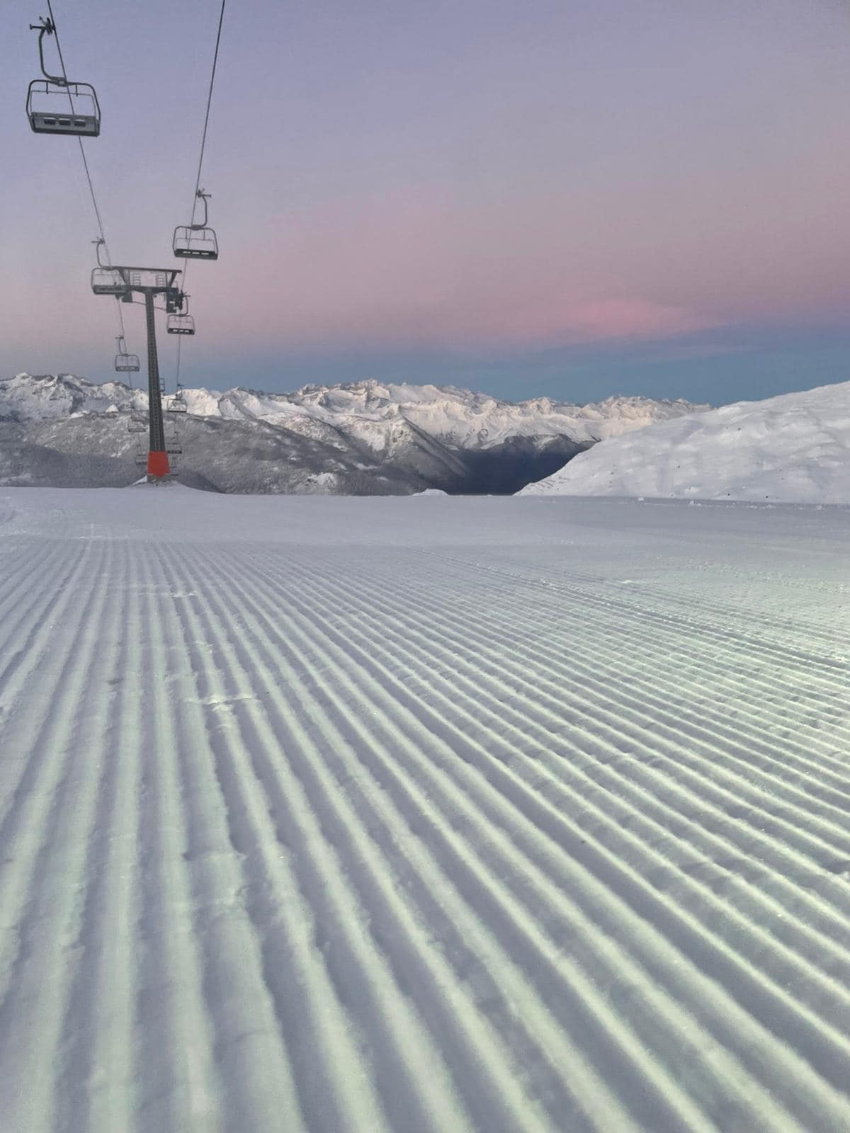
Europe is currently leading in terms of snowfall totals and terrain open with the first ski areas in the world to offer more than 150km (93 miles) of slopes open this season in Austria and France. It’s also the continent that has seen the most snowfall in November, with several resorts having received over a metre (40”) on upper slopes. In news this week, the first resort in the Pyrenees has opened for the 23-24 season there. There have been more big snowfalls in the Alps this week but also strong winds at times leading to high avalanche danger in places.
North America, unusually, is in need of a decent snowfall still, although there have been promising signs with 8-16″ (20-40cm) accumulations in the west and low temperatures down to double-digits below freezing in the east. Most of the continent’s big ski areas are also now open, many wanting to do so ahead of the Thanksgiving holidays at the end of last week.
Europe
EUROPE INTRO
It’s been another good November week for most of Europe. The Pyrenees saw their first good snowfalls for a few weeks, which combined with cold weather meant the first centre could open for 23-24 there at the weekend. The Alps saw low temperatures, double digits below freezing up high and snowfall down to valleys as dozens more ski areas opened. Some of the latest snowfalls this week have been among the biggest of November so far, with up to a foot down in valleys. The amount of terrain open is fast increasing too, with two centres passing the 100km (63 miles) of runs already open mark, dwarfing the few kilometres/miles offered by 95% of the world’s open areas so far. Further north in Scandinavia low temperatures have been the order of the day, with minus teens and minus 20s reported along with up to 50cm (20”) of snowfall and more centres have opened including almost all of the region’s largest centres now.
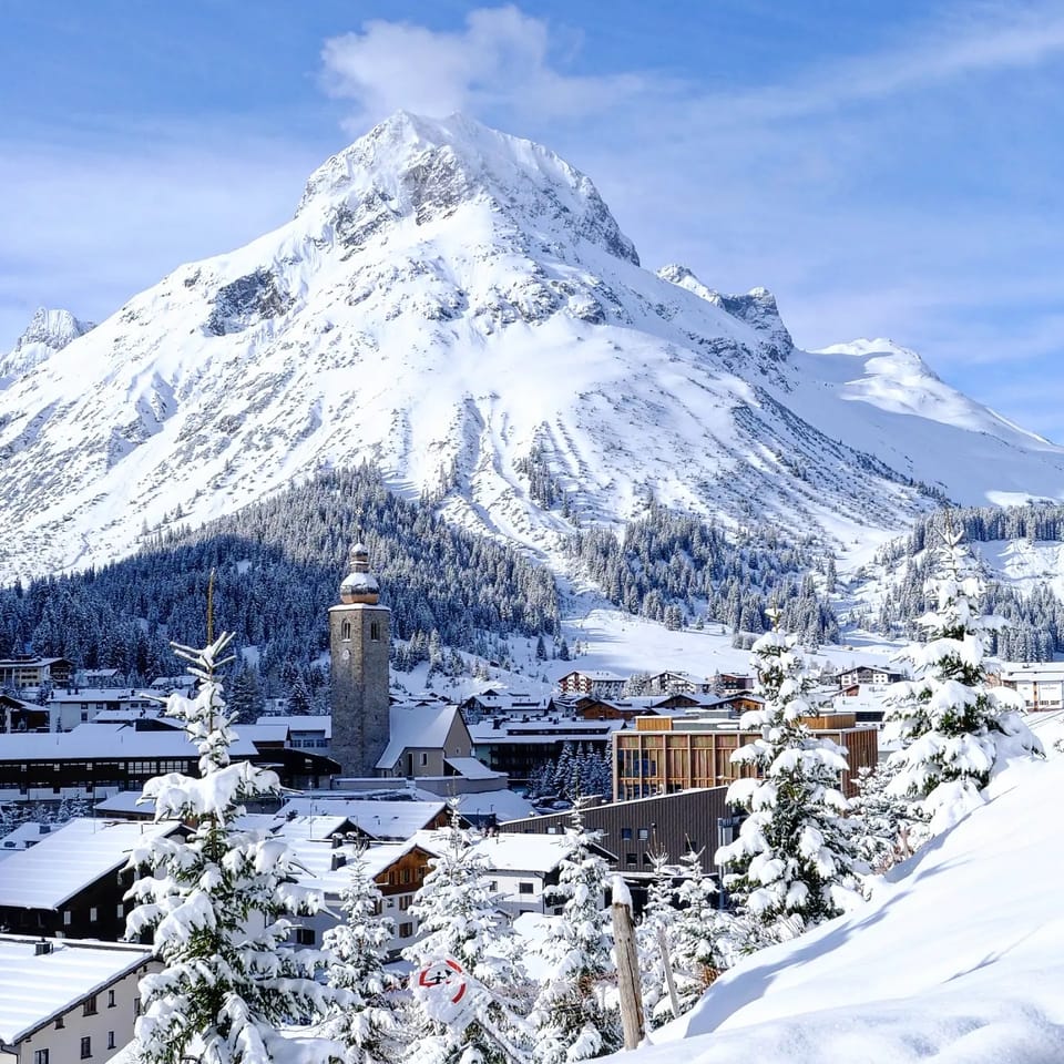
AUSTRIA REPORT
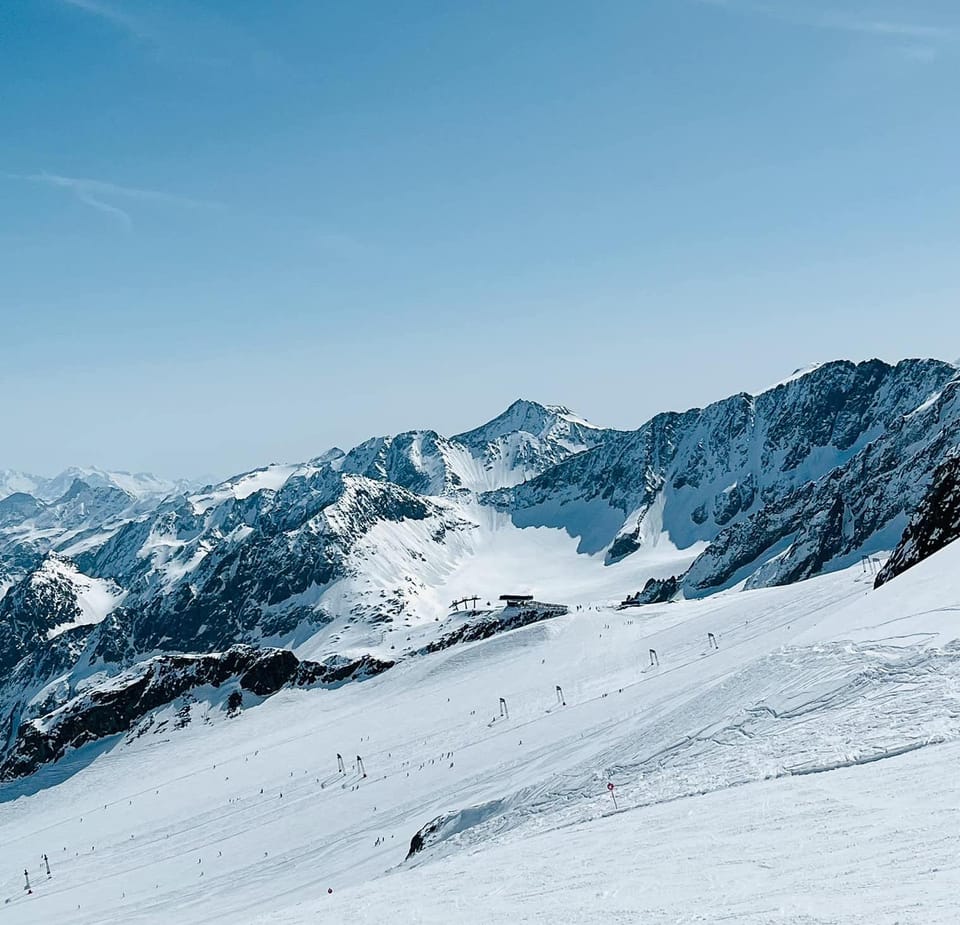
It’s been a good week for snowfall in Austria with snow down to low levels over the weekend. Although Switzerland and the USA have overtaken Austria on the count of open ski areas, Austrian ski areas that are open have much more terrain available. The four areas with the most terrain open in the world last weekend were all fully or partially open in Austria, topped by the newly opened Ischgl-Samnaun (Swiss) (30/50cm / 12/20”) cross-border area, which opened last Thursday with 112km (71 miles) of slopes open; straight in at number one in the world. Equally noteworthy was that this was mostly natural snowfall from earlier in the month, with Ischgl reporting 60cm (24″) of natural stuff, when many years of huge snowmaking effort is required to open much terrain. Worth noting too is that Solden, world number two for open terrain so far this season, was the first to pass the 100km (63 miles) open a few days before Ischgl opened. Solden’s neighbour, Obergurgl, is in third place with 80km (65p miles) of runs already open.
AUSTRIA FORECAST
A good forecast for the end of November and the first few days of December with up to 30cm (a foot) more snowfall expected by the weekend. A mixture of sunshine and cloud with temperatures into double digits below freezing at altitude and only getting up to a few degrees above freezing in valleys too.
SWITZERLAND REPORT
Switzerland is now leading Europe in terms of the number of centres it has opened, passing the 20 mark at the weekend. Among those newly opened is the Corviglia area above St Moritz (10/90cm / 4/36”), which reports 65km (41 miles) of slopes open already. Another new opening, last Thursday, was Samnaun (30/50cm / 12/20, on the Austrian border, which has the largest area open in the world so far with 120km (75 miles) of slopes accessible at the weekend. Zermatt (0/200cm / 0/80″) is still posting the deepest base in the country but hasn’t changed its numbers in months. It has also seen a jump in its open terrain, including runs now open above Cervinia on the Italian side of the border, to 60km (37 miles). Murren (20/100cm / 8/40″) seems to have the most fresh snow but only 3km (2 miles) of runs are open still so far. Swiss resorts have seen the same snowfall and cold temperatures as other parts of the Alps, giving a mostly promising picture for the start of December. Glacier 3000, near Gstaad, reported it had had a metre of snowfall up to last weekend, then more since. However, strong winds have been an ongoing issue and Murren reported the avalanche danger level up to 4 on the scale to 5 there due to the weather combination.
SWITZERLAND FORECAST
It’s looking good for more snow during the week ahead with some areas expected to see up to 50cm (20″) on high slopes, with temperatures as low as -15C overnight. Daytime highs during sunny spells in valleys are only about +6C.
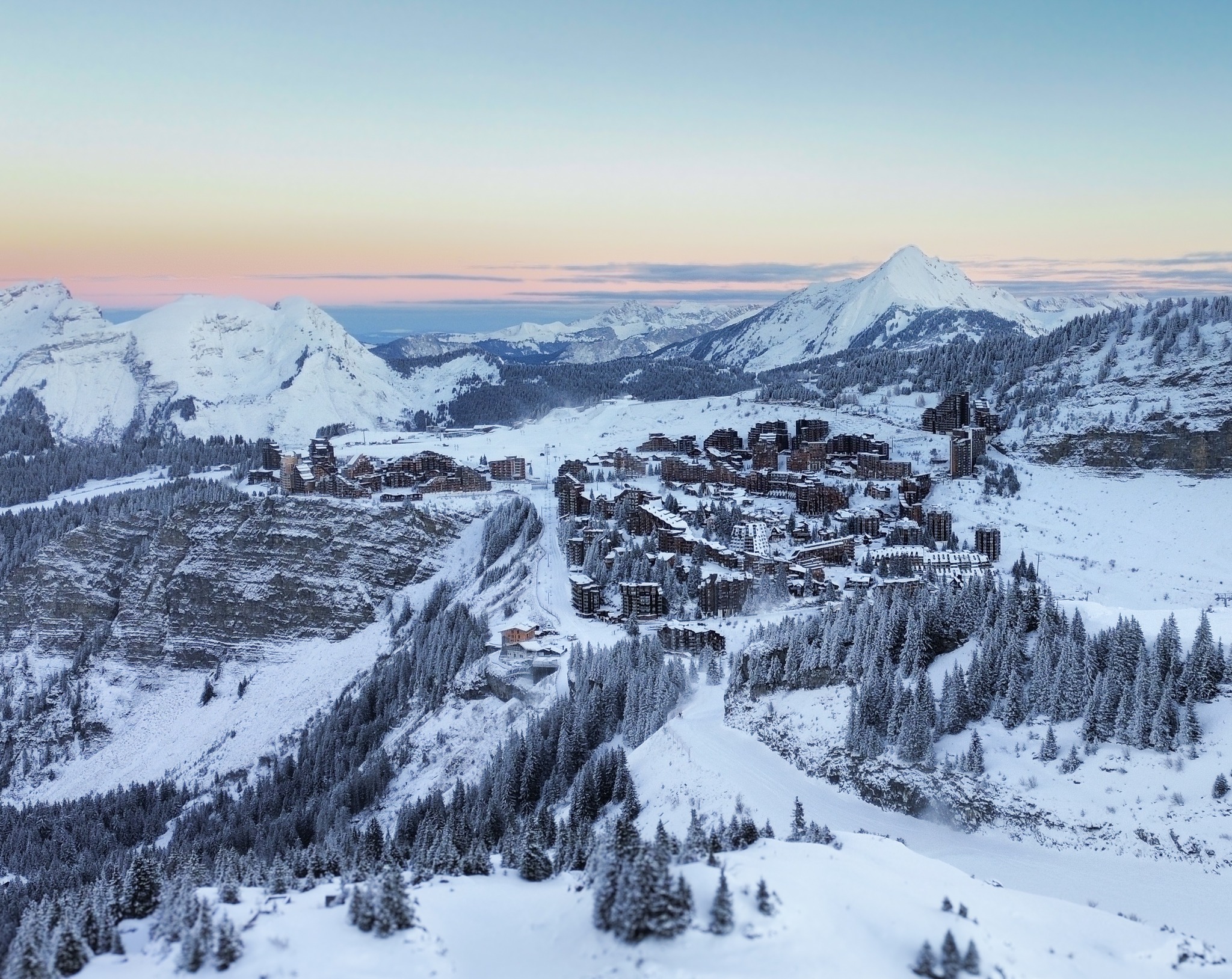
FRANCE REPORT
It is still just Tignes (35/150cm / 14/60”) and Val Thorens (40/100cm / 16/40”) open at present in France, both due to have opened last weekend but actually opening the weekend before thanks to the early abundant snowfall in the French Alps. Things will begin to change from this coming weekend though with resorts including Chamonix, Les 2 Alpes and Montgenevre, among others, lined up to open and then most French resorts over the following few weekends. Avoriaz has announced it will open for a “preview weekend” two weeks ahead of its planned opening date, this coming weekend. Conditions have been moving in the right direction over the last week with more snowfall to lower elevations and cold weather for snowmaking. Some resorts like Megeve posted 30cm (a foot) of snowfall down at resort level on Tuesday morning with higher slopes seeing 60cm (2 feet) or more.
FRANCE FORECAST
It’s looking very promising for the coming week with some significant snowfall expected and temperatures getting down as low as -15C overnight on higher slopes, and only a degree or two above freezing in valleys.
ITALY REPORT
We are up into double figures for the number of Italian areas open with several more centres opening this week and many more, including a sizable chunk of Dolomiti Superski, set to join them this coming weekend. New Italian openings at the weekend included Val Senales, which is usually one of the first in the Alps to open each autumn in September but this year was forced to delay by a cable car lift replacement requirement, now completed. The Kronplatz area (20/60cm / 8/24”) has opened with 50km (31 miles) of runs, the most in the country. The Latemar Centre (20/45cm / 8/18”) around Obereggen has opened with 25km (16 miles) of terrain, the second most open in the country so far. It joins some of the country’s big-name resorts including Cortina d’Ampezzo (0/30cm / 0/12″), Livigno (15/25cm / 6/10″) and Madonna di Campiglio (20/40cm / 8/16″), which have reported low temperatures and more fresh snowfall this week. The amount of terrain open is set to jump this week with Val Gardena opening early on Saturday with 50km of slopes initially but planning to bump that up to 190km from next Tuesday.
ITALY FORECAST
Quite a lot of sunshine in the Italian forecast for the rest of this week with the chance of significant snowfall towards the weekend. Staying cold though with valley temperatures down towards freezing and double digits below the high slopes.
GERMANY REPORT
Germany’s ski season is expected to start this coming weekend at least up on the Zugspitze glacier with several of the country’s traditional more low-lying resorts, including Feldberg, also hoping to open if conditions are right. Up high at 2000m, it has been a cold and snowy start to the week, which bodes well for the likes of Zugspitze where overnight lows of -20C and daytime highs of +5C were recorded at the weekend.
GERMANY FORECAST
Staying cold, mostly below freezing at all levels, day and night in Germany’s mountains. Light snowfalls expected most days, each adding a centimetre or two (an inch) to cover.
SCANDINAVIA REPORT
Scandinavia has had another good week with low temperatures continuing and some more snowfall. In fact some quite significant falls in the last few days with some smaller Norwegian centres posting 50cm accumulations into the weekend. However, Sweden’s Kåbdalis (38/90 cm / 15/36”) is posting the region’s deepest snow at this very early point in the season with Norway’s Kvitfjell (20/80 cm / 8/32”) in second place. In terms of open terrain Levi (25/35cm / 10/14”), in Finnish Lapland, is managing to stay just ahead of the region’s biggest area, Sweden’s Åre (28/61 cm / 11/24”) with 12km (8 miles) of runs to Åre’s 10km which represent about 10% of its full area.
SCANDINAVIA FORECAST
Very cold and snowy weather is forecast for the rest of this week with temperatures staying well below freezing, in the -5 to -25C range, with frequent snow showers.
SCOTLAND REPORT
It’s been a bit of a weather rollercoaster in the Scottish Highlands with highs of +15C in valleys in the middle of last week as violent gales blew through, but then dropping back down below freezing since the end of last week and fresh snow on the hills. It doesn’t look like the season start is imminent but Glencoe and others have said they’ll get their all-weather snowmaking machines in operation in the next few days so things are starting to move forward.
SCOTLAND FORECAST
The forecast appears to be back on track with more promising -5C to +5C temperatures without any warm weather temperature spikes expected this time, fingers crossed.
SPAIN / ANDORRA REPORT
It has been a good week for fresh snowfall in the Pyrenees after a period of warmer, drier weather in mid-November. Ski areas across the region posted 20-40cm (8-16”) accumulations by the weekend. The snowfall was enough for Spain’s largest centre, Baqueira Beret (30/40cm / 12/16”), to decide to open for its 23-24 season on Saturday, starting with 25 km (15 miles) of open slopes and 8 lifts in operation. Most of the rest of the ski areas on the Andorra/Spanish side of the border will be aiming to open this coming weekend in time for various public holidays during the first week of December. Temperatures have stayed cold and there have been more snow showers.
SPAIN / ANDORRA FORECAST
There’s more snowfall forecast through the rest of this week with temperatures in the range of -5C to +5C.
BULGARIA / ROMANIA REPORT
Still looks to be a week or so off opening day for most ski areas in southeastern Europe, although some may open this coming Saturday, but there has been more snowfall with Serbia’s Kopaonik reporting snowfall down to its base last week. Temperatures have typically been down towards -10C with highs around freezing and plenty of snowfall. In Bulgaria, Borovets has reported a lot of snowfall and hinted at a possible early opening.
BULGARIA / ROMANIA FORECAST
Mostly cool and dry with occasional snow showers. The only blip on the horizon is a possible rise to high single/low double figures in Celsius temperature at some lower altitude ski areas towards the end of the week, potentially seeing rain rather than snow, but it looks like it’ll be short-lived.
CZECH REPUBLIC / SLOVAKIA REPORT
There’s still nowhere open in the Czech or Slovak Republics, but it has been a good week for cold temperatures and more snowfall with the area’s largest resort, Jasna, reporting upper slope depths up at 50cm (20″) ahead of its expected opening for the season this coming weekend.
CZECH REPUBLIC / SLOVAKIA FORECAST
It’s predominantly low temperatures and more snowfall forecast more or less daily right through the coming week, lining up well for a snowy start to the season.
NORTH AMERICA INTRO
North America’s early season is still stuttering along without anywhere posting a really big dump or a whole lot of runs open. Well, only Alaska has posted a lot of November snowfall, and there’s not much open there yet. On the other hand, it is not that bad either. Although most areas only have a few miles of runs open so far, most that wanted to open for Thanksgiving have managed to have at least a few runs open. There has been some snowfall too, on both the east and west coasts, with the Rockies reporting about a foot (30cm) of fresh from a storm about a week ago, before the latest days of sunny skies. In the east ski areas in Vermont reported a foot of snowfall on Monday too. So we still need a decent dump or two to really get the party started and so far nothing is looking a lot like that in the forecast, unfortunately.
ROCKIES REPORT
The Rockies saw a decent snowfall just as we were publishing last week’s report, with up to 14” (235cm) reported in 24 hours at some centres in Utah. But after that it was back to sunshine and rather mild temperatures at resort level (although not that mild). So we have an ongoing situation of missing the big early dumps of recent seasons and not a lot open anywhere so far, just a few miles of runs at most. Colorado’s Wolf Creek (27/27” / 68/68cm) is posting the most runs so far with about 20 miles (32km) in total. But more resorts have been able to open with Big Sky (8/10” / 20/25cm), up in Montana, the latest of the big names joining the rush to be open for Thanksgiving. However, some such as Idaho’s largest resort Schweitzer has announced an opening delay blaming too little snow.
ROCKIES FORECAST
Unfortunately, still not much snowfall in the forecast, particularly for Colorado, but temperatures will be lower, down towards single figures on high slopes and not getting much above freezing at resort level either. Slightly more promising from Utah north in that a front with light to moderate snowfall is expected into the weekend.
USA WEST REPORT
It’s a mixed picture along the US West Coast. In the far north Alaska has reported one of its snowiest ever Novembers, but it is more problematic further south with centres in Oregon delaying opening and not much able to open further south, and those that have opened so far posting very thin snow depths and limited terrain open as yet. All that said, Mammoth Mountain (14/18” / 35/45cm) does have the most terrain open in the US so far, though it’s not much, about 12 miles (19km) of slopes. Some centres like Heavenly (2/20″ / 5/50cm) that had to delay opening a week ago did manage to open for Thanksgiving, if only a few miles of runs. It’s been cold at altitude, in the 20s mostly, and just getting a few degrees above freezing in valleys, but the issue so far is the lack of snowfall, with predominantly sunny weather.
USA WEST FORECAST
Unfortunately, there’s no huge change in the forecast with sunny weather continuing for the next few days. That said, there are signs of a snow-bearing front moving in towards the weekend in the north of the area.
MIDWEST REPORT
Temperatures have dipped again in the Midwest and there’s been some natural snowfall too, allowing ski centres that had opened and closed again to re-open and some other centres to open. Ski Brule (24/24” / 60/60cm), in Michigan, was the first to reopen with Minnesota’s Wild Mountain (2/12” / 5/30cm) and Wisconsin’s Trollhaugen re-opening at the weekend.
MIDWEST FORECAST
It’s looking cold for the coming week with temperatures between freezing and about ten degrees below freezing. So good snowmaking conditions although there’s not much snowfall in the forecast.
USA EAST REPORT
A constantly improving picture on the US East Coast this week after a worrying warm spell, with natural snowfalls and very low temperatures down to the teens Fahrenheit turning mountainsides white when a week ago it was just ribbons of machine-made snow down green-brown hillsides and a handful of resorts. Almost all managed to open for Thanksgiving weekend though, and most centres in the northeast also posted images of a well-timed decent dump in the latter half of last week, turning things much more wintery before the Women’s World Cup Tour rolled into Killington (2/14″ / 5/35cm), Vermont for women’s slalom races at the weekend. A little further north Sugarloaf (0/12″ / 0/30cm) and Sunday River (12/12″ / 30/30cm) have their full winter coats on with top to bottom cover. Most areas still only have a thin cover and a few miles of runs open, Smugglers’ Notch (6/12″ / 15/30cm) posting the most with five miles/8km. Fresh snowfall, with some resorts including Vermont’s Sugarbush posting a 12”/30cm accumulation on Monday though is definitely a move in the right direction.
USA EAST FORECAST
Staying cold with daytime highs in valleys only a degree or two above freezing, but more commonly temperatures in the 20s to low 30s. Good for snowmaking which is lucky as there’s not much snow forecast, just the odd inch here or there for most.
CANADA
CANADA WEST REPORT
The 23-24 season is still not yet really getting going in western Canada in terms of big snowfalls, but it is an improving picture with widespread snowfall around the weekend, Banff’s areas posting 30cm (12”)+ and saying this was the snow they’d been waiting for. The country and the continent’s biggest resort Whistler Blackcomb (0/60cm / 0/24”) is also now open, but with just around 10% of its slopes skiable so far, similar to the other areas open already. Mt Norquay (65/100cm / 26/40”) is the first to reach the metre mark for upper slope snow depth.
CANADA WEST FORECAST
After the weekend snowfall it has been mostly dry and that’s the case for the week ahead with a mixture of sunny and cloudy spells. Cold in ski areas with daytime highs around freezing, lows as low as -15C so good for snowmaking at least.
CANADA EAST REPORT
Some cold weather for eastern Canada allowing the region’s largest centre, Tremblant (5/42cm / 2/17”) to reopen for the season. There are 6.9 km (4 miles) of slopes open, the most in the region so far with Sommet Saint-Sauveur (10/20 cm / 4/8″), which had been first in the east to open on either side of the border, re-opening and more of the region’s bigger resorts including Mont-Sainte-Anne and Stoneham now open too. Snow depths and open terrain remain very limited so far, however. Daytime highs have been only a few degrees above freezing and after a sunny end to last week clouds have bubbled up and there’s been more snowfall to start this.
CANADA EAST FORECAST
Temperatures remain close to freezing with more light snowfall forecast through the remainder of this week.
ASIA
JAPAN REPORT
A bit of a hit-and-miss week in Japan with some good snowfalls reported but most areas that had hoped to open for the season last weekend have been delayed as there’s not yet enough. Kiroro is among the latest to delay opening for the time being blaming too little snowfall there so far. Furano (20/30 cm / 8/12″) up on Hokkaido has opened though, as has Shiga Kogen (0/30cm / 0/12″) in Nagano. Both just have a few kilometres of runs open initially. Other resorts like Niseko have reported some good snowfalls in the past few days ahead of their hoped-for opening date this coming weekend, a date targeted by a large number of the country’s resorts. Myoko posted a 35cm (14”) accumulation at the weekend.
JAPAN FORECAST
After a few days of warmer, drier weather following the last snowfalls, it’s a good forecast for the week ahead with more snow expected through the remainder of the week, hopefully with some significant 25-50cm (10-20”) accumulations by the weekend. Temperatures in the -5 to -15C range.