WORLD SNOW ROUNDUP #216
(Updated 22 November 2023) A comprehensive review of snow conditions, weather, and updates for Europe, North America and Asia's winter sports destinations.
Issued: 22nd November 2023
By Patrick “Snowhunter” Thorne
World Overview
More ski areas have been opening across Europe, North America and Asia and it’s expected we’ll pass the 100 open mark by the end of this week.
Europe has had a bit of an up-and-down week with more fresh snowfalls to low levels in some parts of the Alps and very cold weather continuing in Scandinavia, but also rain and thawing weather on some lower slopes below about 2,000m. But still, another dozen or so centres opened at the weekend, many of them opening early and ski areas in the Austrian Alps currently have much more terrain open than anywhere else.
It’s a more nuanced picture in North America with, unfortunately, more ski areas delaying opening here. There’s not been much natural snowfall in November so far and while it has been cold enough for snowmaking in many areas, it’s been rather too warm still in some. Heavenly and Telluride are among the areas delaying opening in the west, Stratton in the east, although some of these have now opened. There has also been up to a foot of snow in the Rockies well timed for Thanksgiving. At the same time other resorts are managing to open, including big East Coast resorts like Sugarloaf and Sunday River and the country’s biggest of all, Heavenly.
A couple of Japanese ski areas have opened now and the weather has turned much more favourable with the next few weekends seeing many big-name areas expecting to open there, although again, some have announced delays
For a little novelty, the Argentinian resort Las Lenas has announced it will offer the rare option of southern hemisphere summer skiing in South America. The resort says it had so much snow this winter it can offer an 800m run at the top of its lifts this summer.
Europe
EUROPE INTRO
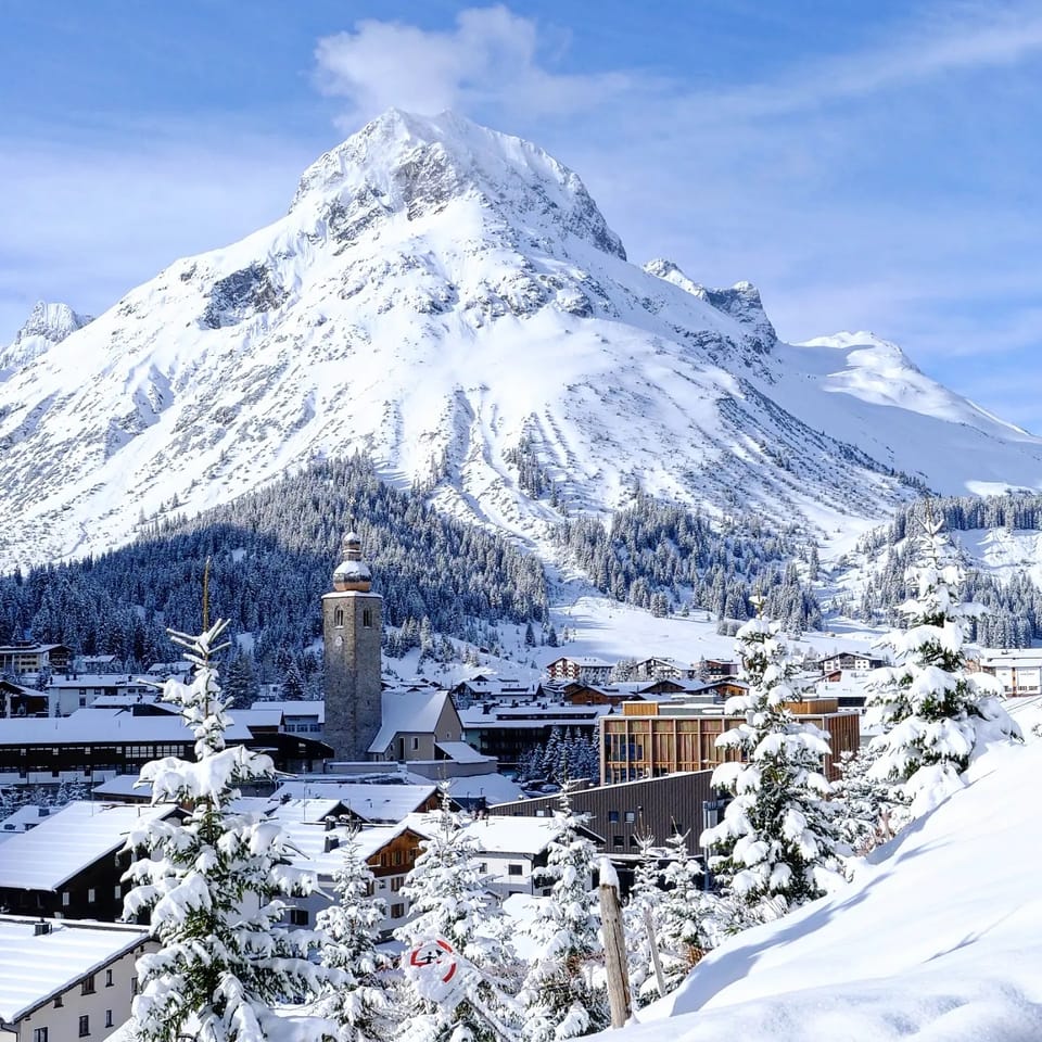
The Alps saw more fresh snowfall on high slopes this week and at times, in places, down as low as 1,000m in valleys too. But warm temperature spikes, as the weather cools overall, as we move towards winter, saw some thawing below 2,000m and periods of rain and sleet too, with strong winds also a factor at times on glaciers. Up in Scandinavia, it has continued to be very cold and daylight hours are diminishing quickly in the far north too. After a warm, dry spell, the Pyrenees have seen fresh snow in the past few days and there’s been more snowfall in Eastern Europe too.
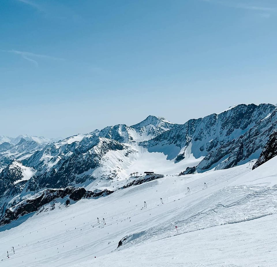
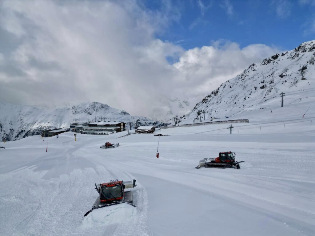
More than 40 areas are now open, about two-thirds of them in Austria or Switzerland. Some of those also have much more terrain already open than anywhere else, led by Austria’s Otztal region where Sölden and Obergurgl have nearly 175km (110 miles) of slopes open between them.
More ski areas have been opening early too including France’s Tignes and Val Thorens starting the country’s 23-24 season at last and Livigno, Madonna di Campiglio and the Presena Glacier, in Italy, doubling the number of areas open there. Switzerland saw Crans Montana, Grimentz and Laax opening early at the weekend but most of the 14 centres open here, the most in Europe to date overtaking Austria, are only open at weekends until the start of December.
AUSTRIA REPORT
Austria may have been overtaken by Switzerland in Europe for the number of ski areas open, and by the USA on a world scale, but its ski areas have by far the most terrain of any currently open ski areas. Sölden (0/175cm / 0/70”) not only has the deepest snow in the country but with more than 90km (55 miles) of slopes open already, half as much again as the ski area in second place. And its recently opened neighbour, Obergurgl (20/88cm / 8/35”), which opened with more than 80km (50 miles) of slopes at the weekend, also successfully staged the first men’s alpine ski race of 23-24 after the previous three planned for Sölden and Zermatt-Cervinia had to be cancelled due to bad weather. The two centres in third and fourth place for open terrain in the world, are also both located in the Austrian Tirol. The Hintertux (15/100cm / 6/40”) and Stubai (10/90cm / 4/36”) glaciers each have about 35km (22 miles) of slopes available. The race to open so much so soon is partly thanks to the great early season conditions and partly the imminent opening of the cross-border Silvretta area shared by Ischgl and Switzerland’s Samnaun. That opens for its 23-24 season in the next few days and usually manages to do so with 100km+ of terrain open, even in a poor autumn when the snow all has to be machine-made. This year it has lots of natural snow cover to play with. Obertauern (40/60cm / 16/24″) is also due to open in the next few days.
AUSTRIA FORECAST
There’s sunshine and snow showers forecast for the rest of the week with temperatures in the -10 to +8C range. Snowfall is expected to be pretty light most days.
SWITZERLAND REPORT
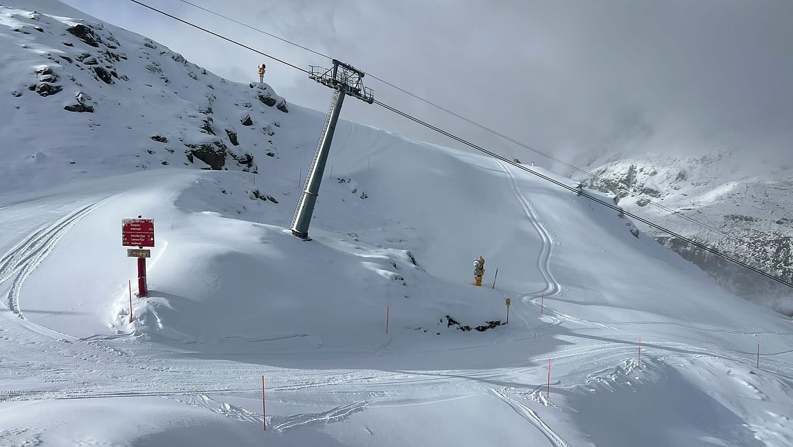
Swiss resorts are having a very positive start to their 23-24 seasons, with 14 open last weekend, overtaking Austria for having the most open in Europe. Many Swiss areas are currently open only at weekends until December though, so mid-week Austria goes back into first place, if we’re counting! To mix things up though, some Swiss centres have switched from weekends to daily opening now since last weekend, including Davos. Among the newly opened centres last weekend were Andermatt (0/85cm / 0/34”) posting it had 80cm (32”) of fresh fallen snow accumulated ahead of opening day on the Gemsstock, as well as Grimentz (10/50cm / 4/20”), Laax and Crans Montana. They joined a list of already open famous Swiss centres including Arosa (10/40cm / 4/16”), Davos (4/47cm / 2/19”), Engelberg, Gstaad (glacier 3000 – 10/88cm / 4/35”), Murren (0/20cm / 0/8”), St Moritz (Diavolezza Glacier), Saas Fee (5/130cm / 2/52”), Verbier (20/60cm / 8/24”) and Zermatt (0/200cm / 0/80”). As to the weather, there have been more snow showers and high wind on upper runs, but temperatures have stayed low and although the fresh snow has thawed on lower runs, as is to be expected in mid-November, it continues to look good above 2,000m.
SWITZERLAND FORECAST
The forecast remains pretty positive for Swiss centres with clearer skies more frequently, but temperatures remaining below freezing on higher slopes and daytime highs of +8C in valleys.
FRANCE REPORT
The 23-24 French ski season is believed to be the latest starter in more than five decades, but it is now underway with Tignes (50/150cm / 20/60”) opening on Saturday with a reported 1300m of skiable vertical from day one. Val Thorens (5/100cm / 2/40”) has also opened and reported more terrain open than Tignes, with 10km of slopes. Both centres had planned to start their seasons at the end of this week but moved their dates forward a week due to all the snowfall in the first half of this month. Val Thorens still plans to run its big grand premiere this coming weekend to celebrate the start of the season with gear tests and events. The weather has not been so favourable this past week with higher temperatures causing fast thawing of the early snowy excesses on lower slopes, with rain and strong winds also impacting the cover and causing higher avalanche danger. However, higher up the snowpack is freezing to form a great base for the season ahead.
FRANCE FORECAST
Mostly dry and sunny with some light snow showers. Predominantly remaining below freezing above 2,000m altitude and in the -5 to +5C range in valleys.
ITALY REPORT
It has been largely dry and sunny in much of Italy over the past week, but that hasn’t stopped ski areas including Livigno (15/25cm / 6/10”), Madonna di Campiglio (20/40cm / 8/16”) and the Presena Glacier (100/120cm / 40/48”) capitalising on the snowfall they received in the first half of November, up to a metre (40”) in fact, and opening early last weekend. They about doubled the amount of skiing available so far in the country, joining Cervinia (0/200cm / 0/80”), which now has terrain open on its side of the Swiss border, not just providing access to the glacier skiing above Zermatt, and Sulden (100/130cm / 40/52”), which continues to post the most terrain open in the country so far, even though that’s only 16km (10 miles) of runs so far.
ITALY FORECAST
The mostly sunny weather is currently forecast to continue through to the weekend with the freezing point fluctuating dramatically between about 500m and 2500m altitudes. This means some daytime thawing on lower slopes but cold enough weather to maintain the snow and allow for more snowmaking up high, and also on lower runs overnight.
GERMANY REPORT
Germany’s ski season is only a week or so away now with the country’s highest slopes on the Zugspitze Glacier targeting Friday, December 1st for opening day. Pre-season conditions continue to be good, especially on high slopes like those of the Zugspitze with another week of frequent snowfalls and sub-zero temperatures concluded.
GERMANY FORECAST
Mostly subzero temperatures above 2,000m are expected for the coming week and not a lot higher even in mountain valleys below 1,000m altitude where daytime highs of only +5-6C are expected. More snow showers, possibly rain-sleet lower down, but it’s largely looking good.
SCANDINAVIA REPORT
Scandinavia’s main season got underway last weekend with several of the region’s biggest resorts now open, including the largest of them all, Sweden’s Åre (25/38 cm / 10/15”), which has opened with 6km (4 miles) of slopes initially (actually the most anywhere at this point in the season). One of Norway’s biggest resorts, Trysil (25/39 cm / 10/16”) has also opened with a couple of miles (3 km) of slopes initially, as has Geilo. They join the leading Finnish centres Ruka (20/30cm / 8/12”) and Levi (15/40cm / 6/16”), which are already approaching two months into their 23-24 seasons. They were joined by another top Finnish resort, Pyha (30/40cm / 12/16”), opening for the season last weekend. All have been experiencing a week of predominantly subzero temperatures (-20C in Lapland) with frequent fine snow showers. Sweden’s Kåbdalis (38/90cm / 15/36”) has the deepest snow in the region so far, altogether there are approaching 20 ski areas open in the region.
SCANDINAVIA FORECAST
Continuing very cold, down as low as -25C overnight in Lapland and not a whole lot warmer further south. After some clear sky days, light snowfall is forecast in many areas for the rest of the week. Daylight hours are now getting very short in the far north.
SCOTLAND REPORT
Conditions remain consistently cold in Scotland and there have been some more snowfalls on the country’s higher slopes. Cairngorm reported snowfall down to 800m altitude, although it also reported that its funicular remains out of action and that it doesn’t expect to open until Christmas week. Glencoe has seen more snowfall too and says it plans to run its access chairlift, which provides access to ski touring terrain, when the inbound slopes aren’t yet open from early December. It will also run its all-weather snowmaking from early next month but initially just to offer tobogganing.
SCOTLAND FORECAST
There’s more of the same forecast with relatively low temperatures and snow showers expected for the coming week.
SPAIN / ANDORRA REPORT
A rather dull week for weather in the Pyrenees with early snowfall gains thawing back and not much fresh snowfall to report until Tuesday, when there was a widespread covering to raise spirits and temperatures cold enough for snowmaking. Most ski areas in the region don’t plan to open for at least another 10 days though, at the start of December, so there’s time yet and snowmaking conditions have been good some nights.
SPAIN / ANDORRA FORECAST
It looks like it will continue to be predominantly dry, but pretty cold, over the next seven days in the Pyrenees. So, snowmaking systems should be able to keep working on pre-season base building.
BULGARIA / ROMANIA REPORT
There’s been more snowfall forecast in southeastern Europe and even over into northwestern Asia and the ski slopes of Turkey over the past week. So it’s looking promising for the week ahead. Most ski areas in the region plan to open in 3-4 weeks’ time in mid-December though some will open sooner all being well.
BULGARIA / ROMANIA FORECAST
Continuing cloudy with snow showers for the rest of this week. Temperatures range from -8 to +8C depending on altitude and time of day.
CZECH REPUBLIC / SLOVAKIA REPORT
Conditions continue to look promising in north-eastern Europe with more snowfalls on higher terrain in the Czech and Slovak Republics as well as Poland. The region’s largest resort, Jasna, is looking good for its season start reporting 10-30cm (4-12”) on high slopes so far. Most areas here plan to open during the first half of December.
CZECH REPUBLIC / SLOVAKIA FORECAST
Continuing mostly cold and snowy with possible rain/sleet at lower elevations during warmer periods in the afternoons. Overnight lows on high runs as low as -10C should be good for snowmaking.
NORTH AMERICA INTRO
America’s season start has stalled a little with the wait continuing for a big snowfall anywhere on the continent (except perhaps up in Alaska) to really get the party started. Ski areas have been opening, including the largest in the US, Park City in Utah, but there’s not much snow lying and the skiing is on a few miles of machine-made stuff. Elsewhere, some areas including some in California and Colorado have announced they’re delaying until things improve. There was some snowfall in the Rockies to start this week though, with up to a foot reported for some in Colorado and Utah. But on the East Coast they’ve been taking advantage of cold temperatures for snowmaking and while delays have been announced here by centres including Stratton, others including Sunday River, Stowe and Sugarloaf have all opened. The coming week will see the continent’s largest centre, Whitler Blackcomb, open for 23-24, following BC’s season start last weekend at Sun Peaks, and eastern Canada’s biggest resort, Mont Tremblant, also. Many other areas plan to open in time for the upcoming US Thanksgiving holiday weekend.
ROCKIES REPORT
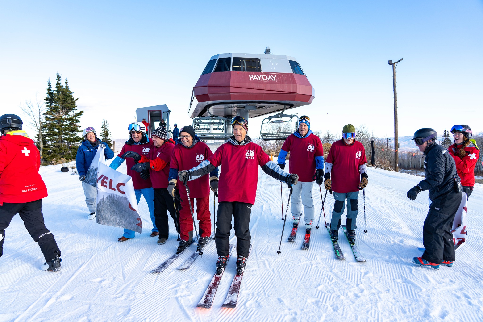
It was mostly sunny last week in the Rockies, but there was some much needed snowfall to start the week with yet-to-open Snowbird in Utah reporting one of the bigger falls – 13” (33cm). More than a dozen ski areas have now opened though, the majority in Colorado, which has more resorts open than any other state or region, but we also have America’s largest ski area at Park City (11/16″ / 28/40cm) opening Utah’s season and Grand Targhee (8/10″ / 20/25cm) open in Wyoming too. Snow depths are typically at a foot or less with Winter Park (12/18″ / 30/45cm) posting the deepest and the amount of terrain each area has open isn’t much yet either. Keystone (4/18″ / 10/45cm) is posting the most with only 4.5 miles (7.5km) of runs so far.
ROCKIES FORECAST
Unfortunately, we’re back to dry weather and there’s no sign of any major change in conditions imminently. There are some snowfalls forecast at the weekend but they currently look like just an inch or so rather than anything significant. Temperatures will remain below freezing on higher slopes though, creeping into the low 40s in afternoons at the resort level.
USA WEST REPORT
It’s not been the best of weeks on the West Coast, particularly towards the south with three Californian ski areas, including Heavenly and Northstar, which we’d expected would be opening last weekend when compiling last week’s report, later announced a delay because of too little snow. They have now announced revised opening with Heavenly starting its season as we complete this week’s report, Northstar following on Thursday. Some centres are open though including Mammoth Mountain (14/18″ / 35/45cm), but like areas in the Rockies, there’s a thin base and just a mile or two of runs open at each. More centres including most major West Coast ski resorts are aiming to open later this week though if they can and up in Alaska there have been reports of record-breaking snowfall.
USA WEST FORECAST
Continuing predominantly dry and frequently sunny weather but getting well below freezing on high runs overnight making snowmaking possible. Some light snow flurries are expected, and daytime highs at resort bases in the low 40s.
MIDWEST REPORT
After having two Midwestern ski centres open at the start of the month, Wild Mountain in Minnesota and Trollhaugen in Wisconsin, both have been forced to close again due to warm weather melting what machine-made snow cover there was. Michigan’s Ski Brule is also reported to have opened and temporarily closed again. It has just been too warm for the past few weeks but the temperatures do now look to be moving in the right direction.
MIDWEST FORECAST
Temperatures are expected to fall away through the remainder of the week, getting more consistently below freezing. There’s no snow forecast but, hopefully, this will allow snowmaking systems to fire back up. Trollhaugen say they’re hopeful of opening this weekend.
USA EAST REPORT
There’s not been much natural snowfall in the east as yet but it has been colder, particularly overnight and particularly further north, allowing several of the region’s bigger centres to open at least some terrain. In most cases, it’s just a mile or two so far. That said, Maine’s Sugarloaf (0/12” / 0/30cm) and Sunday River (12/12” / 30/30cm) have both managed to unveil top-to-bottom descents. So with other areas including Stowe (14/16” / 35/40cm) also opening it’s a big improvement on just some hike-to runs at Killington (0/14” / 0/35cm) for the previous week or so. Okemo (14/16” / 35/40cm) has also opened. The news isn’t 100% positive though with several centres, including Stratton, going the other way and delaying opening.
USA EAST FORECAST
Continuing dry weather with sunny spells. Temperatures getting into the low 20s overnight. So still good for snowmaking although daytime highs in the low 40s could cause more thawing on lower slopes.
CANADA
CANADA WEST REPORT
There have been some more snowfalls and more centres have been opening in western Canada, but so far there’s not a lot of snow and what’s open in each area is limited. BC’s season is underway though with Sun Peaks the first to open some runs last weekend and Whistler Blackcomb, the biggest in the country and the continent, set to join as we publish this week’s report. The deepest reported snow and most terrain open so far is around Banff, with Mt Norquay (58/67cm / 23/27”) and Sunshine’s (30/42cm / 12/17”) 10km of open runs taking Canada’s top spots in each table.
CANADA WEST FORECAST
Pretty cold with daytime highs only a few degrees below freezing at low levels and overnight lows up high down as far as -15C. However, there’s not a whole lot of snowfall in the forecast still, just a few centimetres more here and there. Good for snowmaking though.
CANADA EAST REPORT
It’s still a bit of a battle for eastern Canadian ski areas to open although more are planning to later this week and snowmaking guns are firing out across Quebec and Ontario even though there’s not been much natural snowfall yet. For now, it is just Sommet Saint-Sauveur (10/ 20 cm / 4/8″) open with that kilometre of machine-made snow but Stoneham and the largest in the east, Mont Tremblant, are both set to join them later this week.
CANADA EAST FORECAST
It’s cold in the east with temperatures not looking like they’ll get above freezing, even in the afternoons in valleys, so good news for more snowmaking. What there isn’t is much snowfall in the forecast, just sunny skies, although there may be a few centimetres of the natural stuff to end the week.
ASIA
JAPAN REPORT
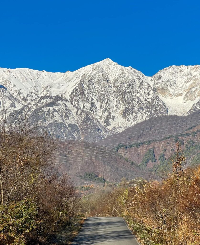
Japan is fast approaching the start of the season with many of the country’s leading resorts targeting this coming weekend, otherwise the weekend after at the start of December. The good news is that Japanese weather has done what it usually does and switched from warm and wet to (mostly) cold and snowy over the past week and it has started dumping down. Some areas have reported half-a-metre of snowfall (20”) so far on their higher slopes. For others though it has arrived a little too late with those announcing a delay due to too little snow, including Nozawa Onsen. The all-weather snow of the Yeti ski area near Mt Fuji has now been joined by the first slopes opening at Shiga Kogen and many more Japanese areas are set to open from Friday or Saturday this week.
JAPAN FORECAST
We’re still in the weather borderlands between rain and snow and temperatures are fluctuating between -10C overnight on high runs and +2C in valleys. So, when the precipitation comes it depends to a large extent when and at what altitude it falls. Hopefully, there is plenty of snowfall forecast for the coming week.