WORLD SNOW ROUNDUP #207
Issued: 13th September 2023
By Patrick “Snowhunter” Thorne
World Overview
The 2023 ski season continues its wind down in the southern hemisphere with spring due to kick in, by the astronomical measure in a week’s time, meaning we’ve entered the period where every measure says spring is here. The next few weekends will see the majority of southern hemisphere ski centres end their 2023 seasons.
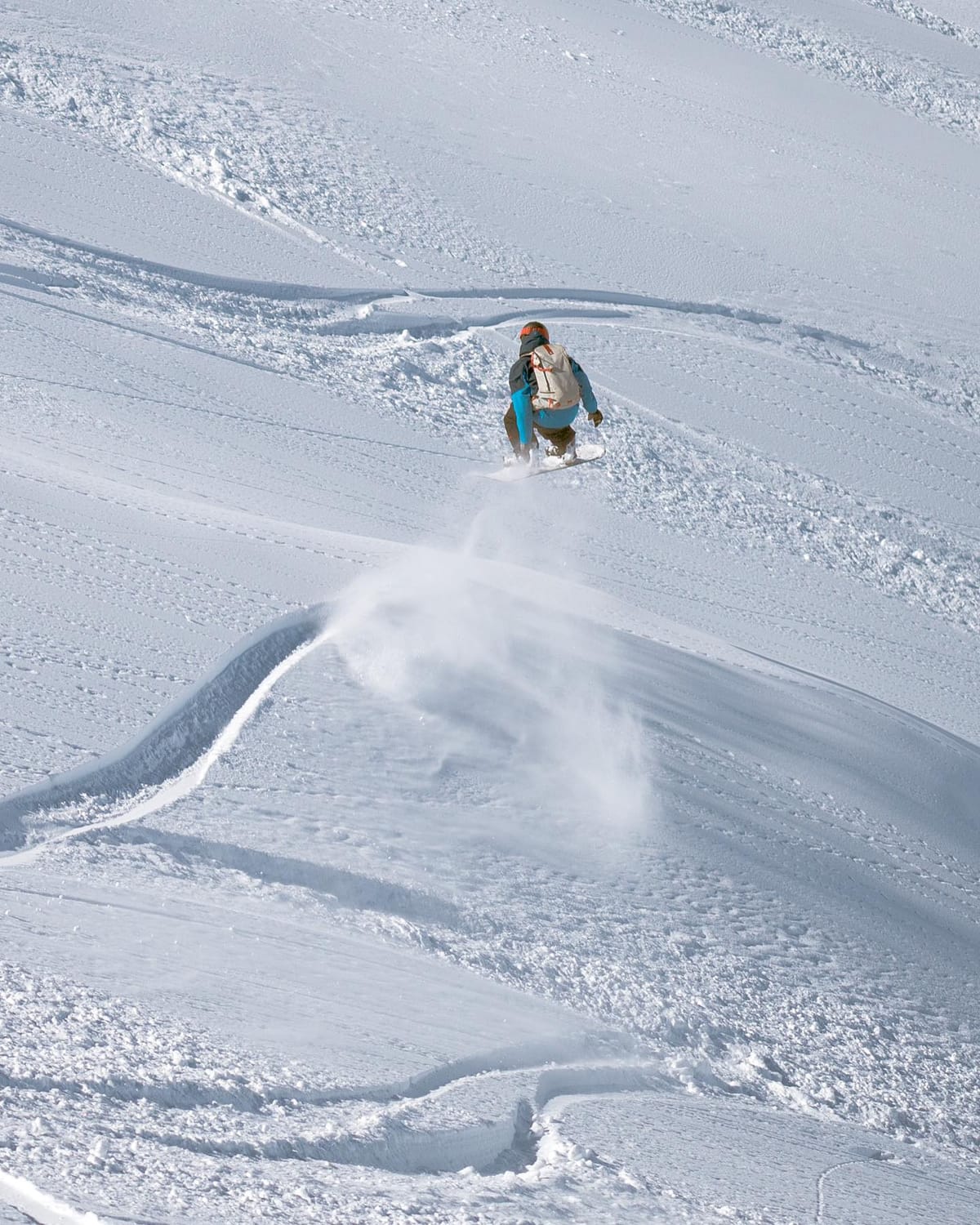
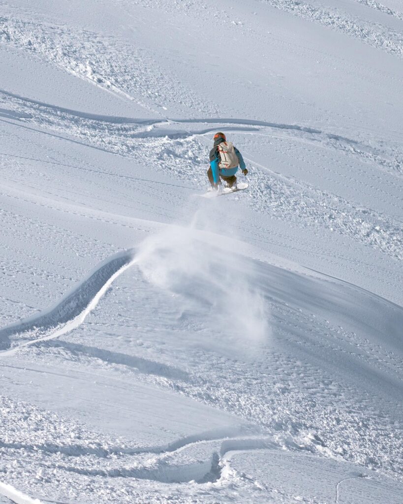
The snow keeps falling in South America, however, as snowfall arrives late in the day, giving a snowy end to winter, which for most resorts in the Andes and Patagonia will end over the next few weekends, just a few making it into October. The latest snow has been intense with reports of up to 50cm (20”) of snowfall in a few hours and another metre (over 3 feet) in 24 hours, leading to warnings of snowpack instability and high avalanche danger.
In New Zealand, springtime continues to be a good time for most of the country’s centres with decent snow depths (the deepest in the world amongst several centres, in fact) and quite a few areas planning to keep going into October. Strong winds of up to 140kph have been the man issue, closing some centres again this week.
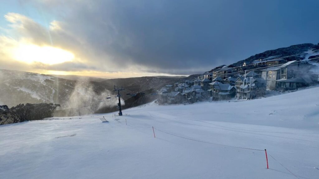
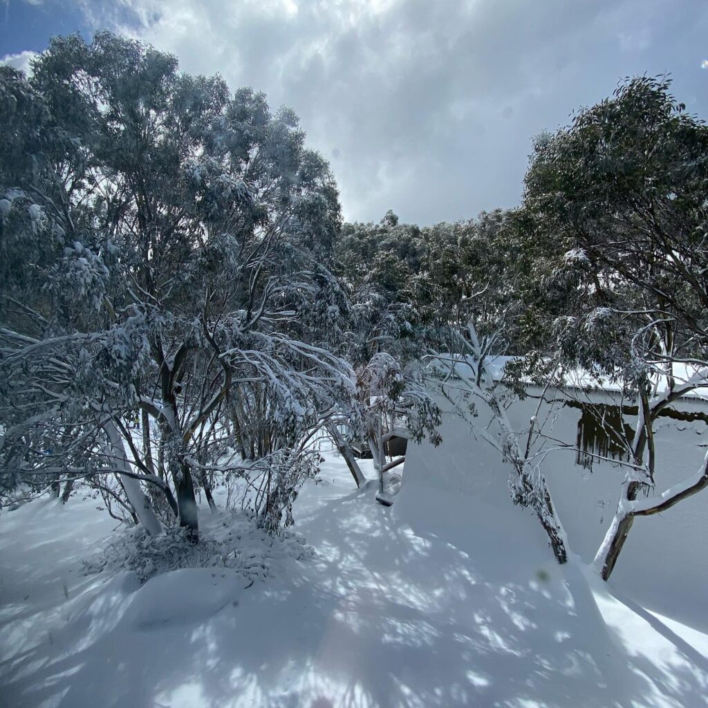
Most Aussie ski areas have just small amounts of terrain (10-20%) of their full areas still open, but they did get a helping hand from Mother Nature at the weekend with an unexpectedly generous dump of up to 20m (8”) of snow. One resort said it would help extend its season slightly but several others have already closed for 2023.
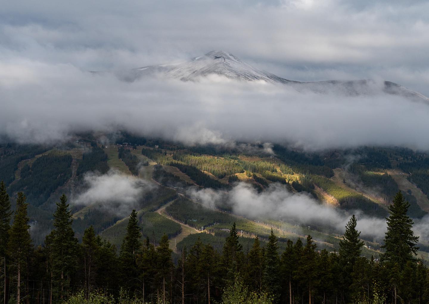
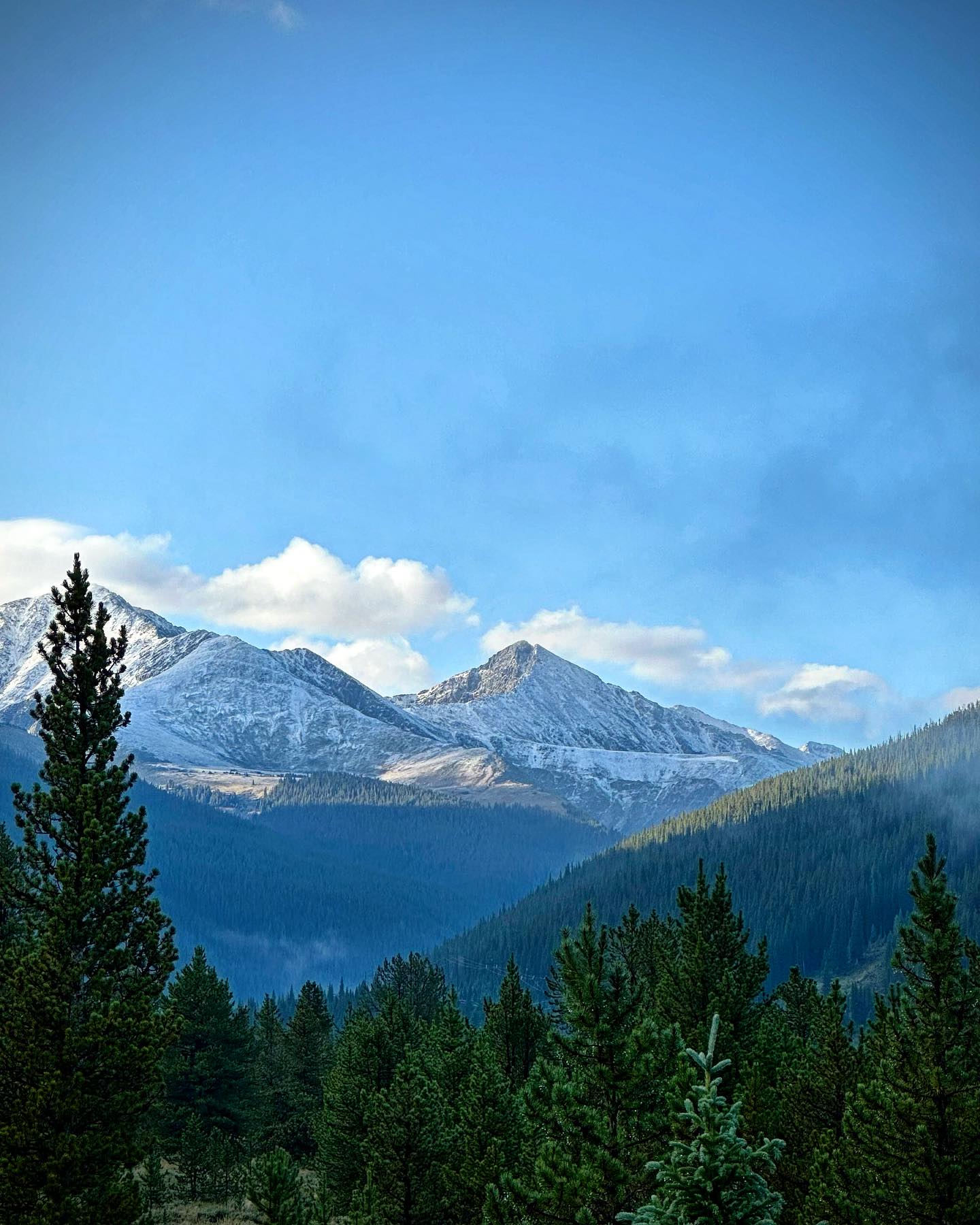
In the northern hemisphere, where we’re entering the last week of astronomical summertime, there was fresh snowfall on high slopes for the weekend in the Canadian Rockies and then on Monday the higher slopes of Colorado turned white for the first time this pre-season. Meanwhile, the end of next week should see the beginning of the autumn opening of glacier ski areas in the Alps and we’re also just over three weeks away from the first centres opening in northern Scandinavia (Lapland) thanks to snow-farming (last winter’s recycled snow spread back out on the slopes after keeping it piled undercover through the hotter months of spring and summer) to create a run of a kilometre or so.
Southern Hemisphere
AUSTRALIA REPORT
There was better than expected news for the centres that are still open for the 2023 season in Australia with up to 28cm (11”) of snowfall reported going into last weekend with temperatures also dropping to -5C overnight, allowing for snow-making systems to fire up too. The heaviest snowfall was on Friday but continued with smaller accumulations on Saturday and then Sunday in most areas. All Aussie centres have been on end-of-season ease down for the past few weeks but the new snow pepped things up and Mt Buller (3/46cm / 1/19”) said that, as a result, it will be staying open longer than planned, to this coming Sunday, September 17th. Mt Hotham (20/40cm / 8/16”), which plans to go for a fortnight longer to 1st October said that the snow and the cold temperatures were helping consolidate what terrain is still open, noting that what’s left is best suited to beginners and intermediates. Perisher (40/110cm / 16/44″), which plans to stay open for at least a week into October, is the only centre still posting more than a metre (40″) of snow lying on upper runs and has the most terrain still open, about 28km/18 miles of slopes. The snowfall has come too late though for Selwyn Resort and Mt Baw Baw, which announced last week that they were forced to end their ski seasons.
AUSTRALIA FORECAST
Following the weekend snowfall we’re back to nearly non-stop sunshine and daytime highs back in double digits. So it may be a challenge for some areas, with thinner bases, to make it to the end of the month. That said, overnight lows are still forecast to get down near freezing, occasionally a degree or two below. So that should help save the snow longer and potentially even be cold enough for snow-making, if deemed worth it at this point in the season.
NEW ZEALAND REPORT
Full winter seems to be running late this year with some very cold and snowy weather for New Zealand again this week. Overnight lows down to -10C have been reported with daytime highs not that much above freezing. Plenty of light snowfall too. The only real downer has been strong winds, up to 140kph reported, making operations difficult at times, closing slopes, lifts and sometimes while centres. Unlike the ski areas in most countries, New Zealand centres have the most terrain open they’ve had all season, generally 90-100% of their terrain. South Island centres Mt. Hutt (115/215 cm / 46/86″), Cardrona (45/55 cm / 18/22) and Coronet Peak (36/120 cm / 15/48″) are each posting about 40 km (25 miles) of slopes open a piece, the most in the country. Tūroa (130/244cm / 52/98”) on Mt. Ruapehu, on the North Island, continues to post the deepest snowpack in the country and the world at present. But there are still signs that spring is starting to take hold with a gradual rise in temperatures leading one smaller field, Mt Lyford to announce its 2023 season is now over.
NEW ZEALAND FORECAST
It will continue to be snowy for the week ahead but it should be progressively drier with sunshine returning by the weekend. Overnight lows still dropping to double digits below freezing up high, but daytime highs starting to creep up to low single figures too.
ARGENTINA REPORT
It has been a week of sunshine and snow showers in Argentina with temperatures yoyoing about six degrees on either side of the freezing point every 24 hours. So springtime freeze/thaw for the final week or two of the season. Catedral (20/110 cm / 8/44”) continues to post the most terrain open in the country and the world, over 80km/50 miles of runs representing about 70% of its terrain. Las Leñas (110/190cm / 44/76”) is in the best shape it has been all season with the country’s deepest snowpack and the most terrain it has had open all winter. It reported another three feet (90cm) of snowfall to start the week.
ARGENTINA FORECAST
It will be constantly dry and sunny at most Argentinian ski areas for the next few days, temperatures also creeping higher, potentially passing +10C in the latter half of this week. But then another front will see temperatures drop and potentially significant snowfall again at the weekend.
CHILE REPORT
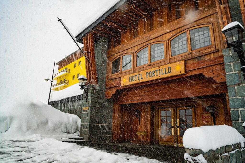
It’s been another very good week for snowfall with Portillo (89/205cm / 36/82″) seeing another half metre (20″) at the weekend taking its seasonal total past the 6m mark. It’s also now one of five centres worldwide posting a base of more than 2 metres (80″). Of course, it is not the only Chilean ski centre reporting plenty of fresh snowfall, but it seems to be getting more than others from the stats. That said, La Parva reported more than 50cm (20”) of snowfall in just a few hours on Monday and warned of an unstable snowpack and high avalanche danger as a result. Corralco (40/60 cm / 16/24″) posted images of fantastic powder conditions and noted its slopes are 95% open for its final weeks of winter. El Colorado (30/90 cm / 12/36″) continues to have the most terrain open in the country though with about 80% of its slopes open, around 40km (25 miles) of runs.
CHILE FORECAST
The snowfall continues through the start of this week, but is expected to ease from Wednesday with sunny skies for most areas for the rest of this week. A big variation in temperatures from -10C overnight to +10C in the afternoons for full spring freeze-thaw conditions.
Europe
EUROPE INTRO
After the cold and sometimes snowy end to August in the Alps temperatures have been climbing again for the first fortnight of September, reaching double-digits above freezing in the afternoons even above 3,000m altitude, and not getting below freezing overnight on the highest slopes either. That’s, unfortunately, not great news for glacier ski areas, especially with more due to open most weekends from the one after next, as the build-up to the main 23-24 season begins. It’s been cooler, but not cool enough in Scandinavia where above zero temperatures have led the one summer ski centre that has been open the past months, Galdhopiggen, to temporarily close until things cool down. It’s also now just over three weeks until Levi and Ruka, up in Finland, begin opening for their 23-24 seasons using snow stockpiled through the summer then spread back out on the slopes to create new runs.
AUSTRIA REPORT
The Huintertux glacier (0/20cm / 0/8”) remains the only area currently open in Austria although four more glacier areas are aiming to open by the end of the month, the first of these, Pitztal, in just over a month’s time. It has been too warm and sunny on the glacier with daytime highs reaching +10C and only dropping to +5C overnight. The past few days have seen the non-stop sunshine start to break up though and fronts move in, although unfortunately because of the temperatures what precipitation there has been has been rain rather than snowfall most of the time.
AUSTRIA FORECAST
Temperatures are starting to dip again and it’s looking promising for some sleet or even possibly snow showers over the next few days. Overnight temperatures should be back to a degree or two below freezing on glaciers and daytime highs below +5C. After the Pitstal glacier next weekend, the Solden, Kaunertal and Kitzsteinhorn glaciers are expected to open over the final few days of the month.
SWITZERLAND REPORT
There’s little change in the stats being published by Switzerland’s two open glacier ski areas, Zermatt (0/200cm / 0/80”) and Saas-Fee (0/210 cm / 0/84”), both reporting about 12km (7 miles) of slopes open. Temperatures on the glaciers have been in the +2C to +8C so warmer than ideal, but cooling in the past few days again. Engelberg is set to be the next Swiss area to open for the season in a month’s time.
SWITZERLAND FORECAST
The temperature drop is expected to continue for the remainder of this week with overnight lows dropped back well below freezing. There’s hopefully going to be 10-20cm (4-8”) of fresh snowfall above 3,000m over the next few days too.
FRANCE REPORT
There are no French glaciers open to ski and none planning to open for another six weeks. At that point, Les 2 Alpes hopes to open for glacier skiing for a late October/early November fortnight, but much depends on conditions at the time. Hopefully, better than at present when temperatures have been reaching 10C or higher at 3,000m and not getting back to freezing overnight on glaciers. Other than the Les 2 Alpes fortnight, if it happens, the French season will kick off around the final weekend of November at resorts including Tignes and Val Thorens. The only snow skiing in France until then is the indoor snow slope at Amneville in the northeast of the country.
FRANCE FORECAST
There is an improvement in the weather over the next few days with temperatures set to dip back below freezing as a front moves through, daytime highs at 3,000m down to +5C and even the chance of some snowfall. Sunnier with temperatures climbing again later in the week.
ITALY REPORT
Cervinia has ended access to Zermatt’s glacier skiing at the end of its summer season but will reopen the connection in October and plans to remain open indefinitely from then on. No more brief spring or autumn access closures. So it’s currently only Passo Stelvio (0/30cm / 0/12″) open with just under half of its terrain accessible (4km/2.5 miles) and a base which is still thin. There’s not much more snow than when it closed for a week last month so the return to warmer weather this past week has not been welcomed, with daytime highs reaching double digits on the glacier. Crucially though we have been getting back to freezing overnight for the early morning ski sessions.
ITALY FORECAST
It’s looking promising with temperatures set to plummet in the latter half of this week and some snowfall forecast from the next front moving through too. So, hopefully, the autumn cool down is finally here.
SCANDINAVIA REPORT
Norway’s Galdhopiggen (0/100cm / 0/40″) glacier area is the only centre currently aiming to open in the area, although webcam images show a snowless glacier except for a rectangle of snow alongside the drag lift and the site has announced it is temporarily closed. Temperatures have been warm in recent weeks, with overnight lows +5C, and daytime highs +10C. Meanwhile, excitement is building in Lapland with Levi and Ruka now just over three weeks away from opening on 6th October. Both have stockpiled record amounts of snow over the summer ready to start spreading back out on the slopes soon to create new runs for opening day.
SCANDINAVIA FORECAST
A changeable week ahead with a mixture of sunny spells, rain, sleet and snow showers. The trajectory is for temperatures to drop down towards freezing temperatures day and night by the weekend at Galdhopiggen with snow falling and lows possibly down to -7C overnight. So, hopefully, good news for reopening.
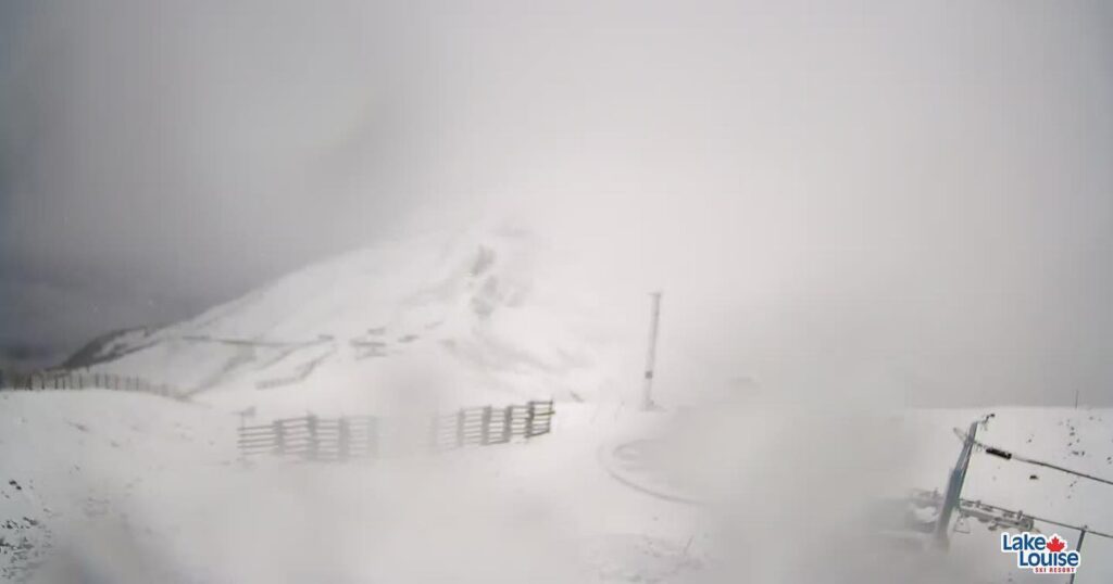
USA REPORT
The Banff Rockies, in Alberta, were among the latest area to report late summer/early fall (depending on whether you follow the meteorological or astronomical measure of the seasons) snowfall with the slopes turning white for a while at the end of last week at a number of ski areas including Sunshine and Lake Louise. These are, of course, among the first to open in Canada each season, with the 23-24 season start now less than two months away (November 10th is the target opening date conditions permitting). Colorado ski areas then reported their first white coverings on high slopes on Monday morning with resorts including Breckenridge, Copper, Keystone and A Basin turning white up top. This snowfall follows cold weather and some snowfall was reported in the first week of this month on high slopes in states like Utah and Oregon in the West and New Hampshire in the Eastern US, so things are moving in the right direction.
USA FORECAST
We are, hopefully, only a fortnight away from the start of snow-making on high slopes in Colorado now. The good news is that overnight lows two miles up in the Colorado Rockies are consistently at or around freezing, so just a little cooler will enable snow-making to start up. It’s a similar story in the coolest spots of the Midwest where snow-making and opening are targeted for early-mid-October, if it is cold enough.