WORLD SNOW ROUNDUP #205
Issued: 30th August 2023
By Patrick “Snowhunter” Thorne
World Overview
We’re on the cusp of the end of summer and the start of autumn in the northern hemisphere, by the meteorological measure of the seasons (another three weeks to the change by the astronomical measure). In the southern hemisphere, winter will become spring over the next few days. So anticipation for the ski season ahead is building in Asia, Europe and North America, helped by reports of unseasonal fresh snowfalls up high for some. While in the southern hemisphere, the season is starting to wind down. The good news for Australia, New Zealand and South America though has been a big blast of winter this past week.
The heaviest snowfall has been for ski areas in Argentina and Chile, reporting their biggest snowfalls of at least two months and for some the biggest all season. New Zealand, meanwhile, is reporting some of the best conditions of the 2023 season at present. The 2023 ski season in southern Africa is now over, however.
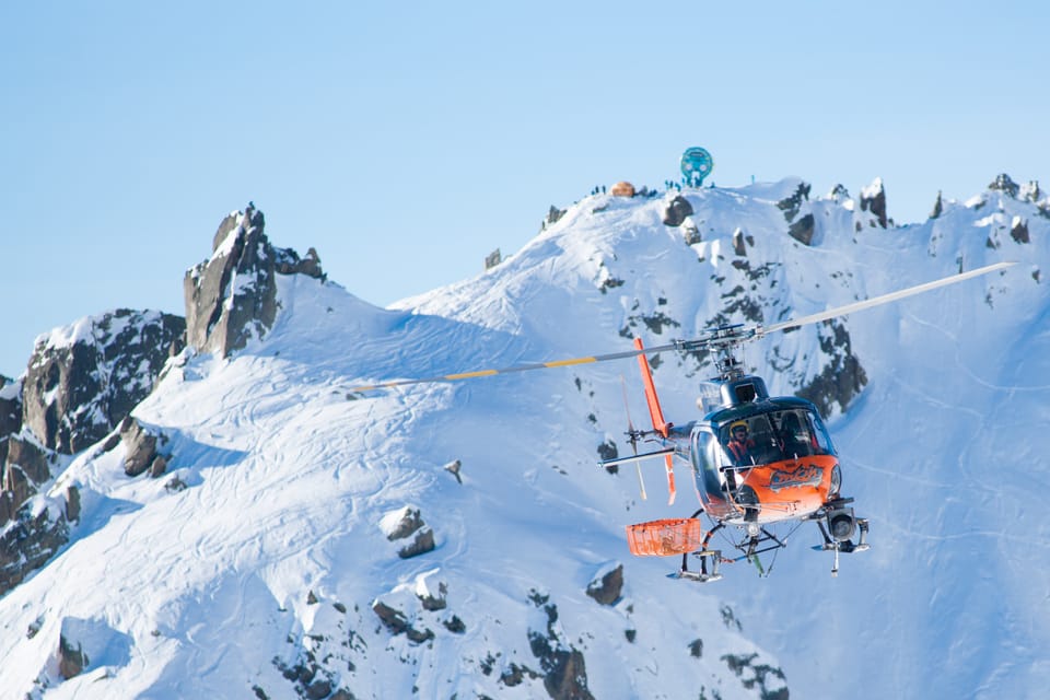
The news from the Alps wasn’t great last week with Swiss meteorologists finding the freezing point had hit a new record high level of nearly 5,300m, or almost 500m higher than the top of the highest mountain in the Alps, Mont Blanc. However, the weekend saw a dramatic drop and temperature and remarkably the new week has started with snowfall down to 1500m and up to 30cm (a foot) of fresh snow on glaciers.
In North America, there was excitement as one ski area in Idaho spotted it had had a snow covering in the middle of the night last week, although it had gone again by the morning. This appears to be the first clearly recorded snow on a ski slope of the 23-24 season build-up, although skiers in Utah are claiming they’d had some a fortnight ago. There’s nowhere currently open in North America, other than dry land slopes and the indoor snow slope in New Jersey, with the first high areas in Colorado expected to begin snow-making in a month’s time.
Southern Hemisphere
AUSTRALIA REPORT
It has been back to predominantly dry and frequently sunny weather in Australia. Temperatures have continued to drop to -5 or -6C overnight allowing centres to continue snow-making, but daytime highs have been hitting double figures above freezing in the afternoons. So the snowpack is thawing too. Perisher (60/130cm / 24/52″) continues to post the deepest snowpack in the country and the most terrain open with about 48km (30 miles) of slopes. Thredbo (50/100cm / 20/40”) is the only other area reporting a metre (40”) snow depth and has more than 35km (22 miles) of slopes open. Falls Creek (52/72cm / 21/29″) has the highest percentage of its terrain open, more than 90%, with about 45km (28 miles) of slopes skiable. Unfortunately, Selwyn resort has been forced to close its recently reopened ski slopes after a shower on Friday fell as rain there rather than snow, damaging the thin cover.
AUSTRALIA FORECAST
Light snow showers will continue for the next few days bringing a few centimetres more, but daytime highs could reach +10C by the weekend so some thawing too. That said overnight lows should get down far enough to enable more snow-making as required.
NEW ZEALAND REPORT
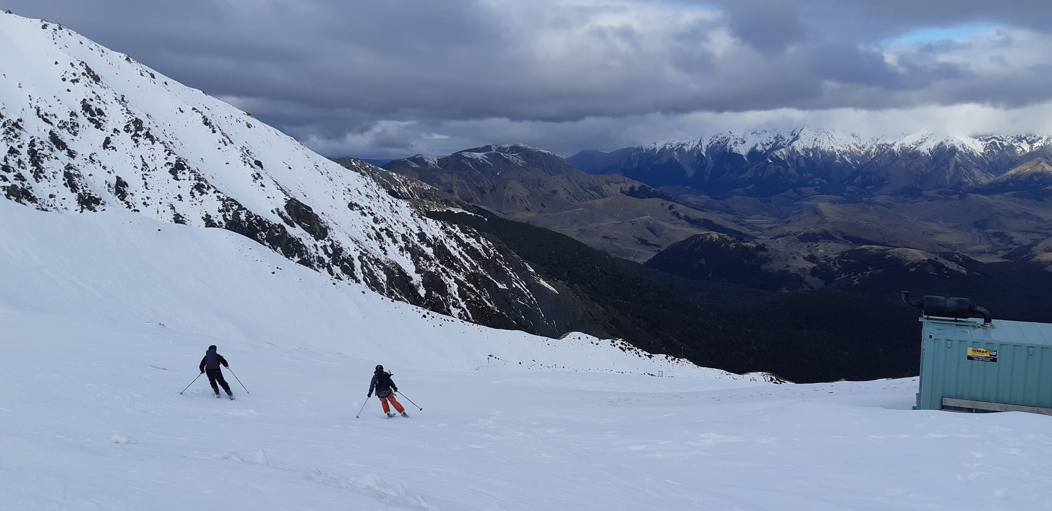
New Zealand’s ski areas have been reporting some of the best conditions of the winter to date thanks to recent snowfalls followed by some clear, cold days. Strong winds have continued to be an occasional issue though, closing some centres for periods. There were some fresh snowfalls to start the week. The deepest reported snowpack in the country (and currently the world) is on the North Island where the season may still have two months to run, the longest lasting in the southern hemisphere. Whakapapa (92/151cm / 37/60″) and Tūroa (130/255cm / 52/102”), on Mt. Ruapehu, both usually stay open until the latter half of October and sometimes into November/ Although it is unclear if the resort’s current “in administration” status might lead to operational issues in the low season even if there’s still plenty of snow lying? On the South Island, where the majority of centres are, conditions remain at a season-high with centres reporting their deepest bases and most terrain (typically 90-100%) open in 2023. Mt. Hutt (115/210cm / 46/84”) and Coronet Peak (46cm/120 cm / 18/48”) are posting the most terrain open in the country at 36km (23 miles) and 40 km (25 miles) of runs respectively.
NEW ZEALAND FORECAST
It will continue to be a largely cold but frequently sunny week with temperatures in the range of -12C overnight to daytime highs of +2 or +3C. A front is expected to move in bringing significant snowfalls at the weekend.
ARGENTINA REPORT
The snowfall that was getting underway as we completed last week’s report just kept dumping on Argentinian ski slope through last week, giving one of the biggest and best dumps of winter 2023 with three weeks of the season left for most of the country’s resorts. The storm continued for 4-5 days through to last weekend when skies cleared. The reported base depth numbers haven’t dropped that dramatically but there are some spectacular anecdotal numbers including claims that Las Leñas (80/120cm / 32/48”) received up to 4 metres (13 feet) of snowfall up high. For piste skiers, the good news is that it is finally posting a decent depth at its base and is up to half of its terrain open. The southern hemisphere’s largest resort, Catedral (20/100cm / 8/40”), has been posting more than 100km (63 miles) and over 80% of its terrain open, the most this winter and the first resort to offer more than 100km of slopes since the end of the northern hemisphere’s main 22-23 season in early May. Since the weekend it has remained cool but skies have cleared a good deal and there’s been plenty of sunshine.
ARGENTINA FORECAST
Back to mostly dry conditions with just the occasional snow shower and plenty of sunshine for the start of spring, overnight lows as low as -10C and afternoon highs as high as +10C, but typically more in the -5 to +5C range.
CHILE REPORT
Chile also saw some heavy snowfalls over the past week with by far the biggest dump of the winter so far, with a total of up to 250 cm (8.2 feet) of snowfall accompanied by high winds and subzero temperatures. In the end, the huge snowstorm lasted five days up to last weekend, but inevitably buried lifts, blocked roads and brought down power lines in places so some resorts have been closed and taken some days to dig out. Portillo (195/215cm / 78/86”) blasted through the two metre/seven feet snow depth mark by last Thursday reporting over three feet (90cm) of snowfall in 24 hours on Wednesday/Thursday last week. It ended up with more than 2.5 metres of snowfall. “Now that the skies are clearing, our team is working on snow safety, avalanche control work and evaluating what terrain we can open. The road to Portillo remains closed while crews work on clearing the snow. We look forward to enjoying the new snow!” a Portillo spokesperson said at the weekend.
CHILE FORECAST
It’s a largely dry forecast for the week ahead with temperatures fluctuating between -10C overnight and +10C in the daytime, although much of the coming week will be more in the -5 to +5C range!
Europe
EUROPE INTRO
As mentioned in our world introduction, the Alps saw record high temperatures at altitude last week driving the freezing point up to nearly 5,300m and seeing continued double-digit plus temperatures Celsius on glaciers, bad news for both the remaining snow cover and the underlying glacial ice. The good news is that by the weekend things had cooled down again a great deal and temperatures dropped well below freezing on glaciers with the bonus that snow clouds moved in for the final week of summer, above about 1,500m.
AUSTRIA REPORT
Austria’s Hintertux (0/20cm / 0/8”) has made it through the hot weather of the past few weeks, albeit with a seriously diminished base and just a couple of kilometres of ski slopes still open. The weather is thankfully now much colder and there’s been fresh snowfall reported with overnight lows dropping as low as -6C and not getting much above freezing in the daytime. Although still the only centre open in Austria, it will be joined by half a dozen more Austrian glacier areas, most of them in the Tirol region, over the next 3-6 weeks. Pitztal, Kaunertal and Kitzsteinhorn (in Salzburgerland) have confirmed target September opening dates with Solden and Stubai glaciers yet to confirm their likely opening dates and the Molltal (in Carinthia) aiming for October.
AUSTRIA FORECAST
The snowy weather is expected to continue through Wednesday and into Thursday before skies clear and the sunshine returns to start September. Temperatures should remain cool on the glacier, in the -5 to +5C range, much better than for much of August.
SWITZERLAND REPORT
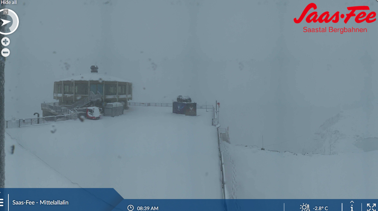
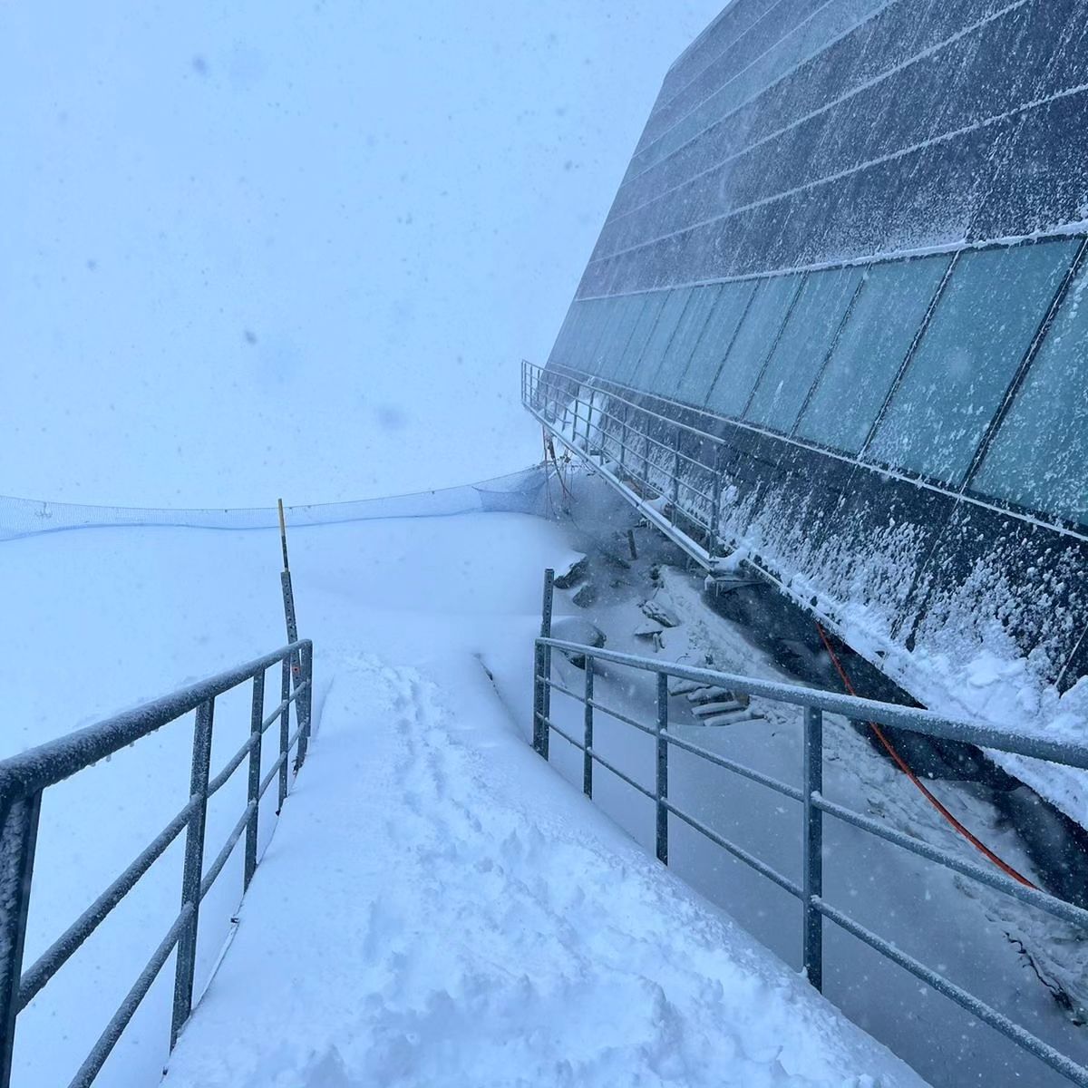
The very hot weather at high altitudes in the Swiss Alps that continued to result in +10C afternoon highs on glaciers has thankfully ended and since the weekend it has been a cold and even snowy picture with temperatures remaining subzero around the clock, well below overnight, a significant change. The two Swiss centres that have been open the past six weeks remain the options this week, both reporting plenty of fresh summer snow since Monday and identical bases after Saas Fee (0/200cm / 0/80”) lost 50cm (20”) in last week’s heat. Both it and Zermatt (0/200cm / 0/80”) have lost a little open terrain in the hot weather, both down around 12km (7 miles) open each, although the changed conditions might reverse that.
SWITZERLAND FORECAST
Skies have cleared after the snowfall to start this week but even with the sun returning temperatures should remain at least 10 degrees cooler than they had been with daytime highs only getting a little above freezing and overnight lows back to well below zero Celcius.
FRANCE REPORT
There’s currently nowhere open in the French Alps, just the option to ski on indoor snow in the northeast of the country at Amneville, home to what’s still the world’s longest indoor snow slope at over 600 metres despite China opening larger centres by area. The next resort expected to open outdoors is still nearly two months away, at Les 2 Alpes, for a 10-day period ending October and starting November. If that plan doesn’t happen for lack of snowfall though (which is currently an unknown), the next opening won’t be for nearly three months with Tignes and Val Thorens expecting to start their 23-24 seasons at the end of November. The past few days have seen an end to the extreme heat at altitude with a stormy start to the weekend and then a return to much colder weather behind the front, particularly noticeable at altitude. There was snow down to as low as 2,000m with 10-20cm (4-8”) accumulations on high slopes across the French Alps.
FRANCE FORECAST
The change in the weather, at least in terms of the temperature drop, looks set in for the coming week with temperatures on glaciers remaining around freezing. Mostly sunny for the next few days but with a chance of more snowfall during the first weekend of September.
ITALY REPORT
The big change this week was Passo Stelvio’s (0/30cm / 0/12” at last report) decision last Friday to shut down its skiing due to the hot weather having melted a lot of the snow cover from its glacier. The decision is due to be reviewed as we complete this week’s report so it may re-open from Wednesday, or not, depending on the decision. Its base had got very thin and it had dropped to less than 3km (2 miles) of slopes open, about a third of its terrain, before making the closure decision. However, the good news is that like glaciers elsewhere in the Alps the weekend saw a big drop in temperatures and some good snowfalls, with about 30cm (a foot) reported at Stelvio, hopefully making a fast reopening more likely. Zermatt’s glacier continues to be accessible from Cervinia (0/200cm / 0/80″) for another week or two before its annual seasonal closure of the lift-up for a month or two. It has said though that this September will be the last time that happens with access remaining open year-round from the start of October onwards.
ITALY FORECAST
The snowfalls have eased but skies will remain overcast for the next few days before sunny weather returns for the end of this week. Temperatures getting as low as -8C on glaciers overnight climbing to +5C in the afternoons, but back to freeze-thaw and much better than they have been for the past few weeks.
SCANDINAVIA REPORT
Norway’s Galdhopiggen (0/120cm / 0/48”) ski area remains the only centre open in Scandinavia. While it has been hot in the Alps it has been merely a little warm on Scandinavia’s highest ski slopes and so far at least, unlike previous summers on recent years, the mile (2km) or so of slopes have stayed open. The weather has been mixed with rain, sleet and snow showers alternating with sunny spells or overcast skies, the whole lot. Temperatures generally dipping below freezing overnight, +2 to +6C in the daytime.
SCANDINAVIA FORECAST
Conditions continuing mixed with some more snowfall expected, along with more sunny spells. Overnight lows continue to drop below freezing, daytime highs +6C. It’s now just five weeks until Levi and Ruka, in Finland, are due to open for their 23-24 seasons at the start of October by using snow recycled from last season with the snow farming technique.
USA REPORT
Much more changeable weather has arrived in the US over the past week with many areas seeing storms, with torrential rains, gale-force winds and much cooler temperatures than in the last few months. Unfortunately, the results of this included reported damage to the base of Lee Canyon Resort near Las Vegas in Nevada. But the changing air also meant the first signs of snowfall of the 23-24 pre-season, with the ski area of Pomerelle in Idaho noticing snow covering for a few hours in the middle of the night when its staff looked at webcam images. It had gone again by the morning but was enough to make ski media news stories across the US. There remains nowhere open for snow sports in North America at present following the 22-23 season ended at Timberline in Oregon and Mammoth Mountain in California earlier this month. The only option is the indoor snow slopes of Big Snow in New Jersey. The first ski areas on the continent’s highest slopes in Colorado at resorts like Loveland will aim to start snow-making in a month if conditions are right.
USA FORECAST
Sunny weather should dominate in the US Rockies for the next few days, with more clouds rolling in at the weekend. Overnight lows at high altitudes are still above freezing, although getting down to the high 30s Fahrenheit, so getting closer to temperatures where snow-making might become feasible.