WORLD SNOW ROUNDUP #204
Issued: 23rd August 2023
By Patrick “Snowhunter” Thorne
World Overview
We’re approaching the final week of summer, by the meteorological measure of the seasons, and the good news is that most southern hemisphere ski areas are probably in their best shape of the winter for the final month or in some cases two, of the 2023 season.
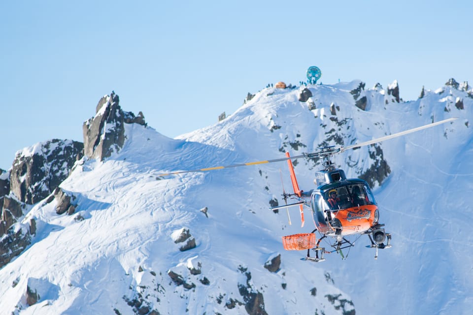
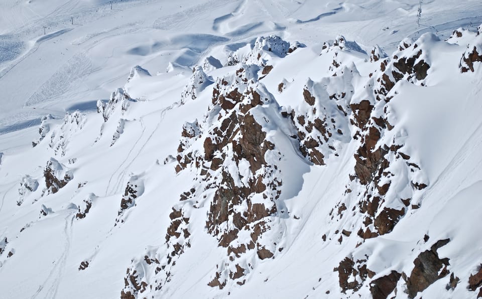
Aussie ski areas have seen some much-needed snowfall allowing some to reopen terrain and one to reopen its ski slopes it had needed to close. New Zealand ski areas have seen more snowfall and continue to post the world’s deepest snowpack. In South America, there’s been significant fresh snowfall this week too and here we see the largest areas currently open anywhere in the world.
In southern Africa, the ski season, for what it was this winter with no lifts running, has pretty much ended with Afriski winding down the season with its annual Winterfest last weekend.
In the northern hemisphere, five centres remain open in Europe after the last closed in North America just over a week ago. The four open glacier summer ski centres in the Alps though are struggling with very high temperatures even on the highest peaks impacting the remaining snow on glaciers. The freezing point hit a record high of 5,300m on Monday. So most are just about hanging in there and the forecast is for a temperature dip and even snowfall up high next week as we near the start of meteorological autumn/fall, so long as they can make it through to then. In Canada and North America the hope is for cooler weather and the first sights of snow on the peaks. This is partly to raise anticipation for the next ski season, hopefully just 6-8 weeks away, but mostly so that the forest fire danger will start to diminish.
Southern Hemisphere
AUSTRALIA REPORT
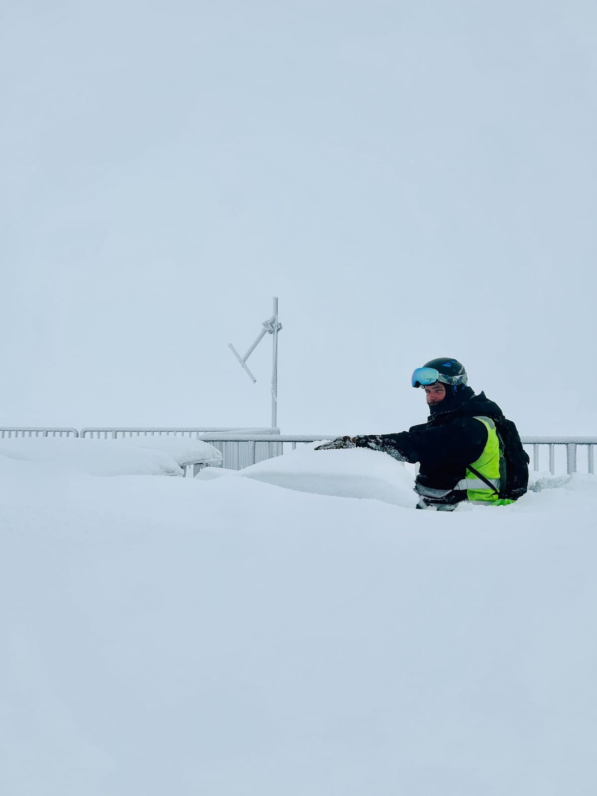
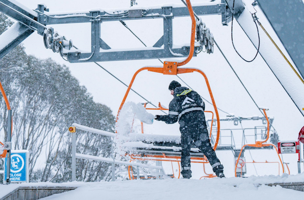
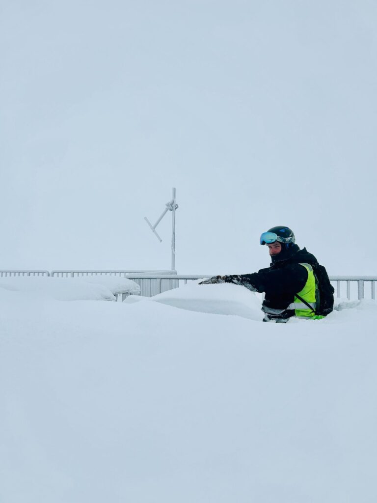
The mood continues to improve in Australia with more cold weather and snowfalls. Centres posted some snow midweek then on Thursday night fresh accumulations of up to 16cm (7”) were reported as the snow kept falling. This allowed for a powder weekend and also for Selwyn ski area, which had had to close its ski slopes the previous three weeks due to inadequate cover, to be able to re-open for skiing at the weekend. Perisher (60/131cm / 24/52”), which reports the deepest snow and most terrain open in the country, had a 5cm (2”) snowfall on Friday last night, bringing their total to 20cm (8”) in the 36 hours since 9 am Thursday and 32cm (13”) in the previous week. Olivia Mason, Marketing Coordinator at Perisher, noted it was peak season and advised skiers to plan ahead for crowds, catch the Skitube or shuttle if they could and, “…stay up to date on the latest weather and snow reports via the Perisher app.” It has about 48km (30 miles) of slopes open. Thredbo (50/100 cm / 20/40”), which previously only had about a third of its terrain open during the warm spell, is back up into the metre depth club and now has about two-thirds of its runs up and running again. Falls Creek (52/72cm / 21/29”) continues to have the highest percentage of terrain open in the country, more than 90% of its runs.
AUSTRALIA FORECAST
A return to drier, sunnier conditions for the remainder of this week, overnight lows should still enable snow-making. But daytime highs could get back up to the high single figures.
NEW ZEALAND REPORT
New Zealand’s ski areas continue to report some of the best conditions of the year. The ski centres here are posting the deepest snow and, as a percentage of their own areas, the most terrain open in the world. Most areas saw fresh snow at the weekend although some were closed for times due to high winds. The past few days have seen a return to sunnier weather with temperatures dipping to -9C at night on the highest slopes, and daytime highs of +5C. Tūroa (130/255cm / 52/102″) continues to post the deepest snowpack in the world with Mt Hutt (110/200cm / 44/80″) reaching the two-metre base mark. It and Coronet Peak (46/120 cm / 18/48″) are both among the few resorts in the world that are 100% open, each with 40km (25 miles) of slopes available.
NEW ZEALAND FORECAST
The sunny weather is expected to dominate over the next few days. But a front moving through later in the week should bring a few centimetres more fresh.
ARGENTINA REPORT
It has been a fairly cold and snowy few days in parts of Argentina with some significant snowfalls giving a boost to conditions for the final month of the season. Temperatures not getting much above freezing in most areas too. Las Leñas (30/170 cm / 12/68”) has seen the biggest boost to its upper slope depth and is definitely in the best shape it has been all winter. Catedral (10/60cm / 4/24”) has the most slopes open in the world at present still, currently posting 70km (44 miles) of slopes open, about 60% of its total area.
ARGENTINA FORECAST
Remaining unsettled with some very cold overnight temperatures, down as low as -10C and not getting much above freezing in the daytime. Snow showers easing off to leave mostly cloudy conditions and some sunny spells.
CHILE REPORT
In Chile much of the reporting of the past week has been of ski areas maintaining decent cover despite warmer, drier weather, they say. Although, that said, many areas have seen some light to moderate snowfall top ups too and some rather more significant accumulations. Nevados de Chillan (90/130cm / 36/52”) briefly overtook Portillo (119/179 cm / 48/72”) for the country’s deepest base, before Portillo posted a 60cm (2 feet) jump in its stats. Both areas have seen some of the most snowfall over the last week, with the storm closing access roads and lifts and the slopes at times. El Colorado (10/50 cm / 4/20”) still isn’t reporting a great base but it has the most terrain open in the country, around 36km (23 miles) of slopes.
CHILE FORECAST
Remaining cold and snowy in most areas for the next few days, with temperatures hardly getting above freezing in the daytime and dropping to -10C or lower overnight. Sunny weather is currently forecast for most areas from Friday through the weekend.
SOUTHERN AFRICA REPORT
The 2023 winter snow season is about over in southern Africa, with hardly any lift-accessed skiing taking place, unfortunately, as the two centres in Lesotho and South Africa have not offered skiing. Tiffindell, in South Africa, has not been open at all. Afriski, in Lesotho, has offered tubing and limited snowboarding on a small area of machine-made snow and finally ramped things up for an end-of-season winter festival last weekend which saw more snowsports offered.
SOUTHERN AFRICA FORECAST
A mostly sunny forecast as we near springtime by the meteorological measure starting at the end of next week. Overnight lows still getting down around freezing but daytime highs are up to +10C or higher in the afternoons.
Europe
EUROPE INTRO
The past week of warm temperatures in the Alps has impacted the open terrain at the four glacier resorts in Austria, Italy and Switzerland that are currently open, but unlike 2022, so far they are managing to keep some terrain. Temperatures have been in double figures above freezing Celsius even at 4,000m over the last seven days, and have not been getting close to freezing overnight either alas, with the inevitable consequence of a fast thaw of the remaining snow cover on the glacial ice. The worst hit, a little ironically, is Austria’s Hintertux ski area, which was the only area that managed to stay open through last summer. Further north, in Norway, it’s been cooler and the Galdhopiggen glacier remains open for skiers and boarders there.
AUSTRIA REPORT
As mentioned in our introduction, the recent heat with temperatures even 3000m at glacier level and well above freezing 24 hours a day is inevitably impacting the remaining snow cover on glaciers. Year-round Hintertux (0/20cm / 0/8″) was already struggling with its remaining snow and that’s now dropped to less than a foot and consequently, open terrain has dropped from a reported 12km (7 miles) of slopes a week ago to just 2km (a mile or so) now. It’s been full sun and temperatures reaching +12C in the afternoons at the top of the slopes at 3,300m. The start of autumn by the meteorological measure of the seasons is just a week away now, however, and in just a month six more Austrian glacier areas are due to start opening, starting with the Pitztal glacier on September 23rd, followed by the Kaunertal and Kitzsteinhorn a week later on the 30th.
AUSTRIA FORECAST
The weather is looking more changeable for the latter half of this week with a front moving across. But temperatures on glaciers remain very warm with daytime highs still at +12C into the final weekend of meteorological summer and overnight lows only +5C. So precipitation is more likely to be rain than snow and the forecast isn’t looking great for the remaining snow.
SWITZERLAND REPORT
Switzerland’s two glacier ski areas appear to be holding up to the high-altitude heat better than others in the Alps. Both Zermatt (0/200 cm /0/80”) and Saas-Fee (0/250 cm / 0/100”) are reporting 12-14km (7-9 miles) of slopes open and some of the deepest snow depths in the world. Those published snow depths have not changed despite temperatures here too reaching +20C at 3,500m during a largely sunny week, although overnights have been down at around freezing.
SWITZERLAND FORECAST
Rapidly cooling temperatures as we approach the weekend, even with the chance of snowfall by the weekend. Overnight lows back well below freezing and daytime highs down to low single figures.
FRANCE REPORT
The French Alps remain the stand-out area for not having any glacier ski areas open at present, and also it seems Tignes is giving up on autumn skiing. Nowhere there is planning to open for another three months, with Tignes and Val Thorens aiming for a late November opening. The possible exception to that statement is that Les 2 Alpes is still talking about their glacier opening for 9 days or so in late October/early November, although stressing that the availability of snowsports depends very much on conditions at the time. It has been a very warm week with temperatures only getting down to about +8C even at 3,500m up on glaciers so that’s not good news for any remaining snowpack.
FRANCE FORECAST
The warm weather in the French Alps is set to continue with temperatures getting just a little cooler by the weekend, hopefully down nearer +5C. There looks like more changeable weather on the way too with the chance of rain at the weekend.
ITALY REPORT
Passo Stelvio (0/50cm / 0/20″), has, like other glacier ski areas in the Alps, seen a substantial loss of the snow cover over the last week, with overnight lows staying well above freezing and daytime highs getting into double figures even on its highest slopes. It still reports 3km (two miles) of slopes open, about a third of its full terrain, however. You can also access the glacier area just on the Swiss side of the border, shared by Zermatt and Cervinia, from the Italian side. Overall, it has been a sunny week with daytime highs reaching a very hot +15C even at 3,500m.
ITALY FORECAST
A front moving in through the latter half of this week should bring cooler temperatures by the weekend. The longer-term forecast points to the possibility of getting back below freezing early next week and even for snow showers. But it’s likely to be rain before that while temperatures start dropping; however not quickly enough.
SCANDINAVIA REPORT
Lapland’s two early-October opening ski areas at Levi and Ruka, also among Finland’s largest centres, have both gone through the ’50 days to season start’ mark in the past week. Each will use snow stored from last season spread back out on the slopes to open a few kilometres of runs a piece in the first few days of October. In the meantime, we have Scandinavia’s highest lift-up at Galdhøpiggen (0/120cm / 0/48″) in Norway still open and planning to remain so until November. There are about a mile (1.5km) of slopes open there. Last week has seen sunny spells but also sleet and rain as temperatures have stubbornly stayed above freezing even overnight with daytime highs up towards +10C.
SCANDINAVIA FORECAST
Mixed weather conditions are set to continue with temperatures getting down to around +1C overnight and around +8C in the daytime. Snow, sleet and rain are forecast along with 2-6 hours of sunshine each day.
USA REPORT
With nowhere currently open in North America, unless you include the indoor snow slope of Big Snow in New Jersey, attention is switching to the rapid approach of the 23-24 ski season with an ever-growing list of resorts announcing their target opening dates. Vail Resorts were the big announcers this last week, saying they hope Keystone Resort, in Colorado, will open in less than two months in mid-October. Then for fixed dates, they say Breckenridge and Vail itself will open on November 10th. Meanwhile, another Colorado ski area, Loveland, is only 40 days away from firing up its snow-making guns to start making snow in the first week of October, all being well. Eyes are also on high peaks in North America with hopes of spotting the first snowfall. There was some hope last week that snow had been spotted up high in Utah, but it was so minimal the jury remains out as to whether it really counted or not.
USA FORECAST
It remains pretty warm and mostly sunny in the Rockies. Temperatures in Colorado where those ski areas hope to be making snow in just over a month and open in two look like they’ll get down to the low 40s Fahrenheit overnight, but be back in the 60s in the daytime. A degree or two cooler at more northerly ski areas like Marmot Basin, in Jasper.