North America Weekly Roundup #232
(Updated 13th March 2024) A comprehensive review of snow conditions, weather, and updates for North America's winter sports.
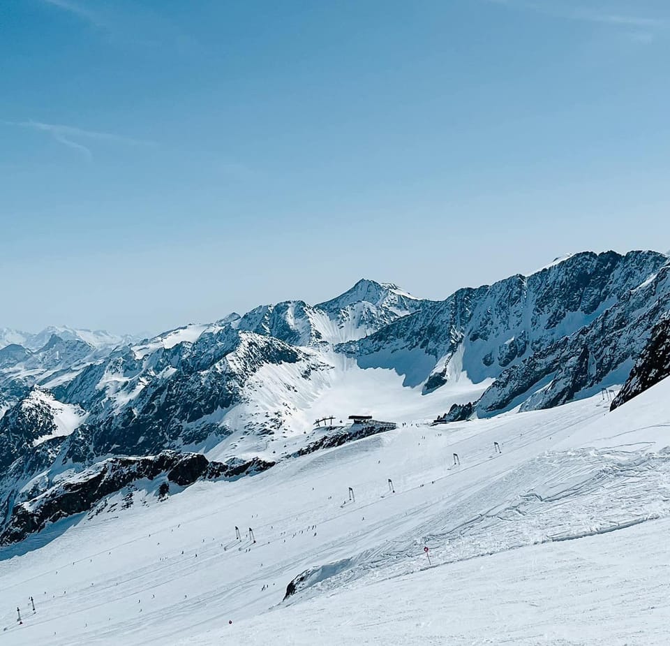
California Dreaming: Ski Resorts Reach Record Depths Surpassing 4 Metres.
- In Western North America, recent snowfall in California has elevated several ski resorts to the top ranks globally, with depths exceeding 4 meters, while cooler temperatures and snowfall return to eastern regions, refreshing slopes.
- In the Rockies, although temperatures have risen to spring-like levels, there has been consistent snowfall, maintaining good conditions with most areas remaining open.
- The US West Coast has seen significant snow cover, with Mammoth Mountain and The Palisades now leading North America's snow depth table, promising an extended season.
NORTH AMERICA INTRO
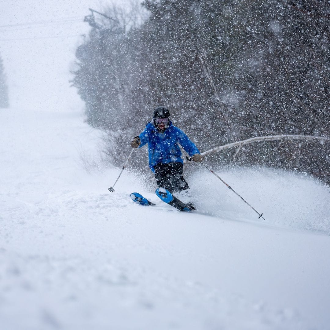
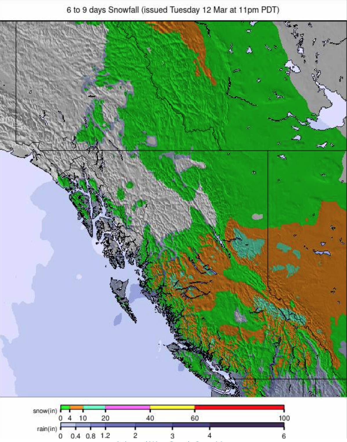
Western North America has recently experienced a touch of spring, following two weeks of snowfall along the Pacific coast and in mountainous regions such as the Rockies. The heavy snowfall in California has pushed several ski resorts into the elite class of having depths exceeding 4 meters (over 13 feet), placing them among the top 10 in the world. However, the last few days have brought a shift towards cooler, more seasonable weather and snowfall in the eastern regions, a welcome change from the earlier warm and wet conditions of the month. As a result, the week has returned to a more typical midwinter climate.
ROCKIES REPORT
It has been a quieter week in the Rockies after the big snow accumulations at the end of February and the start of March. We've seen temperatures climb up to 'springlike' in Colorado, although they've since fallen back again. There have been a few inches of snow most days for most areas too, keeping things fresh. Most areas are at least 90% open. Alta (56/148" / 140/371cm) has the region's deepest snow but has been overtaken from previously having North America's deepest by ski areas in California. Fellow Utah area Park City (79/96" / 196/241cm) still has the most terrain open in the US, though.
ROCKIES FORECAST
Sunny but cold temperatures for the rest of the week and through the weekend. Temperatures are down to low single figures overnight at altitude and staying just below freezing at resort levels in Utah and further north in the afternoons, keeping the snow in top condition. A little warmer in Colorado and further south, with daytime highs getting into the low 40s there.
USA WEST REPORT
Ski areas on the US West Coast have been digging out lifts and making slopes safe after the big snowfalls that ended a week ago brought up to 11 feet (3.3m) of fresh snow cover to the region's slopes. As a result, Mammoth Mountain (101/157" / 253/394cm) and The Palisades (55/158" / 137/396cm) have jumped to the top of North America's snow depth table and The Palisades have announced that their season will last at least until the final weekend of May. This week has been much drier and warmer, more springlike in the south, but the Pacific Northwest corner is in the best shape it has been all season with Crystal Mountain (39/72" / 97/180cm) in Washington State, one of those that had struggled to open more than half its runs for most of the season, now fully open.
USA WEST FORECAST
A mostly sunny end to the week, temperatures quite mild at resort level - into the 40s, but staying close to freezing on high slopes.
MIDWEST REPORT
The 23-24 season in the Midwest is in rapid decline now, despite some significant snowfall for some in the past week. The overall picture, though, is of ever warmer weather, and even the limited cover that most areas have managed to maintain through a challenging winter is fast melting away now. Daytime highs have been reaching the low 60s, although overnight lows have still been touching freezing. As mentioned, though, the past week did bring some significant snowfalls, with parts of North Dakota seeing one of their biggest March snowfalls on record, causing major traffic issues and a small boost to ski centres. Michigan's Ski Brule (48/56" / 120/140") continues to post the region's deepest snow but has dropped from 100 to 80% open now.
MIDWEST FORECAST
Conditions are slightly cooler but still mostly above freezing, day and night, with highs in the 50s, so more thawing, too warm for snowfall or snowmaking and more centres calling it a day on the 23-24 season.
USA EAST REPORT
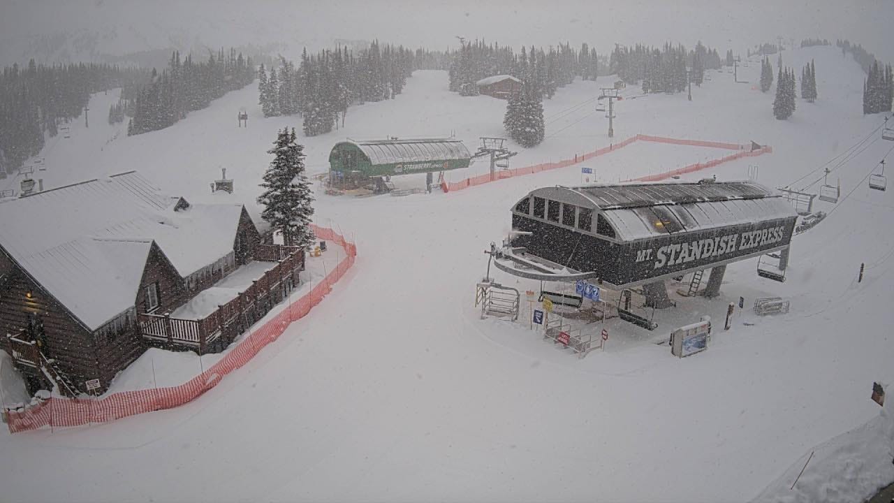
A lot of excitement this week in the eastern US as a period of mostly dry, warm and sometimes wet weather ended and winter made its triumphant return, bringing with it up to 20" (50cm) accumulations across New Hampshire, New York State, Maine and Vermont, giving a very welcome slope refresh a fortnight before Easter. Bases remain thin compared to the season average, but the main centres remain mostly open. Vermont's Killington (8/18"/ 20/45cm) has the most open, about 95% of its terrain, despite its thin cover.
USA EAST FORECAST
Unfortunately, the snowy weather excitement may be short-lived. A temperature spike into the mid-50s is forecast for the latter half of the week, with heavy rain expected on all but the highest slopes.
CANADA WEST REPORT
Western Canada's 23-24 season seems to be peaking in the latter third, with the snow continuing to dump down. Whistler Blackcomb (5/288cm / 2/115") reported an incredible 102cm (41") accumulation on its higher slopes in just 48 hours on Sunday/Monday this week and reported the most terrain it had open all winter - 228 of its 234 trails, so almost all of them. It was the biggest accumulation reported this week in the region, but other resorts in the west have had plenty more, and Big White has announced it's extending its season by a week into mid-April to make the most of it.
CANADA WEST FORECAST
A sunny end to the week with temperatures reaching +10C in valleys by the weekend but still dropping to -8C overnight above 2,000m. So we're talking classic springtime freeze-thaw.
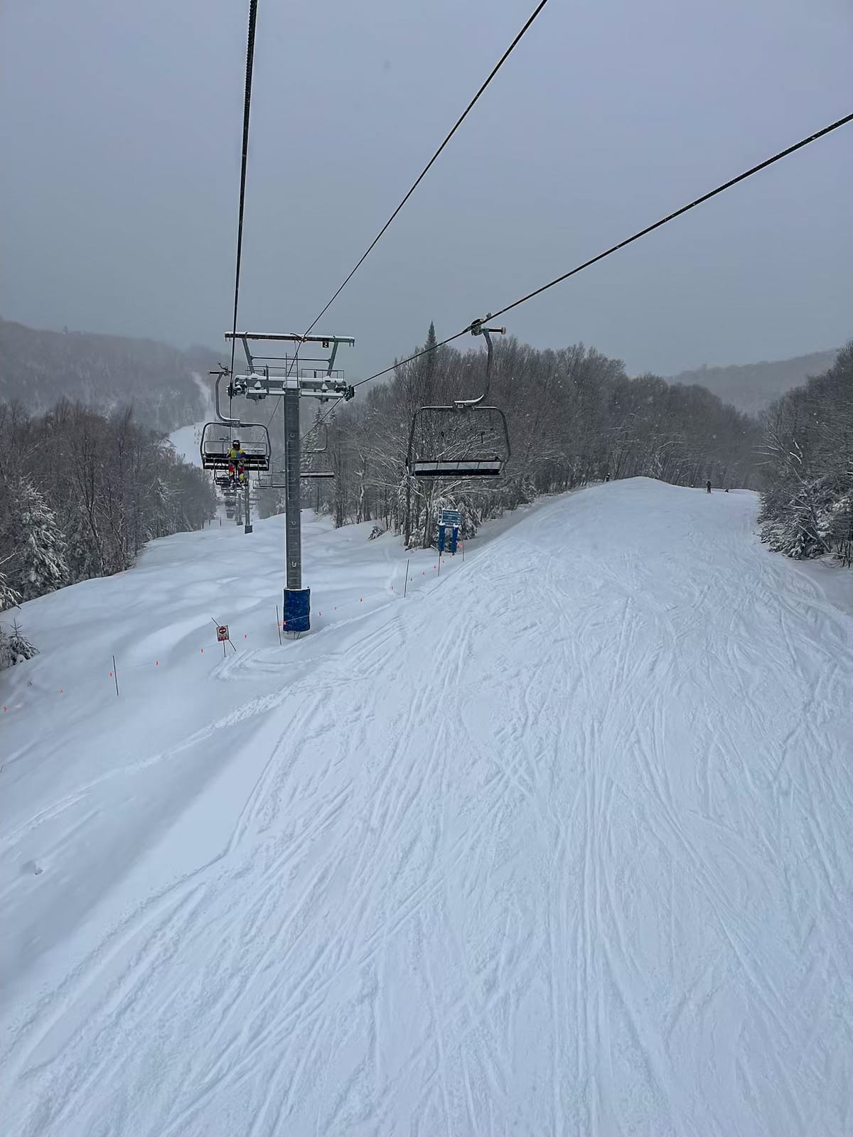
CANADA EAST REPORT
It's been one of the best weeks for a while in Quebec, with cold and snowy weather through the weekend and the start of this week. Mont Sutton was among the resorts posting 15cm (6") of fresh snowfall accumulated by Monday morning. The speed of thaw at Tremblant's (22/140cm / 9/56") base has slowed dramatically and its slopes are nearly 80% open still, the most in the area. Eastern Canada's second biggest, Mont Sainte-Anne (50/70cm / 20/28") has just over half of its runs open.
CANADA EAST FORECAST
Unfortunately, temperatures are climbing and are expected to reach the high single figures at resort base levels in the afternoons over the latter half of this week, so it looks like upcoming showers are as likely to be rain or sleet as snow for the next few days.