
Visiting Willamette Pass
Helpful resort information to assist planning your trip.
- Opens—
- Closes—
- Accommodation—
- Restaurants | Bars2 | 1
- Nearest Airport Eugene
- Nearest Train Station Eugene
- Tourist Office Website
- Tourist Office Phone+15034845030
- Avalanche information:
Willamette Pass Features
The terrain at Willamette Pass includes:
- Halfpipes—
- Terrain Parks1
- X-Country20.0 km
- Ski Hire—
What's it like at Willamette Pass resort?
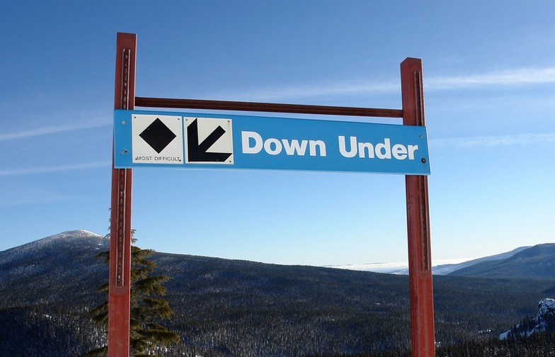
While everyone in the family will enjoy the terrain at Willamette Pass, advanced skiers will pick eight black diamond runs. There's night skiing at Willamette Pass and a 1,563 ft vertical drop. You will find 29 trails over 550 acres and an annual average snowfall of 430 inches. There's plenty of cross-country skiing too. A new six-person, high-speed detachable chair called the "Accelerator" has increased skiers' time on the snow. The nearest airport to Willamette Pass is at Portland.
Latest photos from Willamette Pass. View all photos at the Willamette Pass gallery page.
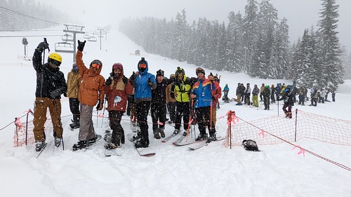 Photo credit: Benjamin Hansen
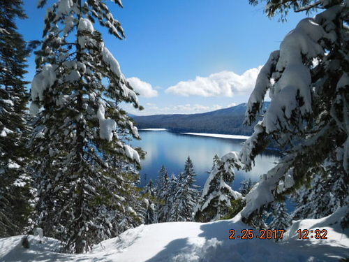 Photo credit: Jo Detraz
 Photo credit: Erin Reed
Explore Willamette Pass Location Map
Interactive Willamette Pass trail map and piste map. View the piste and trails as well as the surrounding terrain and mountain contours for backcountry action. Find and compare nearby resorts by clicking on the resort markers.

When's the snowiest month to visit Willamette Pass?
What's the snow currently like in Willamette Pass?
A summary of the current snow conditions in Willamette Pass. View more information on the Willamette Pass detailed snow report page.
- Piste Condition—
- Off-piste Condition—

| Upper snow depth: | ||
|---|---|---|
| Lower snow depth: | ||
Visitor Reviews of Willamette Pass
Stacie from United States writes:
If I could give zero stars, I would. However, shout out to the younger girl who hands out the snowboards downstairs and the older gentleman who was the greeter, they were seriously the only good part of my trip.
Willamette Pass double charged me and is refusing to give it back, took $496 out of my account instead of $248!! Their customer service is a joke, when I tried to email to explain what happened they were nothing but snarky and I was basically told “tough luck.” It has been a long back and forth conversation of them being rude and now they won’t even answer my email! I’ve tried calling multiple times which gives no option to speak to somebody and I even talked to them at the resort before I emailed and was told the refund would “take a while, try again in two months” by the front ticket lady.
Since they now won’t even reply I had to open a fraudulent dispute with my bank. Not to mention while we were there every employee was down right rude (apart from two people we interacted with mentioned above) and acted like they hated their life or would rather be anywhere else. The lift operators were not attentive at all either and we saw a lot of “almost accidents” which we seriously so scary to see. This was my first and last time coming here. I’d sooo much rather spend more money traveling to Mt Bachelor than ever, ever return here. At least there I know they have integrity as well as their customers safety as a priority.
It’s been over a week since I posted this same review on their Google and Facebook. The owner appears to have ‘liked’ only the good recent comments, I’m still being blatantly ignored! This is outrageous. Out of all the money they made that day and they’re still refusing to just refund the extra $250 they charged me!
Resorts close to Willamette Pass
Discover ski resorts near Willamette Pass. Click below to view there ski resort guides.
 Nearest