

Global Weekly Snow Roundup #318
Weekly Snow News for the world, updated 11 June 2026: Australia's season begins, Val d’Isère reopens and major snowfall is forecast for the Andes.

Next 4 days weather summary:Mostly dry. Very mild (max 16°C on Sat afternoon, min 9°C on Sun night). Wind will be generally light. | Days 5-7 weather summary:Light rain (total 3.0mm), mostly falling on Thu afternoon. Very mild (max 16°C on Thu afternoon, min 8°C on Mon night). Wind will be generally light. | |||||||||||||||
Saturday 13 | Sunday 14 | Monday 15 | Tuesday 16 | Wednesday 17 | ||||||||||||
night | AM | PM | night | AM | PM | night | AM | PM | night | AM | PM | night | AM | PM | night | |
clear | clear | clear | clear | some clouds | some clouds | clear | clear | clear | clear | clear | clear | clear | clear | some clouds | some clouds | |
km/h | ||||||||||||||||
Snow map |  |  |  |  |  |  | ||||||||||
— | — | — | — | — | — | — | — | — | — | — | — | — | — | — | — | |
— | — | — | — | — | — | — | — | — | — | — | — | — | — | — | — | |
max °C | 12 | 14 | 16 | 14 | 13 | 14 | 13 | 12 | 14 | 13 | 11 | 14 | 13 | 13 | 15 | 14 |
min °C | 10 | 11 | 15 | 10 | 11 | 14 | 9 | 10 | 14 | 8 | 10 | 13 | 9 | 11 | 15 | 11 |
9 | 11 | 15 | 10 | 11 | 14 | 8 | 9 | 14 | 8 | 10 | 12 | 9 | 11 | 15 | 11 | |
51 | 26 | 42 | 62 | 32 | 43 | 41 | 29 | 40 | 59 | 42 | 44 | 60 | 48 | 54 | 74 | |
4200 | 4200 | 4300 | 4100 | 4000 | 4050 | 3950 | 3850 | 4050 | 3850 | 3750 | 4000 | 4050 | 4050 | 4300 | 4250 | |
— | 5:47 | — | — | 5:47 | — | — | 5:47 | — | — | 5:47 | — | — | 5:47 | — | — | |
— | — | — | 9:19 | — | — | 9:19 | — | — | 9:20 | — | — | 9:20 | — | — | 9:20 | |
Go pro and carve into:
Avalanche information: European Avalanche Warning Services (EAWS)
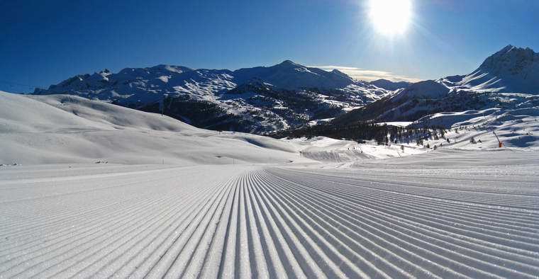
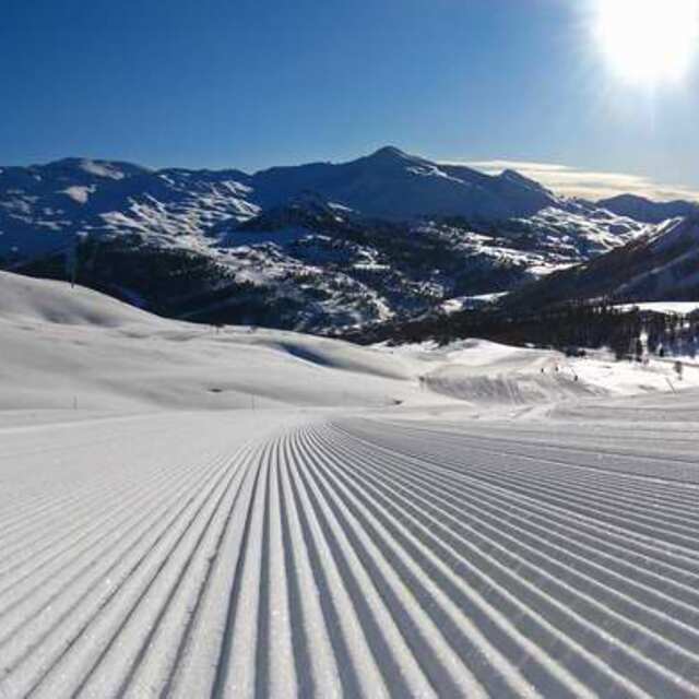
Latest snow reports near Risoul:
| Top snow depth: | 0 cm |
|---|---|
| Bottom snow depth: | 0 cm |
| Fresh snowfall depth: | — |
| Last snowfall: | 18 May 2026 |
| Snow Alerts | Create Alert |
0.0 | Bluebird Powder days Fresh snow, mostly sunny, light wind. |
|---|---|
0.0 | Powder days Fresh snow, limited sun, any wind. |
0.0 | Bluebird days Average snow, mostly sunny, light wind. |
The above table gives the weather forecast for Risoul at the specific elevation of 2300 m. Our sophisticated weather models allow us to provide snow forecasts for the top, middle and bottom ski stations of Risoul. To access the weather forecasts for the other elevations, use the tab navigation above the table. For a wider view of the weather, check out the Weather Map of France.
Click here to read further information on freezing levels and how we forecast our temperatures.
Overall 3.6 Based on 24 votes and 18 reviews
We (2 adults and one 13 yr old) stayed in Risoul the week of 17th Feb 2013. The wait at Turin and transfer was 3 hours, but was well worth it. A great resort for all standard of skier, but mainly beginners and intermediates. Saying that, there's some great safe off-piste with good visibility from the main pistes. The lift system takes you out of he base of the resort on 4 chair lifts and 2 drags, from where you can ski back down on a choice of blue, red and green runs, or head up again and get away from the main resort and also quicky strike across and down into Vars. We were told that this week was the busiest French half-term week as well as the UK week, but still the queues were small or non existent after the usual 9am peak. Can't remember queuing for more than 5 minutes on the Risoul side, but did encounter some slightly longer ones in Vars. The resort is mainly self catering, either in fairly low rise appartment blocks or smaller appartment blocks. We stayed at the Foret Blanche appartments (Sara) which were relatively cheap. Basic but comfortable with great ski lockers. Pretty much ski in-ski out give or take 100m walk to piste. You are pretty much captive once in resort, so the shops are pretty expensive, but you can get a reasonable meal and drinks. The mountain restaurants aren't bad value either, with dishes as low as €8 and great plat du hours at €12-15. We don't tend to return to resorts often as we've only been skiing a few years, but for a value family holiday I would definitely return.
Bruce Jones from United Kingdom writes:
We (2 adults and one 13 yr old) stayed in Risoul the week of 17th Feb 2013. The wait at Turin and transfer was 3 hours, but was well worth it. A great resort for all standard of skier, but mainly beginners and intermediates. Saying that, there's some great safe off-piste with good visibility from the main pistes.
The lift system takes you out of he base of the resort on 4 chair lifts and 2 drags, from where you can ski back down on a choice of blue, red and green runs, or head up again and get away from the main resort and also quicky strike across and down into Vars.
We were told that this week was the busiest French half-term week as well as the UK week, but still the queues were small or non existent after the usual 9am peak. Can't remember queuing for more than 5 minutes on the Risoul side, but did encounter some slightly longer ones in Vars.
The resort is mainly self catering, either in fairly low rise appartment blocks or smaller appartment blocks. We stayed at the Foret Blanche appartments (Sara) which were relatively cheap. Basic but comfortable with great ski lockers. Pretty much ski in-ski out give or take 100m walk to piste. You are pretty much captive once in resort, so the shops are pretty expensive, but you can get a reasonable meal and drinks. The mountain restaurants aren't bad value either, with dishes as low as €8 and great plat du hours at €12-15.
We don't tend to return to resorts often as we've only been skiing a few years, but for a value family holiday I would definitely return.


 Nearest