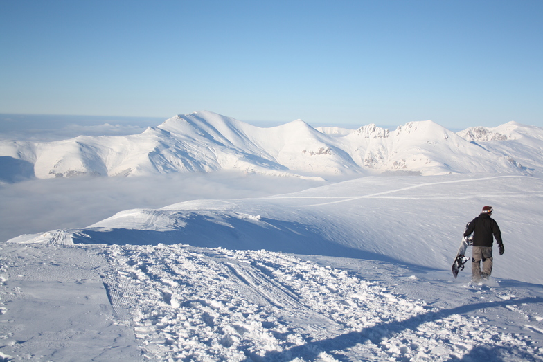


Global Weekly Snow Roundup #318
Weekly Snow News for the world, updated 11 June 2026: Australia's season begins, Val d’Isère reopens and major snowfall is forecast for the Andes.

Next 4 days weather summary:Mostly dry. Very mild (max 14°C on Sun afternoon, min 4°C on Fri night). Wind will be generally light. | Days 5-7 weather summary:Moderate rain (total 14.0mm), heaviest on Wed afternoon. Very mild (max 14°C on Thu afternoon, min 11°C on Mon night). Wind will be generally light. | |||||||||||||||
Saturday 13 | Sunday 14 | Monday 15 | Tuesday 16 | Wednesday 17 | ||||||||||||
night | AM | PM | night | AM | PM | night | AM | PM | night | AM | PM | night | AM | PM | night | |
some clouds | clear | some clouds | clear | clear | clear | clear | clear | clear | clear | some clouds | t-storm risk | rain shwrs | t-storm risk | t-storm risk | rain shwrs | |
km/h | ||||||||||||||||
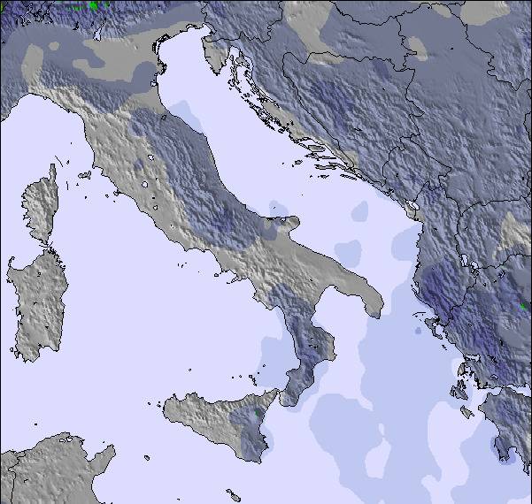
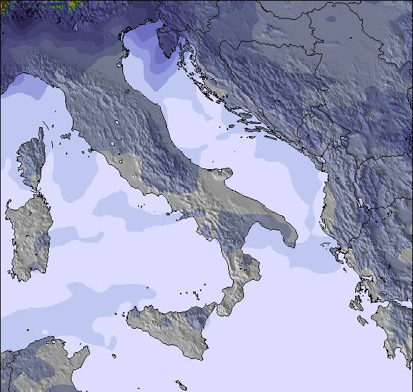
Snow map | 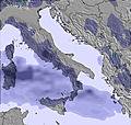 | 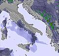 | 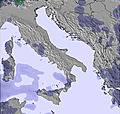 | 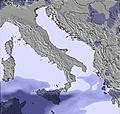 | 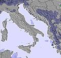 | 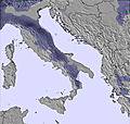 | ||||||||||
— | — | — | — | — | — | — | — | — | — | — | — | — | — | — | — | |
— | — | — | — | — | — | — | — | — | — | — | 2 | 2 | 2 | 6 | 2 | |
max °C | 6 | 7 | 9 | 8 | 11 | 14 | 13 | 13 | 14 | 13 | 12 | 13 | 13 | 12 | 13 | 13 |
min °C | 4 | 5 | 8 | 8 | 9 | 13 | 12 | 12 | 14 | 11 | 11 | 13 | 11 | 11 | 13 | 11 |
1 | 2 | 6 | 6 | 7 | 13 | 11 | 11 | 13 | 10 | 10 | 13 | 11 | 11 | 13 | 10 | |
57 | 53 | 64 | 55 | 43 | 48 | 29 | 54 | 49 | 48 | 59 | 63 | 65 | 68 | 61 | 65 | |
3200 | 3300 | 3200 | 3450 | 3650 | 3800 | 3900 | 3600 | 3650 | 3600 | 3650 | 3700 | 3650 | 3700 | 3850 | 3900 | |
— | 5:00 | — | — | 5:00 | — | — | 5:00 | — | — | 5:00 | — | — | 5:00 | — | — | |
— | — | — | 8:12 | — | — | 8:12 | — | — | 8:13 | — | — | 8:13 | — | — | 8:14 | |
Go pro and carve into:
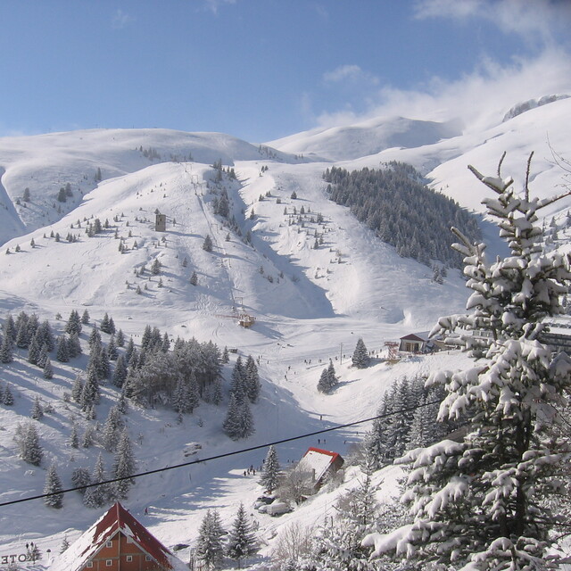
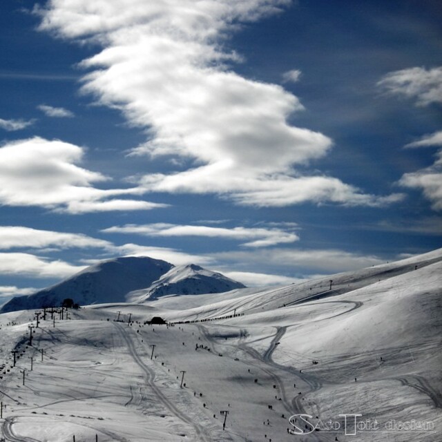
Latest snow reports near Popova Sapka:
| Top snow depth: | — |
|---|---|
| Bottom snow depth: | — |
| Fresh snowfall depth: | — |
| Last snowfall: | 19 May 2026 |
| Snow Alerts | Create Alert |
0.0 | Bluebird Powder days Fresh snow, mostly sunny, light wind. |
|---|---|
0.0 | Powder days Fresh snow, limited sun, any wind. |
0.0 | Bluebird days Average snow, mostly sunny, light wind. |
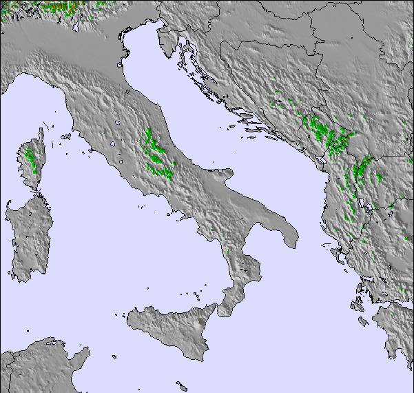
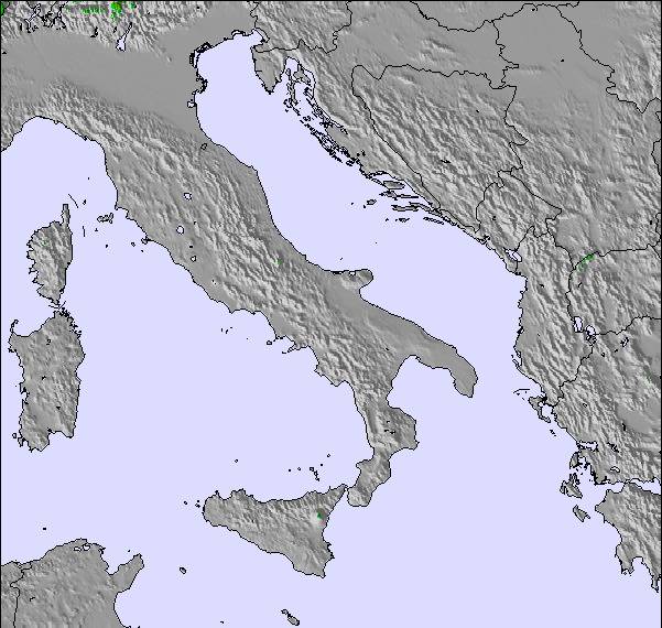
The above table gives the weather forecast for Popova Sapka at the specific elevation of 2035 m. Our sophisticated weather models allow us to provide snow forecasts for the top, middle and bottom ski stations of Popova Sapka. To access the weather forecasts for the other elevations, use the tab navigation above the table. For a wider view of the weather, check out the Weather Map of Rep. of N. Macedonia.
Click here to read further information on freezing levels and how we forecast our temperatures.
Overall 3.7 Based on 36 votes and 15 reviews
This mountain bascially sums up all the negative aspects of this country. Totally disorganized shitshow. Nobody gives a shit about anything. They open when they want and if they want. Trash all over the place and 100's of people in civilian clothes sledding down the hills at the end of the mountain running into random people. Off-piste is good but the people running it are thieves and will overcharge and change the prices after the fact to try to shake down their guests. That's why nobody comes back. It couldn't be a more unfriendly tourist atmosphere. The off-piste companies are half bankrupt and are always trying to extort extra money from their guests, even after charging super high prices. Prices may be cheaper than the Alps but you get less then you pay for nonetheless. The extra savings are not worth the extra hassles and undependability of the staff and local companies. There is zero apres-ski so don't expect anything at all unless you bring a big group.
Tommy from Netherlands writes:
This mountain bascially sums up all the negative aspects of this country. Totally disorganized shitshow. Nobody gives a shit about anything. They open when they want and if they want.
Trash all over the place and 100's of people in civilian clothes sledding down the hills at the end of the mountain running into random people.
Off-piste is good but the people running it are thieves and will overcharge and change the prices after the fact to try to shake down their guests. That's why nobody comes back. It couldn't be a more unfriendly tourist atmosphere. The off-piste companies are half bankrupt and are always trying to extort extra money from their guests, even after charging super high prices.
Prices may be cheaper than the Alps but you get less then you pay for nonetheless. The extra savings are not worth the extra hassles and undependability of the staff and local companies. There is zero apres-ski so don't expect anything at all unless you bring a big group.

 Nearest