

Global Weekly Snow Roundup #318
Weekly Snow News for the world, updated 11 June 2026: Australia's season begins, Val d’Isère reopens and major snowfall is forecast for the Andes.

Next 3 days weather summary:Heavy rain (total 27.0mm), heaviest during Fri afternoon. Mild temperatures (max 9°C on Sun morning, min 6°C on Thu night). Winds decreasing (fresh winds from the W on Fri night, light winds from the NNW by Sat night). | Days 4-6 weather summary:Light rain (total 4.0mm), mostly falling on Mon night. Very mild (max 13°C on Mon afternoon, min 6°C on Sun night). Wind will be generally light. | ||||||||||||||||
Thu 11 | Friday 12 | Saturday 13 | Sunday 14 | Monday 15 | Tuesday 16 | ||||||||||||
PM | night | AM | PM | night | AM | PM | night | AM | PM | night | AM | PM | night | AM | PM | night | |
light rain | light rain | light rain | light rain | light rain | light rain | light rain | rain shwrs | light rain | cloudy | some clouds | some clouds | some clouds | light rain | light rain | cloudy | cloudy | |
km/h | |||||||||||||||||
Snow map | 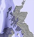 | 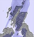 | 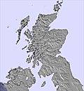 | 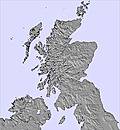 | 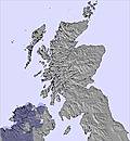 |  | |||||||||||
— | — | — | — | — | — | — | — | — | — | — | — | — | — | — | — | — | |
2 | 4 | 3 | 5 | 5 | 2 | 2 | 2 | 2 | — | — | — | — | 2 | 1 | — | — | |
max °C | 8 | 7 | 8 | 7 | 6 | 7 | 8 | 7 | 9 | 11 | 11 | 12 | 13 | 10 | 10 | 11 | 11 |
min °C | 8 | 6 | 7 | 6 | 6 | 6 | 7 | 6 | 8 | 11 | 6 | 10 | 13 | 9 | 9 | 11 | 10 |
5 | 2 | 3 | 1 | 1 | 1 | 3 | 3 | 6 | 10 | 6 | 10 | 12 | 8 | 8 | 10 | 9 | |
97 | 97 | 91 | 90 | 96 | 91 | 89 | 93 | 86 | 70 | 82 | 57 | 60 | 77 | 93 | 88 | 94 | |
2750 | 3050 | 1800 | 1500 | 1600 | 1500 | 1900 | 2200 | 2050 | 2200 | 2600 | 2650 | 2650 | 2500 | 2600 | 2750 | 2950 | |
— | — | 4:26 | — | — | 4:26 | — | — | 4:26 | — | — | 4:26 | — | — | 4:26 | — | — | |
— | 10:10 | — | — | 10:12 | — | — | 10:13 | — | — | 10:13 | — | — | 10:14 | — | — | 10:15 | |
Go pro and carve into:
Avalanche information: European Avalanche Warning Services (EAWS)
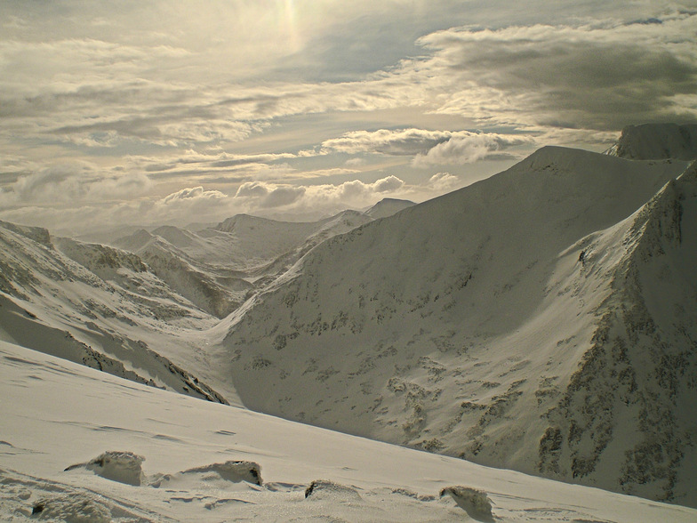
Latest snow reports near Nevis Range:
| Top snow depth: | 0 cm |
|---|---|
| Bottom snow depth: | 0 cm |
| Fresh snowfall depth: | — |
| Last snowfall: | 12 May 2026 |
| Snow Alerts | Create Alert |
0.0 | Bluebird Powder days Fresh snow, mostly sunny, light wind. |
|---|---|
0.0 | Powder days Fresh snow, limited sun, any wind. |
0.0 | Bluebird days Average snow, mostly sunny, light wind. |
The above table gives the weather forecast for Nevis Range at the specific elevation of 656 m. Our sophisticated weather models allow us to provide snow forecasts for the top, middle and bottom ski stations of Nevis Range. To access the weather forecasts for the other elevations, use the tab navigation above the table. For a wider view of the weather, check out the Weather Map of United Kingdom.
Click here to read further information on freezing levels and how we forecast our temperatures.
Overall 3.1 Based on 24 votes and 14 reviews
Had a great time on Wednesday 25 February 2015; a mountain full of snow with plenty to go at. Great hire board and boots (new this season) and great food on the slopes. Wish we could have stayed longer. Will be back; would like to explore the back areas when it is safe to do so.
Ian chick from United Kingdom writes:
Had a great time on Wednesday 25 February 2015; a mountain full of snow with plenty to go at. Great hire board and boots (new this season) and great food on the slopes. Wish we could have stayed longer. Will be back; would like to explore the back areas when it is safe to do so.


 Nearest