

Global Weekly Snow Roundup #318
Weekly Snow News for the world, updated 11 June 2026: Australia's season begins, Val d’Isère reopens and major snowfall is forecast for the Andes.

Next 3 days weather summary:Mostly dry. Very mild (max 17°C on Sat afternoon, min 9°C on Fri night). Wind will be generally light. | Days 4-6 weather summary:Mostly dry. Very mild (max 17°C on Wed afternoon, min 9°C on Mon night). Wind will be generally light. | ||||||||||||||||
Fri 12 | Saturday 13 | Sunday 14 | Monday 15 | Tuesday 16 | Wednesday 17 | ||||||||||||
PM | night | AM | PM | night | AM | PM | night | AM | PM | night | AM | PM | night | AM | PM | night | |
clear | clear | clear | clear | clear | some clouds | clear | clear | clear | clear | some clouds | clear | some clouds | some clouds | clear | some clouds | clear | |
km/h | |||||||||||||||||
Snow map |  |  |  |  |  |  | |||||||||||
— | — | — | — | — | — | — | — | — | — | — | — | — | — | — | — | — | |
— | — | — | — | — | — | — | — | — | — | — | — | — | — | — | — | — | |
max °C | 14 | 12 | 15 | 17 | 15 | 14 | 15 | 14 | 13 | 15 | 13 | 14 | 15 | 13 | 15 | 17 | 16 |
min °C | 13 | 9 | 11 | 16 | 10 | 12 | 15 | 10 | 11 | 14 | 9 | 12 | 15 | 10 | 12 | 17 | 13 |
12 | 9 | 11 | 16 | 10 | 12 | 15 | 10 | 11 | 14 | 9 | 12 | 15 | 10 | 12 | 17 | 13 | |
56 | 75 | 38 | 40 | 52 | 31 | 40 | 57 | 39 | 46 | 65 | 42 | 50 | 60 | 44 | 51 | 62 | |
3900 | 4200 | 4200 | 4100 | 4100 | 3950 | 3750 | 3800 | 3650 | 3600 | 3800 | 3750 | 3750 | 3750 | 3900 | 4100 | 4200 | |
— | — | 5:46 | — | — | 5:46 | — | — | 5:46 | — | — | 5:46 | — | — | 5:46 | — | — | |
— | 9:22 | — | — | 9:22 | — | — | 9:22 | — | — | 9:23 | — | — | 9:23 | — | — | 9:23 | |
Go pro and carve into:
Avalanche information: European Avalanche Warning Services (EAWS)
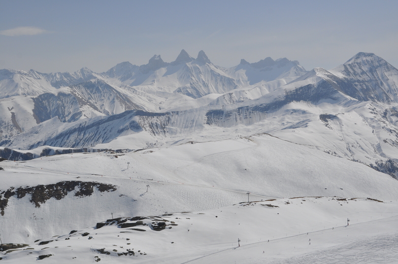
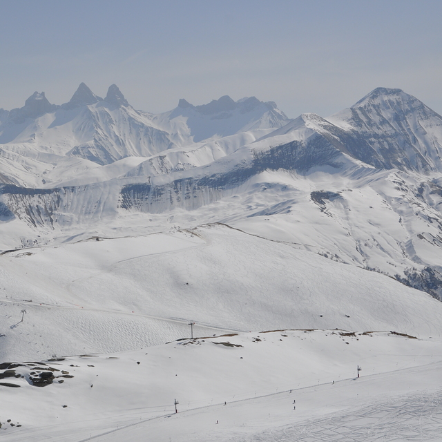
Latest snow reports near Le Corbier (Les Sybelles):
| Top snow depth: | 0 cm |
|---|---|
| Bottom snow depth: | 0 cm |
| Fresh snowfall depth: | — |
| Last snowfall: | 15 May 2026 |
| Snow Alerts | Create Alert |
0.0 | Bluebird Powder days Fresh snow, mostly sunny, light wind. |
|---|---|
0.0 | Powder days Fresh snow, limited sun, any wind. |
0.0 | Bluebird days Average snow, mostly sunny, light wind. |
The above table gives the weather forecast for Le Corbier (Les Sybelles) at the specific elevation of 1907 m. Our sophisticated weather models allow us to provide snow forecasts for the top, middle and bottom ski stations of Le Corbier (Les Sybelles). To access the weather forecasts for the other elevations, use the tab navigation above the table. For a wider view of the weather, check out the Weather Map of France.
Click here to read further information on freezing levels and how we forecast our temperatures.
Overall 3.9 Based on 21 votes and 16 reviews
Nice all round resort with a bit for every ski and snowboard level. Have enjoyed skiing here for nearly 10 seasons with the Big Snow Jam Team. Very good off-piste terrain when there's snow. Sybelles is an unbeatable freeride friendly resort at this price point. Probably the best off-piste offering in Europe for the money. The snow-making and especially the snow grooming should get much better. The resort has been investing in new chairlifts and that is very good; however, Sybelles should also invest reasonably more into grooming the pistes better. Good snow conditions usually from middle of December 'til start of April.
Lukas from Czech Republic writes:
Nice all round resort with a bit for every ski and snowboard level. Have enjoyed skiing here for nearly 10 seasons with the Big Snow Jam Team. Very good off-piste terrain when there's snow. Sybelles is an unbeatable freeride friendly resort at this price point. Probably the best off-piste offering in Europe for the money. The snow-making and especially the snow grooming should get much better. The resort has been investing in new chairlifts and that is very good; however, Sybelles should also invest reasonably more into grooming the pistes better.
Good snow conditions usually from middle of December 'til start of April.
Read 15 more reviews of Le Corbier (Les Sybelles) or submit your own


 Nearest