

Global Weekly Snow Roundup #318
Weekly Snow News for the world, updated 11 June 2026: Australia's season begins, Val d’Isère reopens and major snowfall is forecast for the Andes.

Next 4 days weather summary:Mostly dry. Temperatures will be below freezing (max -5°C on Fri night, min -7°C on Fri night). Winds decreasing (near gales from the WSW on Fri night, moderate winds from the W by Sat night). | Days 5-7 weather summary:Mostly dry. Temperatures will be well below freezing (max -6°C on Mon night, min -8°C on Mon night). Winds decreasing (strong winds from the WSW on Mon night, light winds from the WNW by Thu morning). | |||||||||||||||
Saturday 13 | Sunday 14 | Monday 15 | Tuesday 16 | Wednesday 17 | ||||||||||||
night | AM | PM | night | AM | PM | night | AM | PM | night | AM | PM | night | AM | PM | night | |
clear | clear | snow shwrs | clear | clear | clear | clear | clear | clear | clear | snow shwrs | clear | clear | snow shwrs | snow shwrs | some clouds | |
km/h | ||||||||||||||||
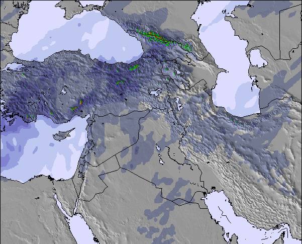
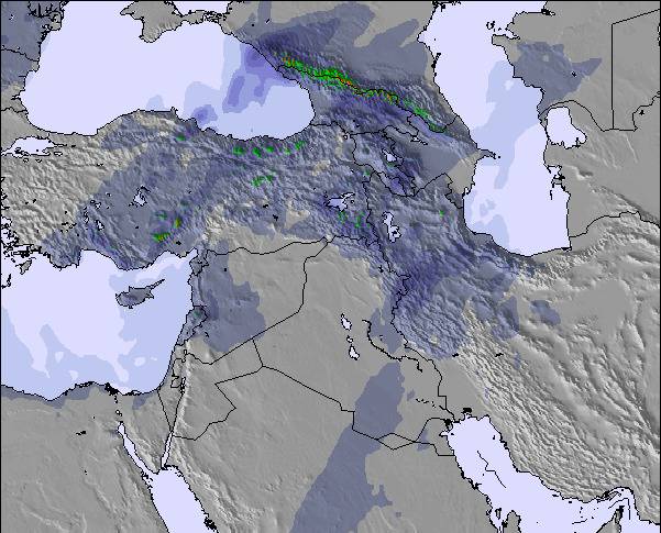
Snow map | 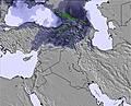 | 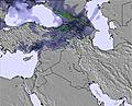 | 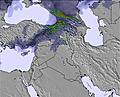 | 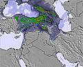 | 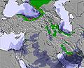 | 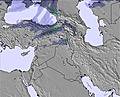 | ||||||||||
— | — | — | — | — | — | — | — | — | — | — | — | — | — | — | — | |
— | — | — | — | — | — | — | — | — | — | — | — | — | — | — | — | |
max °C | -5 | -6 | -6 | -7 | -5 | -5 | -5 | -6 | -5 | -6 | -6 | -6 | -7 | -6 | -6 | -6 |
min °C | -7 | -7 | -6 | -7 | -6 | -5 | -7 | -6 | -6 | -8 | -7 | -7 | -8 | -7 | -6 | -7 |
-18 | -17 | -16 | -16 | -14 | -14 | -17 | -16 | -16 | -18 | -16 | -15 | -17 | -14 | -13 | -14 | |
28 | 22 | 13 | 22 | 15 | 15 | 13 | 11 | 14 | 16 | 18 | 18 | 21 | 22 | 32 | 27 | |
5000 | 4900 | 4950 | 4700 | 4850 | 5000 | 4950 | 4850 | 4950 | 4750 | 4700 | 4850 | 4550 | 4700 | 4900 | 4750 | |
— | 4:43 | — | — | 4:43 | — | — | 4:43 | — | — | 4:43 | — | — | 4:43 | — | — | |
— | — | 7:17 | — | — | 7:19 | — | — | 7:19 | — | — | 7:19 | — | — | 7:20 | — | |
Go pro and carve into:
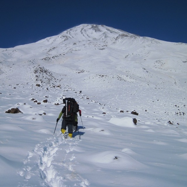
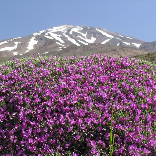
Latest snow reports near Mount Damavand:
| Top snow depth: | — |
|---|---|
| Bottom snow depth: | — |
| Fresh snowfall depth: | 1 cm |
| Last snowfall: | 7 Jun 2026 |
| Snow Alerts | Create Alert |
2.2 | Bluebird Powder days Fresh snow, mostly sunny, light wind. |
|---|---|
0.7 | Powder days Fresh snow, limited sun, any wind. |
2.9 | Bluebird days Average snow, mostly sunny, light wind. |
The above table gives the weather forecast for Mount Damavand at the specific elevation of 5671 m. Our sophisticated weather models allow us to provide snow forecasts for the top, middle and bottom ski stations of Mount Damavand. To access the weather forecasts for the other elevations, use the tab navigation above the table. For a wider view of the weather, check out the Weather Map of Iran (Islamic Republic of).
Click here to read further information on freezing levels and how we forecast our temperatures.
Overall 4.3 Based on 10 votes and 21 reviews
Hi, Our team bozboz-e-ghandi, consisting two person (me, the head and S, the follower) reached the summit at 12:45 on Saturday August the 30, 2014. I think Damavand is a holly place and as you all know there are too many stories about men who came down from or went to Damavand and rescued this land (Fereydoun, Arash, ....) so I thought I should go there at least once in my life and now I am very proud of this. I should state here that this site was a great help and I used the information about weather forecast. K
K from Iran writes:
Hi,
Our team bozboz-e-ghandi, consisting two person (me, the head and S, the follower) reached the summit at 12:45 on Saturday August the 30, 2014.
I think Damavand is a holly place and as you all know there are too many stories about men who came down from or went to Damavand and rescued this land (Fereydoun, Arash, ....) so I thought I should go there at least once in my life and now I am very proud of this.
I should state here that this site was a great help and I used the information about weather forecast.
K

 Nearest