

Global Weekly Snow Roundup #318
Weekly Snow News for the world, updated 11 June 2026: Australia's season begins, Val d’Isère reopens and major snowfall is forecast for the Andes.

Next 3 days weather summary:Mostly dry. Freeze-thaw conditions (max 1°C on Fri afternoon, min -2°C on Sat night). Winds increasing (moderate winds from the W on Sat night, strong winds from the WSW by Mon morning). | Days 4-6 weather summary:Mostly dry. Temperatures will be below freezing (max 0°C on Mon afternoon, min -2°C on Mon night). Winds decreasing (fresh winds from the WSW on Mon afternoon, light winds from the WNW by Thu morning). | ||||||||||||||||
Fri 12 | Saturday 13 | Sunday 14 | Monday 15 | Tuesday 16 | Wednesday 17 | ||||||||||||
PM | night | AM | PM | night | AM | PM | night | AM | PM | night | AM | PM | night | AM | PM | night | |
clear | clear | clear | clear | clear | clear | clear | clear | clear | clear | clear | clear | clear | clear | clear | snow shwrs | clear | |
km/h | |||||||||||||||||
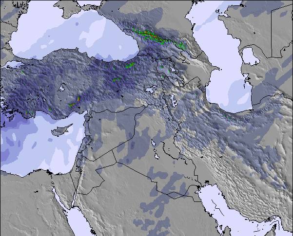
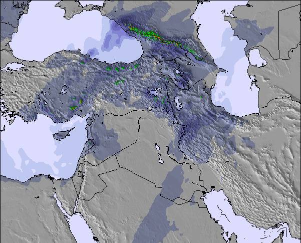
Snow map | 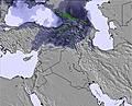 | 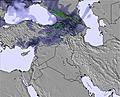 | 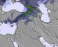 | 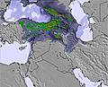 | 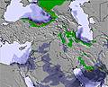 | 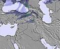 | |||||||||||
— | — | — | — | — | — | — | — | — | — | — | — | — | — | — | — | — | |
— | — | — | — | — | — | — | — | — | — | — | — | — | — | — | — | — | |
max °C | 1 | 1 | 0 | 0 | -1 | 1 | 1 | 1 | 0 | 0 | -1 | -1 | 0 | -1 | 0 | 0 | -1 |
min °C | 1 | -1 | 0 | 0 | -2 | 0 | 1 | -1 | 0 | 0 | -2 | -1 | -2 | -2 | -1 | -1 | -2 |
-5 | -8 | -7 | -7 | -8 | -6 | -5 | -8 | -7 | -7 | -9 | -7 | -8 | -8 | -5 | -6 | -7 | |
26 | 27 | 25 | 18 | 29 | 18 | 20 | 16 | 14 | 19 | 23 | 23 | 25 | 28 | 28 | 32 | 33 | |
5050 | 5000 | 4900 | 4950 | 4700 | 4900 | 5000 | 4950 | 4850 | 4950 | 4750 | 4750 | 4850 | 4600 | 4800 | 4900 | 4750 | |
— | — | 4:43 | — | — | 4:43 | — | — | 4:43 | — | — | 4:43 | — | — | 4:43 | — | — | |
7:17 | — | — | 7:17 | — | — | 7:19 | — | — | 7:19 | — | — | 7:19 | — | — | 7:20 | — | |
Go pro and carve into:
Latest snow reports near Mount Damavand:
| Top snow depth: | — |
|---|---|
| Bottom snow depth: | — |
| Fresh snowfall depth: | 1 cm |
| Last snowfall: | 7 Jun 2026 |
| Snow Alerts | Create Alert |
1.6 | Bluebird Powder days Fresh snow, mostly sunny, light wind. |
|---|---|
0.4 | Powder days Fresh snow, limited sun, any wind. |
1.3 | Bluebird days Average snow, mostly sunny, light wind. |
The above table gives the weather forecast for Mount Damavand at the specific elevation of 4909 m. Our sophisticated weather models allow us to provide snow forecasts for the top, middle and bottom ski stations of Mount Damavand. To access the weather forecasts for the other elevations, use the tab navigation above the table. For a wider view of the weather, check out the Weather Map of Iran (Islamic Republic of).
Click here to read further information on freezing levels and how we forecast our temperatures.
Overall 4.3 Based on 10 votes and 21 reviews
I have climbed to Damavand summit from all four main routes but I prescribed for mountaineers that they want to climb for the first time to any route they must have a coach or a very experienced man in his / her team and have accommodated with physical readiness then start to climbing as example 'the eastern route' have the most climbing distance and also in foggy climates the most danger is to be thrown off to 'Yakhar valley'. 'The northern route' program it is better to reach '5000 Shelter'. The end shelter in the first time and have enough water and also have crampon for transferring the glassier. The western route has the most slope and danger of throwing rocks and needs the most physical readiness at the end. 'The southern route' has the most visitors/climbers so it needs preparations to reserve a bed via net.
Behzad Karimmaslak from Iran writes:
I have climbed to Damavand summit from all four main routes but I prescribed for mountaineers that they want to climb for the first time to any route they must have a coach or a very experienced man in his / her team and have accommodated with physical readiness then start to climbing as example 'the eastern route' have the most climbing distance and also in foggy climates the most danger is to be thrown off to 'Yakhar valley'. 'The northern route' program it is better to reach '5000 Shelter'. The end shelter in the first time and have enough water and also have crampon for transferring the glassier. The western route has the most slope and danger of throwing rocks and needs the most physical readiness at the end. 'The southern route' has the most visitors/climbers so it needs preparations to reserve a bed via net.

 Nearest