


Global Weekly Snow Roundup #318
Weekly Snow News for the world, updated 11 June 2026: Australia's season begins, Val d’Isère reopens and major snowfall is forecast for the Andes.

Next 3 days weather summary:Mostly dry. Warm (max 20°C on Sat afternoon, min 8°C on Thu night). Wind will be generally light. | Days 4-6 weather summary:Mostly dry. Warm (max 26°C on Mon afternoon, min 8°C on Tue night). Winds increasing (calm on Sun night, fresh winds from the W by Tue afternoon). | ||||||||||||||||
Thu 11 | Friday 12 | Saturday 13 | Sunday 14 | Monday 15 | Tuesday 16 | ||||||||||||
PM | night | AM | PM | night | AM | PM | night | AM | PM | night | AM | PM | night | AM | PM | night | |
clear | clear | clear | clear | clear | clear | clear | clear | clear | clear | clear | clear | some clouds | some clouds | clear | clear | clear | |
km/h | |||||||||||||||||
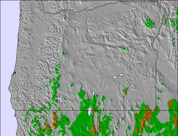
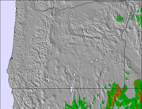
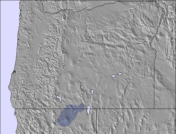
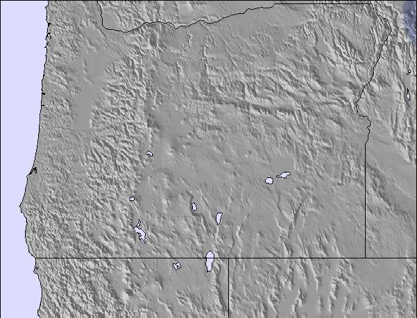
Snow map | 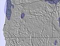 | 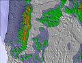 | 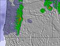 | 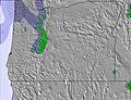 |  |  | |||||||||||
— | — | — | — | — | — | — | — | — | — | — | — | — | — | — | — | — | |
— | — | — | — | — | — | — | — | — | — | — | — | — | — | — | — | — | |
max °C | 17 | 13 | 15 | 18 | 14 | 17 | 20 | 17 | 20 | 22 | 19 | 25 | 26 | 20 | 17 | 19 | 15 |
min °C | 17 | 8 | 11 | 17 | 10 | 14 | 19 | 13 | 17 | 22 | 17 | 21 | 24 | 12 | 14 | 19 | 8 |
17 | 5 | 9 | 17 | 10 | 12 | 19 | 11 | 16 | 22 | 17 | 21 | 24 | 9 | 12 | 18 | 4 | |
35 | 57 | 34 | 38 | 41 | 39 | 32 | 36 | 32 | 28 | 30 | 28 | 29 | 26 | 44 | 30 | 26 | |
3600 | 4050 | 3950 | 4050 | 3850 | 3700 | 4000 | 4150 | 4350 | 4500 | 4600 | 4800 | 4900 | 4900 | 4800 | 4950 | 4700 | |
— | — | 5:16 | — | — | 5:16 | — | — | 5:16 | — | — | 5:16 | — | — | 5:16 | — | — | |
— | 8:53 | — | — | 8:54 | — | — | 8:54 | — | — | 8:55 | — | — | 8:55 | — | — | 8:55 | |
Go pro and carve into:
Avalanche information: National Avalanche Center
Latest snow reports near Cooper Spur:
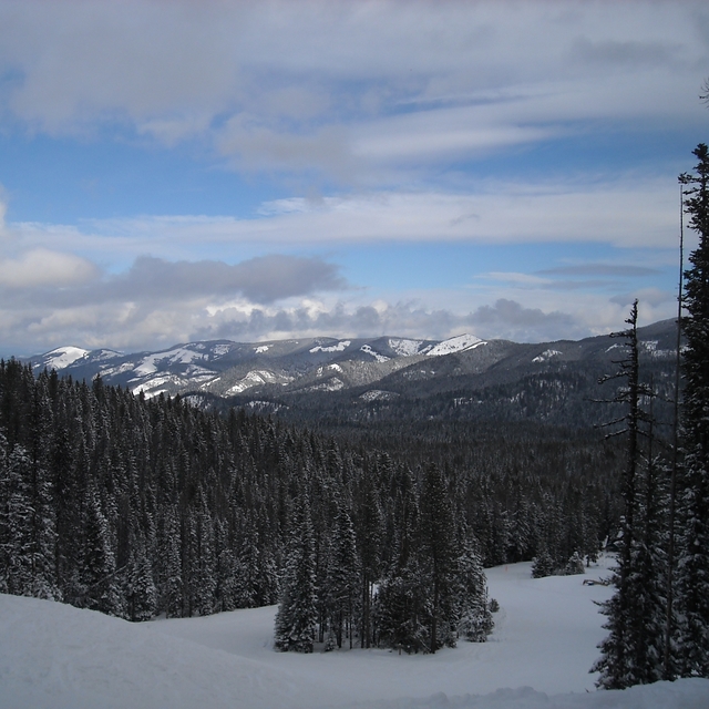
Snow is falling in Mt Hood Meadows. from Mt Hood Meadows
| Top snow depth: | — |
|---|---|
| Bottom snow depth: | — |
| Fresh snowfall depth: | — |
| Last snowfall: | 6 Jun 2026 |
| Snow Alerts | Create Alert |
0.0 | Bluebird Powder days Fresh snow, mostly sunny, light wind. |
|---|---|
0.0 | Powder days Fresh snow, limited sun, any wind. |
0.0 | Bluebird days Average snow, mostly sunny, light wind. |
The above table gives the weather forecast for Cooper Spur at the specific elevation of 1280 m. Our sophisticated weather models allow us to provide snow forecasts for the top, middle and bottom ski stations of Cooper Spur. To access the weather forecasts for the other elevations, use the tab navigation above the table. For a wider view of the weather, check out the Weather Map of United States.
Click here to read further information on freezing levels and how we forecast our temperatures.
Overall 2.6 Based on 3 votes and 6 reviews
The cabins at Cooper Spur are comfortable for a family vacation. The slope at Cooper Spur is good for learning and tune-ups at a family friendly price. Guests at the cabins get a discount on Meadows tickets. If you're looking for a place to relax, check out the Spur. If you need a dose of insanity, head to the Meadows or Timberline, but then you'll be ready for the quiet retreat afforded by a very nice small resort. It's a family run operation, so don't expect Motel 6. 09-10 was a snow-failure year, but 05-06, 06-07, 07-08 and 08-09 all had good snow by Christmas. 09-10 started with a bang, but last week there was a significant melt. 24 inches and temps in the low 20s for the upcoming week portend another nice Christmas.
Pete from United States writes:
The cabins at Cooper Spur are comfortable for a family vacation. The slope at Cooper Spur is good for learning and tune-ups at a family friendly price. Guests at the cabins get a discount on Meadows tickets. If you're looking for a place to relax, check out the Spur. If you need a dose of insanity, head to the Meadows or Timberline, but then you'll be ready for the quiet retreat afforded by a very nice small resort. It's a family run operation, so don't expect Motel 6.
09-10 was a snow-failure year, but 05-06, 06-07, 07-08 and 08-09 all had good snow by Christmas. 09-10 started with a bang, but last week there was a significant melt. 24 inches and temps in the low 20s for the upcoming week portend another nice Christmas.

 Nearest