

Global Weekly Snow Roundup #318
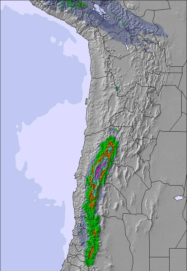
Weekly Snow News for the world, updated 11 June 2026: Australia's season begins, Val d’Isère reopens and major snowfall is forecast for the Andes.

Next 3 days weather summary:Mostly dry. Freeze-thaw conditions (max 5°C on Sat afternoon, min -4°C on Fri night). Winds decreasing (fresh winds from the WSW on Fri afternoon, calm by Sat night). | Days 4-6 weather summary:Light rain (total 2.0mm), mostly falling on Tue afternoon. Freeze-thaw conditions (max 4°C on Mon afternoon, min -4°C on Wed night). Winds increasing (calm on Mon night, strong winds from the WNW by Thu morning). | ||||||||||||||||
Fri 12 | Saturday 13 | Sunday 14 | Monday 15 | Tuesday 16 | Wednesday 17 | ||||||||||||
PM | night | AM | PM | night | AM | PM | night | AM | PM | night | AM | PM | night | AM | PM | night | |
clear | clear | clear | clear | clear | clear | some clouds | clear | clear | some clouds | clear | clear | t-storm risk | snow shwrs | clear | snow shwrs | clear | |
km/h | |||||||||||||||||
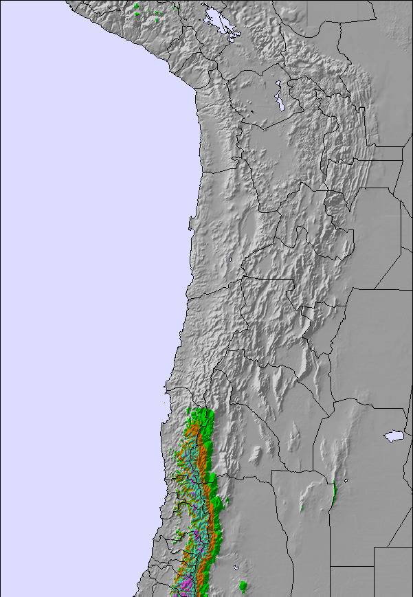
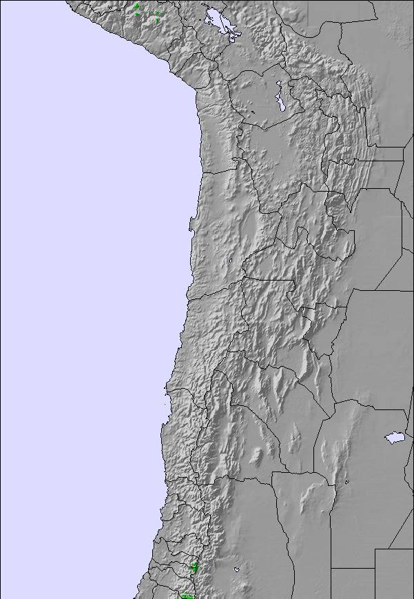
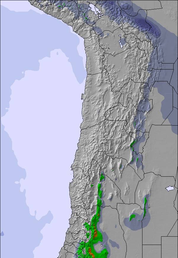
Snow map |  |  |  | 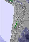 | 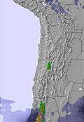 | 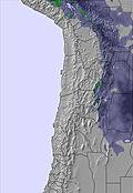 | |||||||||||
— | — | — | — | — | — | — | — | — | — | — | — | — | — | — | — | — | |
— | — | — | — | — | — | — | — | — | — | — | — | 2 | — | — | — | — | |
max °C | 4 | -1 | 3 | 5 | -1 | 3 | 4 | -1 | 2 | 4 | 0 | 2 | 4 | 0 | 2 | 4 | -2 |
min °C | 3 | -4 | -1 | 4 | -3 | -1 | 2 | -4 | -2 | 4 | -3 | -1 | 3 | -3 | -2 | 1 | -4 |
-2 | -9 | -5 | 1 | -5 | -4 | 1 | -7 | -4 | 2 | -3 | -1 | 1 | -7 | -6 | -4 | -11 | |
15 | 20 | 14 | 17 | 34 | 28 | 33 | 50 | 36 | 34 | 63 | 51 | 52 | 65 | 41 | 47 | 54 | |
5400 | 5100 | 5350 | 5450 | 5050 | 5300 | 5300 | 4800 | 5200 | 5400 | 4900 | 5300 | 5350 | 4850 | 5200 | 5150 | 4700 | |
— | — | 6:56 | — | — | 6:58 | — | — | 6:58 | — | — | 6:58 | — | — | 6:58 | — | — | |
6:07 | — | — | 6:07 | — | — | 6:07 | — | — | 6:07 | — | — | 6:07 | — | — | 6:07 | — | |
Go pro and carve into:
Latest snow reports near Chacaltaya:
| Top snow depth: | — |
|---|---|
| Bottom snow depth: | — |
| Fresh snowfall depth: | — |
| Last snowfall: | 28 May 2026 |
| Snow Alerts | Create Alert |
0.0 | Bluebird Powder days Fresh snow, mostly sunny, light wind. |
|---|---|
0.4 | Powder days Fresh snow, limited sun, any wind. |
0.5 | Bluebird days Average snow, mostly sunny, light wind. |

The above table gives the weather forecast for Chacaltaya at the specific elevation of 4895 m. Our sophisticated weather models allow us to provide snow forecasts for the top, middle and bottom ski stations of Chacaltaya. To access the weather forecasts for the other elevations, use the tab navigation above the table. For a wider view of the weather, check out the Weather Map of Bolivia.
Click here to read further information on freezing levels and how we forecast our temperatures.
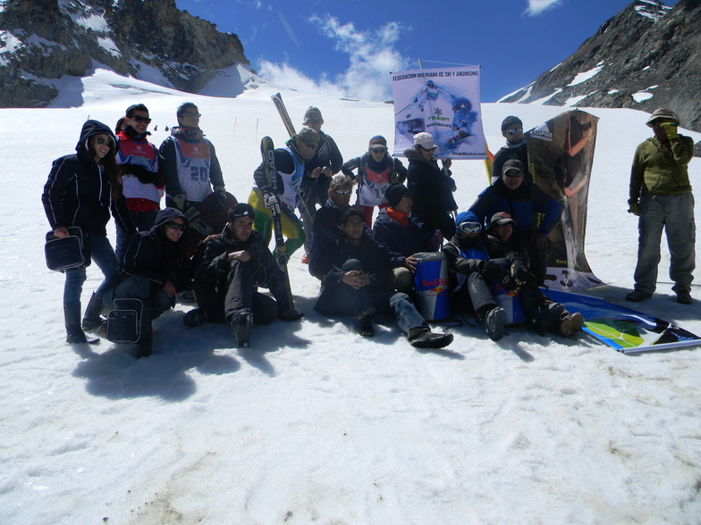
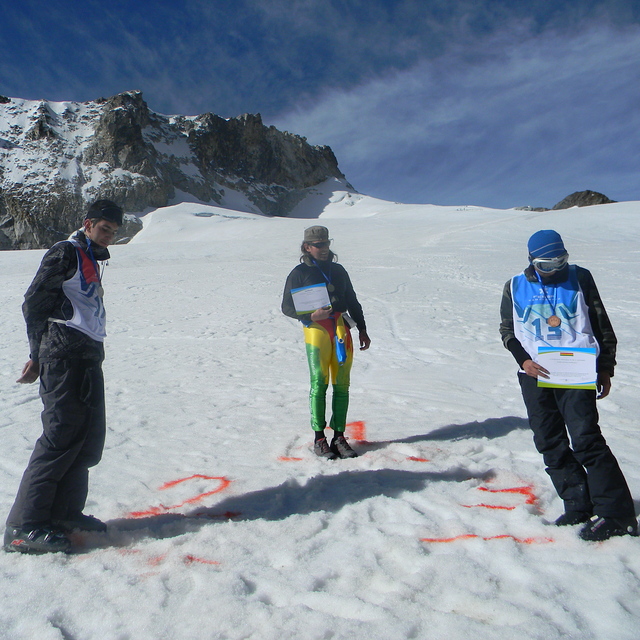
Chacaltaya ski resort the great, Is it really active yet, why the sounds are negative? I would like to have more information about one of the highest altitude ski resort in the world. It's description back to the Ande ranges. but really 4895m to 5395m altitude for skiing is something else! it is just about 400m less than our Damavand peak in Iran. We say it simply, where we live next to the fun coils at home, but we feel it in area by head-ach, lips colour purple, heart rythme faster and so on... But it is amazing.
Bozorgzadegan Amir from Iran writes:
Chacaltaya ski resort the great,
Is it really active yet, why the sounds are negative?
I would like to have more information about one of the highest altitude ski resort in the world.
It's description back to the Ande ranges. but really 4895m to 5395m altitude for skiing is something else! it is just about 400m less than our Damavand peak in Iran.
We say it simply, where we live next to the fun coils at home, but we feel it in area by head-ach, lips colour purple,
heart rythme faster and so on...
But it is amazing.

 Nearest