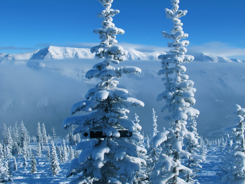


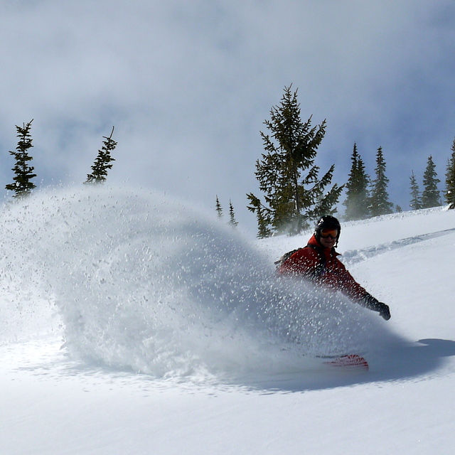
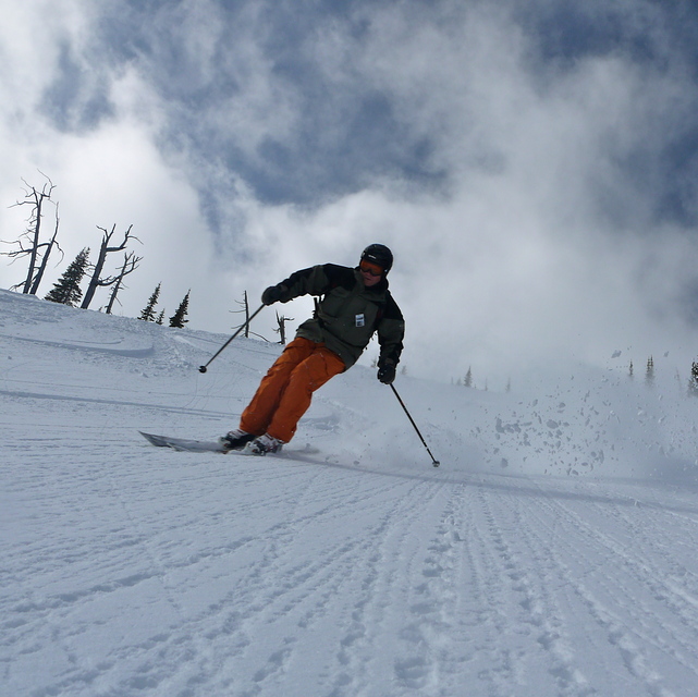
Global Weekly Snow Roundup #318
Weekly Snow News for the world, updated 11 June 2026: Australia's season begins, Val d’Isère reopens and major snowfall is forecast for the Andes.

Next 3 days weather summary:Moderate rain (total 10.0mm), heaviest on Fri afternoon. Freeze-thaw conditions (max 16°C on Mon morning, min 0°C on Fri night). Wind will be generally light. | Days 4-6 weather summary:Heavy rain (total 20.0mm), heaviest during Wed afternoon. Very mild (max 18°C on Tue afternoon, min 4°C on Wed night). Winds decreasing (strong winds from the WSW on Tue afternoon, calm by Wed night). | ||||||||||||||||
Fri 12 | Saturday 13 | Sunday 14 | Monday 15 | Tuesday 16 | Wednesday 17 | ||||||||||||
PM | night | AM | PM | night | AM | PM | night | AM | PM | night | AM | PM | night | AM | PM | night | |
mod. rain | snow shwrs | clear | light rain | some clouds | some clouds | cloudy | some clouds | cloudy | cloudy | some clouds | cloudy | cloudy | rain shwrs | light rain | t-storm risk | rain shwrs | |
km/h | |||||||||||||||||
Snow map | 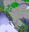 | 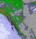 | 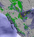 | 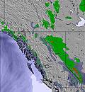 | 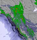 | 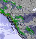 | |||||||||||
— | — | — | — | — | — | — | — | — | — | — | — | — | — | — | — | — | |
8 | 1 | — | 1 | — | — | — | — | — | — | — | — | — | 3 | 2 | 7 | 8 | |
max °C | 4 | 3 | 8 | 11 | 8 | 13 | 15 | 12 | 16 | 17 | 15 | 16 | 18 | 14 | 7 | 10 | 8 |
min °C | 3 | 0 | 4 | 10 | 5 | 9 | 15 | 8 | 13 | 17 | 10 | 14 | 17 | 5 | 6 | 9 | 4 |
1 | 0 | 4 | 10 | 5 | 9 | 15 | 7 | 12 | 16 | 8 | 13 | 15 | 3 | 5 | 8 | 4 | |
94 | 92 | 66 | 46 | 78 | 60 | 37 | 71 | 53 | 42 | 63 | 55 | 47 | 77 | 87 | 70 | 98 | |
2350 | 2200 | 2600 | 2950 | 3050 | 3100 | 3600 | 3800 | 4000 | 4150 | 4300 | 4050 | 4100 | 3400 | 2750 | 3050 | 2850 | |
— | — | 5:31 | — | — | 5:31 | — | — | 5:31 | — | — | 5:31 | — | — | 5:31 | — | — | |
— | 9:43 | — | — | 9:44 | — | — | 9:44 | — | — | 9:45 | — | — | 9:45 | — | — | 9:45 | |
Go pro and carve into:
Avalanche information: Avalanche Canada
Latest snow reports near Castle Mountain Resort:
| Top snow depth: | — |
|---|---|
| Bottom snow depth: | — |
| Fresh snowfall depth: | — |
| Last snowfall: | 1 Jun 2026 |
| Snow Alerts | Create Alert |
0.0 | Bluebird Powder days Fresh snow, mostly sunny, light wind. |
|---|---|
0.1 | Powder days Fresh snow, limited sun, any wind. |
0.0 | Bluebird days Average snow, mostly sunny, light wind. |
The above table gives the weather forecast for Castle Mountain Resort at the specific elevation of 1842 m. Our sophisticated weather models allow us to provide snow forecasts for the top, middle and bottom ski stations of Castle Mountain Resort. To access the weather forecasts for the other elevations, use the tab navigation above the table. For a wider view of the weather, check out the Weather Map of Canada.
Click here to read further information on freezing levels and how we forecast our temperatures.
Overall 3.3 Based on 102 votes and 100 reviews
Had a fantastic day, just missed the big powder dump but the hill was still amazing. It was also alpine demo days and the selection of gear to try was very good. The line ups were a bit long but that's to be expected for a weekend with a huge dump of snow, mild temps and no wind. Can't wait to go back again next season.
Matthew Watson from Canada writes:
Had a fantastic day, just missed the big powder dump but the hill was still amazing.
It was also alpine demo days and the selection of gear to try was very good. The line ups were a bit long but that's to be expected for a weekend with a huge dump of snow, mild temps and no wind.
Can't wait to go back again next season.
Read 99 more reviews of Castle Mountain Resort or submit your own


 Nearest