New South Wales Forecast Maps – 6 Days
(16 day forecast maps are available for members)
Snowfall Accumulations |
||||||
|---|---|---|---|---|---|---|
LAST 3 DAYS
|
LAST 7 DAYS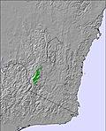
|
NEXT 3 DAYS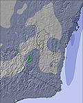
|
NEXT 3–6 DAYS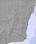
|
NEXT 6–9 DAYSxSign up or loginto access |
NEXT 9–12 DAYSxSign up or loginto access |
NEXT 12–16 DAYSxSign up or loginto access |
Current Weather |
|||
|---|---|---|---|
PRECIPITATION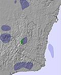
|
WIND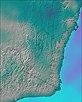
|
TEMPERATURE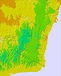
|
CLOUD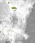
|
6 hour periods – Next 6 days snow |
||||
|---|---|---|---|---|
Thursday 30 Apr 4am
|
Thursday 30 Apr 10am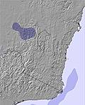
|
Thursday 30 Apr 4pm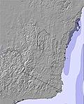
|
Thursday 30 Apr 10pm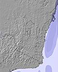
|
Friday 01 May 4am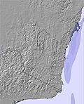
|
Friday 01 May 10am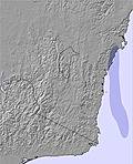
|
Friday 01 May 4pm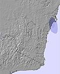
|
Friday 01 May 10pm
|
Saturday 02 May 4am
|
Saturday 02 May 10am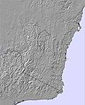
|
Saturday 02 May 4pm
|
Saturday 02 May 10pm
|
Sunday 03 May 4am
|
Sunday 03 May 10am
|
Sunday 03 May 4pm
|
Sunday 03 May 10pm
|
Monday 04 May 4am
|
Monday 04 May 10am
|
Monday 04 May 4pm
|
Monday 04 May 10pm
|
Tuesday 05 May 4am
|
Tuesday 05 May 10am
|
Tuesday 05 May 4pm
|
Tuesday 05 May 10pm
|
Wednesday 06 May 4am
|
Wednesday 06 May 10am
|
Wednesday 06 May 4pm
|
Wednesday 06 May 10pm
|
Thursday 07 May 4amxSign up or loginto access |
Thursday 07 May 10amxSign up or loginto access |
Thursday 07 May 4pmxSign up or loginto access |
Thursday 07 May 10pmxSign up or loginto access |
Friday 08 May 4amxSign up or loginto access |
Friday 08 May 10amxSign up or loginto access |
Friday 08 May 4pmxSign up or loginto access |
Friday 08 May 10pmxSign up or loginto access |
Saturday 09 May 4amxSign up or loginto access |
Saturday 09 May 10amxSign up or loginto access |
Saturday 09 May 4pmxSign up or loginto access |
Saturday 09 May 10pmxSign up or loginto access |
Sunday 10 May 4amxSign up or loginto access |
Sunday 10 May 10amxSign up or loginto access |
Sunday 10 May 4pmxSign up or loginto access |
Sunday 10 May 10pmxSign up or loginto access |
Monday 11 May 4amxSign up or loginto access |
Monday 11 May 10amxSign up or loginto access |
Monday 11 May 4pmxSign up or loginto access |
Monday 11 May 10pmxSign up or loginto access |
Tuesday 12 May 4amxSign up or loginto access |
Tuesday 12 May 10amxSign up or loginto access |
Tuesday 12 May 4pmxSign up or loginto access |
Tuesday 12 May 10pmxSign up or loginto access |
Wednesday 13 May 4amxSign up or loginto access |
Wednesday 13 May 10amxSign up or loginto access |
Wednesday 13 May 4pmxSign up or loginto access |
Wednesday 13 May 10pmxSign up or loginto access |
Thursday 14 May 4amxSign up or loginto access |
Thursday 14 May 10amxSign up or loginto access |
Thursday 14 May 4pmxSign up or loginto access |
Thursday 14 May 10pmxSign up or loginto access |
Friday 15 May 4amxSign up or loginto access |
Friday 15 May 10amxSign up or loginto access |
Friday 15 May 4pmxSign up or loginto access |
Friday 15 May 10pmxSign up or loginto access |
|
| Sign up to get access to full 9 day weather maps | ||||
We also provide animated weather maps of New South Wales and other skiing regions.
 Nearest