By using Snow-Forecast, you agree to our Terms & Services.
Learn more
Don't have an account? Join now
Already a Member? Log In
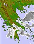
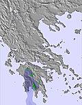
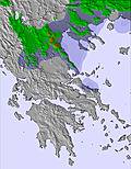
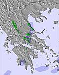
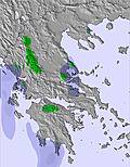
Sunday 01 Feb 2pm
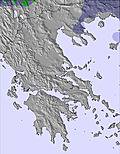
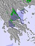
Sunday 01 Feb 8pm
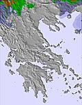
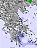
Monday 02 Feb 2am
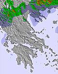
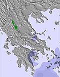
Monday 02 Feb 8am
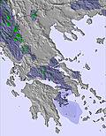
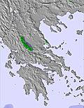
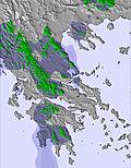
Monday 02 Feb 2pm
Monday 02 Feb 8pm
Tuesday 03 Feb 2am
Tuesday 03 Feb 8am
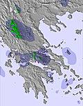
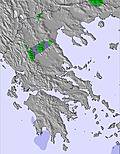
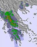
Tuesday 03 Feb 2pm
Tuesday 03 Feb 8pm
Wednesday 04 Feb 2am
Wednesday 04 Feb 8am
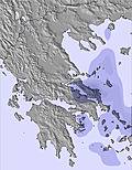
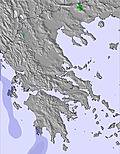
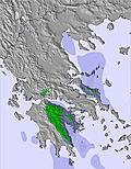
Wednesday 04 Feb 2pm
Wednesday 04 Feb 8pm
Thursday 05 Feb 2am
Thursday 05 Feb 8am
Thursday 05 Feb 2pm
Thursday 05 Feb 8pm
Friday 06 Feb 2am
Friday 06 Feb 8am
Friday 06 Feb 2pm
Friday 06 Feb 8pm
Saturday 07 Feb 2am
Saturday 07 Feb 8am
Saturday 07 Feb 2pm
Saturday 07 Feb 8pm
Sunday 08 Feb 2am
Sunday 08 Feb 8am


 Nearest