


View forecast
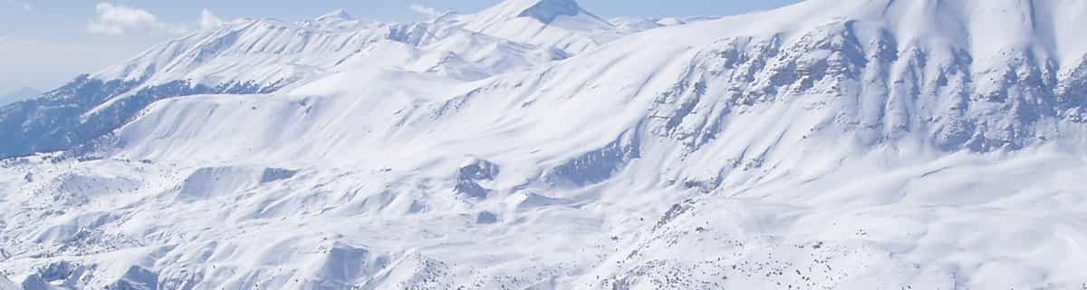
Interlaken at 2971 m altitude
Issued by Snow-Forecast.com at: 7 am (local time) / 21 May 2024
Now
Tuesday 21 | Wednesday 22 | Thursday 23 | Friday 24 | Saturday 25 | Sunday 26 | Monday 27 | |||||||||||||||
AM | PM | night | AM | PM | night | AM | PM | night | AM | PM | night | AM | PM | night | AM | PM | night | AM | PM | night | |
light snow | light snow | snow shwrs | snow shwrs | snow shwrs | light snow | light snow | light snow | snow shwrs | snow shwrs | snow shwrs | light snow | snow shwrs | snow shwrs | snow shwrs | clear | snow shwrs | snow shwrs | clear | rain shwrs | rain shwrs | |
km/h | |||||||||||||||||||||
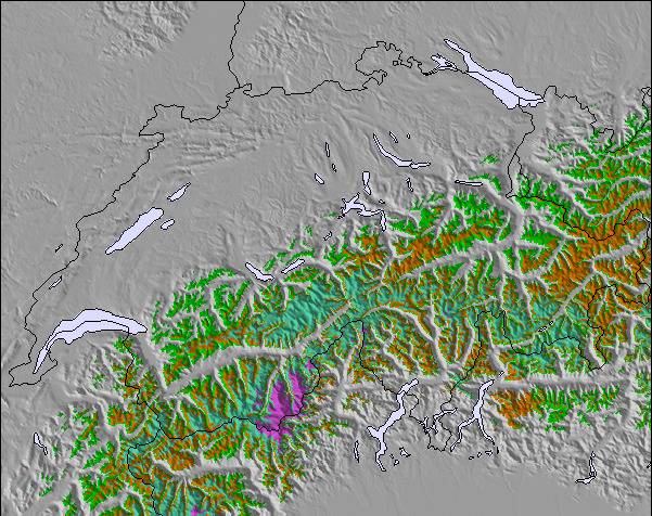
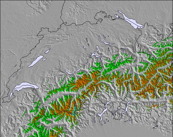
Snow map |  |  |  |  |  |  |  | ||||||||||||||
3 | — | — | — | — | 1.0 | 4 | 4 | — | — | 4 | 3 | — | 3 | 1.0 | — | — | — | — | — | — | |
— | — | — | — | — | — | — | — | — | — | — | — | — | — | — | — | — | — | — | 1.0 | 1.0 | |
max°C | -3 | -2 | -2 | -3 | -2 | -2 | -3 | -3 | -2 | -2 | -2 | -2 | -2 | -1 | -1 | 0 | 1 | 2 | 2 | 3 | 3 |
min°C | -3 | -2 | -3 | -3 | -2 | -3 | -3 | -3 | -3 | -3 | -2 | -3 | -3 | -1 | -1 | -1 | 0 | 2 | 2 | 3 | 3 |
-9 | -6 | -9 | -8 | -4 | -3 | -3 | -6 | -3 | -3 | -2 | -6 | -3 | -1 | -4 | -4 | 0 | 2 | 1 | 3 | 3 | |
81 | 84 | 96 | 92 | 96 | 89 | 97 | 89 | 85 | 87 | 95 | 81 | 81 | 90 | 63 | 62 | 86 | 45 | 47 | 78 | 46 | |
2550 | 2700 | 2500 | 2600 | 2700 | 2600 | 2450 | 2600 | 2500 | 2600 | 2650 | 2600 | 2700 | 2800 | 2850 | 3000 | 3100 | 3350 | 3300 | 3350 | 3450 | |
5:47 | — | — | 5:46 | — | — | 5:45 | — | — | 5:43 | — | — | 5:43 | — | — | 5:41 | — | — | 5:41 | — | — | |
— | — | 9:02 | — | — | 9:04 | — | — | 9:05 | — | — | 9:07 | — | — | 9:07 | — | — | 9:08 | — | — | 9:09 | |
Next 0-3 days weather summary:
A moderate fall of snow, heaviest on Thu afternoon. Temperatures will be below freezing (max -2°C on Tue afternoon, min -3°C on Tue morning). Wind will be generally light.
Next 4-6 days weather summary:
A moderate fall of snow, heaviest on Fri afternoon. Freeze-thaw conditions (max 2°C on Sun night, min -3°C on Fri morning). Wind will be generally light.
Popular Interlaken Pages
Snow Radar
Submit a reportLatest snow reports near Interlaken:
14 km away from Interlaken
2 hours ago
Continuous light snow reported from Jungfrau Mountain at 3576 metres elevation 7 kms E of Mürren but it is probably falling as rain apart from near the top of the ski area from Mürren
Interlaken Snow Conditions
| Top snow depth: | — |
|---|---|
| Bottom snow depth: | — |
| Fresh snowfall depth: | 3.0 cm |
| Last snowfall: | 20 May 2024 |
| Snow Alerts | Create Alert |
Other resorts in Switzerland are reporting: powder (2) / good piste (4)
Snow-Forecast Partner Offers
Show your business here
Snow History
Week 3 of May has on average:
0.7 | Bluebird Powder days Fresh snow, mostly sunny, light wind. |
|---|---|
1.0 | Powder days Fresh snow, limited sun, any wind. |
0.9 | Bluebird days Average snow, mostly sunny, light wind. |
Interlaken Forecast Snowfall

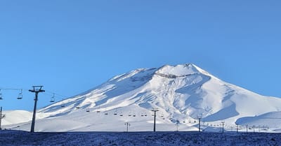
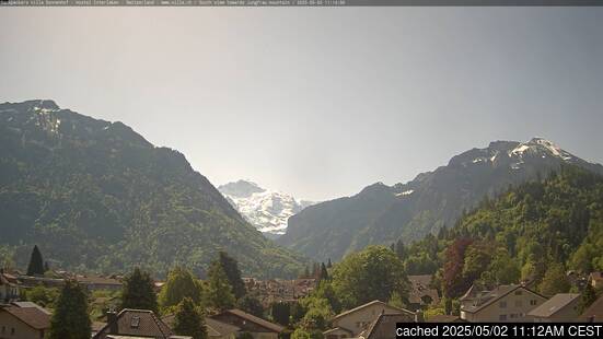
Interlaken Resort Webcam
- 2pm yesterday

- 2 days ago

- 3 days ago

- 4 days ago

- 5 days ago

Other resorts in Switzerland are reporting: powder (2) / good piste (4)
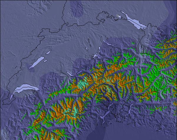
The above table gives the weather forecast for Interlaken at the specific elevation of 2971 m. Our sophisticated weather models allow us to provide snow forecasts for the top, middle and bottom ski stations of Interlaken. To access the weather forecasts for the other elevations, use the tab navigation above the table. For a wider view of the weather, check out the Weather Map of Switzerland.
Click here to read further information on freezing levels and how we forecast our temperatures.
Visitor Reviews of Interlaken
- cs tai from Hong Kong writes:
A very nice place, no busy traffic, no skyscrappers and no pollution, but has beautiful mountains and rivers. The best place for settle before you go to Jungfraujoch.
Visitor Reviews of Interlaken
cs tai from Hong Kong writes:
A very nice place, no busy traffic, no skyscrappers and no pollution, but has beautiful mountains and rivers. The best place for settle before you go to Jungfraujoch.
Free Snow-Forecast.com weather widget for your website
The Interlaken skiing weather widget is available to embed on external websites free of charge. It provides a daily summary of our Interlaken snow forecast and current weather conditions. Simply go to the feed configuration page and follow the 3 simple steps to grab the custom html code snippet and paste it into your own site. You can choose the snow forecast elevation (summit, mid-mountain or bottom lift) and metric/imperial units for the snow forecast feed to suit your own website…. Click here to get the code.
View detailed snow forecast for Interlaken at:
snow-forecast.com

 Nearest