
Ski Hire by Intersport
Click here for discount

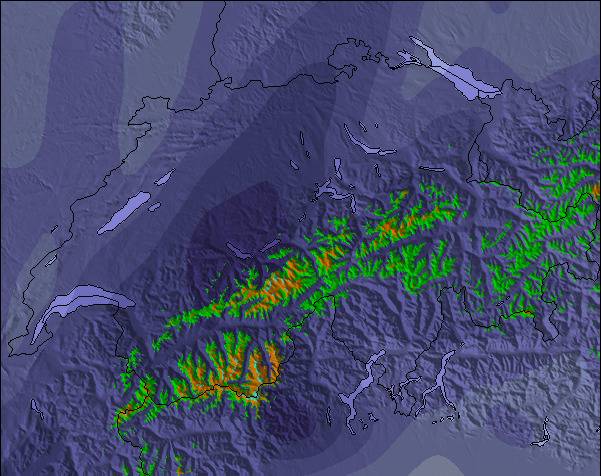
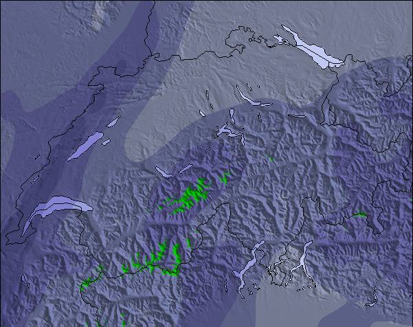
Riederalp - Aletsch Weather (Next 3 days): The snow forecast for Riederalp - Aletsch is: Moderate rain (total 12.0mm) on Sun night. Becoming colder with heavy fall of snow, heaviest during Tue afternoon. Freeze-thaw conditions (max 4°C on Mon afternoon, min -1°C on Tue night). Wind will be generally light.
Riederalp - Aletsch Weather (Days 4-6): A heavy fall of snow, heaviest during Fri morning. Freeze-thaw conditions (max 1°C on Wed afternoon, min -1°C on Wed night). Wind will be generally light.
| Resort | Snow Depth | Temp. (°C) | Wind (km/h) | Weather | ||
|---|---|---|---|---|---|---|
| Top Lift: | -2 | |||||
| Middle Lift: | -1 | |||||
| Bottom Lift: | -2 |
Latest snow reports near Riederalp - Aletsch:
Continuous light snow reported from Jungfrau Mountain at 3576 metres elevation 7 kms E of Mürren but it is probably falling as rain apart from near the top of the ski area from Mürren

Sunday 19 | Monday 20 | Tuesday 21 | Wednesday 22 | Thursday 23 | Friday 24 | Saturday 25 | |||||||||||||||
AM | PM | night | AM | PM | night | AM | PM | night | AM | PM | night | AM | PM | night | AM | PM | night | AM | PM | night | |
some clouds | risk thun- der | rain shwrs | some clouds | light rain | mod. snow | heavy snow | mod. snow | light snow | cloudy | light snow | mod. snow | light snow | light snow | light snow | mod. snow | light snow | light snow | cloudy | light snow | snow shwrs | |
km/h | |||||||||||||||||||||
Snow map |  |  |  |  |  |  |  | ||||||||||||||
— | — | — | — | — | 7 | 11 | 10 | 1.0 | — | 1.0 | 7 | 1.0 | 2.0 | 2.0 | 6 | 2.0 | 2.0 | — | — | — | |
— | 3 | 6 | — | 2.0 | 1.0 | — | — | — | — | — | — | — | — | — | — | — | — | — | — | — | |
max°C | 1 | 3 | 2 | 2 | 4 | 4 | 1 | 0 | 0 | 0 | 1 | 1 | 0 | 1 | 0 | -1 | 0 | 0 | 0 | 2 | 2 |
min°C | 0 | 3 | 2 | 2 | 4 | 1 | 0 | 0 | -1 | 0 | 1 | -1 | -1 | 0 | 0 | -1 | 0 | -1 | 0 | 1 | 1 |
0 | 3 | 2 | 0 | 2 | 0 | 0 | -2 | -3 | 0 | 1 | -1 | -1 | 0 | -2 | -1 | 0 | -3 | -2 | 0 | 1 | |
86 | 85 | 85 | 86 | 81 | 96 | 99 | 98 | 86 | 91 | 92 | 98 | 96 | 96 | 99 | 98 | 97 | 89 | 75 | 89 | 73 | |
2650 | 2950 | 2800 | 2800 | 3050 | 2800 | 2550 | 2500 | 2400 | 2500 | 2700 | 2450 | 2550 | 2550 | 2500 | 2350 | 2550 | 2400 | 2550 | 2750 | 2750 | |
5:48 | — | — | 5:48 | — | — | 5:47 | — | — | 5:46 | — | — | 5:45 | — | — | 5:43 | — | — | 5:43 | — | — | |
— | — | 8:59 | — | — | 9:00 | — | — | 9:01 | — | — | 9:02 | — | — | 9:04 | — | — | 9:05 | — | — | 9:06 | |
Moderate rain (total 12.0mm) on Sun night. Becoming colder with heavy fall of snow, heaviest during Tue afternoon. Freeze-thaw conditions (max 4°C on Mon afternoon, min -1°C on Tue night). Wind will be generally light.
A heavy fall of snow, heaviest during Fri morning. Freeze-thaw conditions (max 1°C on Wed afternoon, min -1°C on Wed night). Wind will be generally light.
Latest snow reports near Riederalp - Aletsch:
Continuous light snow reported from Jungfrau Mountain at 3576 metres elevation 7 kms E of Mürren but it is probably falling as rain apart from near the top of the ski area from Mürren
| Top snow depth: | — |
|---|---|
| Bottom snow depth: | — |
| Fresh snowfall depth: | 2 cm |
| Last snowfall: | 18 May 2024 |
| Snow Alerts | Create Alert |
0.8 | Bluebird Powder days Fresh snow, mostly sunny, light wind. |
|---|---|
0.9 | Powder days Fresh snow, limited sun, any wind. |
0.3 | Bluebird days Average snow, mostly sunny, light wind. |
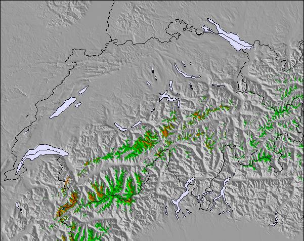
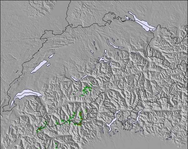
The above table gives the weather forecast for Riederalp - Aletsch at the specific elevation of 2488 m. Our sophisticated weather models allow us to provide snow forecasts for the top, middle and bottom ski stations of Riederalp - Aletsch. To access the weather forecasts for the other elevations, use the tab navigation above the table. For a wider view of the weather, check out the Weather Map of Switzerland.
Click here to read further information on freezing levels and how we forecast our temperatures.
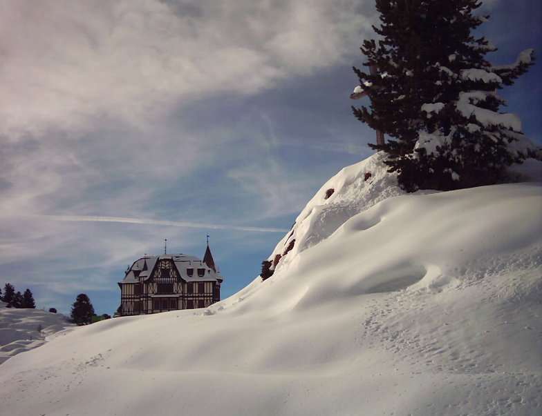
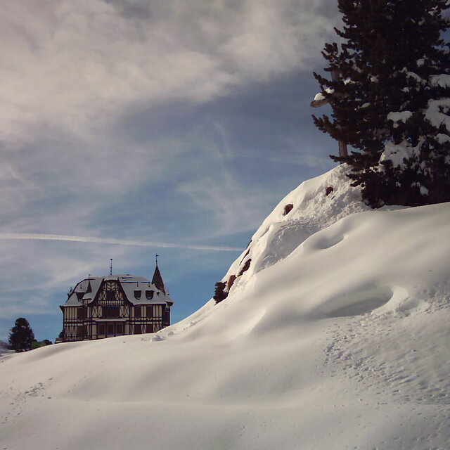
Almost every Christmas I spend the holiday in Fiesch in the Aletsch region with my family. Fiesch, Fiescheralp, Betmmeralp and Riederalp have many not too expensive chalets for rent, ideal for families. The villages are charming and snow covered, breathing Swiss tradition. Don’t expect a thrilling night life. The Alps and the great Aletsch gletscher are UNESCO protected, securing a beautiful environment for the future. The panoramas are one of the most beautiful in European Alps. Since the UNESCO status, no new lifts have been opened, but the capacity and quality of the existing lifts has been increased during the last years. A good connection lift between Bettmeralp and Kuhboden (Fiescheralp) is lacking and the slopes are for good skiers only. When the red Aletsch piste in Bettmeralp is closed, you have to take a few small lifts to get in Riederalp. Also within Riederalp slopes are not good connected. Especially for snowboarders this can be annoying. The ski area has some exciting runs. You can ski from the Eggishorn (2900 metres) to Fiesch (1050 metre), a drop of almost 2 km with steep slopes and a controlled off-piste route. The real pros can take a steep freeride route from the top with their own security equipment. Another experience is the steep, but short, slope after skiing through a 100 meter skitunnel from the Bettmerhorn. You can choose to ski off-piste to Bettmeralp. In Riederalp sometimes a slalom run is opened, the one in Fiescheralp is for groups only. After a good dump of snow, the young locals know, you can descend from Bettmeralp and Riederalp into the valley. These are freeride routes and not on the map. With the Aletsch ski pass you can visit Muhlebach near Ernen. This calm and tiny area only has four lifts, but with nice red runs and off piste possibilities when the off piste snow in the Aletsch area already has been packed by an overkill of skiers and boarders (in the holidays). It seems the Swiss are trying to avoid risk (more than the French do). This area is missing a proper fun park with a lift. In Fiescheralp, there are some cheap and badly groomed plastic slides with scratches on the surface, a cheap rainbow and some badly shaped jumps. In Bettmeralp there are three jumps of a quality far below international freestyle standards. The slope control doesn’t like people building their own kicker. Sometimes I ended up confused when lifts are closed due to “bad weather”, despite perfect snow conditions. The Aletsch area is not for freestyle. Great for families. Also expert skiers can have fun!
Koen Braak from Netherlands writes:
Almost every Christmas I spend the holiday in Fiesch in the Aletsch region with my family. Fiesch, Fiescheralp, Betmmeralp and Riederalp have many not too expensive chalets for rent, ideal for families. The villages are charming and snow covered, breathing Swiss tradition. Don’t expect a thrilling night life.
The Alps and the great Aletsch gletscher are UNESCO protected, securing a beautiful environment for the future. The panoramas are one of the most beautiful in European Alps. Since the UNESCO status, no new lifts have been opened, but the capacity and quality of the existing lifts has been increased during the last years. A good connection lift between Bettmeralp and Kuhboden (Fiescheralp) is lacking and the slopes are for good skiers only. When the red Aletsch piste in Bettmeralp is closed, you have to take a few small lifts to get in Riederalp. Also within Riederalp slopes are not good connected. Especially for snowboarders this can be annoying.
The ski area has some exciting runs. You can ski from the Eggishorn (2900 metres) to Fiesch (1050 metre), a drop of almost 2 km with steep slopes and a controlled off-piste route. The real pros can take a steep freeride route from the top with their own security equipment. Another experience is the steep, but short, slope after skiing through a 100 meter skitunnel from the Bettmerhorn. You can choose to ski off-piste to Bettmeralp.
In Riederalp sometimes a slalom run is opened, the one in Fiescheralp is for groups only.
After a good dump of snow, the young locals know, you can descend from Bettmeralp and Riederalp into the valley. These are freeride routes and not on the map.
With the Aletsch ski pass you can visit Muhlebach near Ernen. This calm and tiny area only has four lifts, but with nice red runs and off piste possibilities when the off piste snow in the Aletsch area already has been packed by an overkill of skiers and boarders (in the holidays).
It seems the Swiss are trying to avoid risk (more than the French do). This area is missing a proper fun park with a lift. In Fiescheralp, there are some cheap and badly groomed plastic slides with scratches on the surface, a cheap rainbow and some badly shaped jumps. In Bettmeralp there are three jumps of a quality far below international freestyle standards. The slope control doesn’t like people building their own kicker. Sometimes I ended up confused when lifts are closed due to “bad weather”, despite perfect snow conditions.
The Aletsch area is not for freestyle. Great for families. Also expert skiers can have fun!
The Riederalp - Aletsch skiing weather widget is available to embed on external websites free of charge. It provides a daily summary of our Riederalp - Aletsch snow forecast and current weather conditions. Simply go to the feed configuration page and follow the 3 simple steps to grab the custom html code snippet and paste it into your own site. You can choose the snow forecast elevation (summit, mid-mountain or bottom lift) and metric/imperial units for the snow forecast feed to suit your own website…. Click here to get the code.
View detailed snow forecast for Riederalp - Aletsch at:
snow-forecast.com


 Nearest