


View forecast
Villarrica-Pucon at 1480 m altitude
Issued by Snow-Forecast.com at: 1 am (local time) / 24 Apr 2024
Now
Wednesday 24 | Thursday 25 | Friday 26 | Saturday 27 | Sunday 28 | Monday 29 | Tuesday 30 | |||||||||||||||
AM | PM | night | AM | PM | night | AM | PM | night | AM | PM | night | AM | PM | night | AM | PM | night | AM | PM | night | |
cloudy | light snow | mod. snow | light snow | light snow | mod. snow | light snow | mod. snow | mod. snow | light snow | light snow | mod. snow | light snow | light snow | heavy rain | light rain | light rain | mod. snow | heavy snow | heavy snow | heavy snow | |
km/h | |||||||||||||||||||||
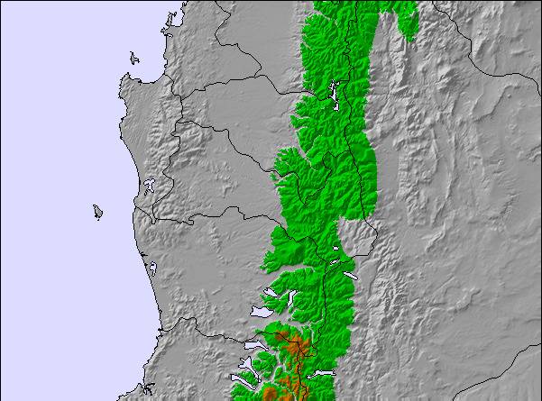
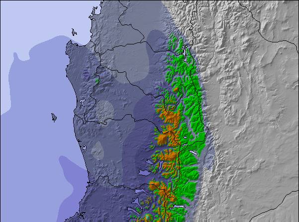
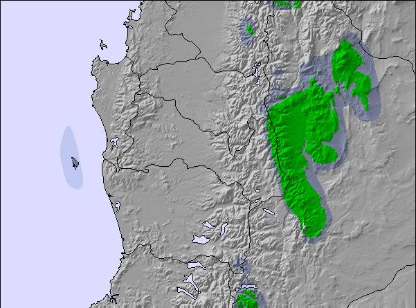
Snow map |  |  |  |  |  |  |  | ||||||||||||||
— | 2.0 | 6 | 1.0 | 1.0 | 10 | 3 | 6 | 10 | 3 | 2.0 | 5 | 3 | 2.0 | — | — | — | 8 | 16 | 13 | 14 | |
— | 1.0 | 11 | — | 6 | 9 | — | — | — | — | — | — | — | 4 | 13 | 3 | 3 | 7 | — | — | 5 | |
max°C | 5 | 3 | 2 | 2 | 2 | 2 | -3 | -2 | -1 | 0 | 1 | 1 | 1 | 2 | 2 | 3 | 4 | 4 | 1 | 0 | 1 |
min°C | 2 | 0 | 1 | 1 | 1 | -2 | -3 | -2 | -2 | -1 | 0 | 1 | 1 | 2 | 2 | 2 | 4 | 1 | 0 | 0 | 0 |
-3 | -7 | -6 | -5 | -5 | -9 | -10 | -10 | -11 | -9 | -8 | -7 | -6 | -5 | -5 | -5 | -2 | -4 | -6 | -6 | -6 | |
41 | 98 | 99 | 98 | 99 | 99 | 97 | 99 | 100 | 100 | 100 | 100 | 100 | 100 | 97 | 97 | 96 | 98 | 100 | 100 | 100 | |
2400 | 1700 | 1800 | 1750 | 1850 | 1550 | 1100 | 1200 | 1400 | 1500 | 1650 | 1700 | 1700 | 1850 | 1800 | 1950 | 2150 | 2100 | 1700 | 1700 | 1700 | |
7:24 | — | — | 7:26 | — | — | 7:26 | — | — | 7:28 | — | — | 7:28 | — | — | 7:30 | — | — | 7:31 | — | — | |
— | 6:05 | — | — | 6:04 | — | — | 6:02 | — | — | 6:00 | — | — | 6:00 | — | — | 5:59 | — | — | 5:58 | — | |
Next 0-3 days weather summary:
A heavy fall of snow, heaviest during Wed night. Becoming milder with heavy rain (total 27.0mm) on Thu night. Freeze-thaw conditions (max 5°C on Wed morning, min -3°C on Fri morning). Winds increasing (moderate winds from the NNW on Wed morning, near gales from the WNW by Thu night).
Next 4-6 days weather summary:
Heavy rain (total 30.0mm) on Sun night. Becoming colder with heavy fall of snow, heaviest during Mon night. Freeze-thaw conditions (max 4°C on Mon afternoon, min -1°C on Sat morning). Mainly gales.
Popular Villarrica-Pucon Pages
Snow Radar
Latest snow reports near Villarrica-Pucon:
Villarrica-Pucon Snow Conditions
| Top snow depth: | 0 cm |
|---|---|
| Bottom snow depth: | 0 cm |
| Fresh snowfall depth: | 20 cm |
| Last snowfall: | 22 Apr 2024 |
| Snow Alerts | Create Alert |
Other resorts in Chile are reporting: powder (0) / good piste (0)
Snow-Forecast Partner Offers
Show your business here
Snow History
Week 4 of April has on average:
0.0 | Bluebird Powder days Fresh snow, mostly sunny, light wind. |
|---|---|
0.4 | Powder days Fresh snow, limited sun, any wind. |
0.0 | Bluebird days Average snow, mostly sunny, light wind. |
Villarrica-Pucon Forecast Snowfall
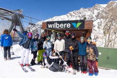
Photos of Villarrica-Pucon
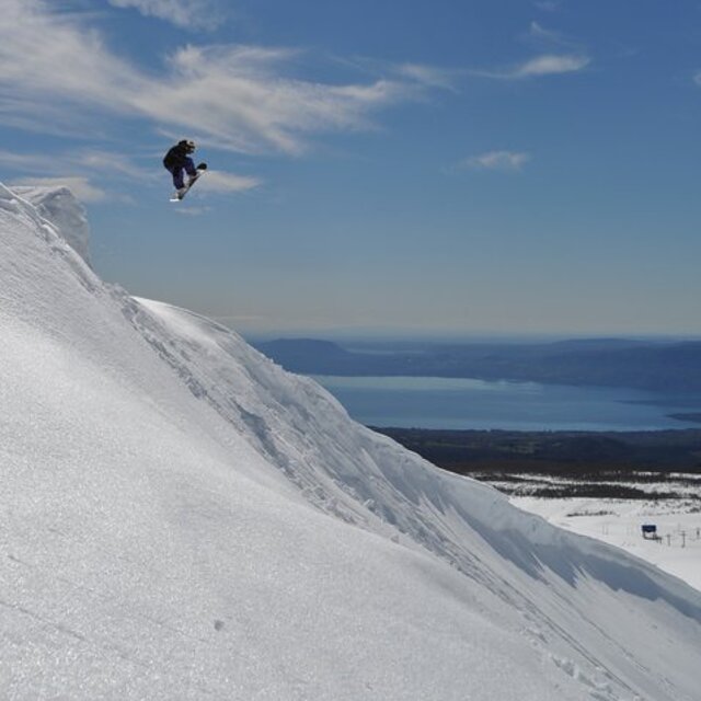
Raul Reyes ( fino ) by Raul Reyes
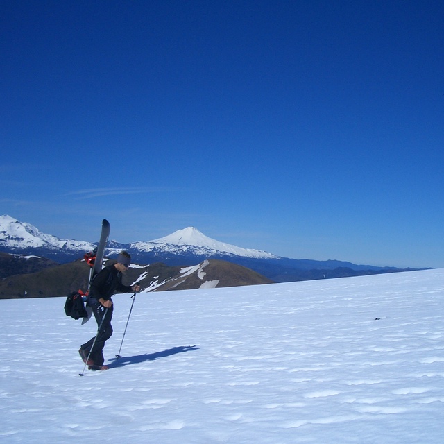
Volcan Lonquimay Oct 2005 (Chile) by xabi....
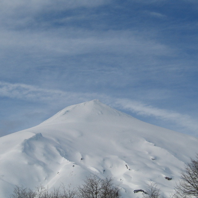
villarica volcano, chile by dunclogie
Other resorts in Chile are reporting: powder (0) / good piste (0)
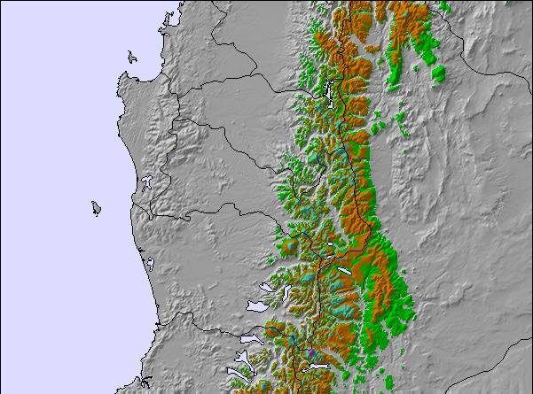
The above table gives the weather forecast for Villarrica-Pucon at the specific elevation of 1480 m. Our sophisticated weather models allow us to provide snow forecasts for the top, middle and bottom ski stations of Villarrica-Pucon. To access the weather forecasts for the other elevations, use the tab navigation above the table. For a wider view of the weather, check out the Weather Map of Chile.
Click here to read further information on freezing levels and how we forecast our temperatures.
Visitor Reviews of Villarrica-Pucon
Overall 3.5 Based on 14 votes and 6 reviews
- Snowsure
- Variety of pistes
- Vote
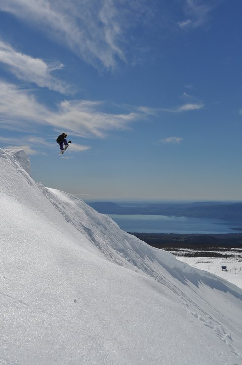
- partner0 from Chile writes:
Pucon (Villarrica-Pucon) is a very entertaining ski resort for advanced snowboarders, even if the resort slopes are flat to the extreme. Also, the snow is not that great (wet and heavy most of the time and lots of wind), but that is what you get from that point and further south. On the other hand, there are plenty of natural features literally all over the place that can be very entertaining. Lots of them very easy to access and very few people actually go there. There are nice cliff jumps (10-15 feet), huge wind lips and all of them with steep reception on 100-200 yards. Just perfect for big jumps :). The landscapes are absolutely breathtaking and the hike to the crater not technical but very entertaining and physical. When there is fresh snowfalls you should prefer Corralco or Termas de Chillan, but otherwise my destination of choice is Pucon (Villarrica-Pucon).
Visitor Reviews of Villarrica-Pucon
partner0 from Chile writes:
Pucon (Villarrica-Pucon) is a very entertaining ski resort for advanced snowboarders, even if the resort slopes are flat to the extreme. Also, the snow is not that great (wet and heavy most of the time and lots of wind), but that is what you get from that point and further south. On the other hand, there are plenty of natural features literally all over the place that can be very entertaining. Lots of them very easy to access and very few people actually go there. There are nice cliff jumps (10-15 feet), huge wind lips and all of them with steep reception on 100-200 yards. Just perfect for big jumps :). The landscapes are absolutely breathtaking and the hike to the crater not technical but very entertaining and physical.
When there is fresh snowfalls you should prefer Corralco or Termas de Chillan, but otherwise my destination of choice is Pucon (Villarrica-Pucon).
Free Snow-Forecast.com weather widget for your website
The Villarrica-Pucon skiing weather widget is available to embed on external websites free of charge. It provides a daily summary of our Villarrica-Pucon snow forecast and current weather conditions. Simply go to the feed configuration page and follow the 3 simple steps to grab the custom html code snippet and paste it into your own site. You can choose the snow forecast elevation (summit, mid-mountain or bottom lift) and metric/imperial units for the snow forecast feed to suit your own website…. Click here to get the code.
View detailed snow forecast for Villarrica-Pucon at:
snow-forecast.com

 Nearest