
Ski Hire by Intersport
CODE: FORECASTSKI


Peyragudes Weather (Next 3 days): The snow forecast for Peyragudes is: A moderate fall of snow, heaviest on Thu night. Freeze-thaw conditions (max 2°C on Fri afternoon, min -6°C on Wed morning). Wind will be generally light.
Peyragudes Weather (Days 4-6): A heavy fall of snow, heaviest during Mon night. Freeze-thaw conditions (max 2°C on Sun afternoon, min -2°C on Sat night). Winds decreasing (fresh winds from the S on Sat afternoon, calm by Mon night).
| Resort | Snow Depth | Temp. (°C) | Wind (km/h) | Weather | ||
|---|---|---|---|---|---|---|
| Top Lift: | 0.0 m | -7 | ||||
| Middle Lift: | -6 | |||||
| Bottom Lift: | 0.0 m | -6 |
Latest snow reports near Peyragudes:
Continuous light snow reported from Refugio Angel Orus (Eriste) at 2375 metres elevation 8 kms W of Cerler Ski Resort from Cerler

Wednesday 24 | Thursday 25 | Friday 26 | Saturday 27 | Sunday 28 | Monday 29 | Tuesday 30 | |||||||||||||||
AM | PM | night | AM | PM | night | AM | PM | night | AM | PM | night | AM | PM | night | AM | PM | night | AM | PM | night | |
some clouds | some clouds | cloudy | cloudy | light snow | heavy snow | light snow | light snow | light snow | light snow | light snow | snow shwrs | some clouds | snow shwrs | snow shwrs | light snow | light snow | heavy snow | light snow | light rain | light snow | |
km/h | |||||||||||||||||||||
Snow map |  | 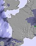 | 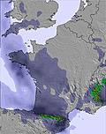 | 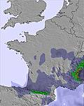 |  |  |  | ||||||||||||||
— | — | — | — | 1.0 | 10 | 1.0 | — | 4 | 4 | 5 | 1.0 | — | — | — | — | 4 | 12 | — | — | 1.0 | |
— | — | — | — | — | — | — | — | — | — | — | — | — | — | — | — | — | — | — | 2.0 | 2.0 | |
max°C | -3 | 0 | 0 | 0 | 1 | -1 | -1 | 2 | 1 | 1 | 1 | 0 | 1 | 2 | 1 | 1 | 1 | 2 | 3 | 3 | 3 |
min°C | -6 | -1 | -3 | -2 | 0 | -2 | -2 | 1 | 0 | 0 | 1 | -2 | -1 | 1 | -2 | 1 | 1 | 0 | 2 | 3 | 2 |
-12 | -5 | -6 | -2 | 0 | -2 | -2 | -2 | -5 | -6 | -5 | -8 | -6 | -2 | -2 | 1 | 0 | 0 | -1 | 3 | 0 | |
72 | 73 | 79 | 70 | 93 | 98 | 90 | 85 | 95 | 95 | 93 | 75 | 73 | 82 | 84 | 94 | 99 | 99 | 92 | 99 | 98 | |
1500 | 2050 | 1700 | 1950 | 1950 | 1750 | 1850 | 2200 | 2100 | 2200 | 2100 | 1850 | 2100 | 2250 | 1700 | 2200 | 2150 | 2200 | 2550 | 2600 | 2450 | |
7:01 | — | — | 7:00 | — | — | 6:58 | — | — | 6:56 | — | — | 6:56 | — | — | 6:54 | — | — | 6:52 | — | — | |
— | — | 8:51 | — | — | 8:52 | — | — | 8:52 | — | — | 8:53 | — | — | 8:54 | — | — | 8:55 | — | — | 8:57 | |
A moderate fall of snow, heaviest on Thu night. Freeze-thaw conditions (max 2°C on Fri afternoon, min -6°C on Wed morning). Wind will be generally light.
A heavy fall of snow, heaviest during Mon night. Freeze-thaw conditions (max 2°C on Sun afternoon, min -2°C on Sat night). Winds decreasing (fresh winds from the S on Sat afternoon, calm by Mon night).
Latest snow reports near Peyragudes:
Continuous light snow reported from Refugio Angel Orus (Eriste) at 2375 metres elevation 8 kms W of Cerler Ski Resort from Cerler
| Top snow depth: | 0 cm |
|---|---|
| Bottom snow depth: | 0 cm |
| Fresh snowfall depth: | 12 cm |
| Last snowfall: | 23 Apr 2024 |
| Snow Alerts | Create Alert |
0.4 | Bluebird Powder days Fresh snow, mostly sunny, light wind. |
|---|---|
0.6 | Powder days Fresh snow, limited sun, any wind. |
0.1 | Bluebird days Average snow, mostly sunny, light wind. |
The above table gives the weather forecast for Peyragudes at the specific elevation of 2000 m. Our sophisticated weather models allow us to provide snow forecasts for the top, middle and bottom ski stations of Peyragudes. To access the weather forecasts for the other elevations, use the tab navigation above the table. For a wider view of the weather, check out the Weather Map of France.
Click here to read further information on freezing levels and how we forecast our temperatures.
Overall 3.8 Based on 11 votes and 13 reviews
J'ai beau être désolé pour le desastre de cette saison et j'ai beau comprendre les dificultés des stations des Pyrénées avec ce manque de neige ça me met un peu les boules que les webcams de peyragudes soit éliminés ou recadrées dès que l'on s'apecoit qu'il n'ya absolument de neige sur la station! S'il ne neige pas bientôt on n'aura plus qu'une webcam sur une tartiflette qui cuit!!!
kito from France writes:
J'ai beau être désolé pour le desastre de cette saison et j'ai beau comprendre les dificultés des stations des Pyrénées avec ce manque de neige ça me met un peu les boules que les webcams de peyragudes soit éliminés ou recadrées dès que l'on s'apecoit qu'il n'ya absolument de neige sur la station! S'il ne neige pas bientôt on n'aura plus qu'une webcam sur une tartiflette qui cuit!!!
The Peyragudes skiing weather widget is available to embed on external websites free of charge. It provides a daily summary of our Peyragudes snow forecast and current weather conditions. Simply go to the feed configuration page and follow the 3 simple steps to grab the custom html code snippet and paste it into your own site. You can choose the snow forecast elevation (summit, mid-mountain or bottom lift) and metric/imperial units for the snow forecast feed to suit your own website…. Click here to get the code.
View detailed snow forecast for Peyragudes at:
snow-forecast.com


 Nearest