


View forecast
Mont Sutton at 511 m altitude
Issued by Snow-Forecast.com at: 1 pm (local time) / 19 Apr 2024
Now
Fri 19 | Saturday 20 | Sunday 21 | Monday 22 | Tuesday 23 | Wednesday 24 | Thursday 25 | ||||||||||||||
PM | night | AM | PM | night | AM | PM | night | AM | PM | night | AM | PM | night | AM | PM | night | AM | PM | night | |
light rain | light rain | light rain | light rain | snow shwrs | light snow | light rain | snow shwrs | clear | clear | some clouds | cloudy | cloudy | mod. rain | light rain | light rain | heavy snow | light snow | light snow | light snow | |
km/h | ||||||||||||||||||||
Snow map |  |  |  |  |  |  |  | |||||||||||||
— | — | — | — | — | 1.0 | — | 1.0 | — | — | — | — | — | — | — | — | 11 | 1.0 | 1.0 | 4 | |
1.0 | 3 | 2.0 | 4 | — | — | 2.0 | 1.0 | — | — | — | — | — | 8 | 4 | 2.0 | 6 | — | — | — | |
max°C | 11 | 9 | 5 | 5 | 1 | 1 | 4 | 3 | -3 | 1 | -1 | 9 | 11 | 8 | 5 | 7 | 5 | -2 | 0 | -1 |
min°C | 10 | 4 | 3 | 3 | -1 | -1 | 3 | -6 | -7 | 0 | -3 | 3 | 9 | 5 | 5 | 6 | -4 | -4 | -1 | -1 |
6 | 0 | -1 | -2 | -6 | -6 | -2 | -13 | -14 | -6 | -7 | -1 | 5 | 1 | 1 | 1 | -7 | -4 | -4 | -3 | |
73 | 84 | 67 | 83 | 88 | 91 | 66 | 78 | 46 | 43 | 62 | 57 | 64 | 93 | 93 | 92 | 97 | 91 | 95 | 99 | |
2650 | 1300 | 1000 | 900 | 450 | 550 | 950 | 200 | 0 | 600 | 0 | 1550 | 1800 | 1700 | 1800 | 1700 | 0 | 150 | 450 | 300 | |
— | — | 5:54 | — | — | 5:54 | — | — | 5:52 | — | — | 5:50 | — | — | 5:48 | — | — | 5:47 | — | — | |
7:40 | — | — | 7:42 | — | — | 7:44 | — | — | 7:45 | — | — | 7:45 | — | — | 7:47 | — | — | 7:49 | — | |
Next 0-3 days weather summary:
Moderate rain (total 13.0mm) heaviest on Sat afternoon, then becoming colder with a dusting of snow on Sun night. Freeze-thaw conditions (max 11°C on Fri afternoon, min -7°C on Mon morning). Winds increasing (light winds from the W on Sat night, fresh winds from the W by Sun night).
Next 4-6 days weather summary:
Mild with heavy rain (total 20.0mm), heaviest during Wed night. Becoming colder with a moderate fall of snow heaviest on Wed night. Freeze-thaw conditions (max 11°C on Tue afternoon, min -4°C on Wed night). Winds decreasing (fresh winds from the S on Wed afternoon, calm by Thu morning).
Popular Mont Sutton Pages
Snow Radar
Latest snow reports near Mont Sutton:
Mont Sutton Snow Conditions
| Top snow depth: | 0 cm |
|---|---|
| Bottom snow depth: | 0 cm |
| Fresh snowfall depth: | — |
| Last snowfall: | 13 Apr 2024 |
| Snow Alerts | Create Alert |
Other resorts in Canada - Quebec are reporting: powder (0) / good piste (0)
Snow-Forecast Partner Offers
Show your business here
Snow History
Week 3 of April has on average:
0.2 | Bluebird Powder days Fresh snow, mostly sunny, light wind. |
|---|---|
0.5 | Powder days Fresh snow, limited sun, any wind. |
0.4 | Bluebird days Average snow, mostly sunny, light wind. |

Mont Sutton Forecast Snowfall


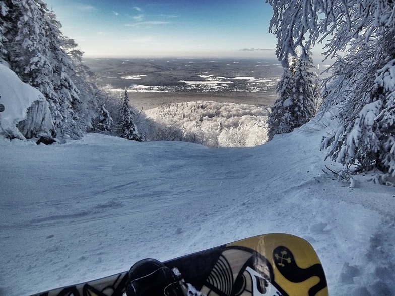
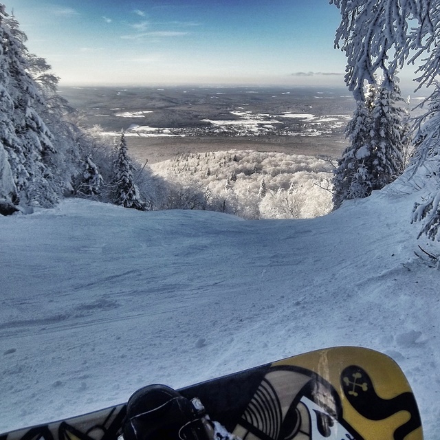
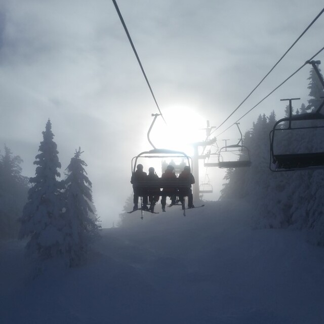
Photos of Mont Sutton
Nice opening run by Jean Gaudet
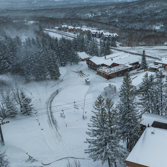
Mont SUTTON main buildings by Mont SUTTON
Mt-Sutton by Franzz
Other resorts in Canada - Quebec are reporting: powder (0) / good piste (0)
The above table gives the weather forecast for Mont Sutton at the specific elevation of 511 m. Our sophisticated weather models allow us to provide snow forecasts for the top, middle and bottom ski stations of Mont Sutton. To access the weather forecasts for the other elevations, use the tab navigation above the table. For a wider view of the weather, check out the Weather Map of Canada.
Click here to read further information on freezing levels and how we forecast our temperatures.
Visitor Reviews of Mont Sutton
Overall 4.0 Based on 7 votes and 4 reviews
- Snowsure
- Variety of pistes
- Vote
- Olivier from Canada writes:
Je vous encourage fortement a y aller. cette année, il est tomber plus de 400 cm à la base de la montagne, de neige au 25 Février 2010. Il vient de neiger 125 cm de neige à la base, et il tombe généralement 60 cm par semaine!:D
Visitor Reviews of Mont Sutton
Olivier from Canada writes:
Je vous encourage fortement a y aller. cette année, il est tomber plus de 400 cm à la base de la montagne, de neige au 25 Février 2010. Il vient de neiger 125 cm de neige à la base, et il tombe généralement 60 cm par semaine!:D
Free Snow-Forecast.com weather widget for your website
The Mont Sutton skiing weather widget is available to embed on external websites free of charge. It provides a daily summary of our Mont Sutton snow forecast and current weather conditions. Simply go to the feed configuration page and follow the 3 simple steps to grab the custom html code snippet and paste it into your own site. You can choose the snow forecast elevation (summit, mid-mountain or bottom lift) and metric/imperial units for the snow forecast feed to suit your own website…. Click here to get the code.
View detailed snow forecast for Mont Sutton at:
snow-forecast.com

 Nearest