
Ski Lessons by SkiBro
BOOK NOW
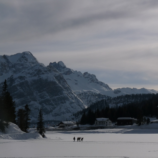
Ski lessons in Misurina
Book now


Misurina Weather (Next 3 days): The snow forecast for Misurina is: Mild at first with light rain (total 2.0mm) on Tue morning followed by colder weather and light fall of snow, heaviest on Tue afternoon. Freeze-thaw conditions (max 3°C on Tue morning, min -7°C on Tue night). Wind will be generally light.
Misurina Weather (Days 4-6): A light covering of new snow, mostly falling on Fri night. Temperatures will be below freezing (max -1°C on Fri afternoon, min -7°C on Sat night). Wind will be generally light.
| Resort | Snow Depth | Temp. (°C) | Wind (km/h) | Weather | ||
|---|---|---|---|---|---|---|
| Top Lift: | 3 | |||||
| Middle Lift: | 4 | |||||
| Bottom Lift: | 5 |
Latest snow reports near Misurina:
Rain reported from Virgen at 1198 metres elevation 6 kms ESE of Prägraten am Großvenediger but it is forecast cold enough for snow at the ski area from Prägraten am Großvenediger
Light rain showers reported from Virgen at 1198 metres elevation 6 kms ESE of Prägraten am Großvenediger but it is forecast cold enough for snow at the ski area from Prägraten am Großvenediger

Tuesday 16 | Wednesday 17 | Thursday 18 | Friday 19 | Saturday 20 | Sunday 21 | Monday 22 | |||||||||||||||
AM | PM | night | AM | PM | night | AM | PM | night | AM | PM | night | AM | PM | night | AM | PM | night | AM | PM | night | |
light snow | mod. snow | snow shwrs | light snow | light snow | light snow | light snow | light snow | snow shwrs | some clouds | light snow | light snow | light snow | light snow | snow shwrs | snow shwrs | light snow | snow shwrs | cloudy | light snow | snow shwrs | |
km/h | |||||||||||||||||||||
Snow map |  |  |  |  |  |  |  | ||||||||||||||
2.0 | 6 | — | — | 2.0 | 1.0 | — | 2.0 | — | — | — | 3 | 1.0 | 2.0 | — | — | 2.0 | 1.0 | — | — | — | |
2.0 | — | — | — | — | — | — | — | — | — | — | — | — | — | — | — | — | — | — | — | — | |
max°C | 3 | -2 | -3 | -2 | -1 | -4 | -4 | -2 | -5 | -3 | -1 | -4 | -3 | -1 | -4 | -2 | -2 | -5 | -3 | 0 | -3 |
min°C | -1 | -2 | -7 | -5 | -2 | -6 | -5 | -2 | -7 | -5 | -2 | -5 | -4 | -2 | -7 | -5 | -2 | -7 | -6 | -1 | -4 |
-1 | -6 | -11 | -10 | -6 | -6 | -5 | -5 | -11 | -8 | -4 | -7 | -7 | -5 | -10 | -8 | -2 | -10 | -10 | -4 | -7 | |
94 | 77 | 78 | 66 | 68 | 79 | 64 | 53 | 78 | 43 | 66 | 97 | 74 | 54 | 81 | 52 | 61 | 77 | 51 | 44 | 78 | |
1650 | 1750 | 850 | 1700 | 1700 | 1150 | 1550 | 1700 | 950 | 1650 | 1750 | 1150 | 1700 | 1800 | 850 | 1700 | 1750 | 900 | 1650 | 1950 | 1200 | |
6:20 | — | — | 6:18 | — | — | 6:16 | — | — | 6:16 | — | — | 6:13 | — | — | 6:11 | — | — | 6:09 | — | — | |
— | — | 8:00 | — | — | 8:01 | — | — | 8:02 | — | — | 8:04 | — | — | 8:06 | — | — | 8:07 | — | — | 8:07 | |
Mild at first with light rain (total 2.0mm) on Tue morning followed by colder weather and light fall of snow, heaviest on Tue afternoon. Freeze-thaw conditions (max 3°C on Tue morning, min -7°C on Tue night). Wind will be generally light.
A light covering of new snow, mostly falling on Fri night. Temperatures will be below freezing (max -1°C on Fri afternoon, min -7°C on Sat night). Wind will be generally light.
Latest snow reports near Misurina:
Rain reported from Virgen at 1198 metres elevation 6 kms ESE of Prägraten am Großvenediger but it is forecast cold enough for snow at the ski area from Prägraten am Großvenediger
Light rain showers reported from Virgen at 1198 metres elevation 6 kms ESE of Prägraten am Großvenediger but it is forecast cold enough for snow at the ski area from Prägraten am Großvenediger
| Top snow depth: | — |
|---|---|
| Bottom snow depth: | — |
| Fresh snowfall depth: | — |
| Last snowfall: | 10 Apr 2024 |
| Snow Alerts | Create Alert |
0.4 | Bluebird Powder days Fresh snow, mostly sunny, light wind. |
|---|---|
0.6 | Powder days Fresh snow, limited sun, any wind. |
0.4 | Bluebird days Average snow, mostly sunny, light wind. |
The above table gives the weather forecast for Misurina at the specific elevation of 1978 m. Our sophisticated weather models allow us to provide snow forecasts for the top, middle and bottom ski stations of Misurina. To access the weather forecasts for the other elevations, use the tab navigation above the table. For a wider view of the weather, check out the Weather Map of Italy.
Click here to read further information on freezing levels and how we forecast our temperatures.
The Misurina skiing weather widget is available to embed on external websites free of charge. It provides a daily summary of our Misurina snow forecast and current weather conditions. Simply go to the feed configuration page and follow the 3 simple steps to grab the custom html code snippet and paste it into your own site. You can choose the snow forecast elevation (summit, mid-mountain or bottom lift) and metric/imperial units for the snow forecast feed to suit your own website…. Click here to get the code.
View detailed snow forecast for Misurina at:
snow-forecast.com


 Nearest