
Ski Lessons by SkiBro
BOOK NOW
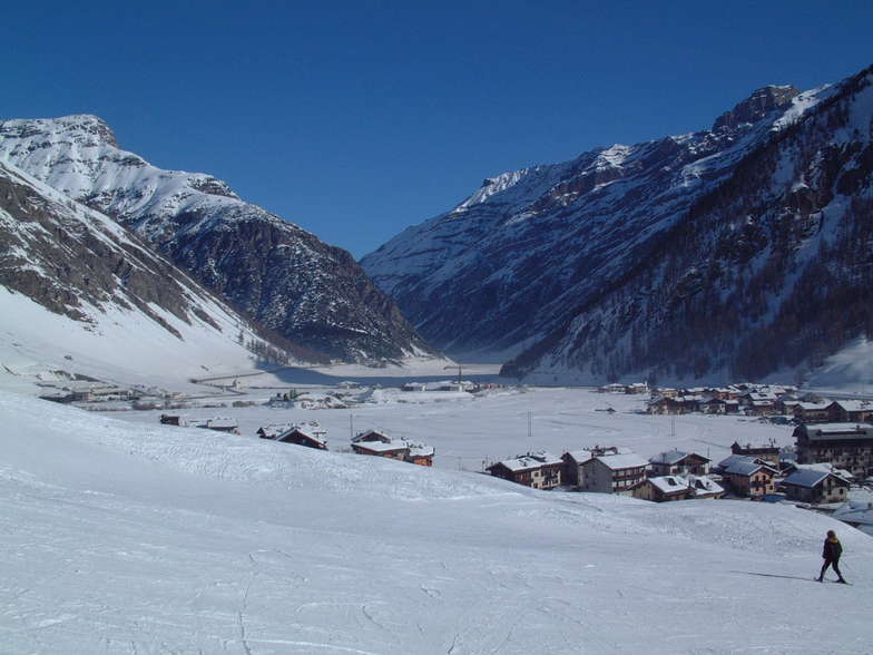
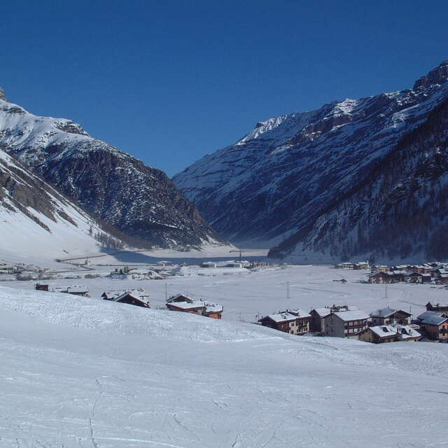
Ski lessons in Livigno
Book now


Livigno Weather (Next 3 days): The snow forecast for Livigno is: A moderate fall of snow, heaviest on Mon afternoon. Temperatures will be well below freezing (max -7°C on Fri night, min -13°C on Sat night). Wind will be generally light.
Livigno Weather (Days 4-6): A light covering of new snow, mostly falling on Mon night. Temperatures will be well below freezing (max -6°C on Thu afternoon, min -12°C on Mon night). Wind will be generally light.
| Resort | Snow Depth | Temp. (°C) | Wind (km/h) | Weather | ||
|---|---|---|---|---|---|---|
| Top Lift: | 1.6 m | -8 | ||||
| Middle Lift: | -5 | |||||
| Bottom Lift: | 0.19 m | -2 |
Latest snow reports near Livigno:
Light snow reported from Samedan at 1710 metres elevation one km NE of Celerina/Engadin Ski Resort from Celerina/Engadin
Rain reported from Galtür at 1577 metres elevation SSW of Galtur-Silvapark but it is forecast cold enough for snow at the ski area from Galtur-Silvapark

Saturday 20 | Sunday 21 | Monday 22 | Tuesday 23 | Wednesday 24 | Thursday 25 | ||||||||||||||
night | AM | PM | night | AM | PM | night | AM | PM | night | AM | PM | night | AM | PM | night | AM | PM | night | |
mod. snow | light snow | light snow | snow shwrs | snow shwrs | light snow | light snow | light snow | light snow | light snow | light snow | light snow | light snow | cloudy | cloudy | light snow | light snow | light snow | light snow | |
km/h | |||||||||||||||||||
Snow map |  |  |  |  |  |  |  | ||||||||||||
7 | 1.0 | 1.0 | — | — | 2.0 | 2.0 | — | 5 | 5 | — | 1.0 | — | — | — | — | — | 2.0 | 1.0 | |
— | — | — | — | — | — | — | — | — | — | — | — | — | — | — | — | — | — | — | |
max°C | -7 | -12 | -11 | -12 | -12 | -11 | -12 | -11 | -9 | -10 | -12 | -10 | -11 | -11 | -8 | -9 | -8 | -6 | -7 |
min°C | -11 | -12 | -11 | -13 | -13 | -11 | -12 | -12 | -9 | -12 | -12 | -10 | -12 | -12 | -9 | -9 | -9 | -6 | -8 |
-19 | -20 | -20 | -19 | -19 | -16 | -19 | -12 | -9 | -15 | -17 | -16 | -20 | -20 | -12 | -12 | -14 | -11 | -12 | |
92 | 79 | 77 | 75 | 80 | 89 | 94 | 93 | 95 | 93 | 98 | 91 | 81 | 93 | 77 | 81 | 94 | 95 | 96 | |
1450 | 1300 | 1400 | 400 | 1250 | 1400 | 850 | 1350 | 1500 | 600 | 1200 | 1550 | 550 | 1350 | 1750 | 1200 | 1750 | 2000 | 1550 | |
— | 6:22 | — | — | 6:20 | — | — | 6:18 | — | — | 6:16 | — | — | 6:16 | — | — | 6:13 | — | — | |
— | — | — | 8:14 | — | — | 8:15 | — | — | 8:16 | — | — | 8:17 | — | — | 8:20 | — | — | 8:21 | |
A moderate fall of snow, heaviest on Mon afternoon. Temperatures will be well below freezing (max -7°C on Fri night, min -13°C on Sat night). Wind will be generally light.
A light covering of new snow, mostly falling on Mon night. Temperatures will be well below freezing (max -6°C on Thu afternoon, min -12°C on Mon night). Wind will be generally light.
Latest snow reports near Livigno:
Light snow reported from Samedan at 1710 metres elevation one km NE of Celerina/Engadin Ski Resort from Celerina/Engadin
Rain reported from Galtür at 1577 metres elevation SSW of Galtur-Silvapark but it is forecast cold enough for snow at the ski area from Galtur-Silvapark
| Top snow depth: | 161 cm |
|---|---|
| Bottom snow depth: | 19 cm |
| Fresh snowfall depth: | 4 cm |
| Last snowfall: | 18 Apr 2024 |
| Snow Alerts | Create Alert |
0.8 | Bluebird Powder days Fresh snow, mostly sunny, light wind. |
|---|---|
3.4 | Powder days Fresh snow, limited sun, any wind. |
0.7 | Bluebird days Average snow, mostly sunny, light wind. |
The above table gives the weather forecast for Livigno at the specific elevation of 2797 m. Our sophisticated weather models allow us to provide snow forecasts for the top, middle and bottom ski stations of Livigno. To access the weather forecasts for the other elevations, use the tab navigation above the table. For a wider view of the weather, check out the Weather Map of Italy.
Click here to read further information on freezing levels and how we forecast our temperatures.
Overall 4.6 Based on 60 votes and 77 reviews
Just leaving Livigno tomorrow (29/4/2019). I've been in a lot of ski resorts worldwide over the past 30 years but first time at Livigno. Granted that this is last week of season and weather and snow have been pretty poor. However, I see the problem here that could be at other times and certainly in high season is what do they do with all the skiers staying here. It certainly is one of the biggest ski towns in the Alps. However, it does not have the ski area to deal with this. Out of the published 115 km of piste I would say about a third of that is beginner slopes served by Pomas etc. It is one thing to have numerous high powered lifts but the people have to go somewhere. Beware of busy times !!
Andy cornish from United Kingdom writes:
Just leaving Livigno tomorrow (29/4/2019). I've been in a lot of ski resorts worldwide over the past 30 years but first time at Livigno. Granted that this is last week of season and weather and snow have been pretty poor. However, I see the problem here that could be at other times and certainly in high season is what do they do with all the skiers staying here. It certainly is one of the biggest ski towns in the Alps. However, it does not have the ski area to deal with this. Out of the published 115 km of piste I would say about a third of that is beginner slopes served by Pomas etc. It is one thing to have numerous high powered lifts but the people have to go somewhere. Beware of busy times !!
The Livigno skiing weather widget is available to embed on external websites free of charge. It provides a daily summary of our Livigno snow forecast and current weather conditions. Simply go to the feed configuration page and follow the 3 simple steps to grab the custom html code snippet and paste it into your own site. You can choose the snow forecast elevation (summit, mid-mountain or bottom lift) and metric/imperial units for the snow forecast feed to suit your own website…. Click here to get the code.
View detailed snow forecast for Livigno at:
snow-forecast.com


 Nearest