
Ski Lessons by SkiBro
BOOK NOW
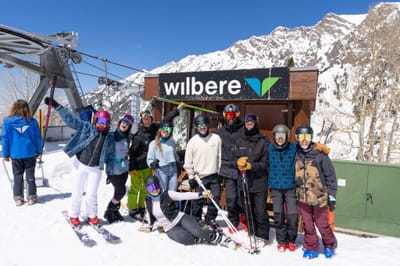
Ski lessons in Leogang
Book now


Leogang Weather (Next 3 days): The snow forecast for Leogang is: Moderate rain (total 10.0mm) heaviest on Wed morning, then becoming colder with a dusting of snow on Wed night. Freeze-thaw conditions (max 9°C on Fri afternoon, min -4°C on Tue night). Wind will be generally light.
Leogang Weather (Days 4-6): Some drizzle, heaviest during Fri night. Warm (max 20°C on Mon afternoon, min 1°C on Fri night). Wind will be generally light.
| Resort | Snow Depth | Temp. (°C) | Wind (km/h) | Weather | ||
|---|---|---|---|---|---|---|
| Top Lift: | -6 | |||||
| Middle Lift: | -4 | |||||
| Bottom Lift: | -1 |
Latest snow reports near Leogang:
Light rain showers reported from Loferer Alm at 1625 metres elevation 7 kms SSW of Unken/Heutal but it is forecast cold enough for snow at the ski area from Unken/Heutal
Rain reported from Bischofshofen at 550 metres elevation 8 kms S of Werfenweng but it is forecast cold enough for snow at the ski area from Werfenweng
Rain reported from Saalbach at 981 metres elevation only 3 kms NE of Saalbach Hinterglemm but it is forecast cold enough for snow at the ski area from Saalbach Hinterglemm

Wednesday 24 | Thursday 25 | Friday 26 | Saturday 27 | Sunday 28 | Monday 29 | ||||||||||||||
night | AM | PM | night | AM | PM | night | AM | PM | night | AM | PM | night | AM | PM | night | AM | PM | night | |
light snow | light snow | light rain | light snow | light rain | light rain | snow shwrs | clear | light rain | rain shwrs | clear | clear | clear | clear | some clouds | cloudy | cloudy | cloudy | clear | |
km/h | |||||||||||||||||||
Snow map |  |  |  |  |  |  |  | ||||||||||||
1.0 | — | — | 1.0 | — | — | — | — | — | — | — | — | — | — | — | — | — | — | — | |
— | 1.0 | 2.0 | 1.0 | 1.0 | 2.0 | 1.0 | — | 2.0 | 1.0 | — | — | — | — | — | — | — | — | — | |
max°C | 1 | 3 | 4 | 2 | 4 | 5 | 3 | 7 | 9 | 4 | 10 | 13 | 7 | 13 | 16 | 10 | 17 | 20 | 13 |
min°C | -4 | 0 | 4 | -2 | 1 | 5 | -2 | 2 | 9 | 1 | 5 | 13 | 4 | 8 | 15 | 7 | 11 | 20 | 8 |
-4 | 0 | 2 | -2 | 1 | 4 | -5 | 0 | 9 | -2 | 3 | 12 | 1 | 6 | 15 | 5 | 11 | 20 | 7 | |
98 | 81 | 74 | 97 | 73 | 85 | 92 | 69 | 63 | 83 | 64 | 61 | 84 | 63 | 56 | 76 | 54 | 54 | 81 | |
400 | 1150 | 1450 | 800 | 1300 | 1500 | 950 | 1850 | 2050 | 1600 | 2300 | 2550 | 2550 | 2900 | 3050 | 3500 | 3500 | 3350 | 3400 | |
— | 6:03 | — | — | 6:01 | — | — | 6:00 | — | — | 5:58 | — | — | 5:56 | — | — | 5:54 | — | — | |
— | — | — | 8:10 | — | — | 8:12 | — | — | 8:14 | — | — | 8:15 | — | — | 8:15 | — | — | 8:17 | |
Moderate rain (total 10.0mm) heaviest on Wed morning, then becoming colder with a dusting of snow on Wed night. Freeze-thaw conditions (max 9°C on Fri afternoon, min -4°C on Tue night). Wind will be generally light.
Some drizzle, heaviest during Fri night. Warm (max 20°C on Mon afternoon, min 1°C on Fri night). Wind will be generally light.
Latest snow reports near Leogang:
Light rain showers reported from Loferer Alm at 1625 metres elevation 7 kms SSW of Unken/Heutal but it is forecast cold enough for snow at the ski area from Unken/Heutal
Rain reported from Bischofshofen at 550 metres elevation 8 kms S of Werfenweng but it is forecast cold enough for snow at the ski area from Werfenweng
Rain reported from Saalbach at 981 metres elevation only 3 kms NE of Saalbach Hinterglemm but it is forecast cold enough for snow at the ski area from Saalbach Hinterglemm
| Top snow depth: | — |
|---|---|
| Bottom snow depth: | — |
| Fresh snowfall depth: | 10 cm |
| Last snowfall: | 22 Apr 2024 |
| Snow Alerts | Create Alert |
0.0 | Bluebird Powder days Fresh snow, mostly sunny, light wind. |
|---|---|
0.0 | Powder days Fresh snow, limited sun, any wind. |
0.0 | Bluebird days Average snow, mostly sunny, light wind. |
The above table gives the weather forecast for Leogang at the specific elevation of 800 m. Our sophisticated weather models allow us to provide snow forecasts for the top, middle and bottom ski stations of Leogang. To access the weather forecasts for the other elevations, use the tab navigation above the table. For a wider view of the weather, check out the Weather Map of Austria.
Click here to read further information on freezing levels and how we forecast our temperatures.
Tiny and very quiet village, with great back door access to Saalbach's slopes. We liked it, and were lucky with the snow. Would recommend the hotel Salzburgerhof, which has a great wellness area and is about, oooh, 50m from the cable car.
Nerys Roberts from United Kingdom writes:
Tiny and very quiet village, with great back door access to Saalbach's slopes. We liked it, and were lucky with the snow. Would recommend the hotel Salzburgerhof, which has a great wellness area and is about, oooh, 50m from the cable car.
The Leogang skiing weather widget is available to embed on external websites free of charge. It provides a daily summary of our Leogang snow forecast and current weather conditions. Simply go to the feed configuration page and follow the 3 simple steps to grab the custom html code snippet and paste it into your own site. You can choose the snow forecast elevation (summit, mid-mountain or bottom lift) and metric/imperial units for the snow forecast feed to suit your own website…. Click here to get the code.
View detailed snow forecast for Leogang at:
snow-forecast.com


 Nearest