
Ski Hire by Skiset
extra 5% off
Kranjska Gora Weather (Next 3 days): The snow forecast for Kranjska Gora is: Mild at first with light rain (total 9.0mm) on Tue afternoon followed by colder weather and light fall of snow, heaviest on Tue afternoon. Freeze-thaw conditions (max 5°C on Thu afternoon, min 0°C on Tue morning). Wind will be generally light.
Kranjska Gora Weather (Days 4-6): Light rain (total 7.0mm), mostly falling on Fri morning. Very mild (max 14°C on Sun afternoon, min 3°C on Fri morning). Wind will be generally light.
| Resort | Snow Depth | Temp. (°C) | Wind (km/h) | Weather | ||
|---|---|---|---|---|---|---|
| Top Lift: | 0.0 m | -4 | ||||
| Middle Lift: | -1 | |||||
| Bottom Lift: | 0.0 m | 2 |
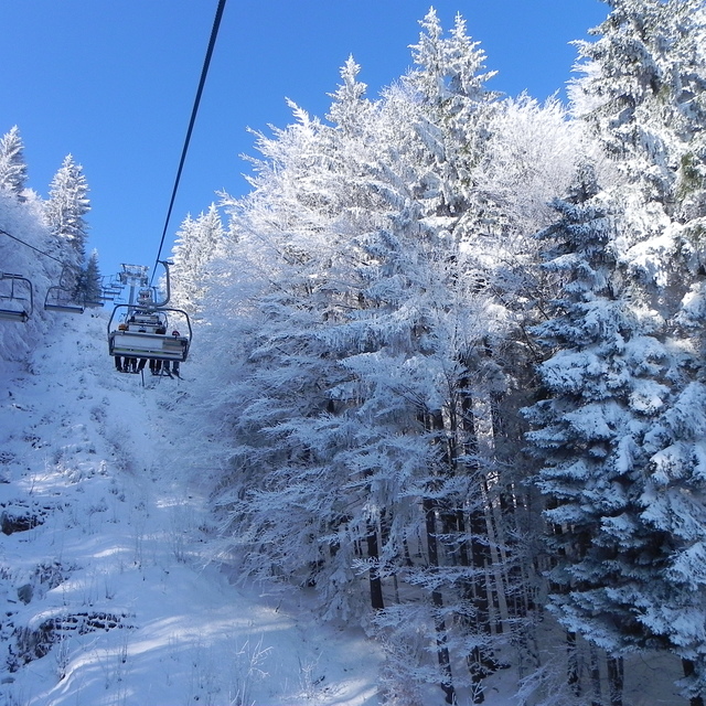
Latest snow reports near Kranjska Gora:
Intermittent light snow reported from Tarvisio Airport at 149 metres elevation only 2 kms SSW of Tarvisio Ski Resort from Tarvisio
Continuous light snow reported from Rateceplanica at 865 metres elevation only 3 kms SSE of Dreilaendereck Ski Resort from Dreilaendereck
Moderate to heavy freezing rain reported from Lescehlebce at 515 metres elevation 7 kms SE of Bled but it is forecast cold enough for snow at the ski area from Bled

Tuesday 23 | Wednesday 24 | Thursday 25 | Friday 26 | Saturday 27 | Sunday 28 | Monday 29 | |||||||||||||||
AM | PM | night | AM | PM | night | AM | PM | night | AM | PM | night | AM | PM | night | AM | PM | night | AM | PM | night | |
light snow | light snow | light snow | light snow | light rain | light snow | light snow | rain shwrs | rain shwrs | rain shwrs | light rain | some clouds | rain shwrs | rain shwrs | rain shwrs | some clouds | some clouds | some clouds | clear | clear | clear | |
km/h | |||||||||||||||||||||
Snow map |  |  |  |  |  |  |  | ||||||||||||||
1.0 | 2.0 | 4 | 1.0 | — | 4 | 1.0 | — | — | — | — | — | — | — | — | — | — | — | — | — | — | |
— | 2.0 | — | — | 2.0 | 1.0 | 1.0 | 2.0 | 1.0 | 1.0 | 2.0 | — | 1.0 | 2.0 | 1.0 | — | — | — | — | — | — | |
max°C | 2 | 2 | 1 | 2 | 4 | 2 | 3 | 5 | 2 | 6 | 7 | 4 | 7 | 10 | 7 | 11 | 14 | 9 | 16 | 19 | 13 |
min°C | 0 | 2 | 0 | 1 | 4 | 0 | 1 | 5 | 0 | 3 | 7 | 3 | 5 | 9 | 6 | 8 | 13 | 6 | 10 | 19 | 9 |
-3 | -1 | -2 | -1 | 4 | -2 | 0 | 5 | -2 | 1 | 6 | 1 | 3 | 7 | 4 | 6 | 12 | 4 | 10 | 19 | 9 | |
97 | 99 | 99 | 96 | 94 | 95 | 86 | 84 | 87 | 85 | 85 | 92 | 89 | 81 | 93 | 83 | 71 | 77 | 64 | 45 | 63 | |
1050 | 1100 | 1100 | 1050 | 1400 | 1000 | 1150 | 1500 | 1400 | 1550 | 1750 | 1600 | 1800 | 2200 | 2300 | 3000 | 3150 | 3400 | 3500 | 3400 | 3300 | |
6:03 | — | — | 6:01 | — | — | 5:58 | — | — | 5:58 | — | — | 5:56 | — | — | 5:54 | — | — | 5:52 | — | — | |
— | — | 8:02 | — | — | 8:05 | — | — | 8:06 | — | — | 8:07 | — | — | 8:08 | — | — | 8:09 | — | — | 8:10 | |
Mild at first with light rain (total 9.0mm) on Tue afternoon followed by colder weather and light fall of snow, heaviest on Tue afternoon. Freeze-thaw conditions (max 5°C on Thu afternoon, min 0°C on Tue morning). Wind will be generally light.
Light rain (total 7.0mm), mostly falling on Fri morning. Very mild (max 14°C on Sun afternoon, min 3°C on Fri morning). Wind will be generally light.
Latest snow reports near Kranjska Gora:
Intermittent light snow reported from Tarvisio Airport at 149 metres elevation only 2 kms SSW of Tarvisio Ski Resort from Tarvisio
Continuous light snow reported from Rateceplanica at 865 metres elevation only 3 kms SSE of Dreilaendereck Ski Resort from Dreilaendereck
Moderate to heavy freezing rain reported from Lescehlebce at 515 metres elevation 7 kms SE of Bled but it is forecast cold enough for snow at the ski area from Bled
| Top snow depth: | 0 cm |
|---|---|
| Bottom snow depth: | 0 cm |
| Fresh snowfall depth: | 15 cm |
| Last snowfall: | 22 Apr 2024 |
| Snow Alerts | Create Alert |
0.0 | Bluebird Powder days Fresh snow, mostly sunny, light wind. |
|---|---|
0.0 | Powder days Fresh snow, limited sun, any wind. |
0.0 | Bluebird days Average snow, mostly sunny, light wind. |
The above table gives the weather forecast for Kranjska Gora at the specific elevation of 810 m. Our sophisticated weather models allow us to provide snow forecasts for the top, middle and bottom ski stations of Kranjska Gora. To access the weather forecasts for the other elevations, use the tab navigation above the table. For a wider view of the weather, check out the Weather Map of Slovenia.
Click here to read further information on freezing levels and how we forecast our temperatures.
Overall 4.0 Based on 9 votes and 16 reviews
We just came back from a fantastic week at Kranjska Gora with loads of snow and some lovely sunny days. Whilst the skiing is quite limited in total size it worked well for our mixed group of kids (who went to the excellent ski school and enjoyed the plentiful nursery slopes) and intermediates - advanced adults who skied on the (empty!) world cup pistes on the Podkoren side of the resort and also managed a couple of trips to nearby resorts (we actually skied 3 resorts in 3 countries in 3 days!). The accessability of the pistes of Kranjska Gora is a blessing especially if you have kids and the prices make you wonder why you have put up with paying double in more "prestigious" resorts for so long! A shout to the team at Think Slovenia who sorted out excellent self catering accommodation for us in the lovely village of Ratece and arranged our tuition / ski hire. Would definitely return.
Jim from United Kingdom writes:
We just came back from a fantastic week at Kranjska Gora with loads of snow and some lovely sunny days. Whilst the skiing is quite limited in total size it worked well for our mixed group of kids (who went to the excellent ski school and enjoyed the plentiful nursery slopes) and intermediates - advanced adults who skied on the (empty!) world cup pistes on the Podkoren side of the resort and also managed a couple of trips to nearby resorts (we actually skied 3 resorts in 3 countries in 3 days!). The accessability of the pistes of Kranjska Gora is a blessing especially if you have kids and the prices make you wonder why you have put up with paying double in more "prestigious" resorts for so long! A shout to the team at Think Slovenia who sorted out excellent self catering accommodation for us in the lovely village of Ratece and arranged our tuition / ski hire. Would definitely return.
The Kranjska Gora skiing weather widget is available to embed on external websites free of charge. It provides a daily summary of our Kranjska Gora snow forecast and current weather conditions. Simply go to the feed configuration page and follow the 3 simple steps to grab the custom html code snippet and paste it into your own site. You can choose the snow forecast elevation (summit, mid-mountain or bottom lift) and metric/imperial units for the snow forecast feed to suit your own website…. Click here to get the code.
View detailed snow forecast for Kranjska Gora at:
snow-forecast.com


 Nearest