
Ski Lessons by SkiBro
BOOK NOW
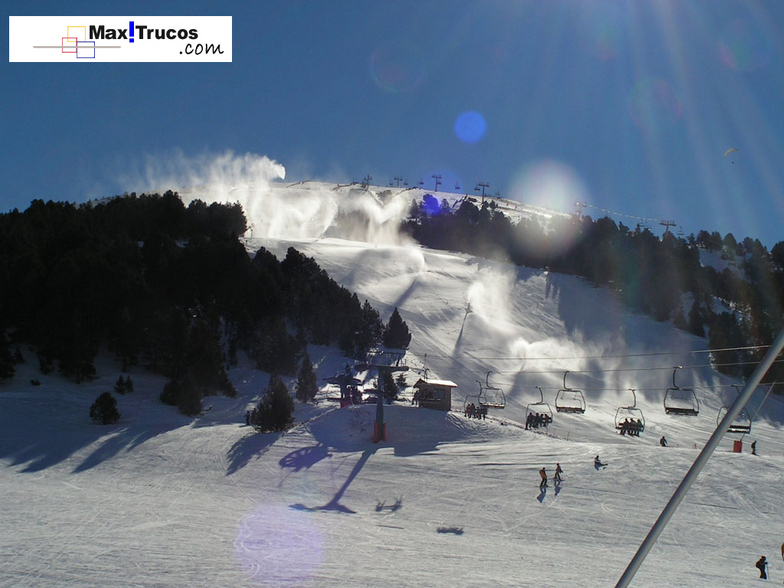
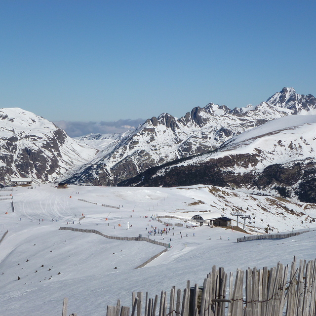
Ski lessons in Grandvalira El Tarter
Book now

Grandvalira El Tarter Weather (Next 3 days): The snow forecast for Grandvalira El Tarter is: A heavy fall of snow, heaviest during Sat afternoon. Temperatures will be below freezing (max -1°C on Sat afternoon, min -5°C on Wed night). Winds increasing (calm on Thu morning, strong winds from the S by Sat morning).
Grandvalira El Tarter Weather (Days 4-6): A heavy fall of snow, heaviest during Mon morning. Temperatures will be below freezing (max 0°C on Mon night, min -4°C on Sat night). Winds decreasing (strong winds from the SSW on Sat night, light winds from the S by Sun night).
| Resort | Snow Depth | Temp. (°C) | Wind (km/h) | Weather | ||
|---|---|---|---|---|---|---|
| Top Lift: | -4 | |||||
| Middle Lift: | -2 | |||||
| Bottom Lift: | -1 |
Latest snow reports near Grandvalira El Tarter:

Thursday 25 | Friday 26 | Saturday 27 | Sunday 28 | Monday 29 | Tuesday 30 | ||||||||||||||
night | AM | PM | night | AM | PM | night | AM | PM | night | AM | PM | night | AM | PM | night | AM | PM | night | |
snow shwrs | cloudy | light snow | mod. snow | light snow | light snow | light snow | mod. snow | light snow | light snow | light snow | light snow | light snow | heavy snow | mod. snow | light snow | light snow | snow shwrs | snow shwrs | |
km/h | |||||||||||||||||||
Snow map |  | 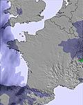 | 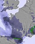 | 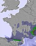 | 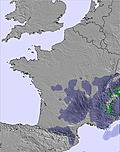 |  |  | ||||||||||||
— | — | 2.0 | 8 | — | 1.0 | 2.0 | 6 | 4 | 5 | — | 1.0 | 4 | 10 | 6 | 2.0 | — | — | — | |
— | — | — | — | — | — | — | — | — | — | — | — | — | — | — | — | — | — | — | |
max°C | -4 | -4 | -4 | -4 | -4 | -3 | -2 | -2 | -1 | -2 | -3 | -2 | -1 | -1 | -1 | 0 | -1 | -1 | -1 |
min°C | -5 | -5 | -4 | -5 | -5 | -3 | -3 | -2 | -2 | -4 | -3 | -2 | -2 | -2 | -1 | -1 | -2 | -1 | -2 |
-10 | -9 | -7 | -7 | -9 | -8 | -9 | -10 | -11 | -11 | -10 | -8 | -6 | -7 | -8 | -7 | -8 | -6 | -2 | |
70 | 74 | 94 | 98 | 89 | 89 | 95 | 95 | 94 | 92 | 75 | 94 | 97 | 99 | 99 | 97 | 85 | 84 | 69 | |
1600 | 2050 | 2050 | 1800 | 2000 | 2250 | 2150 | 2250 | 2350 | 2000 | 2200 | 2250 | 2300 | 2300 | 2400 | 2500 | 2350 | 2500 | 2200 | |
— | 6:56 | — | — | 6:54 | — | — | 6:52 | — | — | 6:50 | — | — | 6:50 | — | — | 6:48 | — | — | |
— | — | — | 8:46 | — | — | 8:47 | — | — | 8:49 | — | — | 8:50 | — | — | 8:51 | — | — | 8:52 | |
A heavy fall of snow, heaviest during Sat afternoon. Temperatures will be below freezing (max -1°C on Sat afternoon, min -5°C on Wed night). Winds increasing (calm on Thu morning, strong winds from the S by Sat morning).
A heavy fall of snow, heaviest during Mon morning. Temperatures will be below freezing (max 0°C on Mon night, min -4°C on Sat night). Winds decreasing (strong winds from the SSW on Sat night, light winds from the S by Sun night).
Latest snow reports near Grandvalira El Tarter:
| Top snow depth: | — |
|---|---|
| Bottom snow depth: | — |
| Fresh snowfall depth: | 8 cm |
| Last snowfall: | 23 Apr 2024 |
| Snow Alerts | Create Alert |
0.2 | Bluebird Powder days Fresh snow, mostly sunny, light wind. |
|---|---|
0.5 | Powder days Fresh snow, limited sun, any wind. |
0.4 | Bluebird days Average snow, mostly sunny, light wind. |

The above table gives the weather forecast for Grandvalira El Tarter at the specific elevation of 2591 m. Our sophisticated weather models allow us to provide snow forecasts for the top, middle and bottom ski stations of Grandvalira El Tarter. To access the weather forecasts for the other elevations, use the tab navigation above the table. For a wider view of the weather, check out the Weather Map of Andorra.
Click here to read further information on freezing levels and how we forecast our temperatures.
Overall 4.2 Based on 19 votes and 6 reviews
This was my fifth time skiing in Grandvalira area. I am an experienced older skier and love the Pyrenees and this is why I returned to Grandvalira again. I have skied in many parts of the world. This year for the first time in my long skiing career on my first day a young snowboarder speeding at a ca 50 km/hr skied on the back of my skis. This stopped me immediately with my body flying forward and then hitting the ground with considerable force. I was understandably shocked but sustained no injuries. The snowboarder disappeared and was probably unaware of the consequences of his behaviour. I reckon if a heavy snowboarder collided with my body, rather than over my skis, you would not be reading this review and the likelihood of a serious injury or fatality would have been high. On the fourth day of skiing a snowboarder hit me from behind and we both fell on the ground. This was in an area near a chairlift where there were clear signs on the slope advising skiers and snowboarders to pay attention and slow down. Grandvalira ski area authority should perhaps consider increasing the number of effective patrolling personnel similar to the USA resorts. It might increase safety if the number of signs alerting skiers to slow down were increased. I would question the sales of alcoholic beverages at lunchtime. Driving under the influence of alcohol is dangerous and is a crime. Skiing whilst inebriated too. I was very surprised that the first language on the signs on some slopes was Russian above Catalan!(e.g at the bottom of the Rossinyol slope).I encountered many Russians with whom I spoke. One couple came directly from Moscow and were vociferously pro Putin and the war. This was in the week when Ursula von der Leyen, the President of the European Commission, met President Zelensky and spoke about increasing sanctions against Russia. What are the Andorran authorities doing in this regard? As usual, the slopes were extremely well groomed and the staff in the cafes and restaurants very friendly. I was fortunate to have only one day of poor visibility and heavy snow during my holiday. Thank you for your attention.
J R from United Kingdom writes:
This was my fifth time skiing in Grandvalira area. I am an experienced older skier and love the Pyrenees and this is why I returned to Grandvalira again. I have skied in many parts of the world. This year for the first time in my long skiing career on my first day a young snowboarder speeding at a ca 50 km/hr skied on the back of my skis. This stopped me immediately with my body flying forward and then hitting the ground with considerable force. I was understandably shocked but sustained no injuries. The snowboarder disappeared and was probably unaware of the consequences of his behaviour. I reckon if a heavy snowboarder collided with my body, rather than over my skis, you would not be reading this review and the likelihood of a serious injury or fatality would have been high. On the fourth day of skiing a snowboarder hit me from behind and we both fell on the ground. This was in an area near a chairlift where there were clear signs on the slope advising skiers and snowboarders to pay attention and slow down. Grandvalira ski area authority should perhaps consider increasing the number of effective patrolling personnel similar to the USA resorts. It might increase safety if the number of signs alerting skiers to slow down were increased. I would question the sales of alcoholic beverages at lunchtime. Driving under the influence of alcohol is dangerous and is a crime. Skiing whilst inebriated too.
I was very surprised that the first language on the signs on some slopes was Russian above Catalan!(e.g at the bottom of the Rossinyol slope).I encountered many Russians with whom I spoke. One couple came directly from Moscow and were vociferously pro Putin and the war. This was in the week when Ursula von der Leyen, the President of the European Commission, met President Zelensky and spoke about increasing sanctions against Russia. What are the Andorran authorities doing in this regard?
As usual, the slopes were extremely well groomed and the staff in the cafes and restaurants very friendly. I was fortunate to have only one day of poor visibility and heavy snow during my holiday.
Thank you for your attention.
Read 5 more reviews of Grandvalira El Tarter or submit your own
The Grandvalira El Tarter skiing weather widget is available to embed on external websites free of charge. It provides a daily summary of our Grandvalira El Tarter snow forecast and current weather conditions. Simply go to the feed configuration page and follow the 3 simple steps to grab the custom html code snippet and paste it into your own site. You can choose the snow forecast elevation (summit, mid-mountain or bottom lift) and metric/imperial units for the snow forecast feed to suit your own website…. Click here to get the code.
View detailed snow forecast for Grandvalira El Tarter at:
snow-forecast.com


 Nearest