
Ski Lessons by SkiBro
BOOK NOW
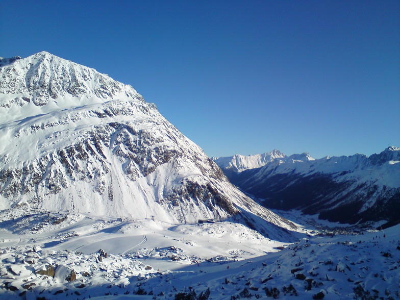
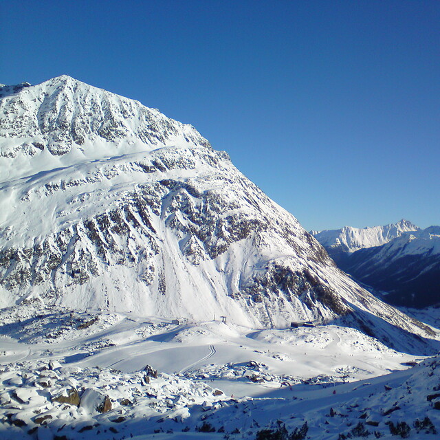
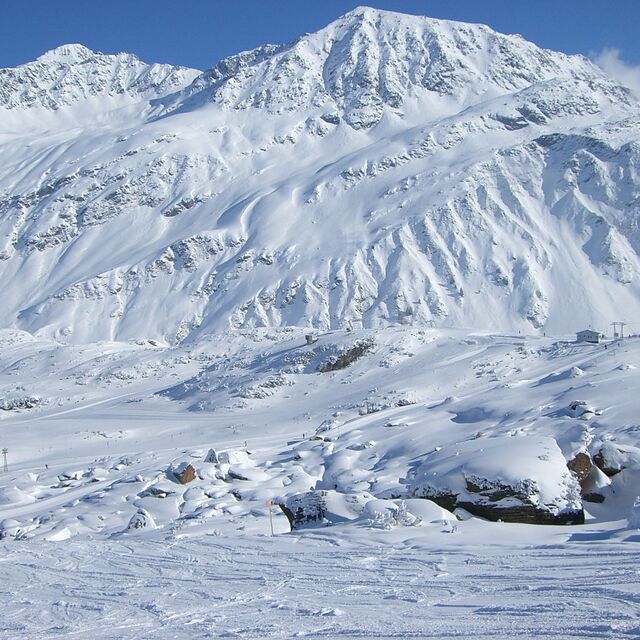
Ski lessons in Galtur-Silvapark
Book now


Galtur-Silvapark Weather (Next 3 days): The snow forecast for Galtur-Silvapark is: A heavy fall of snow, heaviest during Wed morning. Temperatures will be below freezing (max -3°C on Tue morning, min -8°C on Wed night). Wind will be generally light.
Galtur-Silvapark Weather (Days 4-6): A heavy fall of snow, heaviest during Fri night. Temperatures will be below freezing (max -4°C on Fri morning, min -9°C on Sat night). Wind will be generally light.
| Resort | Snow Depth | Temp. (°C) | Wind (km/h) | Weather | ||
|---|---|---|---|---|---|---|
| Top Lift: | 0.0 m | -5 | ||||
| Middle Lift: | -3 | |||||
| Bottom Lift: | 0.0 m | -1 |
Latest snow reports near Galtur-Silvapark:
Light rain showers reported from Galtür at 1577 metres elevation SSW of Galtur-Silvapark but it is forecast cold enough for snow at the ski area from Galtur-Silvapark
Continuous light rain reported from Oberstdorf at 723 metres elevation 5 kms NE of Oberstdorf-Söllereck but it is forecast cold enough for snow at higher elevations in the ski area from Oberstdorf-Söllereck
Snow grains reported from Galzig Mountain at 2090 metres elevation only 2 kms E of St. Christoph Ski Resort from St. Christoph
Rain and snow or hail reported from Oberstdorf at 723 metres elevation 5 kms NE of Oberstdorf-Söllereck but it is probably falling as rain apart from near the top of the ski area from Oberstdorf-Söllereck

Tuesday 16 | Wednesday 17 | Thursday 18 | Friday 19 | Saturday 20 | Sunday 21 | Monday 22 | |||||||||||||||
AM | PM | night | AM | PM | night | AM | PM | night | AM | PM | night | AM | PM | night | AM | PM | night | AM | PM | night | |
light snow | light snow | light snow | light snow | light snow | light snow | cloudy | light snow | light snow | cloudy | light snow | heavy snow | light snow | light snow | light snow | light snow | light snow | light snow | light snow | mod. snow | mod. snow | |
km/h | |||||||||||||||||||||
Snow map |  |  |  |  |  |  |  | ||||||||||||||
2.0 | 1.0 | 4 | 5 | 3 | 2.0 | — | 2.0 | 1.0 | — | 1.0 | 12 | 3 | 4 | 2.0 | — | 2.0 | 1.0 | 2.0 | 6 | 7 | |
— | — | — | — | — | — | — | — | — | — | — | — | — | — | — | — | — | — | — | — | — | |
max°C | -3 | -3 | -4 | -5 | -4 | -6 | -6 | -5 | -6 | -4 | -4 | -4 | -5 | -4 | -6 | -5 | -4 | -6 | -5 | -3 | -3 |
min°C | -4 | -3 | -5 | -5 | -5 | -8 | -7 | -5 | -8 | -7 | -4 | -5 | -6 | -4 | -9 | -8 | -4 | -8 | -6 | -4 | -4 |
-8 | -7 | -8 | -9 | -9 | -8 | -7 | -9 | -8 | -7 | -7 | -8 | -10 | -8 | -9 | -8 | -8 | -11 | -9 | -8 | -8 | |
89 | 76 | 95 | 88 | 80 | 92 | 80 | 79 | 93 | 50 | 90 | 96 | 91 | 86 | 95 | 83 | 79 | 94 | 91 | 93 | 95 | |
1400 | 1600 | 1150 | 1300 | 1350 | 600 | 1200 | 1350 | 800 | 1350 | 1350 | 1250 | 1250 | 1350 | 400 | 1250 | 1400 | 800 | 1250 | 1500 | 1300 | |
6:28 | — | — | 6:26 | — | — | 6:24 | — | — | 6:22 | — | — | 6:20 | — | — | 6:20 | — | — | 6:18 | — | — | |
— | — | 8:08 | — | — | 8:10 | — | — | 8:12 | — | — | 8:13 | — | — | 8:15 | — | — | 8:15 | — | — | 8:16 | |
A heavy fall of snow, heaviest during Wed morning. Temperatures will be below freezing (max -3°C on Tue morning, min -8°C on Wed night). Wind will be generally light.
A heavy fall of snow, heaviest during Fri night. Temperatures will be below freezing (max -4°C on Fri morning, min -9°C on Sat night). Wind will be generally light.
Latest snow reports near Galtur-Silvapark:
Light rain showers reported from Galtür at 1577 metres elevation SSW of Galtur-Silvapark but it is forecast cold enough for snow at the ski area from Galtur-Silvapark
Continuous light rain reported from Oberstdorf at 723 metres elevation 5 kms NE of Oberstdorf-Söllereck but it is forecast cold enough for snow at higher elevations in the ski area from Oberstdorf-Söllereck
Snow grains reported from Galzig Mountain at 2090 metres elevation only 2 kms E of St. Christoph Ski Resort from St. Christoph
Rain and snow or hail reported from Oberstdorf at 723 metres elevation 5 kms NE of Oberstdorf-Söllereck but it is probably falling as rain apart from near the top of the ski area from Oberstdorf-Söllereck
| Top snow depth: | 0 cm |
|---|---|
| Bottom snow depth: | 0 cm |
| Fresh snowfall depth: | — |
| Last snowfall: | 10 Apr 2024 |
| Snow Alerts | Create Alert |
0.2 | Bluebird Powder days Fresh snow, mostly sunny, light wind. |
|---|---|
1.0 | Powder days Fresh snow, limited sun, any wind. |
0.2 | Bluebird days Average snow, mostly sunny, light wind. |

The above table gives the weather forecast for Galtur-Silvapark at the specific elevation of 1950 m. Our sophisticated weather models allow us to provide snow forecasts for the top, middle and bottom ski stations of Galtur-Silvapark. To access the weather forecasts for the other elevations, use the tab navigation above the table. For a wider view of the weather, check out the Weather Map of Austria.
Click here to read further information on freezing levels and how we forecast our temperatures.
Resort name is also written as Galtur Silvapark.
Overall 4.1 Based on 1 vote and 3 reviews
Did a day here in early March, it's high and snow sure. The sun was shining, the snow was fresh and everyone was heading in the opposite direction for a day in Ischgl. Result: deserted pistes, perfect grippy powder and that increasingly rare occurrence: no ice! It was without doubt the best day's skiing I've had in approx. 20 years! The ski area is compact with good lifts, including a new gondola opening up an extended black run. Also good selection of reds and perfect for young families. For hard core skiers there's only enough to keep you happy for 2 or 3 days, so you'll want the valley pass which provides full access to Ischgl, Kappl and See. Subsistence on the mountain: excellent value. Didn't sample the night life but, all in all, a highly recommended resort.
Tirolerhund from United Kingdom writes:
Did a day here in early March, it's high and snow sure. The sun was shining, the snow was fresh and everyone was heading in the opposite direction for a day in Ischgl. Result: deserted pistes, perfect grippy powder and that increasingly rare occurrence: no ice! It was without doubt the best day's skiing I've had in approx. 20 years!
The ski area is compact with good lifts, including a new gondola opening up an extended black run. Also good selection of reds and perfect for young families.
For hard core skiers there's only enough to keep you happy for 2 or 3 days, so you'll want the valley pass which provides full access to Ischgl, Kappl and See.
Subsistence on the mountain: excellent value.
Didn't sample the night life but, all in all, a highly recommended resort.
The Galtur-Silvapark skiing weather widget is available to embed on external websites free of charge. It provides a daily summary of our Galtur-Silvapark snow forecast and current weather conditions. Simply go to the feed configuration page and follow the 3 simple steps to grab the custom html code snippet and paste it into your own site. You can choose the snow forecast elevation (summit, mid-mountain or bottom lift) and metric/imperial units for the snow forecast feed to suit your own website…. Click here to get the code.
View detailed snow forecast for Galtur-Silvapark at:
snow-forecast.com


 Nearest