


View forecast
Great Canadian Heli-Skiing at 3200 m altitude
Issued by Snow-Forecast.com at: 5 pm (local time) / 24 Apr 2024
Now
Wed 24 | Thursday 25 | Friday 26 | Saturday 27 | Sunday 28 | Monday 29 | Tuesday 30 | ||||||||||||||
PM | night | AM | PM | night | AM | PM | night | AM | PM | night | AM | PM | night | AM | PM | night | AM | PM | night | |
light snow | snow shwrs | snow shwrs | light snow | light snow | light snow | light snow | light snow | light snow | light snow | snow shwrs | snow shwrs | light snow | snow shwrs | snow shwrs | snow shwrs | light snow | light snow | light snow | light snow | |
km/h | ||||||||||||||||||||
Snow map | 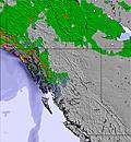 | 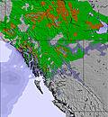 | 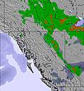 | 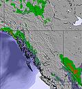 | 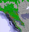 | 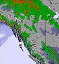 | 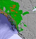 | |||||||||||||
1.0 | 1.0 | — | — | 3 | 1.0 | — | — | — | 1.0 | — | — | — | 2.0 | — | — | — | — | — | — | |
— | — | — | — | — | — | — | — | — | — | — | — | — | — | — | — | — | — | — | — | |
max°C | -8 | -8 | -10 | -8 | -8 | -9 | -8 | -8 | -9 | -8 | -7 | -9 | -8 | -8 | -12 | -11 | -11 | -12 | -10 | -10 |
min°C | -9 | -9 | -10 | -8 | -8 | -9 | -9 | -8 | -9 | -8 | -9 | -9 | -8 | -12 | -13 | -12 | -12 | -13 | -11 | -10 |
-18 | -17 | -17 | -14 | -12 | -13 | -14 | -13 | -15 | -14 | -16 | -15 | -15 | -21 | -21 | -20 | -17 | -20 | -17 | -14 | |
85 | 86 | 83 | 91 | 96 | 96 | 97 | 93 | 94 | 93 | 91 | 90 | 81 | 93 | 69 | 64 | 77 | 81 | 76 | 75 | |
2150 | 1750 | 1750 | 2200 | 1900 | 1550 | 2050 | 1800 | 1950 | 2250 | 1950 | 1900 | 2250 | 1800 | 1750 | 1950 | 1600 | 1650 | 2050 | 1800 | |
— | — | 6:31 | — | — | 6:30 | — | — | 6:28 | — | — | 6:26 | — | — | 6:24 | — | — | 6:22 | — | — | |
— | 9:01 | — | — | 9:04 | — | — | 9:06 | — | — | 9:07 | — | — | 9:08 | — | — | 9:10 | — | — | 9:12 | |
Next 0-3 days weather summary:
A light covering of new snow, mostly falling on Thu night. Temperatures will be well below freezing (max -8°C on Wed afternoon, min -10°C on Thu morning). Wind will be generally light.
Next 4-6 days weather summary:
A light covering of new snow, mostly falling on Sun night. Temperatures will be well below freezing (max -7°C on Sat night, min -13°C on Mon morning). Wind will be generally light.
Popular Great Canadian Heli-Skiing Pages
Snow Radar
Latest snow reports near Great Canadian Heli-Skiing:
Great Canadian Heli-Skiing Snow Conditions
| Top snow depth: | — |
|---|---|
| Bottom snow depth: | — |
| Fresh snowfall depth: | — |
| Last snowfall: | 21 Apr 2024 |
| Snow Alerts | Create Alert |
Other resorts in Canada - BC are reporting: powder (0) / good piste (0)
Snow-Forecast Partner Offers
Show your business here
Snow History
Week 4 of April has on average:
1.7 | Bluebird Powder days Fresh snow, mostly sunny, light wind. |
|---|---|
1.4 | Powder days Fresh snow, limited sun, any wind. |
2.1 | Bluebird days Average snow, mostly sunny, light wind. |

Great Canadian Heli-Skiing Forecast Snowfall


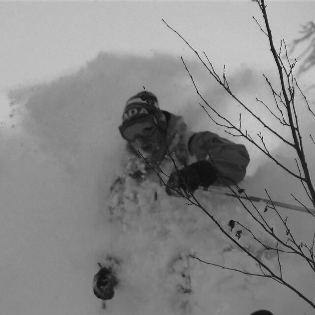
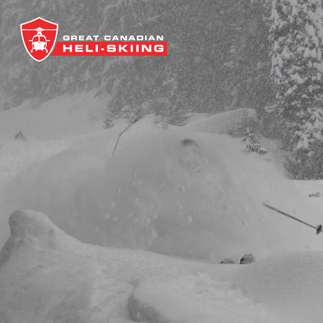
Photos of Great Canadian Heli-Skiing
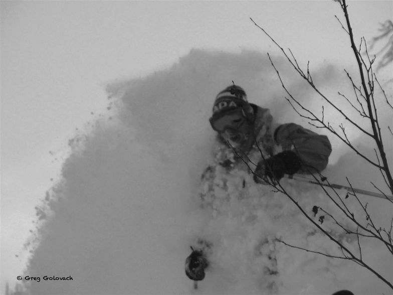
It's DRIER UP HERE! Mike Parr by Greg Golovach by Greg Porter
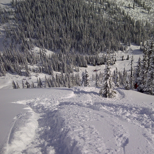
Sexy steep meadows by Greg Porter
No Faceshoots.....Just OVER The Head Shots! by Greg Porter
Other resorts in Canada - BC are reporting: powder (0) / good piste (0)
The above table gives the weather forecast for Great Canadian Heli-Skiing at the specific elevation of 3200 m. Our sophisticated weather models allow us to provide snow forecasts for the top, middle and bottom ski stations of Great Canadian Heli-Skiing. To access the weather forecasts for the other elevations, use the tab navigation above the table. For a wider view of the weather, check out the Weather Map of Canada.
Click here to read further information on freezing levels and how we forecast our temperatures.
Visitor Reviews of Great Canadian Heli-Skiing
Overall 3.5 Based on 5 votes and 3 reviews
- Snowsure
- Variety of pistes
- Vote
- Adrian Westlake from United Kingdom writes:
Superb service from a very experienced guiding team and pilots, at Great Canadian HeliSki, coupled with excellent food and accommodation in a package which, when you add it all up, represents very good value in comparison with the competitors. Add that to the location on Rogers Pass, which seems to be something of a snow magnet, and loads of varied terrain and why wouldn't you want to keep going back?
Visitor Reviews of Great Canadian Heli-Skiing
Adrian Westlake from United Kingdom writes:
Superb service from a very experienced guiding team and pilots, at Great Canadian HeliSki, coupled with excellent food and accommodation in a package which, when you add it all up, represents very good value in comparison with the competitors. Add that to the location on Rogers Pass, which seems to be something of a snow magnet, and loads of varied terrain and why wouldn't you want to keep going back?
Read 2 more reviews of Great Canadian Heli-Skiing or submit your own
Free Snow-Forecast.com weather widget for your website
The Great Canadian Heli-Skiing skiing weather widget is available to embed on external websites free of charge. It provides a daily summary of our Great Canadian Heli-Skiing snow forecast and current weather conditions. Simply go to the feed configuration page and follow the 3 simple steps to grab the custom html code snippet and paste it into your own site. You can choose the snow forecast elevation (summit, mid-mountain or bottom lift) and metric/imperial units for the snow forecast feed to suit your own website…. Click here to get the code.
View detailed snow forecast for Great Canadian Heli-Skiing at:
snow-forecast.com

 Nearest