
Ski Hire by Intersport
Click here for discount
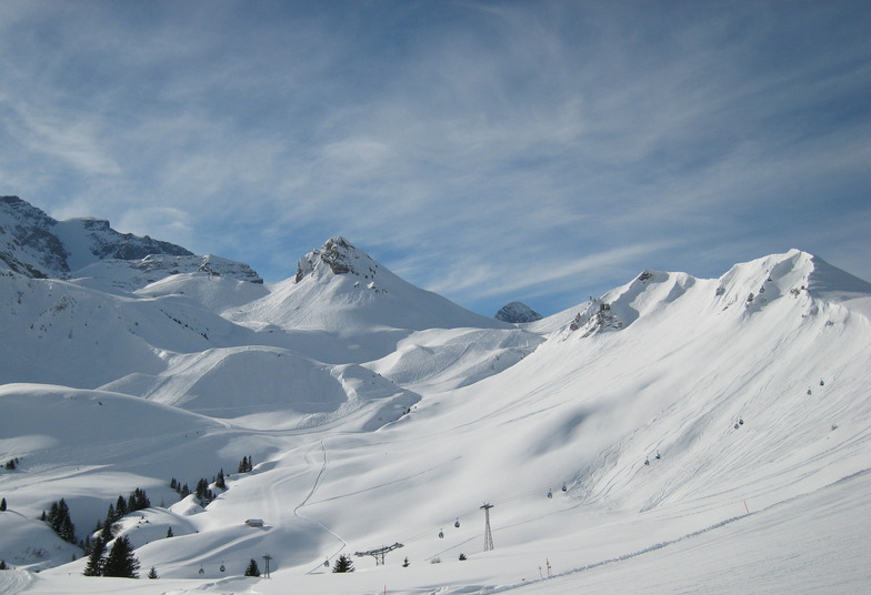

Adelboden Weather (Next 3 days): The snow forecast for Adelboden is: A heavy fall of snow, heaviest during Sun afternoon. Temperatures will be below freezing (max -5°C on Sat afternoon, min -11°C on Sun night). Wind will be generally light.
Adelboden Weather (Days 4-6): A light covering of new snow, mostly falling on Tue afternoon. Temperatures will be below freezing (max -2°C on Fri morning, min -9°C on Tue night). Wind will be generally light.
| Resort | Snow Depth | Temp. (°C) | Wind (km/h) | Weather | ||
|---|---|---|---|---|---|---|
| Top Lift: | 0.0 m | -5 | ||||
| Middle Lift: | -2 | |||||
| Bottom Lift: | 0.0 m | 1 |
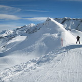
Latest snow reports near Adelboden:
Light rain reported from Thun at 560 metres elevation 8 kms W of Schwanden - Sigriswil but it is forecast cold enough for snow at the ski area from Schwanden - Sigriswil
Continuous light snow reported from Jungfrau Mountain at 3576 metres elevation 7 kms E of Mürren Ski Resort from Mürren
It’s still snowing and cold. Lots of new snow . 3 chairlifts open at KS. from Wengen

Sat 20 | Sunday 21 | Monday 22 | Tuesday 23 | Wednesday 24 | Thursday 25 | Friday 26 | ||||||||||||||
PM | night | AM | PM | night | AM | PM | night | AM | PM | night | AM | PM | night | AM | PM | night | AM | PM | night | |
light snow | snow shwrs | light snow | heavy snow | light snow | light snow | light snow | light snow | light snow | light snow | light snow | light snow | light snow | snow shwrs | light snow | light snow | light snow | cloudy | light snow | light snow | |
km/h | ||||||||||||||||||||
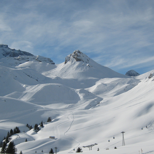
Snow map |  |  |  |  |  |  |  | |||||||||||||
2.0 | 1.0 | 1.0 | 10 | 3 | 1.0 | 1.0 | 2.0 | 2.0 | 3 | 1.0 | — | 2.0 | 1.0 | — | 1.0 | — | — | 1.0 | 1.0 | |
— | — | — | — | — | — | — | — | — | — | — | — | — | — | — | — | — | — | — | — | |
max°C | -5 | -6 | -6 | -6 | -8 | -7 | -6 | -7 | -7 | -6 | -7 | -7 | -5 | -6 | -6 | -4 | -4 | -2 | -1 | -1 |
min°C | -6 | -10 | -8 | -7 | -11 | -9 | -6 | -9 | -8 | -6 | -9 | -9 | -5 | -9 | -8 | -4 | -7 | -4 | -1 | -3 |
-10 | -10 | -12 | -12 | -15 | -12 | -10 | -13 | -12 | -10 | -9 | -9 | -9 | -9 | -8 | -4 | -11 | -7 | -1 | -6 | |
93 | 74 | 90 | 92 | 87 | 83 | 92 | 97 | 93 | 89 | 94 | 84 | 82 | 93 | 90 | 88 | 91 | 83 | 94 | 91 | |
1300 | 0 | 1100 | 900 | 300 | 900 | 1150 | 550 | 1050 | 1150 | 450 | 1100 | 1350 | 600 | 1250 | 1450 | 700 | 1700 | 1850 | 1550 | |
— | — | 6:31 | — | — | 6:28 | — | — | 6:26 | — | — | 6:26 | — | — | 6:24 | — | — | 6:22 | — | — | |
— | 8:23 | — | — | 8:25 | — | — | 8:27 | — | — | 8:28 | — | — | 8:30 | — | — | 8:30 | — | — | 8:31 | |
A heavy fall of snow, heaviest during Sun afternoon. Temperatures will be below freezing (max -5°C on Sat afternoon, min -11°C on Sun night). Wind will be generally light.
A light covering of new snow, mostly falling on Tue afternoon. Temperatures will be below freezing (max -2°C on Fri morning, min -9°C on Tue night). Wind will be generally light.
Latest snow reports near Adelboden:
Light rain reported from Thun at 560 metres elevation 8 kms W of Schwanden - Sigriswil but it is forecast cold enough for snow at the ski area from Schwanden - Sigriswil
Continuous light snow reported from Jungfrau Mountain at 3576 metres elevation 7 kms E of Mürren Ski Resort from Mürren
It’s still snowing and cold. Lots of new snow . 3 chairlifts open at KS. from Wengen
| Top snow depth: | 0 cm |
|---|---|
| Bottom snow depth: | 0 cm |
| Fresh snowfall depth: | 22 cm |
| Last snowfall: | 19 Apr 2024 |
| Snow Alerts | Create Alert |
0.7 | Bluebird Powder days Fresh snow, mostly sunny, light wind. |
|---|---|
2.9 | Powder days Fresh snow, limited sun, any wind. |
0.6 | Bluebird days Average snow, mostly sunny, light wind. |


The above table gives the weather forecast for Adelboden at the specific elevation of 1974 m. Our sophisticated weather models allow us to provide snow forecasts for the top, middle and bottom ski stations of Adelboden. To access the weather forecasts for the other elevations, use the tab navigation above the table. For a wider view of the weather, check out the Weather Map of Switzerland.
Click here to read further information on freezing levels and how we forecast our temperatures.
Overall 3.7 Based on 9 votes and 9 reviews
Very good.
hoidoei from Netherlands writes:
Very good.
The Adelboden skiing weather widget is available to embed on external websites free of charge. It provides a daily summary of our Adelboden snow forecast and current weather conditions. Simply go to the feed configuration page and follow the 3 simple steps to grab the custom html code snippet and paste it into your own site. You can choose the snow forecast elevation (summit, mid-mountain or bottom lift) and metric/imperial units for the snow forecast feed to suit your own website…. Click here to get the code.
View detailed snow forecast for Adelboden at:
snow-forecast.com


 Nearest